Kuna (/ˈkjuːnə/ KYOO-nə) is a city in Ada County, Idaho. It is part of the Boise metropolitan area. The population was 24,011 at the time of the 2020 census.
Kuna is one of the fastest-growing areas in Idaho, having nearly tripled in population between 2000 and 2010 and a nearly additional 60 percent gain between 2010 and 2020.
| Name: | Kuna city |
|---|---|
| LSAD Code: | 25 |
| LSAD Description: | city (suffix) |
| State: | Idaho |
| County: | Ada County |
| Elevation: | 2,694 ft (821 m) |
| Total Area: | 19.88 sq mi (51.49 km²) |
| Land Area: | 19.78 sq mi (51.23 km²) |
| Water Area: | 0.10 sq mi (0.26 km²) |
| Total Population: | 24,011 |
| Population Density: | 1,200/sq mi (470/km²) |
| ZIP code: | 83634 |
| Area code: | 208, 986 |
| FIPS code: | 1644290 |
| GNISfeature ID: | 0396755 |
| Website: | kunacity.id.gov |
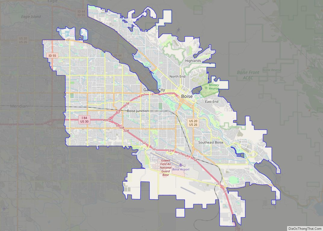
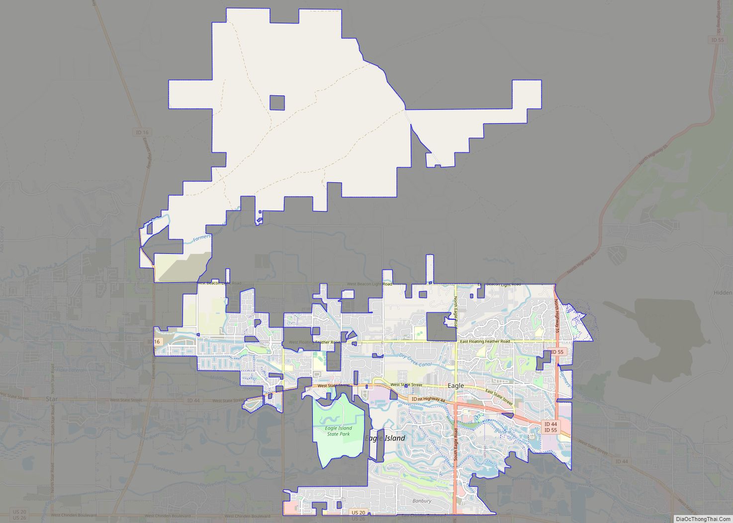
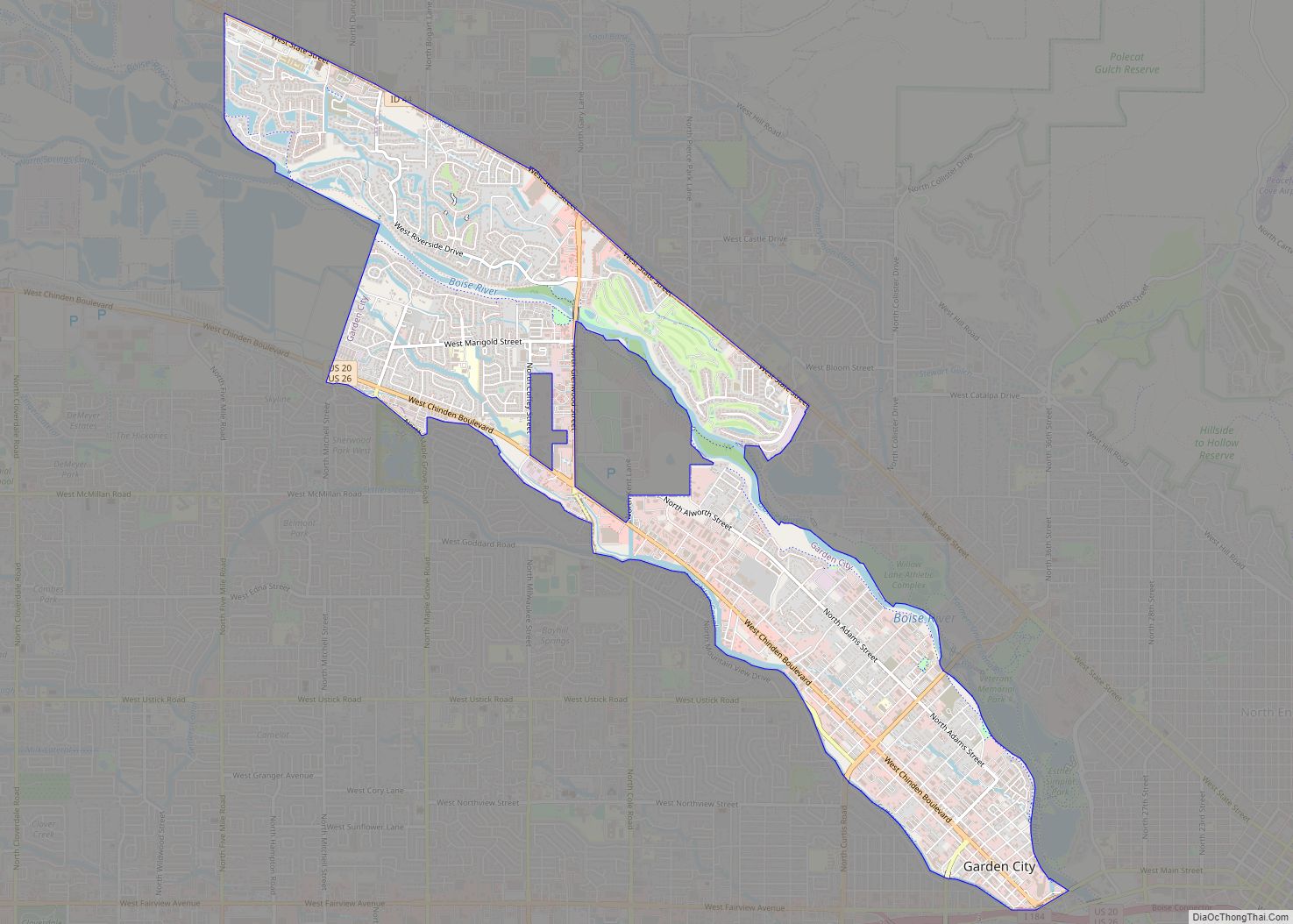
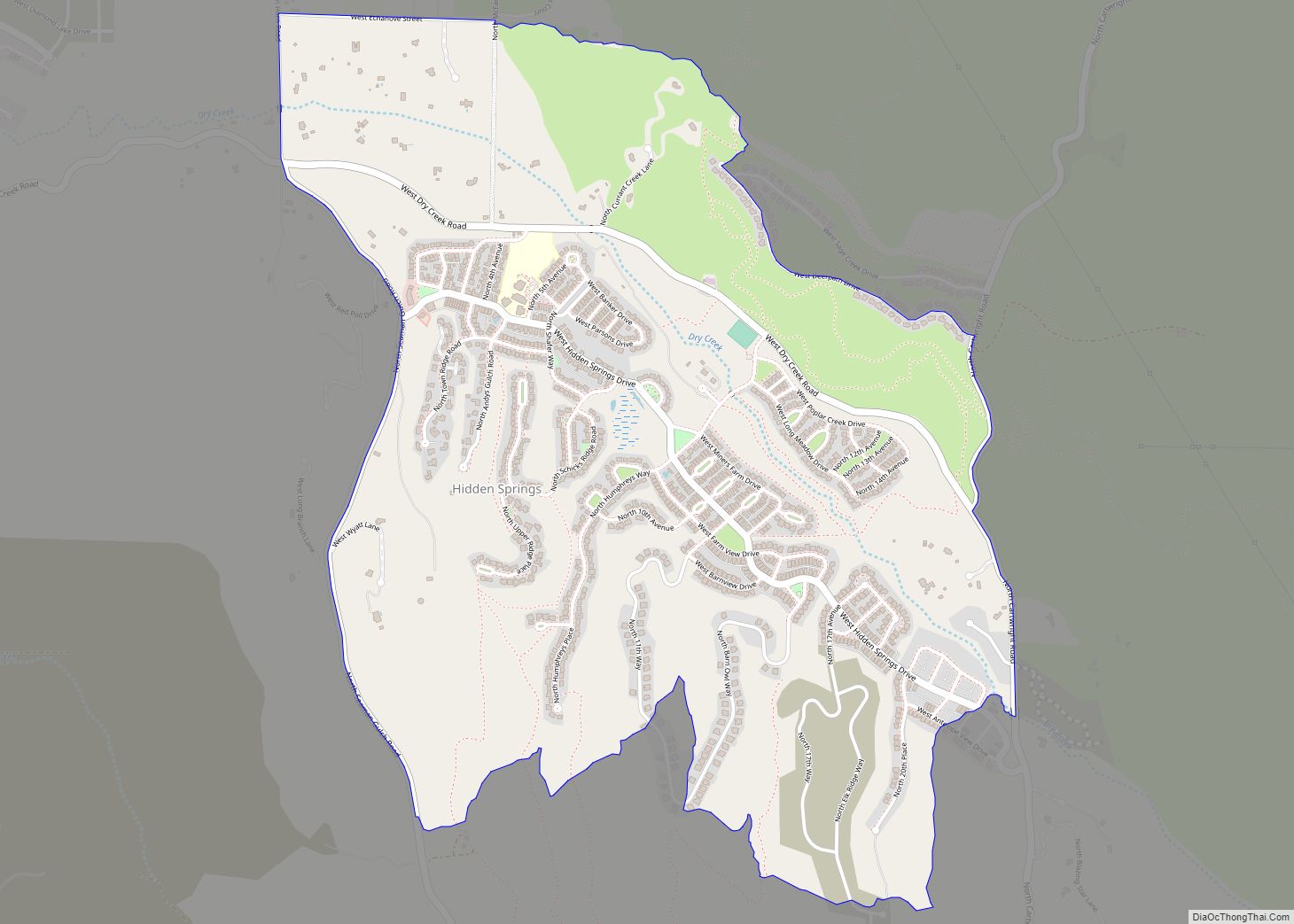
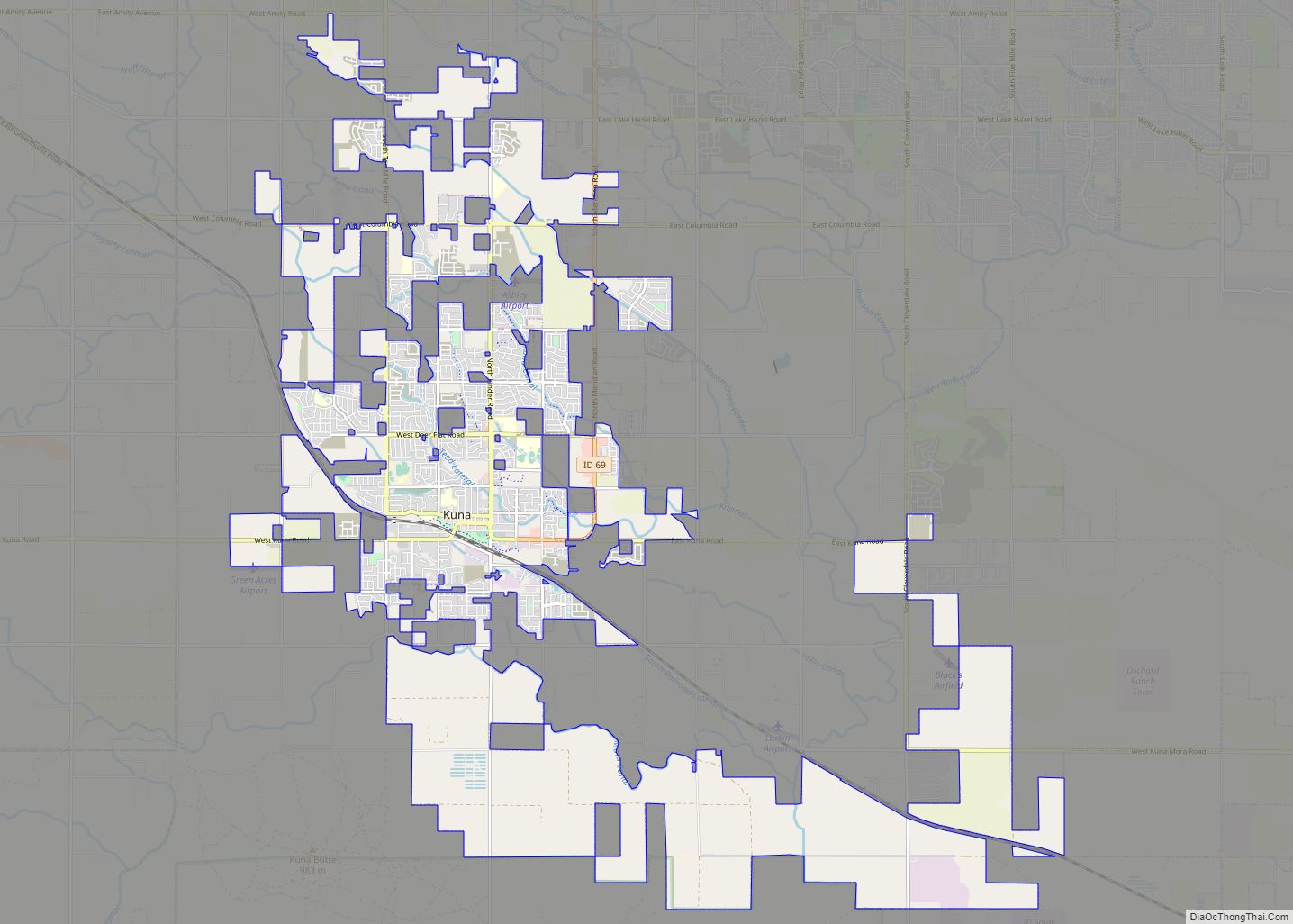
Online Interactive Map
Click on ![]() to view map in "full screen" mode.
to view map in "full screen" mode.
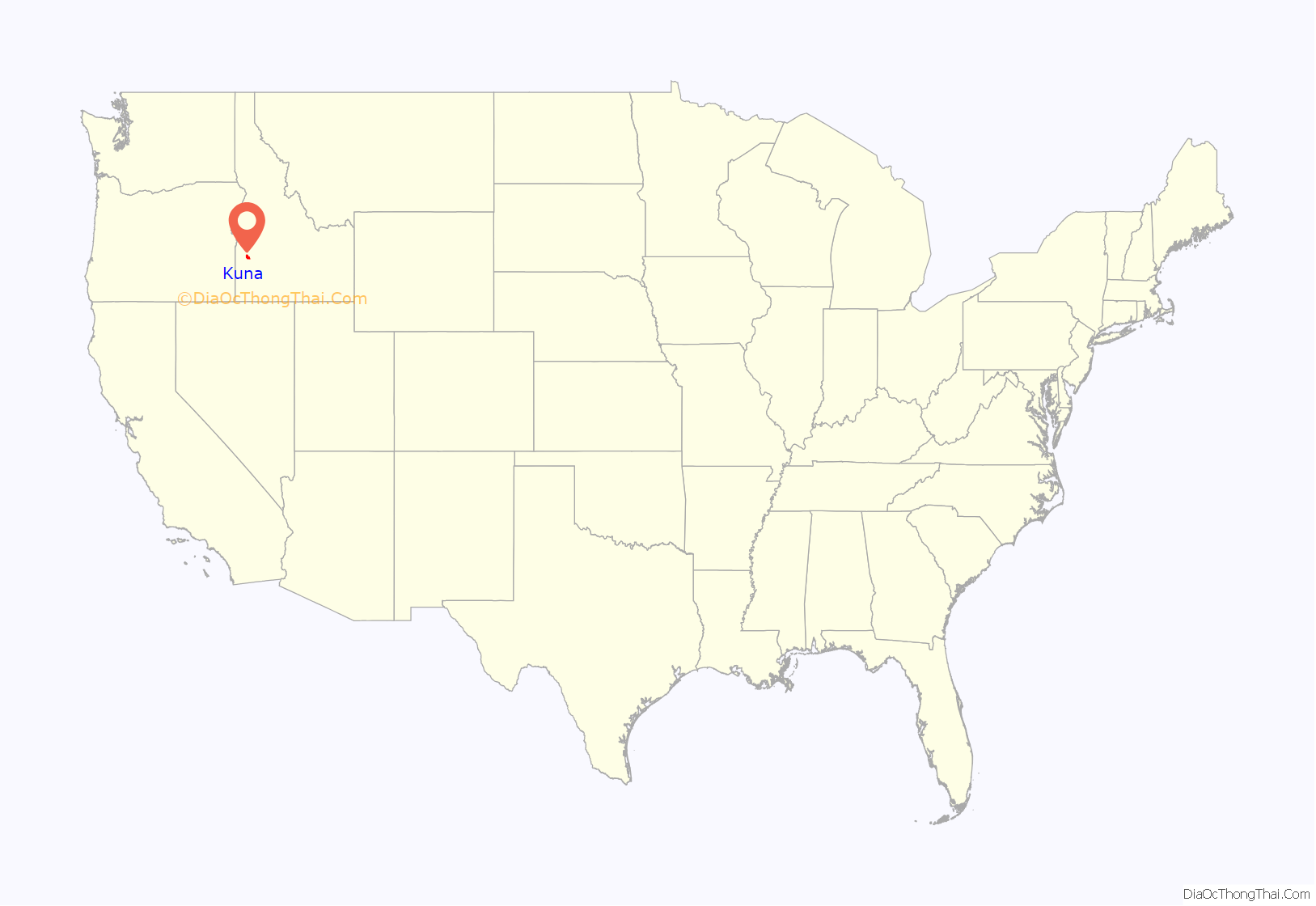
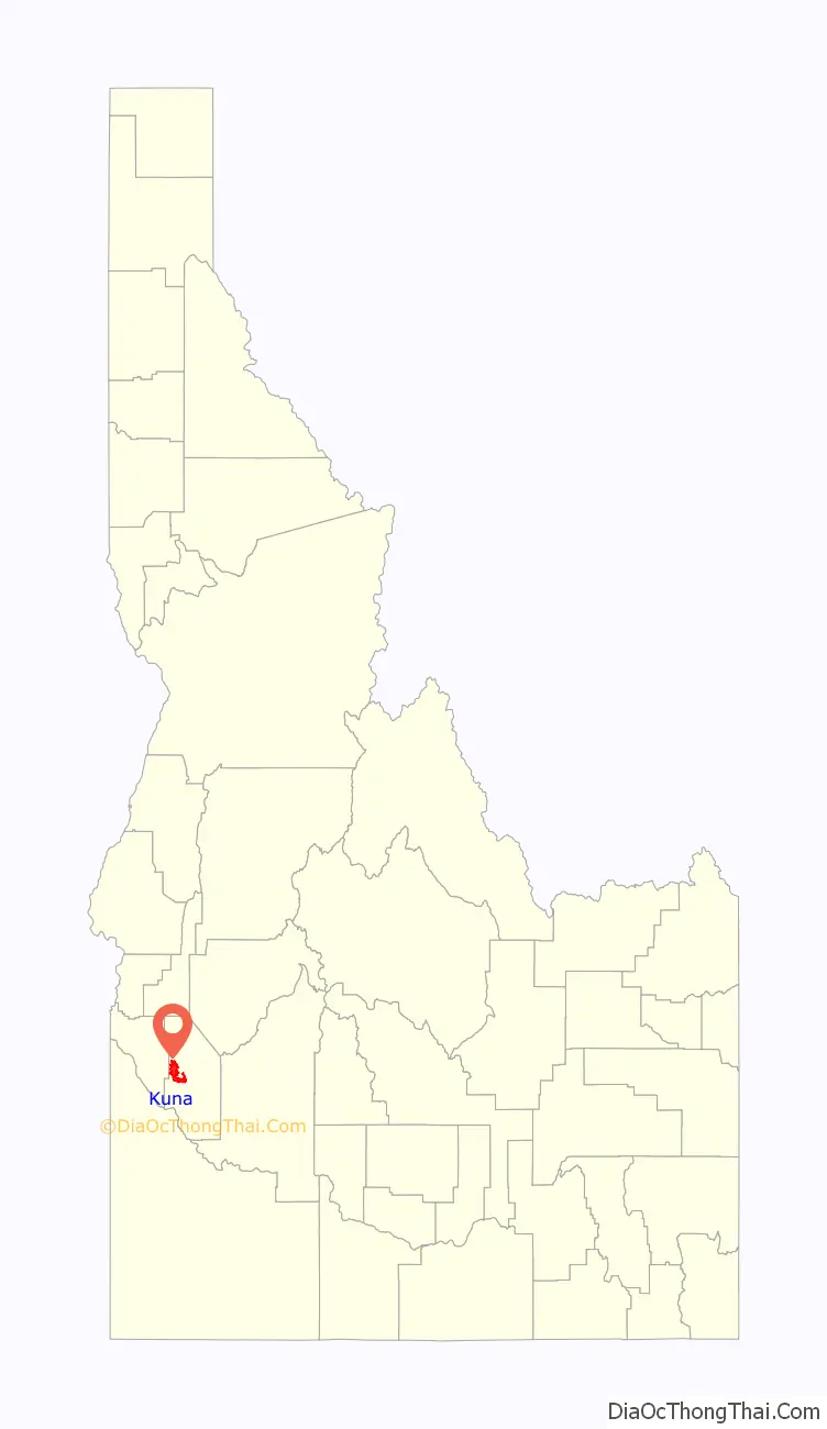
Kuna location map. Where is Kuna city?
History
Kuna originated as a railroad stop with coach transport to Boise. It is popularly believed, as cited by the Kuna Chamber of Commerce, that the translation of the name “Kuna” means “the end of the trail”, but Charles S. Walgamott cites the origin of the name as a Shoshone Indian word meaning “green leaf, good to smoke.”
The Western Heritage Historic Byway, designated as a national as well as a state scenic byway, travels around a number of historic sites in the area.
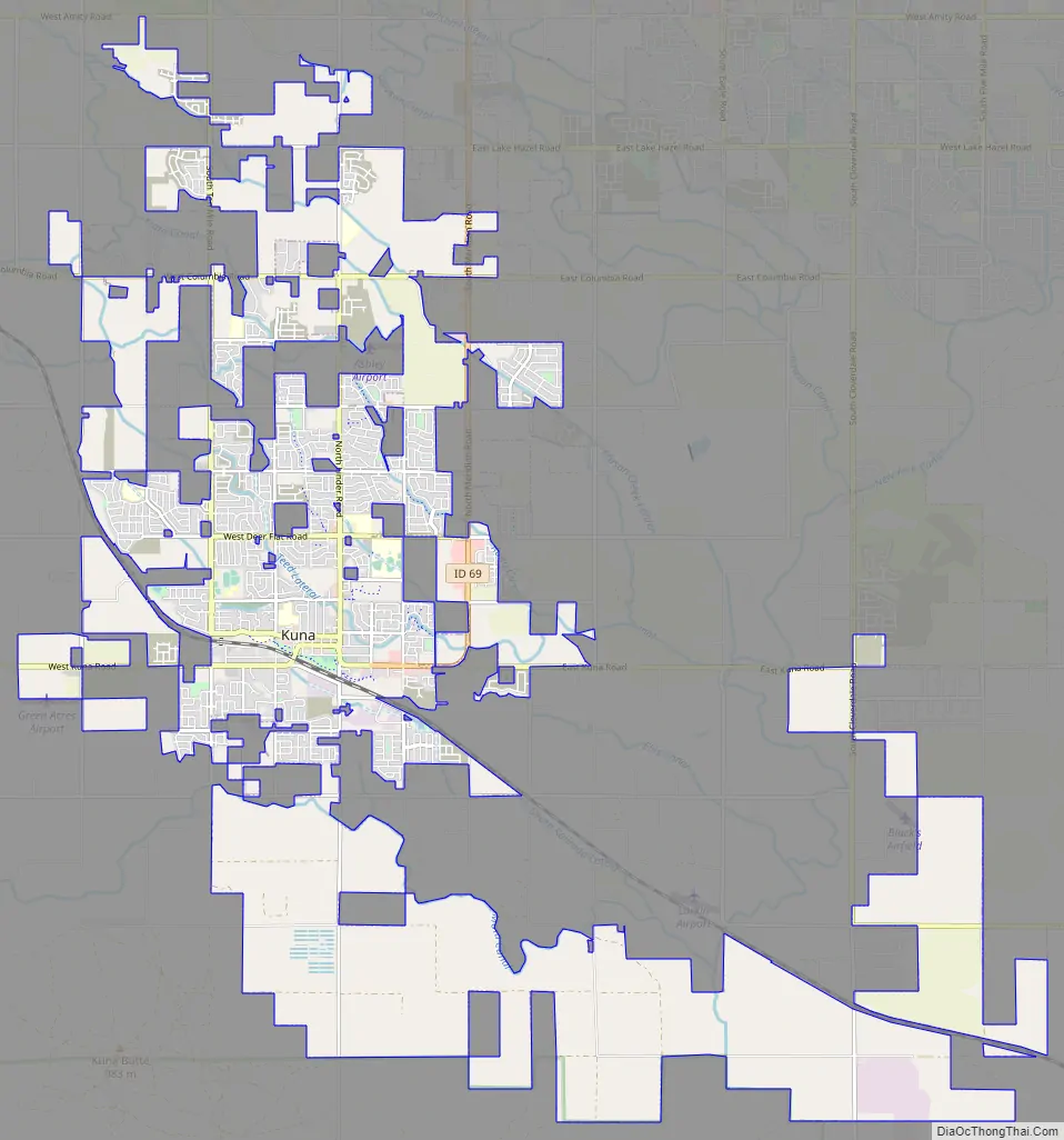
Kuna Road Map
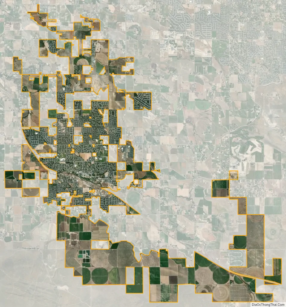
Kuna city Satellite Map
Geography
Kuna’s business center is approximately 18 miles (29 km) southwest of downtown Boise, the state capital.
According to the United States Census Bureau, the city has a total area of 18.18 square miles (47.09 km), of which 18.08 square miles (46.83 km) is land and 0.10 square miles (0.26 km) is water.
South of Kuna is the Kuna Caves a lava tube.
A small seasonal creek, Indian Creek, runs through the city. It is now used as an irrigation canal, filled by the New York Canal from the Boise River Diversion Dam. One of the few small floatable waterways in the region, Indian Creek is a favorite swimming spot for local residents.
See also
Map of Idaho State and its subdivision:- Ada
- Adams
- Bannock
- Bear Lake
- Benewah
- Bingham
- Blaine
- Boise
- Bonner
- Bonneville
- Boundary
- Butte
- Camas
- Canyon
- Caribou
- Cassia
- Clark
- Clearwater
- Custer
- Elmore
- Franklin
- Fremont
- Gem
- Gooding
- Idaho
- Jefferson
- Jerome
- Kootenai
- Latah
- Lemhi
- Lewis
- Lincoln
- Madison
- Minidoka
- Nez Perce
- Oneida
- Owyhee
- Payette
- Power
- Shoshone
- Teton
- Twin Falls
- Valley
- Washington
- Alabama
- Alaska
- Arizona
- Arkansas
- California
- Colorado
- Connecticut
- Delaware
- District of Columbia
- Florida
- Georgia
- Hawaii
- Idaho
- Illinois
- Indiana
- Iowa
- Kansas
- Kentucky
- Louisiana
- Maine
- Maryland
- Massachusetts
- Michigan
- Minnesota
- Mississippi
- Missouri
- Montana
- Nebraska
- Nevada
- New Hampshire
- New Jersey
- New Mexico
- New York
- North Carolina
- North Dakota
- Ohio
- Oklahoma
- Oregon
- Pennsylvania
- Rhode Island
- South Carolina
- South Dakota
- Tennessee
- Texas
- Utah
- Vermont
- Virginia
- Washington
- West Virginia
- Wisconsin
- Wyoming