Meridian is a city located in Ada County in the U.S. state of Idaho. As of the 2020 census, the population of Meridian was 117,635, making it the second largest city in the county and Idaho after Boise, the state capital. Meridian is considered the state’s fastest-growing city and among the fastest-growing cities in the United States.
| Name: | Meridian city |
|---|---|
| LSAD Code: | 25 |
| LSAD Description: | city (suffix) |
| State: | Idaho |
| County: | Ada County |
| Founded: | 1893 |
| Incorporated: | 1903 |
| Elevation: | 2,605 ft (794 m) |
| Land Area: | 33.97 sq mi (87.98 km²) |
| Water Area: | 0.06 sq mi (0.17 km²) |
| Population Density: | 3,462.9/sq mi (1,337.1/km²) |
| ZIP code: | 83642, 83646, 83680 |
| Area code: | 208, 986 |
| FIPS code: | 1652120 |
| GNISfeature ID: | 0396879 |
| Website: | MeridianCity.Org |
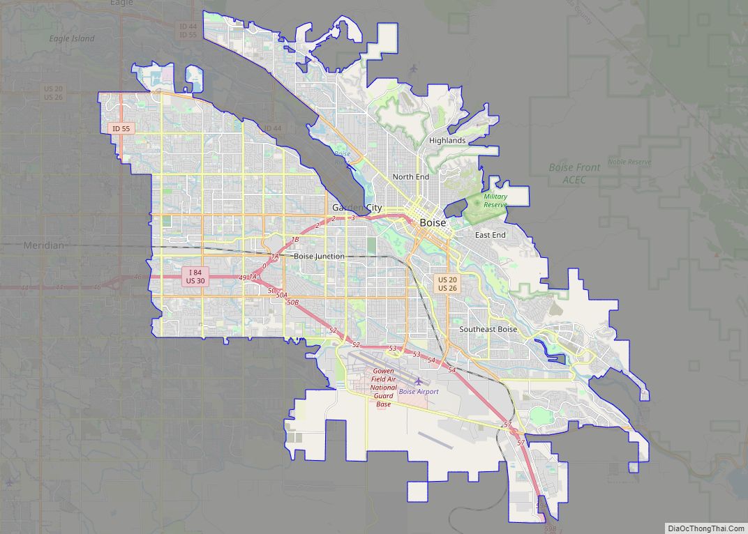
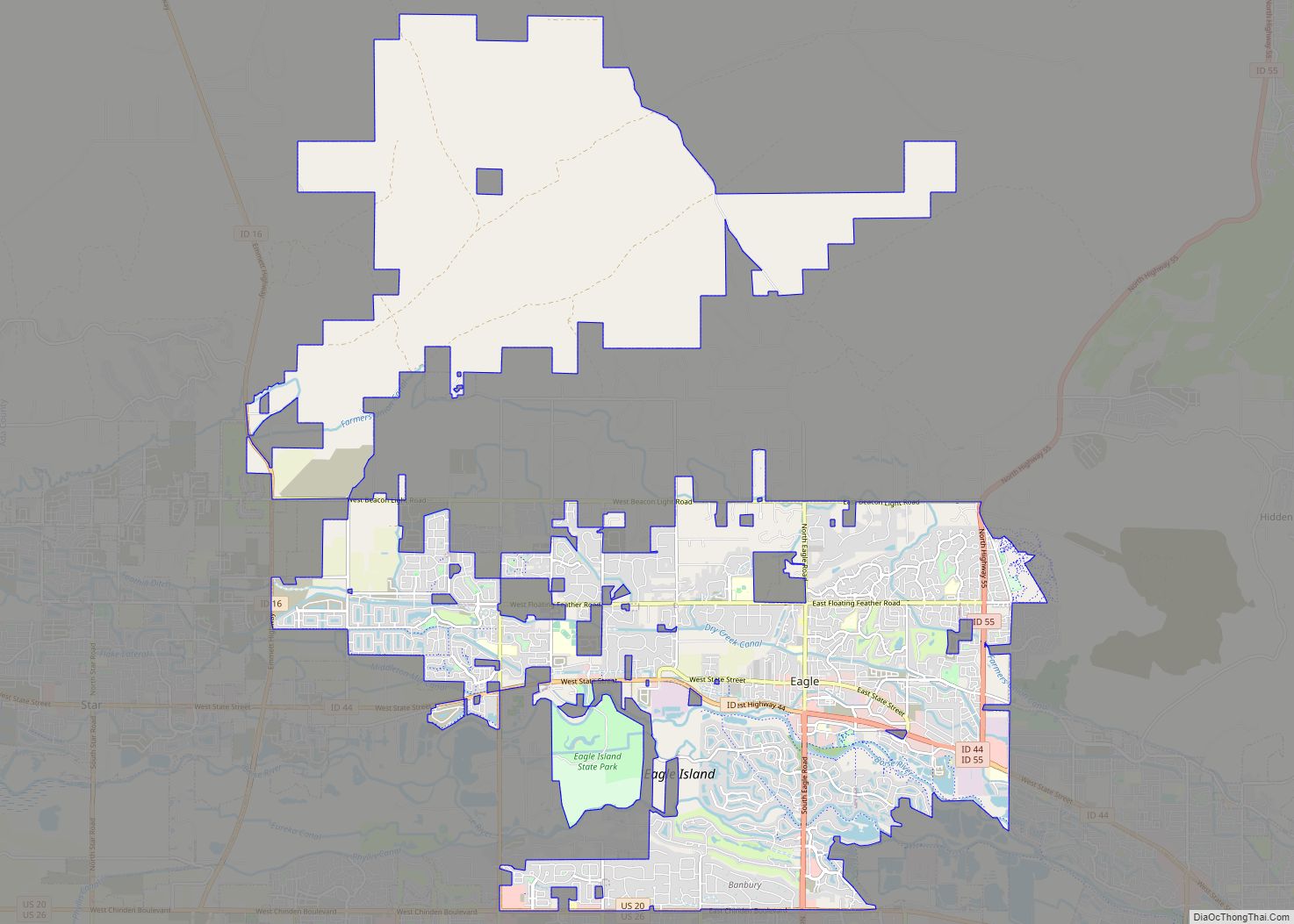
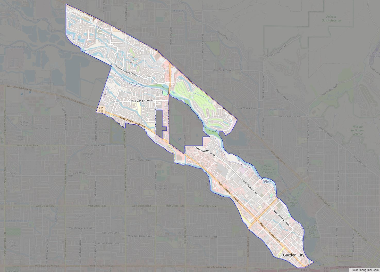
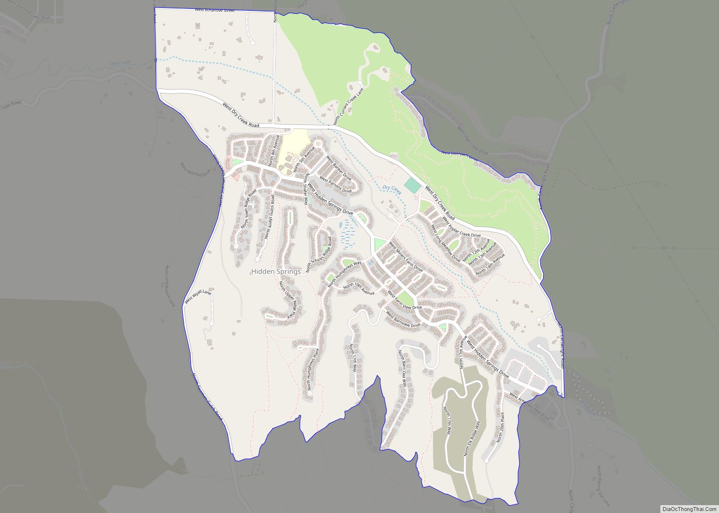
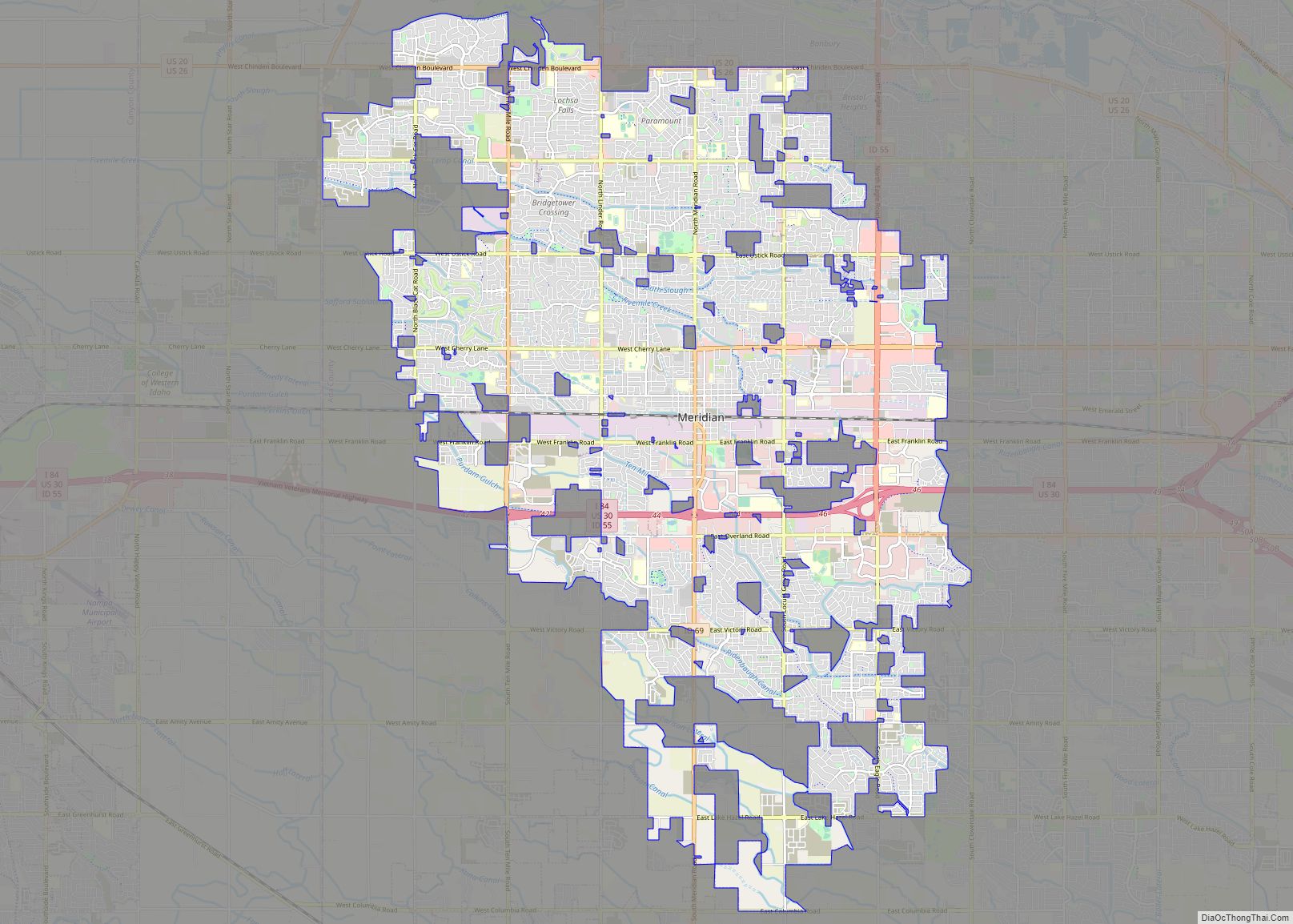
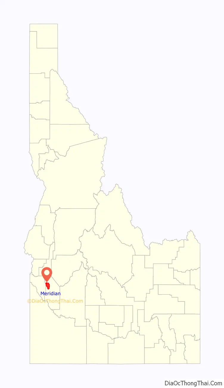
Online Interactive Map
Click on ![]() to view map in "full screen" mode.
to view map in "full screen" mode.
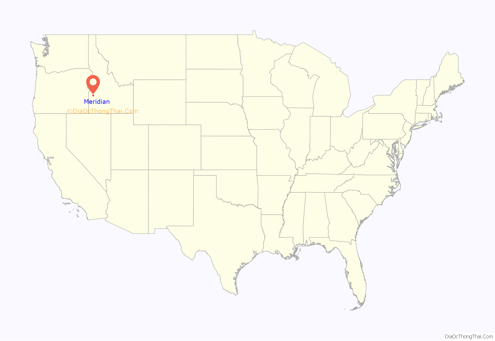
Meridian location map. Where is Meridian city?
History
The town was established in 1891 on the Onweiler farm north of the present site and was called Hunter. Two years later an I.O.O.F. lodge was organized and called itself Meridian because it was located on the Boise Meridian and the town was renamed. The Settlers’ Irrigation Ditch, 1892, changed the arid region into a productive farming community which was incorporated in 1902.
Meridian was incorporated in 1903. The information in the following sections (Irrigation, Village, Rail Transportation, and Creamery) is found on the displays in the Meridian City Hall Plaza.
Irrigation (1890– )
Early settlers arriving in the area came with no knowledge of gravity flow irrigation. Their previous homes were in areas where rain provided the needed moisture to raise crops. Irrigation soon became a necessity, since having a water source was a requirement for receiving the patent for the land from the U.S. Land Office. Irrigation districts, such as the Nampa-Meridian and Settlers irrigation districts, continue to serve the immediate Meridian area.
Village (1903–41)
The original Meridian town site was filed in 1893 on homestead grant land belonging to Eliza Ann Zenger. Her husband, Christian, filed the plat with county officials and called it Meridian. The early settlers, many of whom were relatives, left their homes in Missouri to go west, either by wagon, train, or immigrant railroad car, bringing their lodge and church preferences with them. They established local institutions soon after arriving and filed for homestead lands.
Around the start of the 20th century, settlers established fruit orchards and built fruit packing businesses and prune dryers along the railroad tracks. Local orchards produced many varieties of apples and Italian prunes. Production continued through the mid-1940s when it was no longer profitable and the businesses closed. In 1941, Meridian’s status changed from a village to a city.
Rail transportation (1908–28)
Following the raising of $4,000 to lay the Interurban rail line from Onweiler (Meridian and Ustick Roads), the tracks were completed into the village center. Turning east on Broadway and ending at East Second, the last car would spend the night in Meridian before returning to Boise early the next morning with passengers and freight. The interurban Station and Generator building (west one-third of the old library at Meridian and Idaho Streets) was built in 1912, and the line continued on to Nampa via Meridian. The tracks down Broadway were not used after 1912. The Interurban Company entered into receivership and closed in 1928 after 20 years of providing continuous transportation to neighboring towns. It was Meridian’s main connection to the area outside the local community.
The Union Pacific Railroad spur opened in 1900 and is currently operated by the Boise Valley Railroad. Many industrial customers continue to ship forest, agricultural, and chemical products along this corridor.
Creamery (1929–70)
The lowest days of the Great Depression brightened for area dairymen when the Ada County Dairymen’s cooperative creamery began operation in 1929. It provided milk checks to those who were members of the cooperative, enabling them to pay their taxes and provide food for their families. Other community members hauled milk to the creamery and were employed by the creamery, whose product was Challenge Butter.
The creamery ran 7 days a week for 40 years. Additions and improvements were made while the plant was in full operation. Later years saw the Wyeth Laboratories affiliate with the creamery to manufacture SMA baby formula.
After the creamery ceased local operations in 1970, the dairymen shipped their milk to the Caldwell creamery for processing.
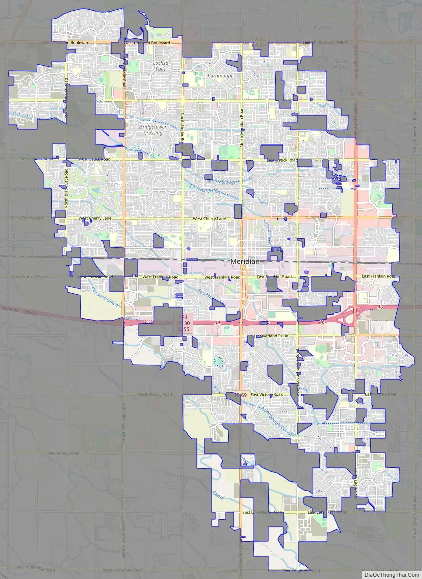
Meridian Road Map
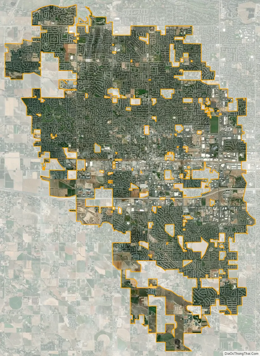
Meridian city Satellite Map
Geography
Meridian is located at 43°36′51″N 116°23′56″W / 43.61417°N 116.39889°W / 43.61417; -116.39889 (43.614229, -116.398963).
According to the U.S. Census Bureau, the city has a total area of 26.84 square miles (69.52 km), of which, 26.79 square miles (69.39 km) is land and 0.05 square miles (0.13 km) is water.
The majority of Meridian lies on a flat plain, roughly in the north central part of Treasure Valley. There is a low bench along the south east edge of the city. The city is crossed by several irrigation canals that generally run from the south east to the north west. The Boise River runs north of the city. The Snake River runs far south of the city. Squaw Butte is visible to the north at 5,873 feet (1,790 m). Shafer Butte is visible to the north east at 7,572 feet (2,308 m). The Owyhee Mountains are visible to the far south.
Climate
Meridian’s climate is characterized as semi-arid with four distinct seasons. Meridian experiences hot and dry summers where temperatures can often exceed 100 °F (38 °C), as well as cold winters with occasional light snowfall. Rainfall is usually infrequent and light, usually averaging less than an inch (25.4 mm) per month. December is the wettest month with an average of 1.55 inches (39 mm) of precipitation, and August is the driest month with 0.24 inches (6.1 mm). Spring and fall are generally temperate.
See also
Map of Idaho State and its subdivision:- Ada
- Adams
- Bannock
- Bear Lake
- Benewah
- Bingham
- Blaine
- Boise
- Bonner
- Bonneville
- Boundary
- Butte
- Camas
- Canyon
- Caribou
- Cassia
- Clark
- Clearwater
- Custer
- Elmore
- Franklin
- Fremont
- Gem
- Gooding
- Idaho
- Jefferson
- Jerome
- Kootenai
- Latah
- Lemhi
- Lewis
- Lincoln
- Madison
- Minidoka
- Nez Perce
- Oneida
- Owyhee
- Payette
- Power
- Shoshone
- Teton
- Twin Falls
- Valley
- Washington
- Alabama
- Alaska
- Arizona
- Arkansas
- California
- Colorado
- Connecticut
- Delaware
- District of Columbia
- Florida
- Georgia
- Hawaii
- Idaho
- Illinois
- Indiana
- Iowa
- Kansas
- Kentucky
- Louisiana
- Maine
- Maryland
- Massachusetts
- Michigan
- Minnesota
- Mississippi
- Missouri
- Montana
- Nebraska
- Nevada
- New Hampshire
- New Jersey
- New Mexico
- New York
- North Carolina
- North Dakota
- Ohio
- Oklahoma
- Oregon
- Pennsylvania
- Rhode Island
- South Carolina
- South Dakota
- Tennessee
- Texas
- Utah
- Vermont
- Virginia
- Washington
- West Virginia
- Wisconsin
- Wyoming