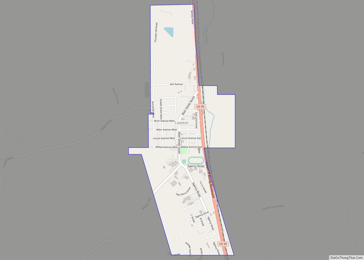
Lapwai is a city in the northwest United States, in Nez Perce County, Idaho. Its population was 1,137 at the 2010 census, and it is the seat of government of the Nez Perce Indian Reservation. Lapwai actually means “The land of the butterflies”
| Name: | Lapwai city |
|---|---|
| LSAD Code: | 25 |
| LSAD Description: | city (suffix) |
| State: | Idaho |
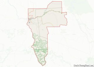
| County: | Nez Perce County |
| Elevation: | 955 ft (291 m) |
| Total Area: | 0.77 sq mi (1.98 km²) |
| Land Area: | 0.76 sq mi (1.96 km²) |
| Water Area: | 0.01 sq mi (0.03 km²) |
| Total Population: | 1,137 |
| Population Density: | 1,503.97/sq mi (580.55/km²) |
| ZIP code: | 83540 |
| Area code: | 208, 986 |
| FIPS code: | 1645370 |
| GNISfeature ID: | 0396768 |
| Website: | cityoflapwai.com |
Online Interactive Map
Click on ![]() to view map in "full screen" mode.
to view map in "full screen" mode.
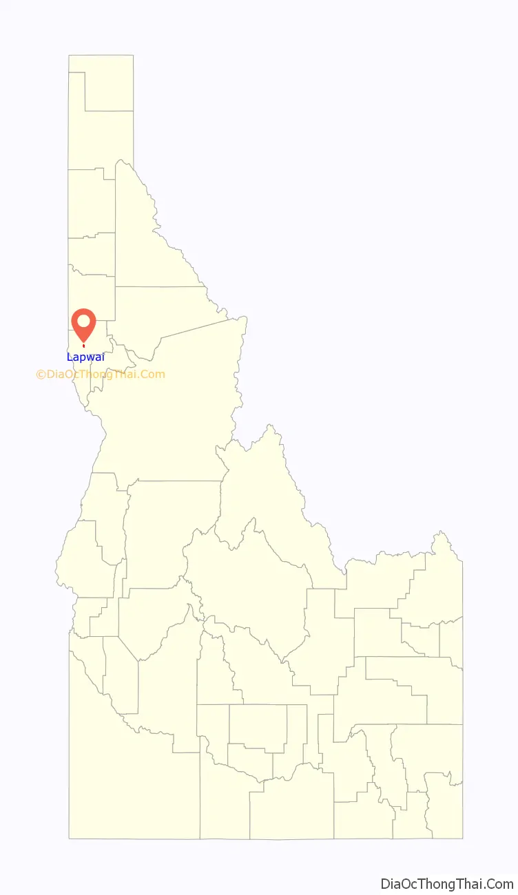
Lapwai location map. Where is Lapwai city?

History
The area that is today Lapwai was the home of Hin-ma-tute-ke-kaikt, also known as Big Thunder and later as James. It was here that Henry Spalding established a Protestant mission among the Nez Perce in 1836. This was also the general region that Bill Craig settled, since his wife was James’ daughter.
The city’s predecessor, Fort Lapwai, operated on the site from 1863 to 1884. The village of Lapwai was incorporated in 1911, with a model rural school.
The word “Lapwai” means place of the butterflies, as the area had thousands in early summer in earlier years.
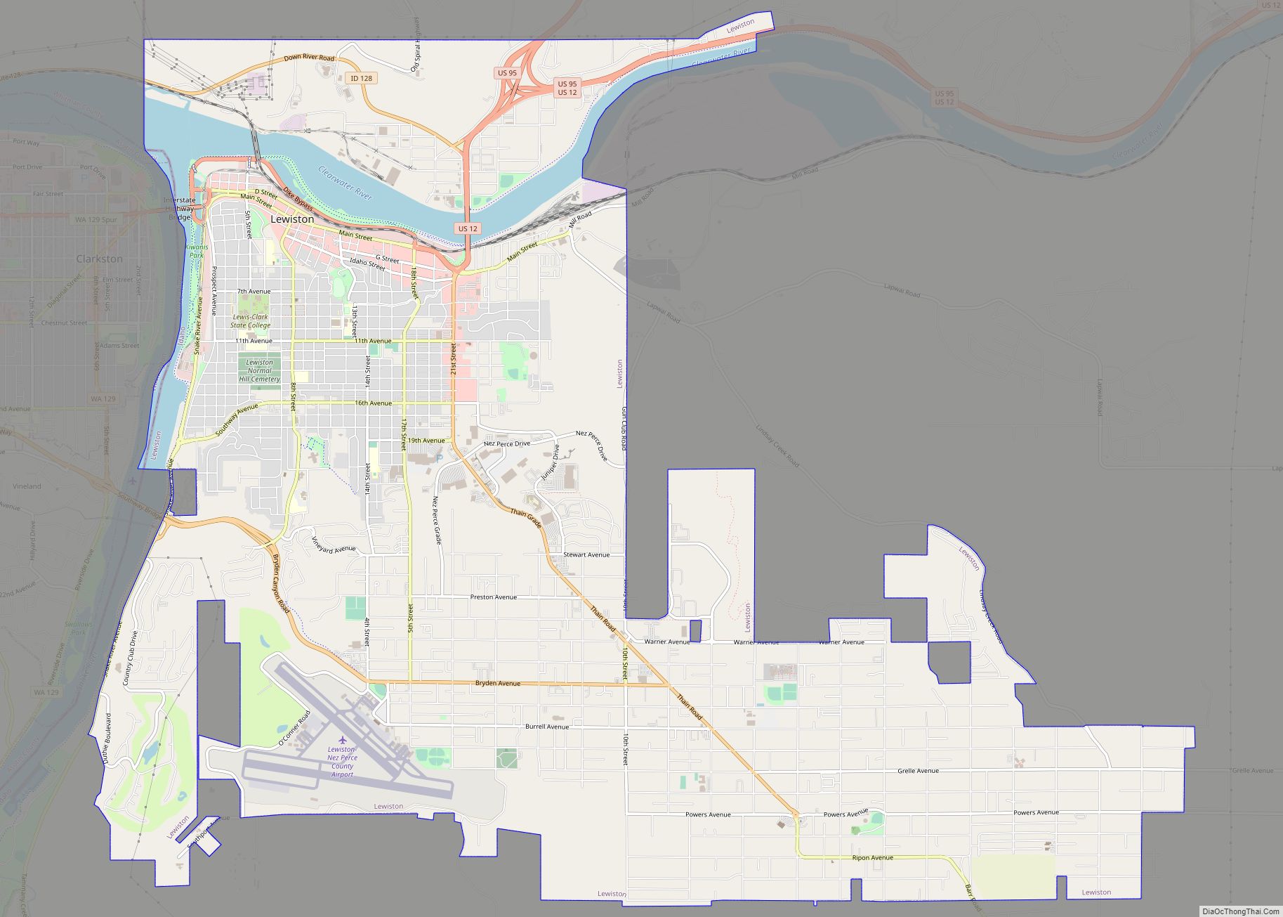
Lapwai is part of the Lewiston, ID-WA Metropolitan Statistical Area.
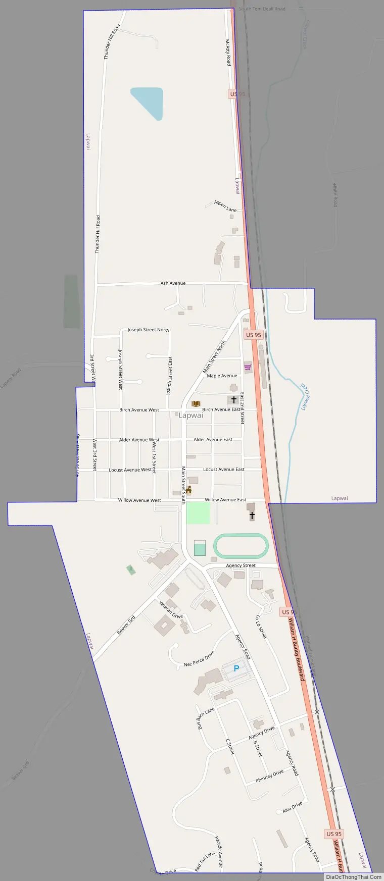
Lapwai Road Map
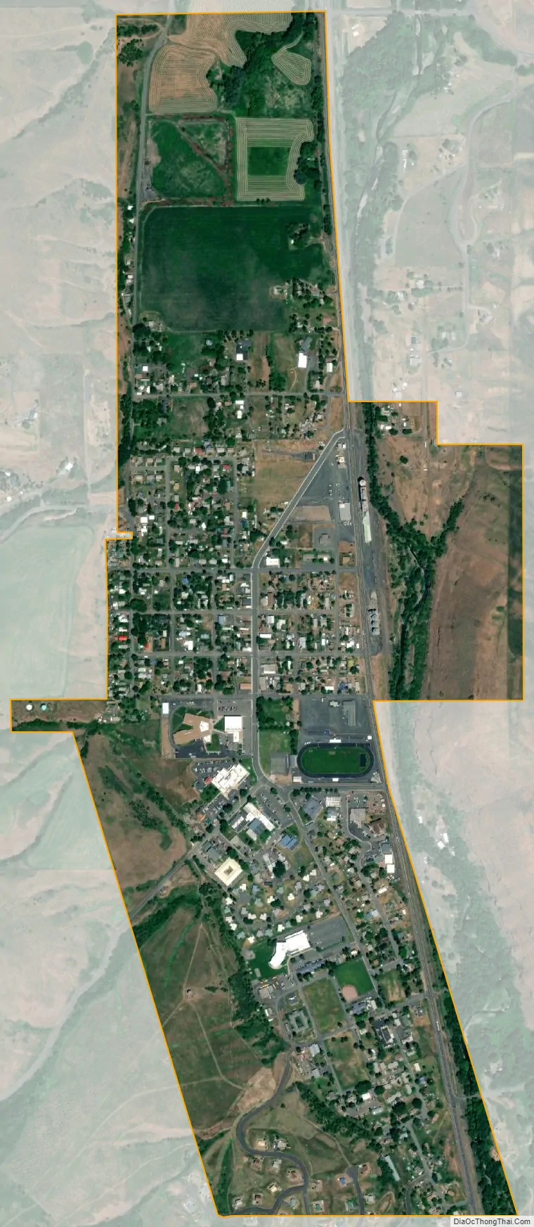
Lapwai city Satellite Map
Geography
Lapwai is located at 46°24′16″N 116°48′16″W / 46.40444°N 116.80444°W / 46.40444; -116.80444 (46.404388, -116.804376)., at an elevation of 955 feet (291 m) above sea level
According to the United States Census Bureau, the city has a total area of 0.81 square miles (2.10 km), of which, 0.80 square miles (2.07 km) is land and 0.01 square miles (0.03 km) is water.
Lapwai is located on the floor of a valley carved by Lapwai Creek, roughly 3 miles south of its confluence with the Clearwater River. The hills to the east and west of the city rise dramatically more than 600 feet in less than a mile from the city. U.S. Route 95 passes through Lapwai.
See also
Map of Idaho State and its subdivision:- Ada
- Adams
- Bannock
- Bear Lake
- Benewah
- Bingham
- Blaine
- Boise
- Bonner
- Bonneville
- Boundary
- Butte
- Camas
- Canyon
- Caribou
- Cassia
- Clark
- Clearwater
- Custer
- Elmore
- Franklin
- Fremont
- Gem
- Gooding
- Idaho
- Jefferson
- Jerome
- Kootenai
- Latah
- Lemhi
- Lewis
- Lincoln
- Madison
- Minidoka
- Nez Perce
- Oneida
- Owyhee
- Payette
- Power
- Shoshone
- Teton
- Twin Falls
- Valley
- Washington
- Alabama
- Alaska
- Arizona
- Arkansas
- California
- Colorado
- Connecticut
- Delaware
- District of Columbia
- Florida
- Georgia
- Hawaii
- Idaho
- Illinois
- Indiana
- Iowa
- Kansas
- Kentucky
- Louisiana
- Maine
- Maryland
- Massachusetts
- Michigan
- Minnesota
- Mississippi
- Missouri
- Montana
- Nebraska
- Nevada
- New Hampshire
- New Jersey
- New Mexico
- New York
- North Carolina
- North Dakota
- Ohio
- Oklahoma
- Oregon
- Pennsylvania
- Rhode Island
- South Carolina
- South Dakota
- Tennessee
- Texas
- Utah
- Vermont
- Virginia
- Washington
- West Virginia
- Wisconsin
- Wyoming