Lewiston is a city and the county seat of Nez Perce County, Idaho, United States, in the state’s north central region. It is the second-largest city in the northern Idaho region, behind Coeur d’Alene, and ninth-largest in the state. Lewiston is the principal city of the Lewiston, ID-WA Metropolitan Statistical Area, which includes all of Nez Perce County and Asotin County, Washington. As of the 2020 census, the population of Lewiston was 34,203 up from 31,894 in 2010.
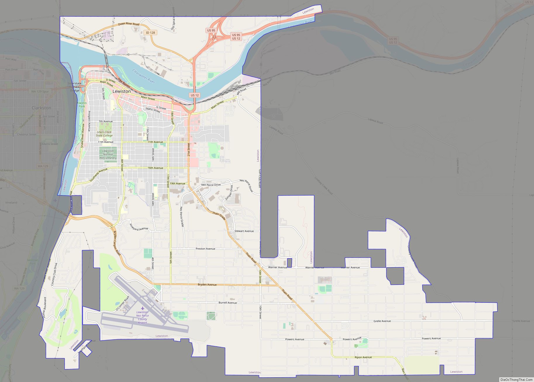
Lewiston is located at the confluence of the Snake River and Clearwater River, thirty miles (50 km) upstream and southeast of the Lower Granite Dam. Because of dams (and their locks) on the Snake and Columbia River, Lewiston is reachable by some ocean-going vessels. The Port of Lewiston (Idaho’s only seaport) has the distinction of being the farthest inland port east of the West Coast. The Lewiston-Nez Perce County Airport serves the city by air.
Lewiston was founded in 1861 in the wake of a gold rush which began the previous year near Pierce, northeast of Lewiston. The city was incorporated by the Washington Territorial Legislature in January 1863. In March 1863, Lewiston became the first capital of the newly created Idaho Territory. Its stint as seat of the new territory’s government was short-lived, as a resolution to have the capital moved south to Boise was passed by the Idaho Territorial Legislature on December 7, 1864.
Lewiston’s main industries are agriculture, paper, and timber products, and light manufacturing. Ammunition manufacturing maintains a very important and growing presence in Lewiston, being the headquarters of ammunition makers CCI and Speer Bullet. The city is the primary regional transportation, retail, health care, and entertainment center of the surrounding area and serves as a recreation destination for the Hells Canyon National Recreation Area.
Lewiston is home to Lewis–Clark State College, a public undergraduate college. Community events in Lewiston include the Dogwood Festival, Hot August Nights, and the Lewiston Roundup.
| Name: | Lewiston city |
|---|---|
| LSAD Code: | 25 |
| LSAD Description: | city (suffix) |
| State: | Idaho |
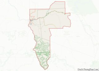
| County: | Nez Perce County |
| Founded: | 1861; 162 years ago (1861) |
| Incorporated: | 1861 |
| Elevation: | 745 ft (227 m) |
| Land Area: | 17.30 sq mi (44.81 km²) |
| Water Area: | 0.81 sq mi (2.08 km²) |
| Population Density: | 1,895.15/sq mi (731.71/km²) |
| ZIP code: | 83501 |
| Area code: | 208, 986 (208 |
| FIPS code: | 1646540 |
| GNISfeature ID: | 0396788 |
| Website: | www.cityoflewiston.org |
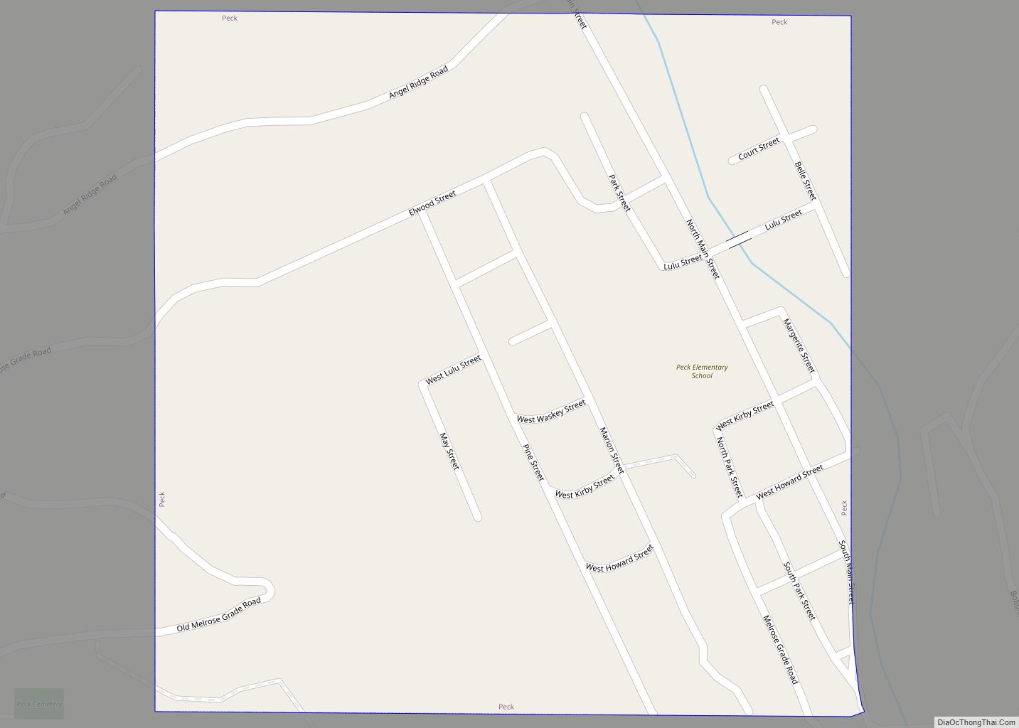
Online Interactive Map
Click on ![]() to view map in "full screen" mode.
to view map in "full screen" mode.
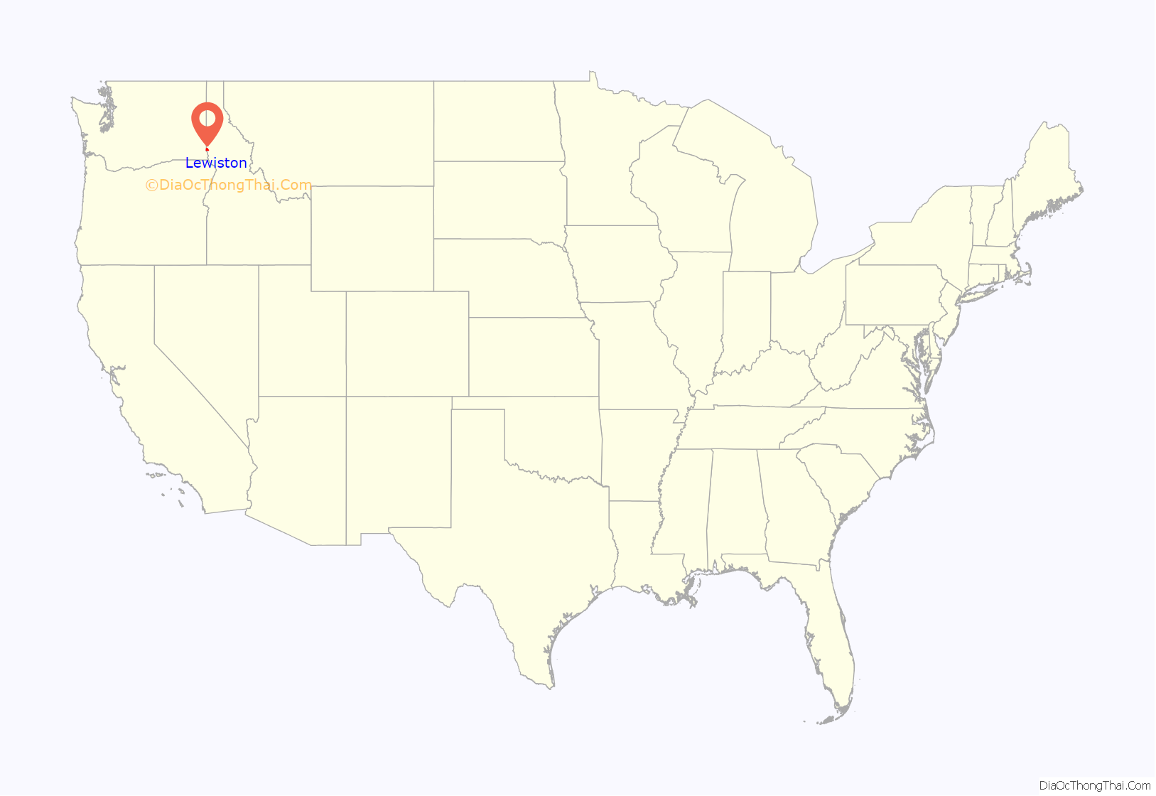
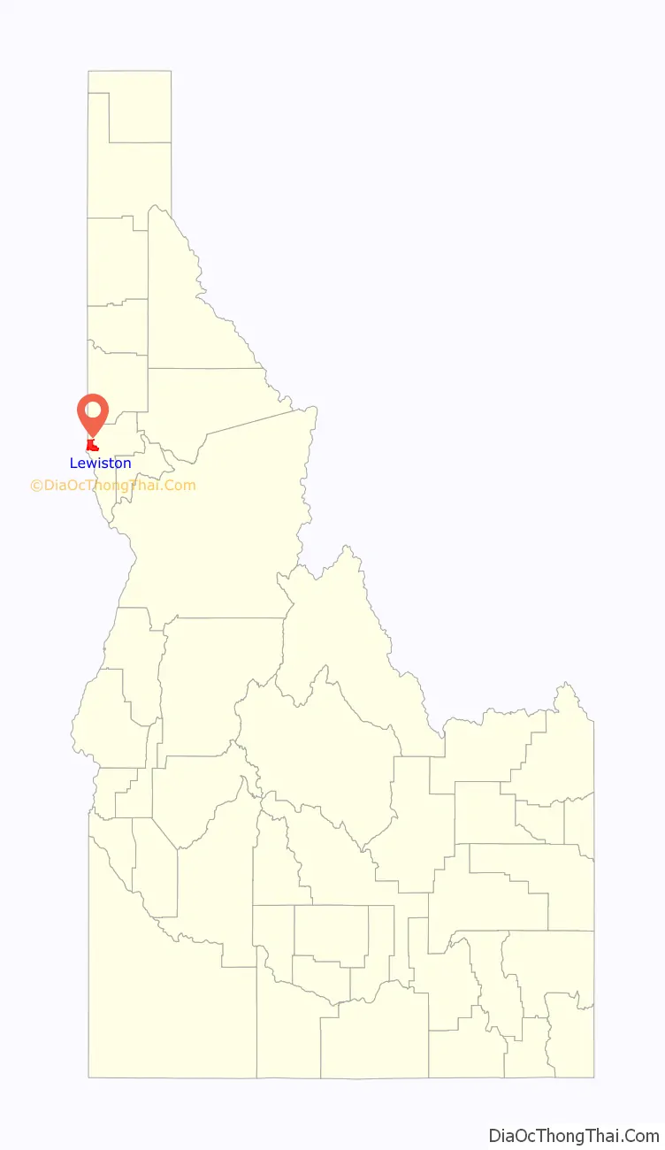
Lewiston location map. Where is Lewiston city?
History
The Nimiipuu (Nez Perce) have inhabited the area for thousands of years. The first people of European ancestry to visit the Lewiston area were members of the David Thompson expedition of 1803. Thompson was looking to establish fur trading posts for the Hudson’s Bay Company of British North America (now Canada). Thompson established the first white settlement in Idaho, MacKenzie’s Post. But it soon failed as the local Nez Perce tribe’s men considered beaver trapping to be women’s work, the tribe was migratory and apparently women thought they already had enough to do. This was followed by the Lewis and Clark Expedition in October 1805. At the future townsite, they encountered settlements of the native Nez Perce, and they returned to the valley on their eastward trip from the Pacific in the spring of 1806.
The town is believed to have been named after Meriwether Lewis and after Victor Trevitt’s hometown of Lewiston, Maine, but people did not know that was the reason Trevitt shouted the idea out. He simply stated the “Journal of Lewis and Clark” talked about being in the valley. The town was founded 162 years ago in 1861, in the wake of a gold rush which began the previous year near Pierce, northeast of Lewiston leading to the Nez Perce War and the removal of Nez Perce. The first newspaper in present-day Idaho, The Golden Age, began publication in the city of Lewiston, Washington Territory in 1862, and was joined by the present (and only) newspaper, the Lewiston Morning Tribune in September 1892. In March 1863 Lewiston became the capital of the newly created Idaho Territory. Thomas J. Beall, one of the first three white settlers in Lewiston, wrote many of the Lewiston Tribune‘s first articles, and continued to do so until his death at the age of 89.
The city’s stint as a seat of the new territory’s government was short-lived. As the gold rush quieted in northern Idaho, it heated up in a new mineral rush in southwestern Idaho, centered in Idaho City, which became the largest city in the Northwest in the mid-1860s. A resolution in late 1864 to have the capital moved from Lewiston to Boise was passed by the Idaho Territorial Legislature on December 7, six weeks before the territorial legislature’s session legally began, and after litigation, on a split decision decided by one vote on the territorial supreme court on geographic lines.
Boise became the capital in 1866; the move was very unpopular in northern Idaho and in violation of a court order. So, the territorial governor, Caleb Lyon and the territorial secretary, secretly took the territorial seal, archives, and treasury, and fled from Lewiston. Lyon went down river to Portland, Oregon, a trip marked by the alleged theft of the treasury from his steamship cabin. The territorial secretary departed southward for Boise to avoid the public outrage that was sure to erupt.
North Idahoans were somewhat placated in 1889 when the University of Idaho was awarded to nearby Moscow, thirty miles (50 km) north, and began instruction in 1892. Lewiston State Normal School, now Lewis-Clark State College, was established in 1893, as was another normal school or teacher education college, now defunct, in the south at Albion. These were the state’s first three institutions of higher education. Lewiston was the site of the first public school in Idaho, in 1862. In December 1880, the district was the first to be chartered by the Legislature and thus carries the designation of Lewiston Independent School District #1. (Boise was second, opening school doors in 1865.)
The City of Lewiston’s high reservoir failed on January 18, 2023. The failure caused flooding with the release of approximately three million gallons of water.
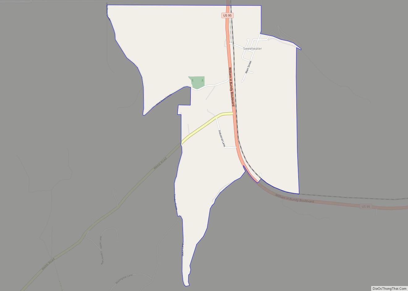
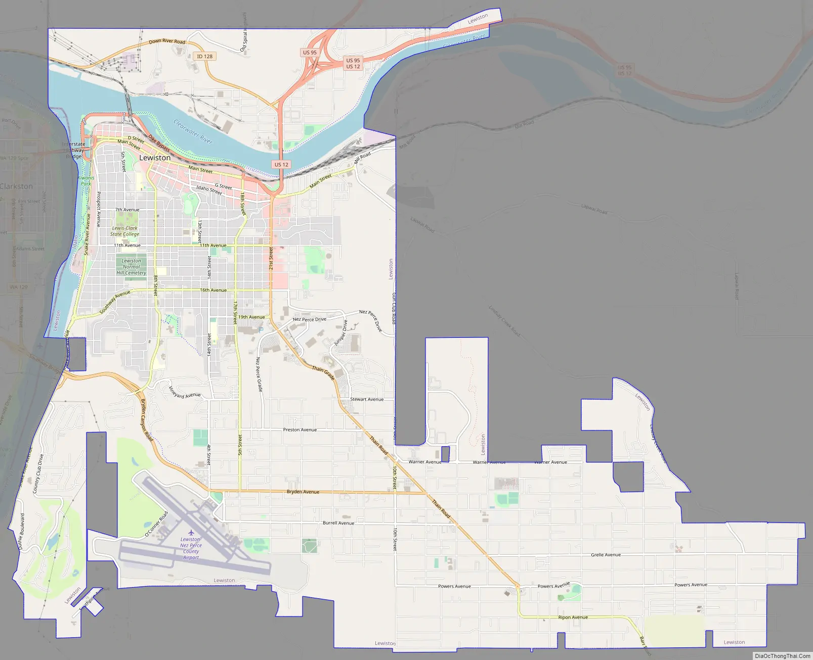
Lewiston Road Map
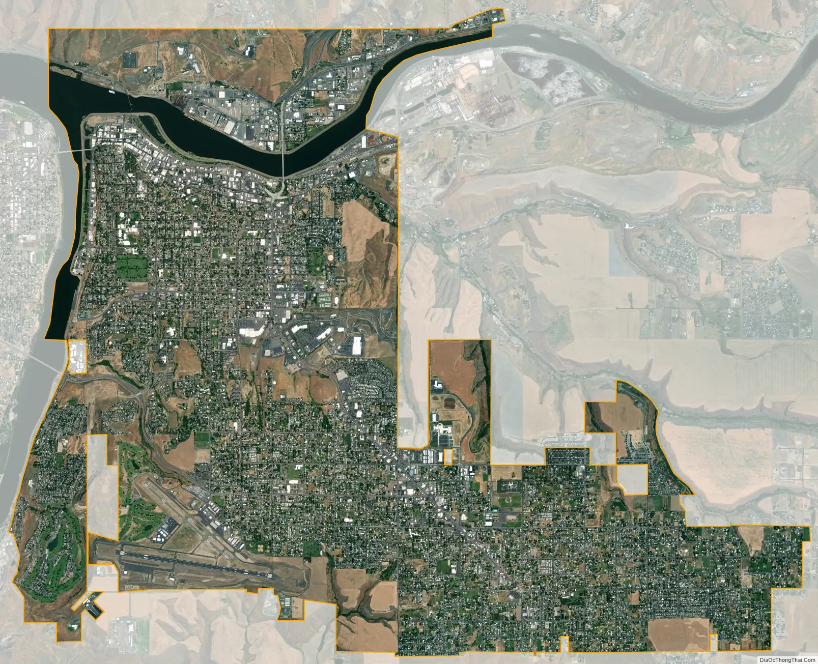
Lewiston city Satellite Map
Geography
Lewiston is located at the confluence of the Snake and Clearwater rivers. Immediately west of Lewiston is the smaller twin city of Clarkston, Washington. The north-flowing Snake River departs Hells Canyon and forms the state boundary with Washington, while west-flowing Clearwater River defines the northern border of the city. At their confluence at the city’s northwest corner, the lower Snake River turns west into Washington, and after passing four dams, empties into the Columbia River at Burbank.
Lower Granite Dam
Thirty miles (50 km) northwest of the city is the Lower Granite Dam, the last and upper-most of the four dams on the lower Snake River, the largest tributary of the Columbia River. It was completed 48 years ago in 1975, and raised the river level back to Lewiston, effectively making it the eastern end of the new reservoir, Lower Granite Lake. Because of these dams (and their locks), Lewiston is navigable by some ocean-going vessels. At 465 miles (750 km) upstream of the Pacific Ocean (at the mouth of the Columbia River, adjacent to Astoria, Oregon), the Port of Lewiston has the distinction of being the most inland seaport east of the West Coast, and Idaho’s only seaport. Barges of timber products, grain, and other goods are shipped via the Snake-Columbia system to the Pacific. The first barge went to Portland; it was loaded with wheat and departed Lewiston on August 9, 1975.
Levees
Lewiston’s main industries are agriculture, the paper and timber products from the mill owned and operated by the Clearwater Paper Corporation (until December 2008, a part of the Potlatch Corporation), and light manufacturing.
Along much of the Snake River is a system of levees to protect against flooding; most are maintained by the U.S. Army Corps of Engineers.
According to the U.S. Census Bureau, the city has a total area of 18.04 square miles (46.72 km), of which 17.23 square miles (44.63 km) is land and 0.81 square miles (2.10 km) is water. Downtown Lewiston, at elevations between 740 feet (230 m) and 780 feet (240 m), is only slightly higher in elevation than the river, about 741 ft (226 m), which was thirty feet (9 m) lower prior to the completion of the Lower Granite Dam. Away from downtown the terrain gains elevation quickly, as the steep riverbank highway of U.S. 95 north of Lewiston ascends to 2,756 feet (840 m).
The lowest point in the state of Idaho is located on the Snake River in Lewiston, where it meets the Clearwater and flows west into Washington. The populated areas in Idaho with the lowest elevations are along (or near) the Clearwater River, from Lowell at 1,486 feet (453 m) to Lewiston.
The Orchards
The heavily residential southern half of the city is referred to as “The Orchards”. This area is much higher in elevation than downtown, at about 1,400 ft (425 m), and is named for the fruit orchards that previously covered the area. Formerly unincorporated, it was annexed in late 1969, which nearly doubled the city’s population and doubled the area of the city. There is little sign of any orchards today, although there is a wide proliferation of fruit trees in the backyards of many residences in this area of town. The Lewiston-Nez Perce County Airport is located on the western edge of the Orchards plateau at 1,438 feet (438 m) above sea level, with Bryden Canyon Road providing westbound access via the Southway Bridge into Clarkston.
Climate
Lewiston experiences a semi-arid climate (Köppen BSk) with occasionally cold, but short, winters, mostly influenced by mild Pacific air, and hot, dry summers. The monthly daily average temperature ranges from 33.7 °F (0.9 °C) in December to 74.4 °F (23.6 °C) in July; the temperature reaches 100 °F (38 °C) on 7.7 afternoons, 90 °F (32 °C) on 42 afternoons, and does not rise above freezing on 14 afternoons annually. Precipitation averages 12.31 inches (31 cm) annually, including an average seasonal snowfall of 10.5 inches (27 cm).
At 195 days, the growing season is relatively long, with the average window for freezing temperatures being October 23 thru April 10. The plant hardiness zone are 7 and 8 with temperatures below 0 °F (−18 °C) being rare. Extreme temperatures range from −23 °F (−31 °C) on December 13, 1919 to 117 °F (47 °C) on July 27, 1939. Tornadoes are very rare with only three tornadoes being reported in Nez Perce County since 1950, and the only significant tornado was an F2 in Lapwai on May 8, 1962.
See also
Map of Idaho State and its subdivision:- Ada
- Adams
- Bannock
- Bear Lake
- Benewah
- Bingham
- Blaine
- Boise
- Bonner
- Bonneville
- Boundary
- Butte
- Camas
- Canyon
- Caribou
- Cassia
- Clark
- Clearwater
- Custer
- Elmore
- Franklin
- Fremont
- Gem
- Gooding
- Idaho
- Jefferson
- Jerome
- Kootenai
- Latah
- Lemhi
- Lewis
- Lincoln
- Madison
- Minidoka
- Nez Perce
- Oneida
- Owyhee
- Payette
- Power
- Shoshone
- Teton
- Twin Falls
- Valley
- Washington
- Alabama
- Alaska
- Arizona
- Arkansas
- California
- Colorado
- Connecticut
- Delaware
- District of Columbia
- Florida
- Georgia
- Hawaii
- Idaho
- Illinois
- Indiana
- Iowa
- Kansas
- Kentucky
- Louisiana
- Maine
- Maryland
- Massachusetts
- Michigan
- Minnesota
- Mississippi
- Missouri
- Montana
- Nebraska
- Nevada
- New Hampshire
- New Jersey
- New Mexico
- New York
- North Carolina
- North Dakota
- Ohio
- Oklahoma
- Oregon
- Pennsylvania
- Rhode Island
- South Carolina
- South Dakota
- Tennessee
- Texas
- Utah
- Vermont
- Virginia
- Washington
- West Virginia
- Wisconsin
- Wyoming