Kamiah (/ˈkæmi.aɪ/ (listen) KAM-ee-eye) is a city in Lewis and Idaho counties in the U.S. state of Idaho. The largest city in Lewis County, it extends only a small distance into Idaho County, south of Lawyer Creek. The population was 1,295 at the 2010 census, up from 1,160 in 2000. The city lies in the narrow valley of the Clearwater River; downstream are Orofino and Lewiston, at the confluence with the Snake River.
| Name: | Kamiah city |
|---|---|
| LSAD Code: | 25 |
| LSAD Description: | city (suffix) |
| State: | Idaho |
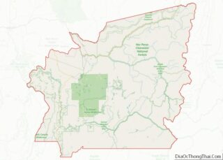
| County: | Idaho County, Lewis County |
| Elevation: | 1,240 ft (380 m) |
| Total Area: | 1.18 sq mi (3.07 km²) |
| Land Area: | 1.10 sq mi (2.84 km²) |
| Water Area: | 0.09 sq mi (0.22 km²) |
| Total Population: | 1,295 |
| Population Density: | 1,132.97/sq mi (437.49/km²) |
| ZIP code: | 83536 |
| Area code: | 208 |
| FIPS code: | 1642400 |
| GNISfeature ID: | 0396726 |
| Website: | www.kamiahchamber.com |
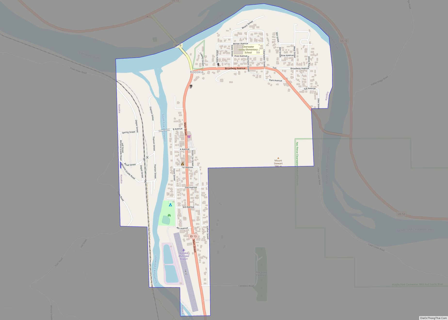
Online Interactive Map
Click on ![]() to view map in "full screen" mode.
to view map in "full screen" mode.
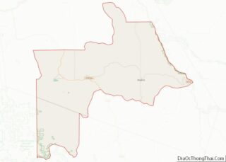
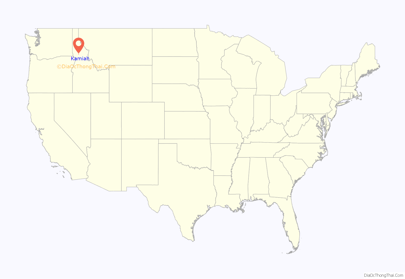
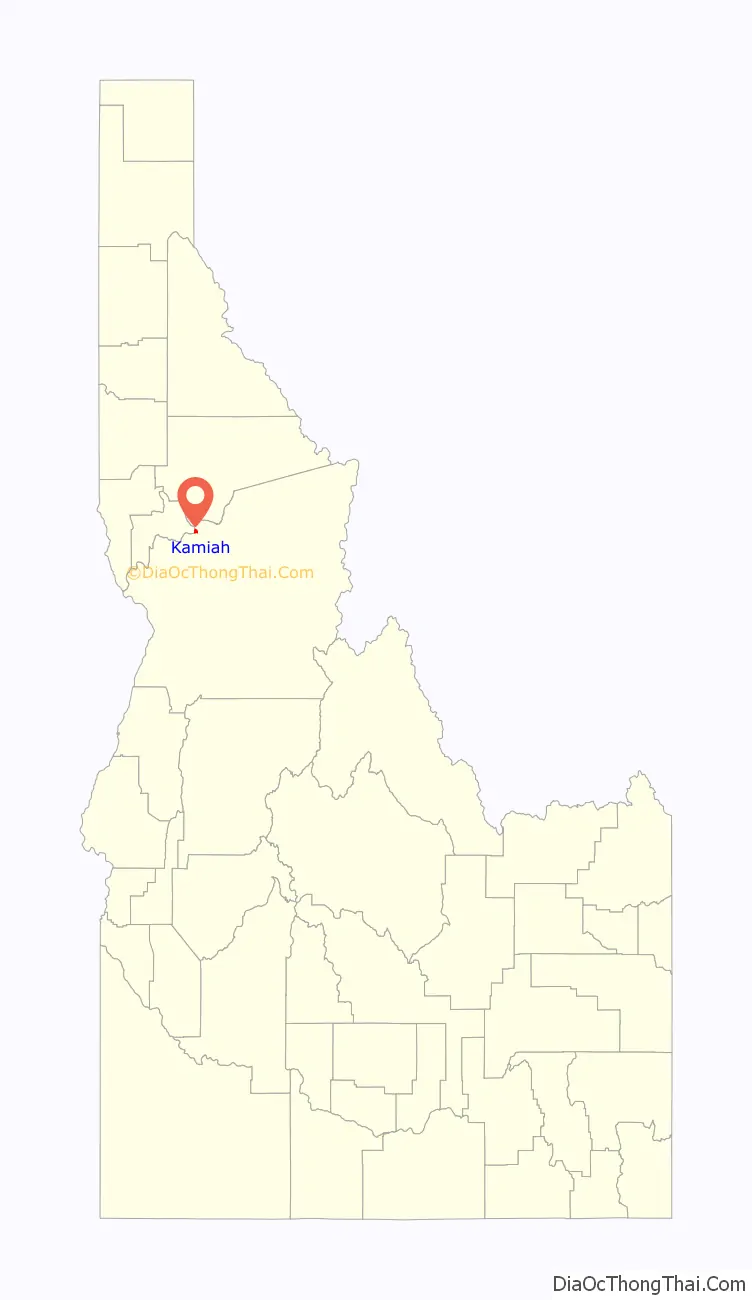
Kamiah location map. Where is Kamiah city?
History
The Kamiah area has been inhabited by the Nez Perce for centuries. The name “Kamiah” is Nez Perce for “many rope litters,” as Nez Perce manufactured “Kamia” ropes in the area to fish steelhead. Also according to Nez Perce tradition, the Appaloosa horse was first bred in the area.
On their return trip east, the Lewis and Clark Expedition camped in the Kamiah area for several weeks during the spring of 1806, waiting for snows to melt.
Kamiah is the character name of the Nez Perce/Blackfoot woman in Across the Wide Missouri, a 1951 ‘mountain men’ film set in the 1830s. Similar in fame to Sacagawea of the Lewis & Clark expedition, Kamiah led her associated mountain men’s troop over the Bitterroot Range to her homeland (Three Forks, Montana for Sacagawea).
Hohots Ilppilp was the leader around Kamiah from at least the time of Lewis and Clark until the 1840s. When the first leader for all the Nez Perce was appointed, it was Hohots Ilppilp’s grandson Ellis who lived in this area and maintained large herds of sheep, cattle and over a thousand horses.
Kamiah is within the Nez Perce Indian Reservation. Similar to the opening of lands in Oklahoma, the U.S. government opened the reservation for white settlement 128 years ago in November 1895. The proclamation had been signed less than two weeks earlier by President Cleveland.
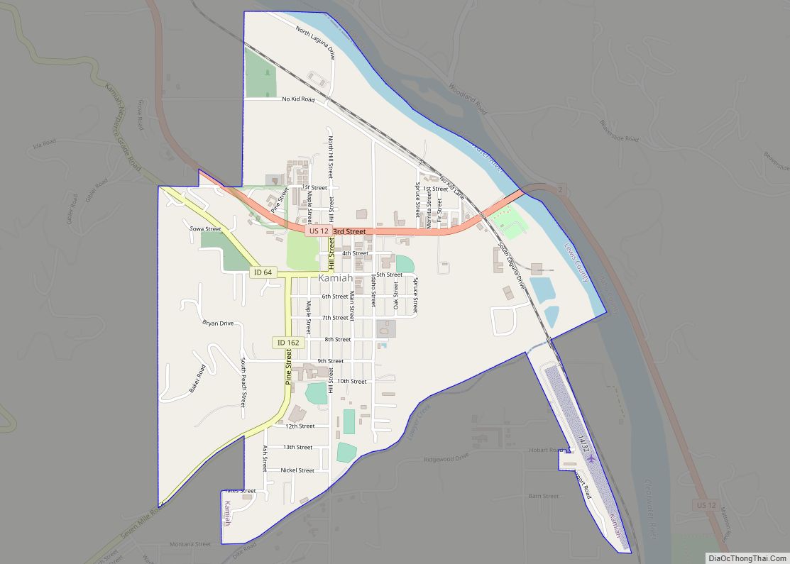
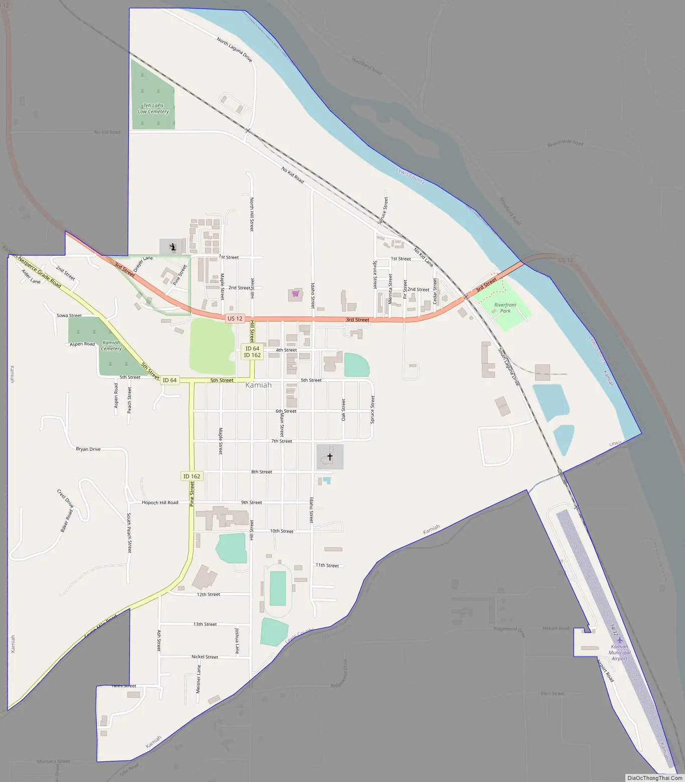
Kamiah Road Map
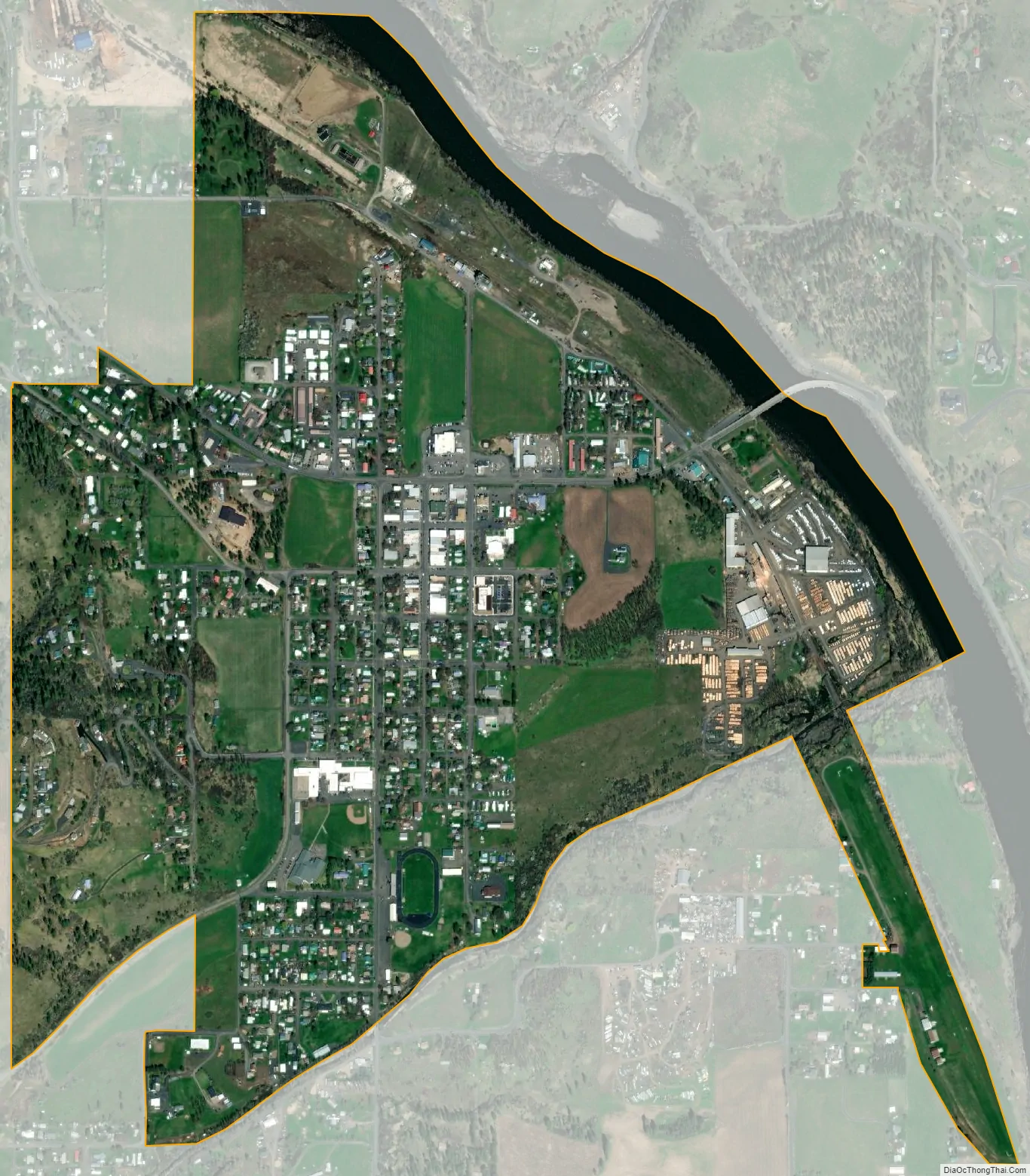
Kamiah city Satellite Map
Geography
According to the United States Census Bureau, the city has a total area of 1.17 square miles (3.03 km), of which 1.08 square miles (2.80 km) is land and 0.09 square miles (0.23 km) is water.
The city is located at the confluence of Lawyer Creek and the Clearwater River on the left bank of the latter. In the Kamiah area, the Lewis-Idaho County line follows Lawyer Creek to its confluence with the Clearwater, and then turns to follow the Clearwater. U.S. Route 12 passes through Kamiah, crossing from the right to left bank of the Clearwater at the city. The two streams cut deep and narrow valleys through the otherwise relatively flat, rolling Camas Prairie region that surrounds Kamiah. The city is located at 1,250 feet above sea level, but elevations of over 2,800 feet on the prairie lie within three miles of Kamiah.
In addition to U.S. Route 12, transportation links to Kamiah are provided by Idaho State Highway 64 and Idaho State Highway 162.
Climate
According to the Köppen climate classification system, Kamiah has a hot-summer continental climate (Köppen Dfa).
See also
Map of Idaho State and its subdivision:- Ada
- Adams
- Bannock
- Bear Lake
- Benewah
- Bingham
- Blaine
- Boise
- Bonner
- Bonneville
- Boundary
- Butte
- Camas
- Canyon
- Caribou
- Cassia
- Clark
- Clearwater
- Custer
- Elmore
- Franklin
- Fremont
- Gem
- Gooding
- Idaho
- Jefferson
- Jerome
- Kootenai
- Latah
- Lemhi
- Lewis
- Lincoln
- Madison
- Minidoka
- Nez Perce
- Oneida
- Owyhee
- Payette
- Power
- Shoshone
- Teton
- Twin Falls
- Valley
- Washington
- Alabama
- Alaska
- Arizona
- Arkansas
- California
- Colorado
- Connecticut
- Delaware
- District of Columbia
- Florida
- Georgia
- Hawaii
- Idaho
- Illinois
- Indiana
- Iowa
- Kansas
- Kentucky
- Louisiana
- Maine
- Maryland
- Massachusetts
- Michigan
- Minnesota
- Mississippi
- Missouri
- Montana
- Nebraska
- Nevada
- New Hampshire
- New Jersey
- New Mexico
- New York
- North Carolina
- North Dakota
- Ohio
- Oklahoma
- Oregon
- Pennsylvania
- Rhode Island
- South Carolina
- South Dakota
- Tennessee
- Texas
- Utah
- Vermont
- Virginia
- Washington
- West Virginia
- Wisconsin
- Wyoming