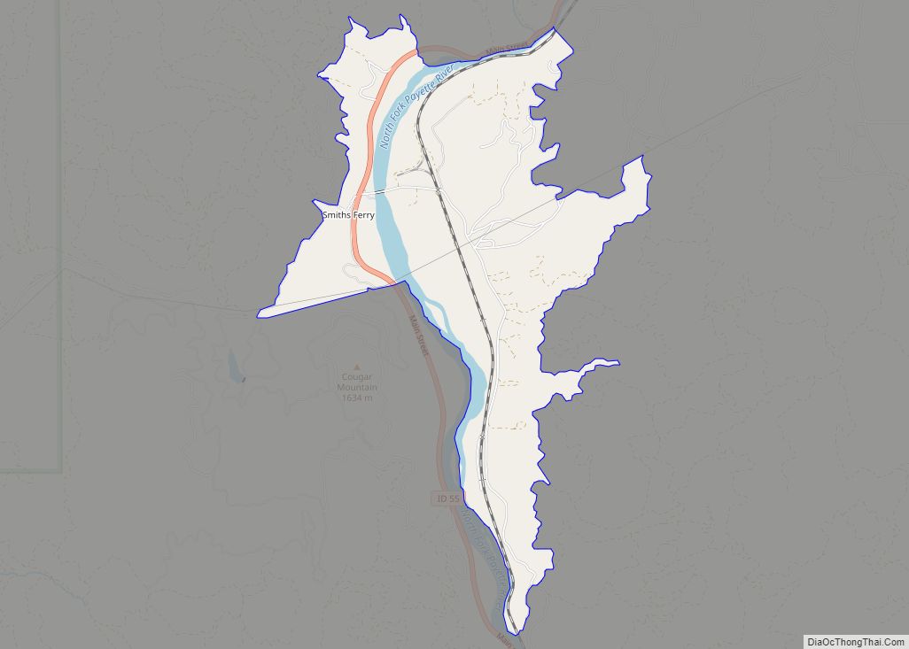
Smiths Ferry is a census-designated place in Valley County, Idaho, United States. Its population was 75 as of the 2010 census. Situated where the North Fork of the Payette River briefly calms and widens, its elevation is 4,554 feet (1,388 m) above sea level.
A ferry at the river was established by Clinton Meyers in 1887 to transport livestock to summer pasture in the Round and Long Valleys across the river. Also popular with freighters, the ferry was sold by Meyers to Jim Smith in 1891, hence the name Smith’s Ferry.
| Name: | Smiths Ferry CDP |
|---|---|
| LSAD Code: | 57 |
| LSAD Description: | CDP (suffix) |
| State: | Idaho |
| County: | Valley County |
| Elevation: | 4,554 ft (1,388 m) |
| Total Area: | 2.009 sq mi (5.20 km²) |
| Land Area: | 1.849 sq mi (4.79 km²) |
| Water Area: | 0.160 sq mi (0.41 km²) |
| Total Population: | 75 |
| Population Density: | 37/sq mi (14/km²) |
| Area code: | 208, 986 |
| FIPS code: | 1675160 |
| GNISfeature ID: | 400096 |
Online Interactive Map
Click on ![]() to view map in "full screen" mode.
to view map in "full screen" mode.
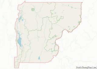
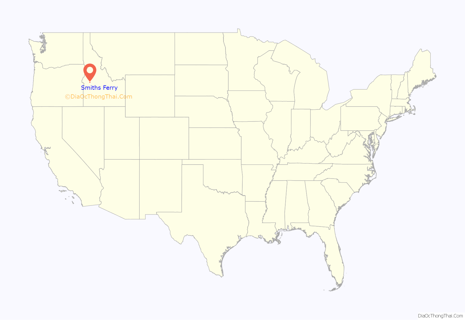
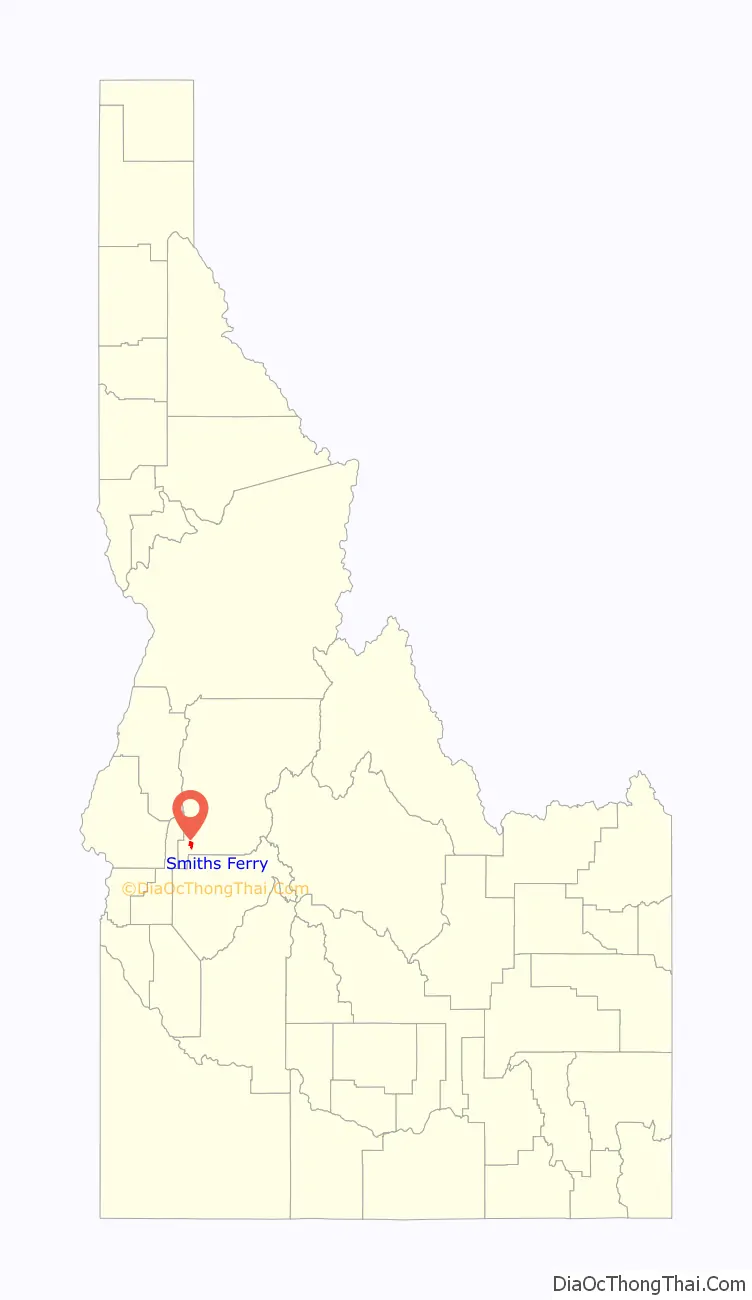
Smiths Ferry location map. Where is Smiths Ferry CDP?
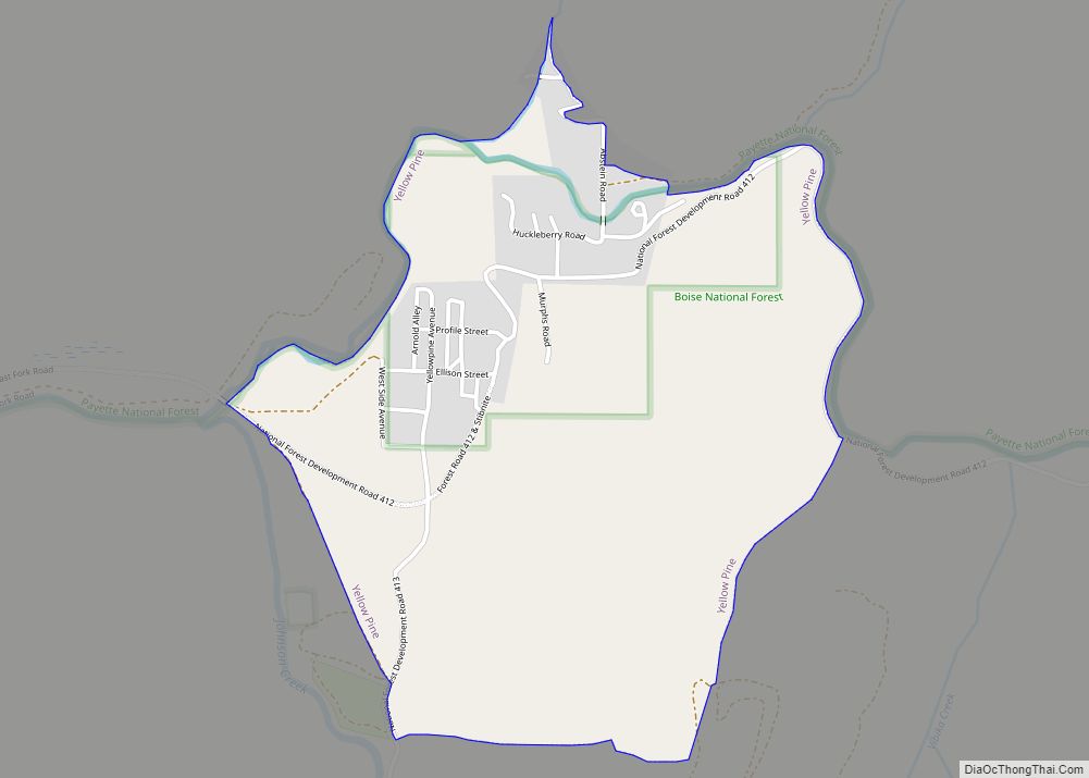
Smiths Ferry Road Map
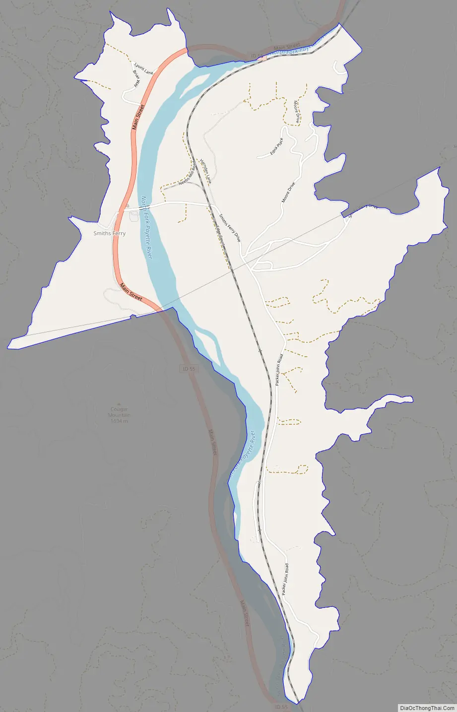
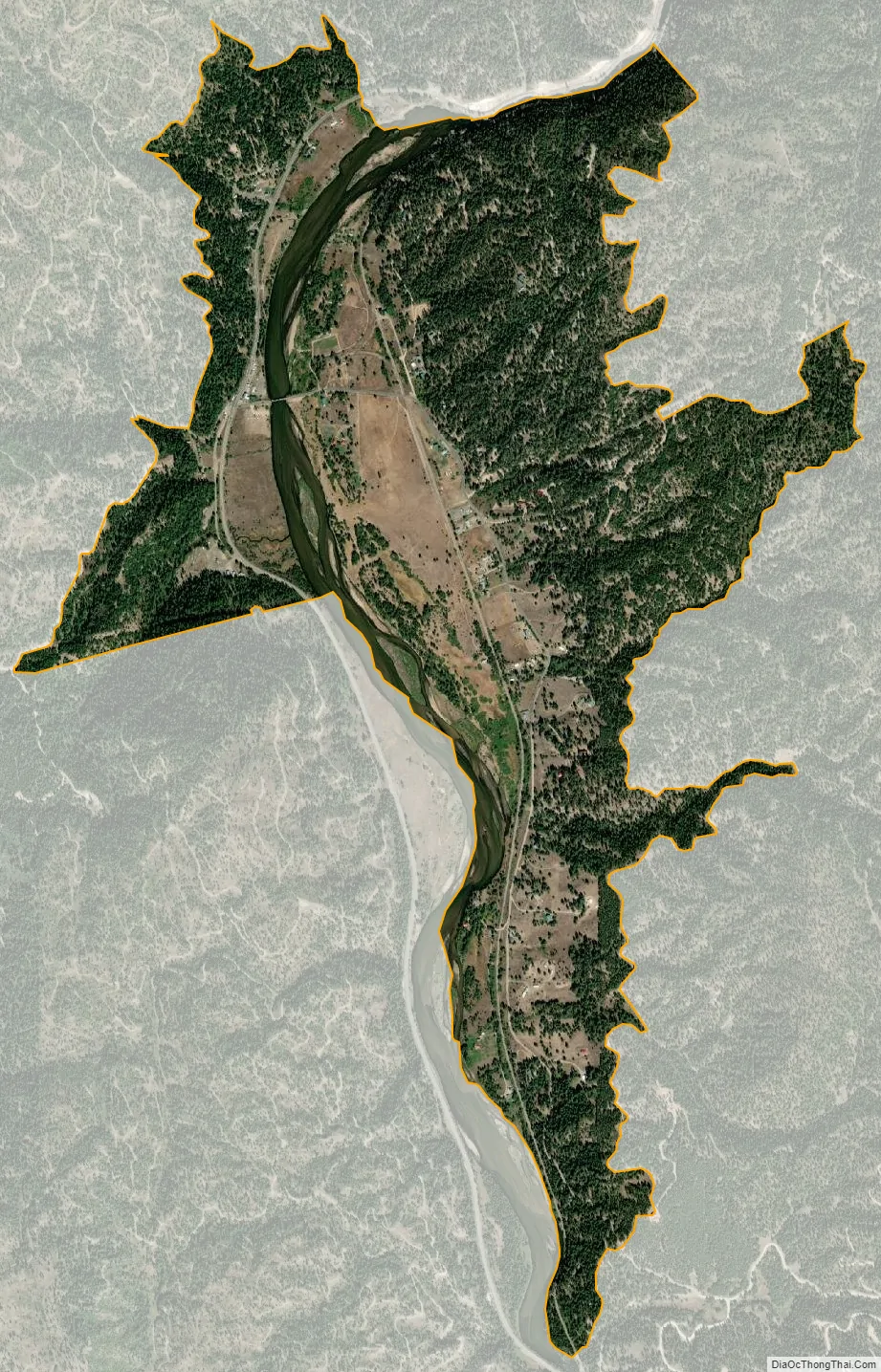
Smiths Ferry city Satellite Map
See also
Map of Idaho State and its subdivision:- Ada
- Adams
- Bannock
- Bear Lake
- Benewah
- Bingham
- Blaine
- Boise
- Bonner
- Bonneville
- Boundary
- Butte
- Camas
- Canyon
- Caribou
- Cassia
- Clark
- Clearwater
- Custer
- Elmore
- Franklin
- Fremont
- Gem
- Gooding
- Idaho
- Jefferson
- Jerome
- Kootenai
- Latah
- Lemhi
- Lewis
- Lincoln
- Madison
- Minidoka
- Nez Perce
- Oneida
- Owyhee
- Payette
- Power
- Shoshone
- Teton
- Twin Falls
- Valley
- Washington
- Alabama
- Alaska
- Arizona
- Arkansas
- California
- Colorado
- Connecticut
- Delaware
- District of Columbia
- Florida
- Georgia
- Hawaii
- Idaho
- Illinois
- Indiana
- Iowa
- Kansas
- Kentucky
- Louisiana
- Maine
- Maryland
- Massachusetts
- Michigan
- Minnesota
- Mississippi
- Missouri
- Montana
- Nebraska
- Nevada
- New Hampshire
- New Jersey
- New Mexico
- New York
- North Carolina
- North Dakota
- Ohio
- Oklahoma
- Oregon
- Pennsylvania
- Rhode Island
- South Carolina
- South Dakota
- Tennessee
- Texas
- Utah
- Vermont
- Virginia
- Washington
- West Virginia
- Wisconsin
- Wyoming