Yellow Pine is an unincorporated census-designated place in Valley County, Idaho. As of the 2010 census, its population was 32. Yellow Pine has an area of 0.995 square miles (2.58 km); 0.984 square miles (2.55 km) of this is land, and 0.011 square miles (0.028 km) is water.
| Name: | Yellow Pine CDP |
|---|---|
| LSAD Code: | 57 |
| LSAD Description: | CDP (suffix) |
| State: | Idaho |
| County: | Valley County |
| Total Area: | 0.995 sq mi (2.58 km²) |
| Land Area: | 0.984 sq mi (2.55 km²) |
| Water Area: | 0.011 sq mi (0.03 km²) |
| Total Population: | 32 |
| ZIP code: | 83677 |
| Area code: | 208 |
| FIPS code: | 1688660 |
| GNISfeature ID: | 0393748 |
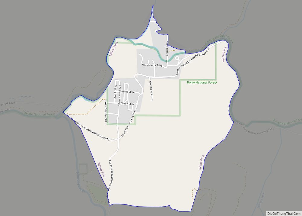
Online Interactive Map
Click on ![]() to view map in "full screen" mode.
to view map in "full screen" mode.
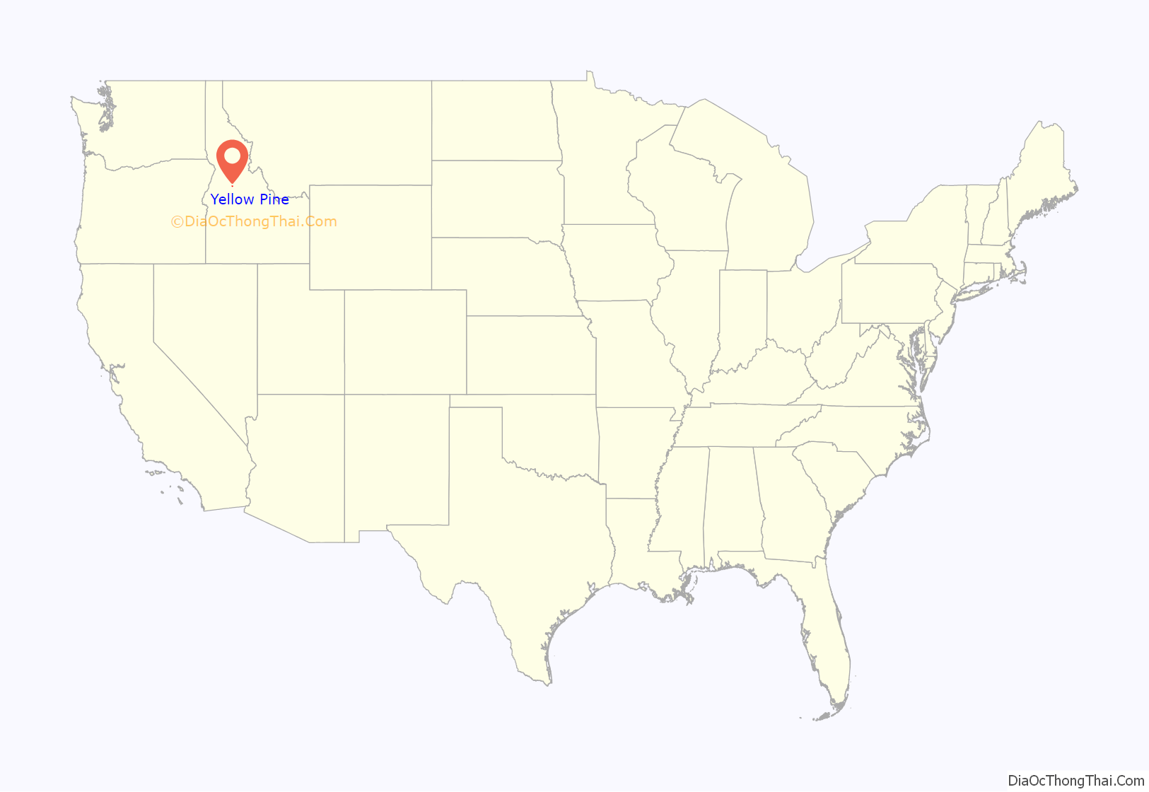
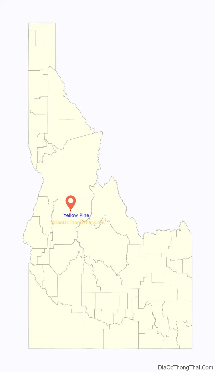
Yellow Pine location map. Where is Yellow Pine CDP?
History
In 1906, Albert Behne established the first post office and mail service. In 1924, he received the patent on the 47½ acres where the village presently exists. In 1930, at the age of 76, he platted the original Yellow Pine townsite.
Other original patentees were Oscar Ray Call, Behne’s former mining partner, and Henry Abstein. Abstein, the first patentee in the area, homesteaded 160 acres (0.65 km) north and east of the present townsite. Although his primary interest was mining, he was also an active horticulturist and many of the apple trees that he planted are still living today. His original holdings have since been subdivided.
Yellow Pine is located 50 miles (80 km) east of McCall, via the Lick Creek road (open seasonally); 65 miles (105 km) from Cascade, via the Warm Lake and Johnson Creek Roads (open seasonally); and 70 miles (110 km) from Cascade via the Warm Lake and South Fork Roads (open year around).
Yellow Pine Road Map
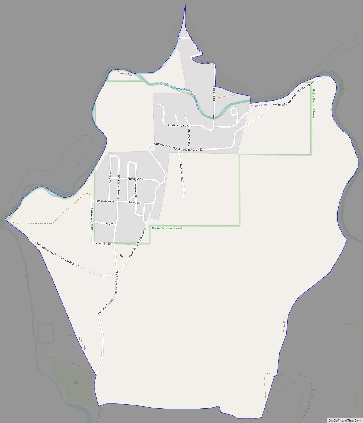
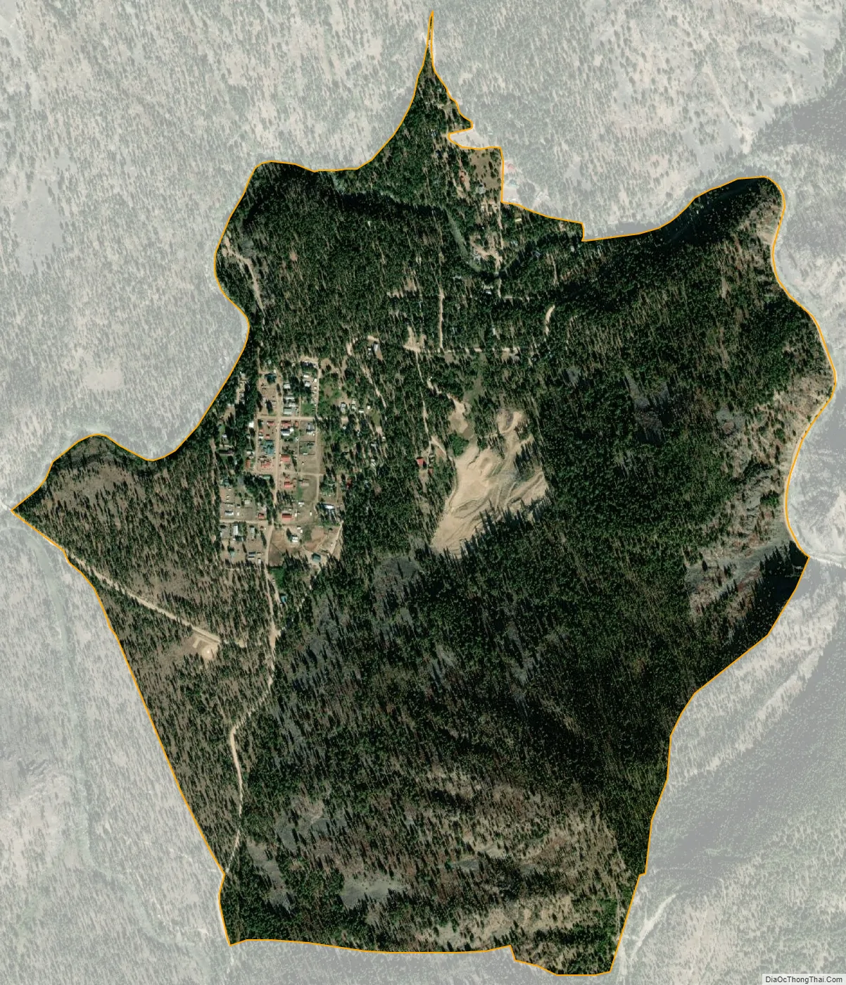
Yellow Pine city Satellite Map
Geography
Although unincorporated, the community has its own zip code, 83677, where overall 44 people live on a total land area of 174.269 square miles (451.35 km), according to the 2010 census.
Yellow Pine is a 247-acre (1.00 km) “inholder” community in eastern Valley County, located on the East Fork of the South Fork of the Salmon River, approximately half a mile upstream from its confluence with Johnson Creek. It is bounded on the north by the Payette National Forest and on the south by the Boise National Forest. Located at 4,802 feet (1,464 m), Yellow Pine has historically served as the trade center for the larger Yellow Pine basin mining area, including the Stibnite Mining District. Many of the early miner-settlers came from Warren, Idaho.
See also
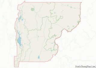
Map of Idaho State and its subdivision:- Ada
- Adams
- Bannock
- Bear Lake
- Benewah
- Bingham
- Blaine
- Boise
- Bonner
- Bonneville
- Boundary
- Butte
- Camas
- Canyon
- Caribou
- Cassia
- Clark
- Clearwater
- Custer
- Elmore
- Franklin
- Fremont
- Gem
- Gooding
- Idaho
- Jefferson
- Jerome
- Kootenai
- Latah
- Lemhi
- Lewis
- Lincoln
- Madison
- Minidoka
- Nez Perce
- Oneida
- Owyhee
- Payette
- Power
- Shoshone
- Teton
- Twin Falls
- Valley
- Washington
- Alabama
- Alaska
- Arizona
- Arkansas
- California
- Colorado
- Connecticut
- Delaware
- District of Columbia
- Florida
- Georgia
- Hawaii
- Idaho
- Illinois
- Indiana
- Iowa
- Kansas
- Kentucky
- Louisiana
- Maine
- Maryland
- Massachusetts
- Michigan
- Minnesota
- Mississippi
- Missouri
- Montana
- Nebraska
- Nevada
- New Hampshire
- New Jersey
- New Mexico
- New York
- North Carolina
- North Dakota
- Ohio
- Oklahoma
- Oregon
- Pennsylvania
- Rhode Island
- South Carolina
- South Dakota
- Tennessee
- Texas
- Utah
- Vermont
- Virginia
- Washington
- West Virginia
- Wisconsin
- Wyoming