Winchester is a city in western Lewis County, Idaho, United States, located on the Camas Prairie in the north central part of the state. The population was 356 at the 2020 census, up from 340 in 2010.
| Name: | Winchester city |
|---|---|
| LSAD Code: | 25 |
| LSAD Description: | city (suffix) |
| State: | Idaho |
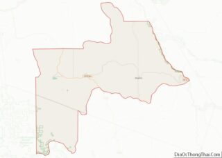
| County: | Lewis County |
| Elevation: | 3,980 ft (1,210 m) |
| Total Area: | 0.18 sq mi (0.46 km²) |
| Land Area: | 0.18 sq mi (0.46 km²) |
| Water Area: | 0.00 sq mi (0.00 km²) |
| Total Population: | 356 |
| Population Density: | 2,517.05/sq mi (970.19/km²) |
| ZIP code: | 83555 |
| Area code: | 208 |
| FIPS code: | 1687850 |
| GNISfeature ID: | 0375955 |
Online Interactive Map
Click on ![]() to view map in "full screen" mode.
to view map in "full screen" mode.
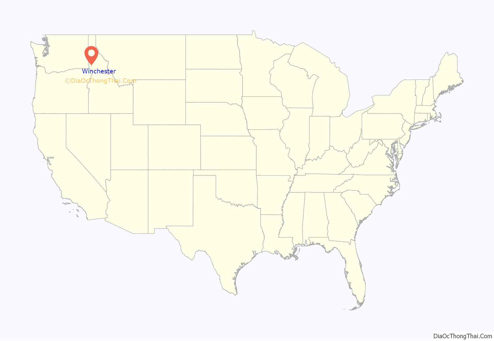
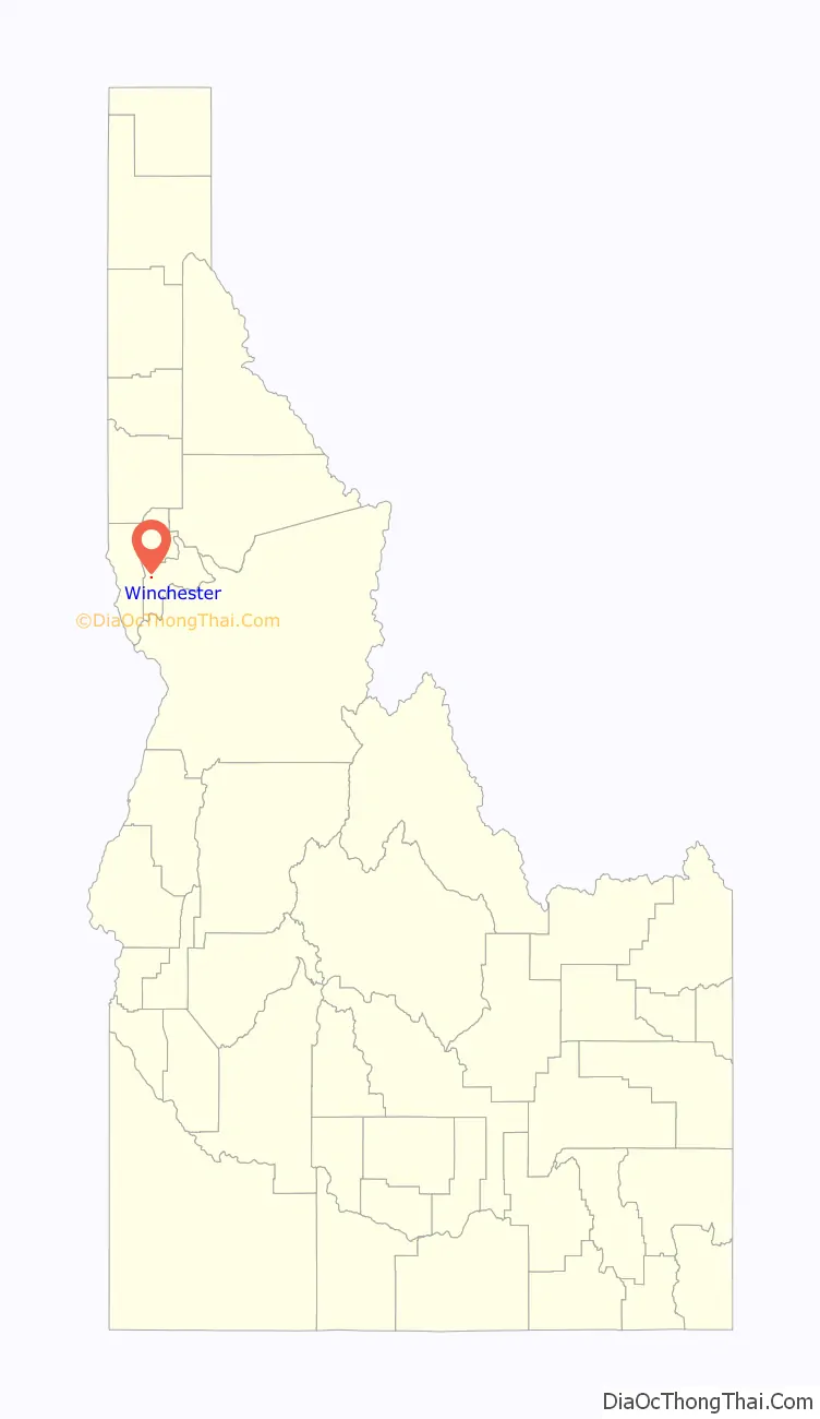
Winchester location map. Where is Winchester city?
History
Winchester is within the Nez Perce Indian Reservation, and similar to the opening of lands in Oklahoma, the U.S. government opened the reservation for white settlement in November 1895. The proclamation had been signed less than two weeks earlier by President Cleveland.
The city was named in 1900 during a meeting to establish a school district. While considering the possibilities, an individual looked at the stack of Winchester rifles at the door and suggested the name, which was approved. The sawmill closed in May 1965 after the mature timber in the area had been cut. The mill was operated by Boise Cascade for its final five years; its closure followed a fire which destroyed much of downtown Winchester in November 1964.
A half mile (1 km) outside of town is Winchester Lake State Park, planned in 1966 and established in 1969. Originally it was a mill pond, created in 1910 by damming Lapwai Creek. Water quality issues at the lake were addressed with the installation of aeration units in 2002.
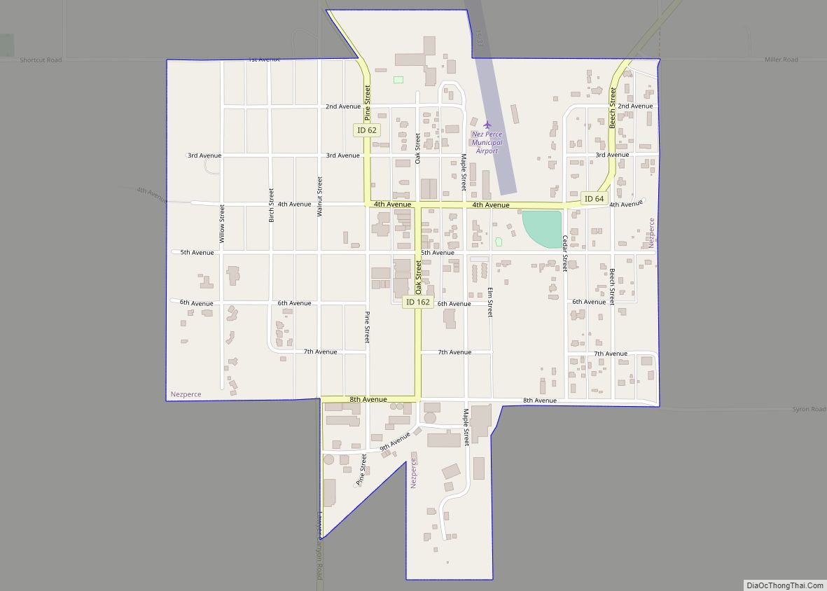
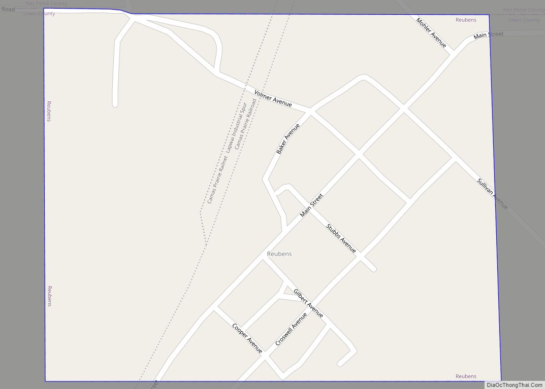
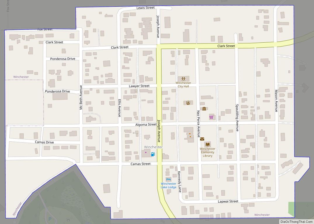
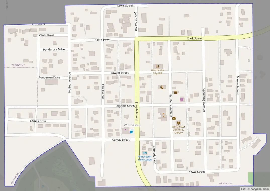
Winchester Road Map
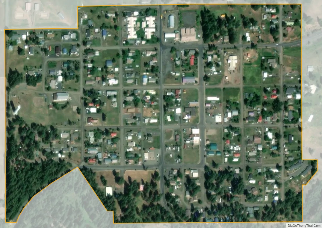
Winchester city Satellite Map
Geography
Winchester is located at 46°14′27″N 116°37′24″W / 46.24083°N 116.62333°W / 46.24083; -116.62333 , at an elevation of 3,980 feet (1,210 m) above sea level.
According to the United States Census Bureau, the city has a total area of 0.18 square miles (0.47 km), all of it land.
Winchester is located on the northern shore of Lapwai Lake at the location where Lapwai Creek emerges from the lake. U.S. Route 95 passes about a mile to the northeast of Winchester, but the town is connected to the highway by a business route of U.S. 95. It is located in the broader Camas Prairie region.
See also
Map of Idaho State and its subdivision:- Ada
- Adams
- Bannock
- Bear Lake
- Benewah
- Bingham
- Blaine
- Boise
- Bonner
- Bonneville
- Boundary
- Butte
- Camas
- Canyon
- Caribou
- Cassia
- Clark
- Clearwater
- Custer
- Elmore
- Franklin
- Fremont
- Gem
- Gooding
- Idaho
- Jefferson
- Jerome
- Kootenai
- Latah
- Lemhi
- Lewis
- Lincoln
- Madison
- Minidoka
- Nez Perce
- Oneida
- Owyhee
- Payette
- Power
- Shoshone
- Teton
- Twin Falls
- Valley
- Washington
- Alabama
- Alaska
- Arizona
- Arkansas
- California
- Colorado
- Connecticut
- Delaware
- District of Columbia
- Florida
- Georgia
- Hawaii
- Idaho
- Illinois
- Indiana
- Iowa
- Kansas
- Kentucky
- Louisiana
- Maine
- Maryland
- Massachusetts
- Michigan
- Minnesota
- Mississippi
- Missouri
- Montana
- Nebraska
- Nevada
- New Hampshire
- New Jersey
- New Mexico
- New York
- North Carolina
- North Dakota
- Ohio
- Oklahoma
- Oregon
- Pennsylvania
- Rhode Island
- South Carolina
- South Dakota
- Tennessee
- Texas
- Utah
- Vermont
- Virginia
- Washington
- West Virginia
- Wisconsin
- Wyoming