Winchester is a town in Middlesex County, Massachusetts, located 8.2 miles (13.2 km) north of downtown Boston as part of the Greater Boston metropolitan area. It is also one of the wealthiest municipalities in Massachusetts. The population was 22,970 at the 2020 United States Census.
| Name: | Winchester CDP |
|---|---|
| LSAD Code: | 57 |
| LSAD Description: | CDP (suffix) |
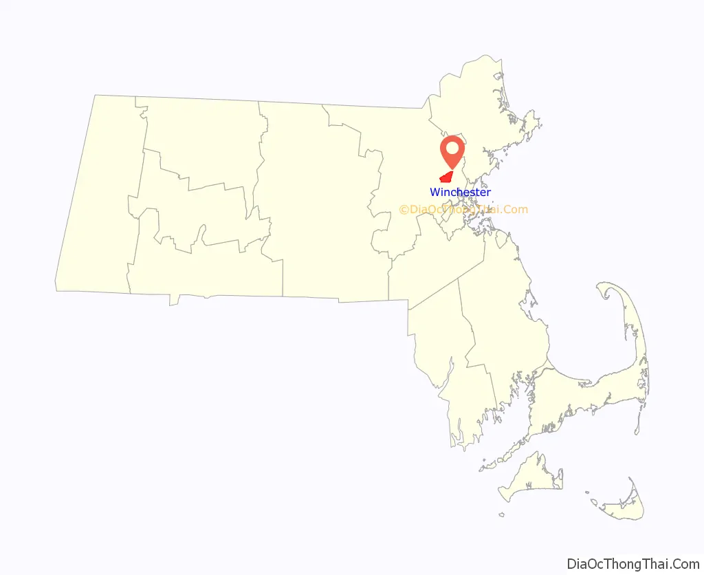
| State: | Massachusetts |
| County: | Middlesex County |
| Incorporated: | 1850 |
| Elevation: | 19 m (62 ft) |
| Total Area: | 16.3 km² (6.3 sq mi) |
| Land Area: | 15.6 km² (6.0 sq mi) |
| Water Area: | 0.6 km² (0.3 sq mi) |
| Total Population: | 22,970 |
| Population Density: | 1,472.4/km² (3,828.3/sq mi) |
| ZIP code: | 01890 |
| Area code: | 339 / 781 |
| FIPS code: | 2580545 |
| GNISfeature ID: | 0618247 |
| Website: | www.winchester.us |
Online Interactive Map
Click on ![]() to view map in "full screen" mode.
to view map in "full screen" mode.
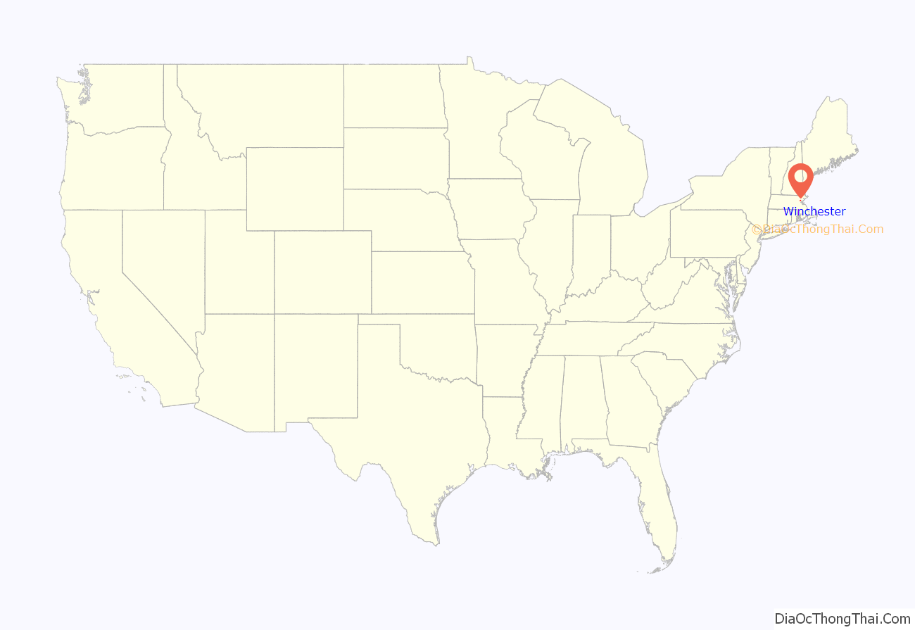
Winchester location map. Where is Winchester CDP?
History
Native Americans inhabited the area that would become Winchester for thousands of years prior to European colonization of the Americas. At the time of contact, the area was inhabited by the Naumkeag people, from whom the land that would become Winchester was purchased for the settlement of Charlestown in 1639.
From the 17th century until the middle of the 19th century, parts of Arlington, Medford, Cambridge, and Woburn comprised what is now Winchester. In the early years of the settlement, the area was known informally as Waterfield, a reference to its many ponds and to the river which bisected the central village. In its second century, the area was referred to as Black Horse Village, after the busy tavern and hostelry in its center.The movement toward incorporation of what, by this time, was called South Woburn was likely precipitated by the rise of the Whig Party in Massachusetts (History of Winchester, Massachusetts by H. S. Chapman and Bruce W. Stone, 1936, 1975).
19th and 20th centuries
The town’s early growth paralleled improvements in transportation. Prior to incorporation, the Middlesex Canal, linking the Merrimack River to Boston, was completed through then Waterfield. It flourished from 1803 to 1836, until the Boston and Lowell Railroad completed a line which neatly bisected the town and provided it with two stations. Able to deliver passengers as well as goods, the railroad soon bankrupted the canal and spurred more people to move to the area. The first church was built in 1840, the Post Office followed in 1841, and soon after incorporation town schools were started. Industries small and large followed, including the Beggs and Cobb tannery and the Winn Watch Hand factory which would operate well into the 20th century.
By the time of the Civil War, to which Winchester lent many citizens, the need for a municipal water supply became apparent. Engineers convinced a skeptical public to fund a dam in the highlands to the east of town. The structure blocked the creek which flowed from the Middlesex Fells and produced the first of three reservoirs which continue to provide clear water today.
In the early 20th century, growth continued apace as Winchester evolved from its agri-industrial roots into the bedroom community it is today. A rich mix of immigrants—the Irish in the northern and eastern neighborhoods, a smattering of African-Americans who flocked to the New Hope Baptist Church in the highlands, and finally Italians who came to work in the westside farms and live in the “Plains” to the east—complemented Winchester’s Yankee forebears.
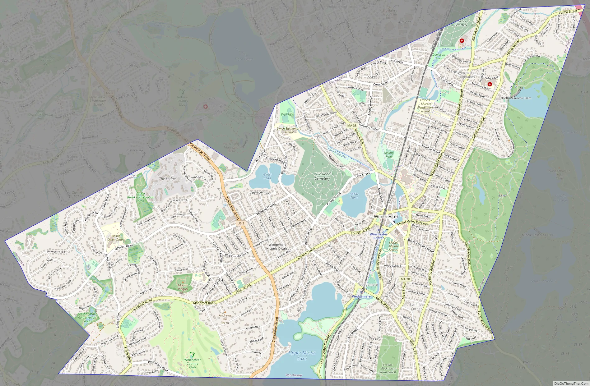
Winchester Road Map
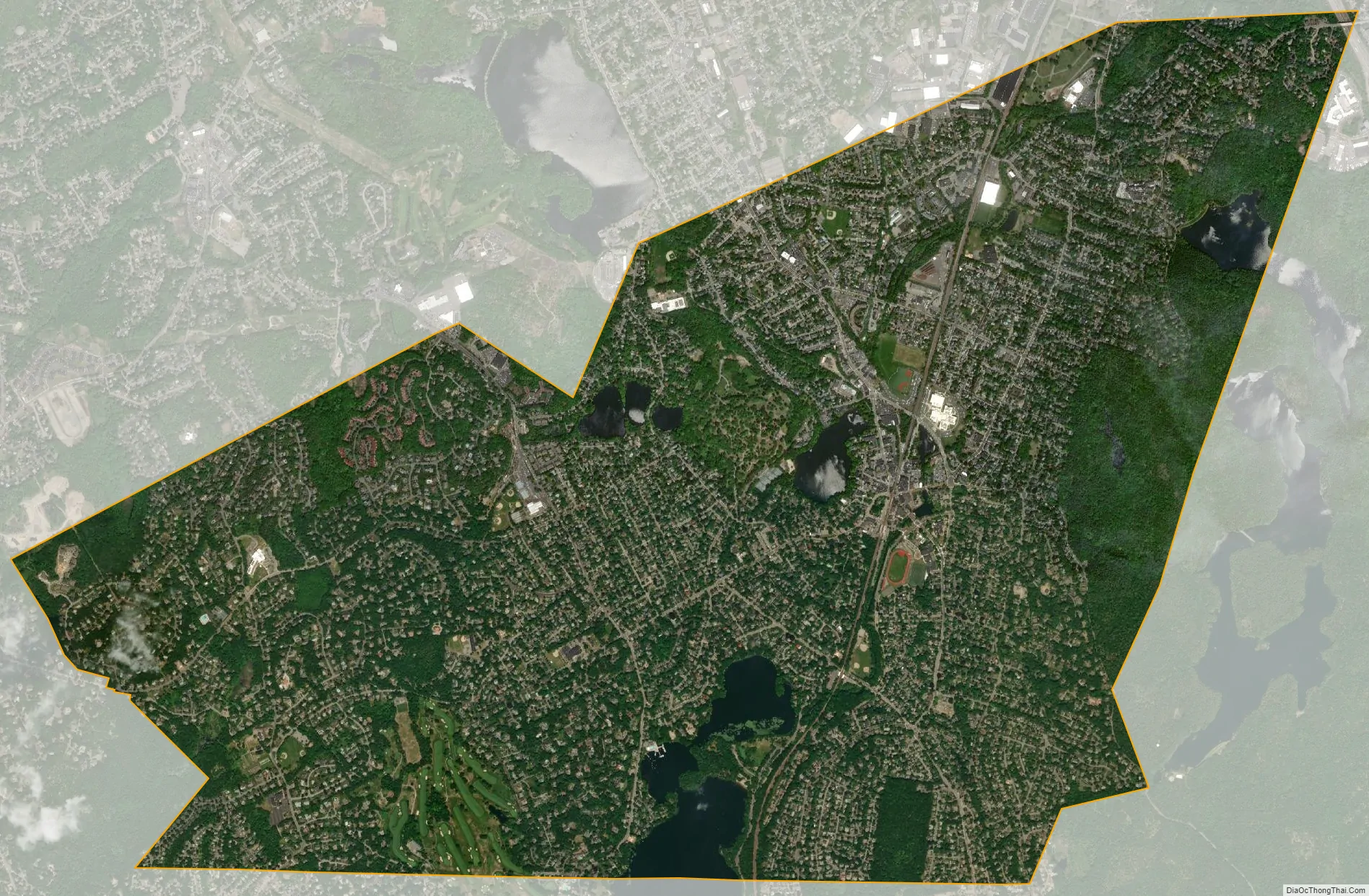
Winchester city Satellite Map
Geography
According to the United States Census Bureau, the town has a total area of 6.3 square miles (16.3 km), of which 6.0 square miles (15.6 km) is land and 0.2 square miles (0.6 km) is water. The total area is 3.97% water.
The town is roughly bisected by a central valley which is the remnant of the original course of the Merrimack River. After glacial debris effectively rerouted the Merrimack north to its current location, all that remained of its original course through present day Winchester is the Aberjona River and the several ponds it feeds en route to the Mystic Lakes on Winchester’s southern border.
On its eastern third, the valley rises steeply into the wooded hills of the Middlesex Fells Reservation, in which lie the North, Middle, and South Reservoirs. The western edge of the valley yields to Arlington and Lexington heights, and the boundaries with those two towns. To the north, the town’s longest border is shared with Woburn.
Winchester has several major bodies of water, including the Mystic Lakes, Wedge Pond, Winter Pond, and the Aberjona River, as well as several minor bodies of water such as Sucker Brook and Sachem Swamp.
Winchester borders the towns of Woburn, Stoneham, Medford, Arlington, and Lexington.
See also
Map of Massachusetts State and its subdivision: Map of other states:- Alabama
- Alaska
- Arizona
- Arkansas
- California
- Colorado
- Connecticut
- Delaware
- District of Columbia
- Florida
- Georgia
- Hawaii
- Idaho
- Illinois
- Indiana
- Iowa
- Kansas
- Kentucky
- Louisiana
- Maine
- Maryland
- Massachusetts
- Michigan
- Minnesota
- Mississippi
- Missouri
- Montana
- Nebraska
- Nevada
- New Hampshire
- New Jersey
- New Mexico
- New York
- North Carolina
- North Dakota
- Ohio
- Oklahoma
- Oregon
- Pennsylvania
- Rhode Island
- South Carolina
- South Dakota
- Tennessee
- Texas
- Utah
- Vermont
- Virginia
- Washington
- West Virginia
- Wisconsin
- Wyoming


