Woburn (/ˈwuːbərn/ WOO-bərn) is a city in Middlesex County, Massachusetts, United States. The population was 40,876 at the 2020 census. Woburn is located 9 miles (14 km) north of Boston. Woburn uses Massachusetts’ mayor-council form of government, in which an elected mayor is the executive and a partly district-based, partly at-large city council is the legislature. It is the only one of Massachusetts’ 351 municipalities to refer to members of its City Council as “Aldermen.”
| Name: | Woburn city |
|---|---|
| LSAD Code: | 25 |
| LSAD Description: | city (suffix) |
| State: | Massachusetts |
| County: | Middlesex County |
| Elevation: | 100 ft (30 m) |
| Total Area: | 12.94 sq mi (33.52 km²) |
| Land Area: | 12.65 sq mi (32.76 km²) |
| Water Area: | 0.29 sq mi (0.76 km²) |
| Total Population: | 40,876 |
| Population Density: | 3,231.30/sq mi (1,247.64/km²) |
| ZIP code: | 01801 / 01888 |
| Area code: | 339 / 781 |
| FIPS code: | 2581035 |
| GNISfeature ID: | 0612270 |
| Website: | www.woburnma.gov |
Online Interactive Map
Click on ![]() to view map in "full screen" mode.
to view map in "full screen" mode.
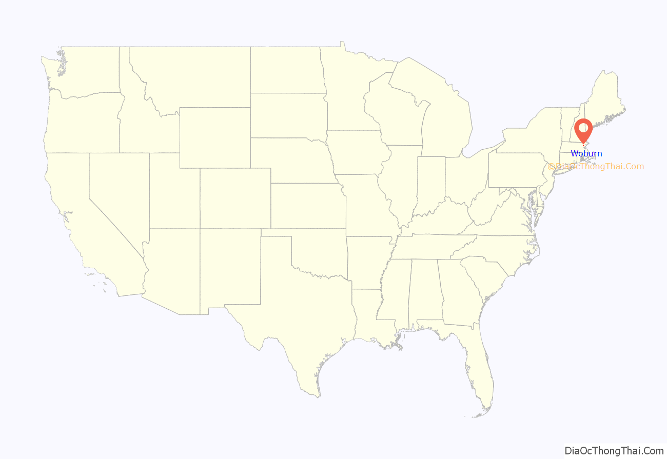
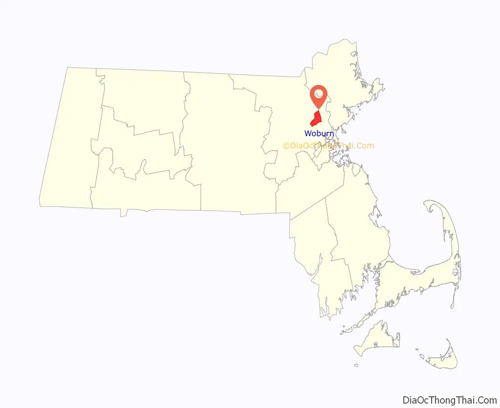
Woburn location map. Where is Woburn city?
History
Woburn was first settled in 1640 near Horn Pond, a primary source of the Mystic River, and was officially incorporated in 1642. At that time the area included present day towns of Woburn, Winchester, Burlington, and parts of Stoneham and Wilmington. In 1740 Wilmington separated from Woburn. In 1799 Burlington separated from Woburn; in 1850 Winchester did so, too.
Woburn got its name from Woburn, Bedfordshire. Woburn played host to the first religious ordination in the Americas on Nov. 22, 1642. Rev. Thomas Carter was sworn in by many of the most prominent men of New England including John Cotton, minister of the First Church of Boston, Richard Mather minister of the First Church of Dorchester, and Capt. Edward Johnson co-founder of the church and town of Woburn. Johnson is regarded as “the father of Woburn.” He served as the first town clerk, represented the town in the Massachusetts General Court, made the first map of Massachusetts, and wrote the first history of the colony.
The first organizational Town Meeting was held on April 13, 1644, and the first town officers were chosen. Town Selectmen were Edward Johnson, Edward Convers, John Mousall, William Learned, Ezekiel Richardson, Samuel Richardson and James Thompson. William Learned was also selected as Constable. Michael Bacon, Ralph Hill, Thomas Richardson were chosen as Surveyors of Highways. (The History of Woburn, 1868)
Deacon Edward Convers was also one of the founders of Woburn. He was one of its first selectmen, and built the first house and first mill in Woburn. He was very active in town affairs and was a large landowner, miller and surveyor.
List of important events
- Gershom Flagg’s tannery was built in 1668
- The Middlesex Canal was opened in 1803
- Thompson established a tannery at Cummingsville in 1823
- The Boston and Lowell Railroad started operating through Woburn in 1835
- The Woburn Sentinel newspaper began in 1839
- In 1840 the first membership library opened
- The telegraph started operating in Woburn in 1867
- “America’s oldest active gun club,” the Massachusetts Rifle Association, was founded in 1875 and moved to Woburn in 1876.
- The public library opened in 1879
- The telephone was introduced in Woburn in 1882; Electric lights in 1885
- Woburn was incorporated as a City on June 12, 1888
- Route 128 opened in 1951
- Route 93 was built through the town in 1963
- Rail depot closed in 1962.
- Cummings Properties, the major holder of commercial properties in the region, was founded in 1970.
- Cummings Foundation was established in 1986.
- Cummings Foundation purchased the former Choate Memorial Hospital site and turned it into the New Horizons of Choate senior living community in 1990.
- Community Weeklies Inc. was founded by William S. Cummings and began publishing Woburn Advocate in 1991. The firm was bought by a division of Fidelity Investments in 1994, and Woburn Advocate is now being published by GateHouse Media.
- Middlesex Superior Courthouse moved to TradeCenter 128 business campus in 2008.
- The final phase of construction is completed on TradeCenter 128 business campus in 2010.
- Woburn Police Officer John B. Maguire was killed in the line of duty while responding to an armed robbery on December 26, 2010.
- Massachusetts Biotechnology Council awarded Woburn the platinum-level “Bio-Ready community” designation in 2011.
Groundwater contamination incident
Woburn was the scene of a high-profile water contamination crisis. During the mid to late 1970s, the local community became concerned over the high incidence of childhood leukemia and other illnesses, particularly in the Pine Street area of east Woburn. After high levels of chemical contamination were found in City of Woburn’s Wells G and H in 1979, some members of the community suspected that the unusually high incidence of leukemia, cancer, and a wide variety of other health problems were linked to the possible exposure to volatile organic compounds in the groundwater pumped from wells G and H.
In May 1982, a number of citizens whose children had developed or died from leukemia filed a civil lawsuit against two corporations, W. R. Grace and Company and Beatrice Foods. Grace’s subsidiary, Cryovac, and Beatrice were suspected of contaminating the groundwater by improperly disposing of trichloroethylene (TCE), perchloroethylene (perc or PCE) and other industrial solvents at their facilities in Woburn near wells G and H.
In a controversial decision, Judge Walter Jay Skinner ruled that the jurors should answer questions that they and many others considered confusing. Beatrice was acquitted and Grace only paid $8 million, a third of which went to the lawyers and lawyer fees. A United States Environmental Protection Agency report later found Beatrice and Grace responsible for the contamination. A book titled A Civil Action was written about the case by Jonathan Harr. In 1998 the book was turned into a movie starring John Travolta and Robert Duvall, also titled A Civil Action. The film was largely filmed in nearby Bedford and Lexington, with only a few shots on location in Woburn.
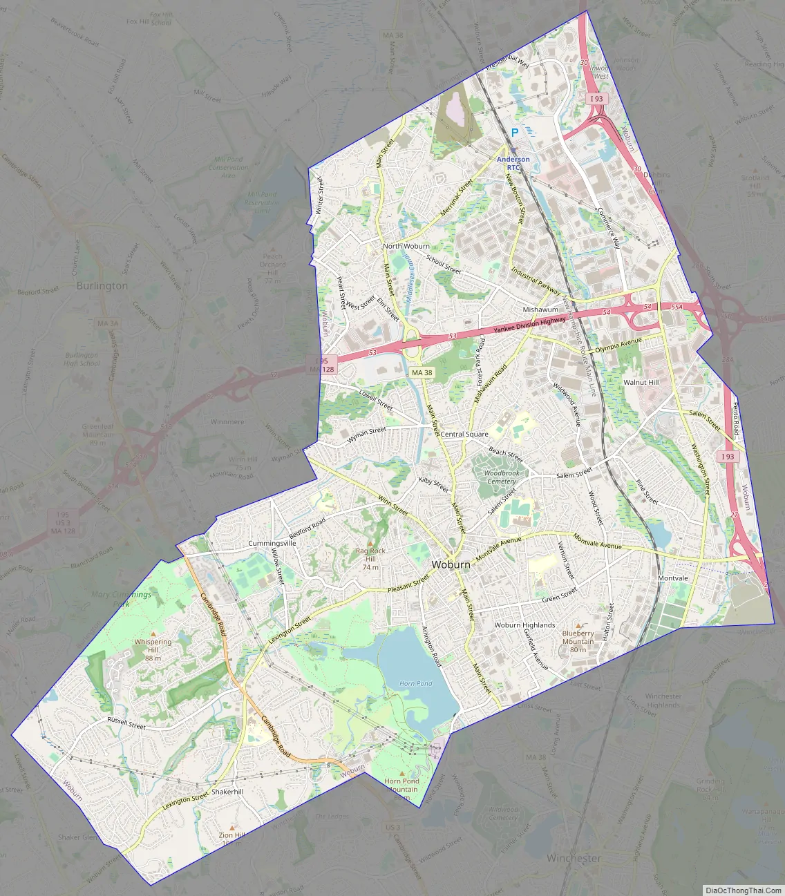
Woburn Road Map
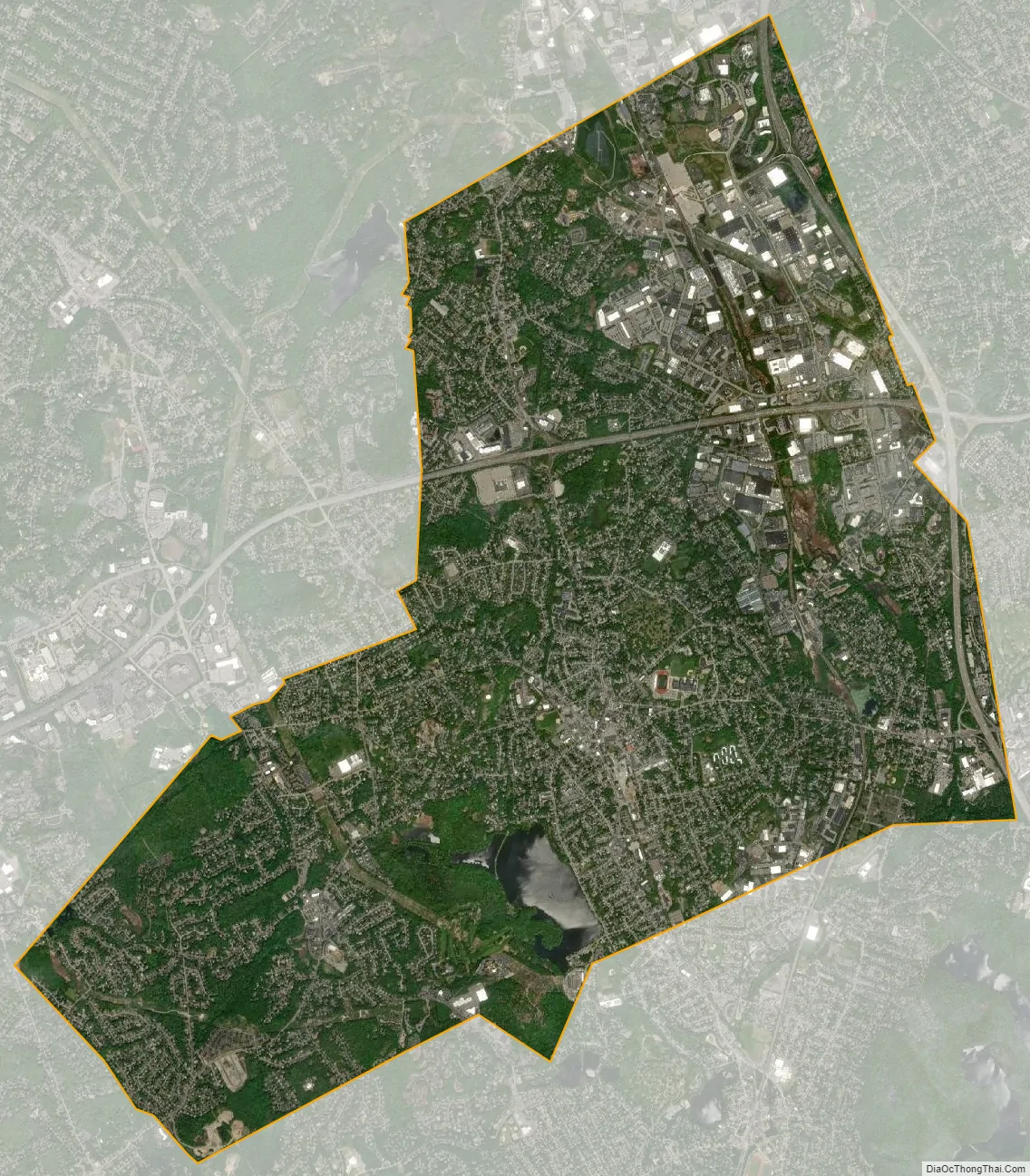
Woburn city Satellite Map
Geography
Woburn is located at 42°29′4″N 71°9′7″W / 42.48444°N 71.15194°W / 42.48444; -71.15194 (42.484545, −71.152060). It is bordered by the towns of Wilmington, Reading, Stoneham, Winchester, Lexington, and Burlington.
According to the United States Census Bureau, the city has a total area of 12.9 square miles (33 km), of which 12.7 square miles (33 km) is land and 0.2 square miles (0.52 km) (1.71%) is water.
Climate
Woburn features a humid continental climate, similar to those of many of the other Boston suburban areas. It features moderately cold winters, but not usually as bad as the ones around The Great Lakes Regions or Southern Canada, or even Northern New England. Nonetheless, it features occasional ‘arctic blasts’ which can easily drop the temperature below zero. Spring generally starts out cool, around 45-50 degrees, often with snow still on the ground. However, it quickly begins to rapidly warm to around 75 degrees by the time summer begins. Summers are generally warm or hot & often accompanied with humidity, though not nearly as bad as cities in The Midwest & Mid-Atlantic, and even Rhode Island. Temperatures often top in the 80s, but when an Atlantic low comes, temperatures may fail to rise out of the 60s. High pressure from the Gulf of Mexico, occasionally brings much hotter conditions with temperatures sometimes topping near 100, though this is fairly rare and only happens so often. Falls are generally crisp, but start out warm with temperature highs around 70 & lows around 50. Quickly things cool, and it feels and looks like winter with temperatures around 40 usually towards the end. Like most of the region, temperatures can vary widely in the span of a day.
See also
Map of Massachusetts State and its subdivision: Map of other states:- Alabama
- Alaska
- Arizona
- Arkansas
- California
- Colorado
- Connecticut
- Delaware
- District of Columbia
- Florida
- Georgia
- Hawaii
- Idaho
- Illinois
- Indiana
- Iowa
- Kansas
- Kentucky
- Louisiana
- Maine
- Maryland
- Massachusetts
- Michigan
- Minnesota
- Mississippi
- Missouri
- Montana
- Nebraska
- Nevada
- New Hampshire
- New Jersey
- New Mexico
- New York
- North Carolina
- North Dakota
- Ohio
- Oklahoma
- Oregon
- Pennsylvania
- Rhode Island
- South Carolina
- South Dakota
- Tennessee
- Texas
- Utah
- Vermont
- Virginia
- Washington
- West Virginia
- Wisconsin
- Wyoming


