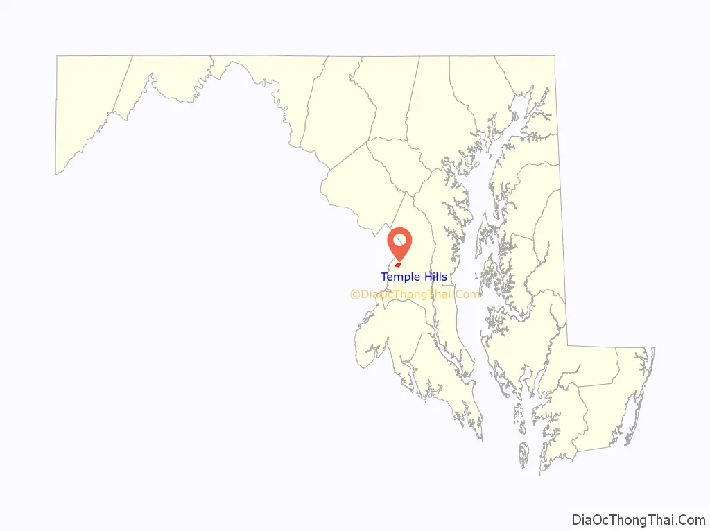
Temple Hills is an unincorporated area and census-designated place (CDP) in Prince George’s County, Maryland, United States. Temple Hills borders the communities of Hillcrest Heights, Marlow Heights, Camp Springs and Oxon Hill. Per the 2020 census, the population was 8,350.
The community was named after Edward Temple, who in the 1860s lived in a home beside Henson Creek known as Moor Park. Within the area are numerous garden apartments, duplexes, and single family communities constructed mostly from the 1950s through 1970s. The adjacent, unincorporated communities of Hillcrest Heights and Marlow Heights, which are home to both the Iverson Mall & Marlow Heights Shopping Center, which both serve the community of Temple Hills, are assigned Temple Hills addresses and zipcodes.
Rosecroft Raceway (since 1949, harness horse racing) is nearby in Oxon Hill, although the racing audience has declined greatly. There are large public indoor and outdoor swimming pools operated by the Maryland-National Capital Park and Planning Commission, and also the private Temple Hills Swim Club. The area is especially convenient to the Capital Beltway (I-95/I-495), the Metrorail Green Line, Andrews Air Force Base, the U.S. Census Bureau, and Capitol Hill.
Since the clogged interstate Woodrow Wilson Bridge was widened in 2008, commuter access to Northern Virginia’s booming job market has improved.
| Name: | Temple Hills CDP |
|---|---|
| LSAD Code: | 57 |
| LSAD Description: | CDP (suffix) |
| State: | Maryland |
| County: | Prince George’s County |
| Elevation: | 269 ft (82 m) |
| Total Area: | 1.41 sq mi (3.65 km²) |
| Land Area: | 1.41 sq mi (3.65 km²) |
| Water Area: | 0.00 sq mi (0.00 km²) |
| Total Population: | 8,350 |
| Population Density: | 5,930.40/sq mi (2,290.19/km²) |
| Area code: | 301, 240 |
| FIPS code: | 2477100 |
| GNISfeature ID: | 0598158 |
Online Interactive Map
Click on ![]() to view map in "full screen" mode.
to view map in "full screen" mode.
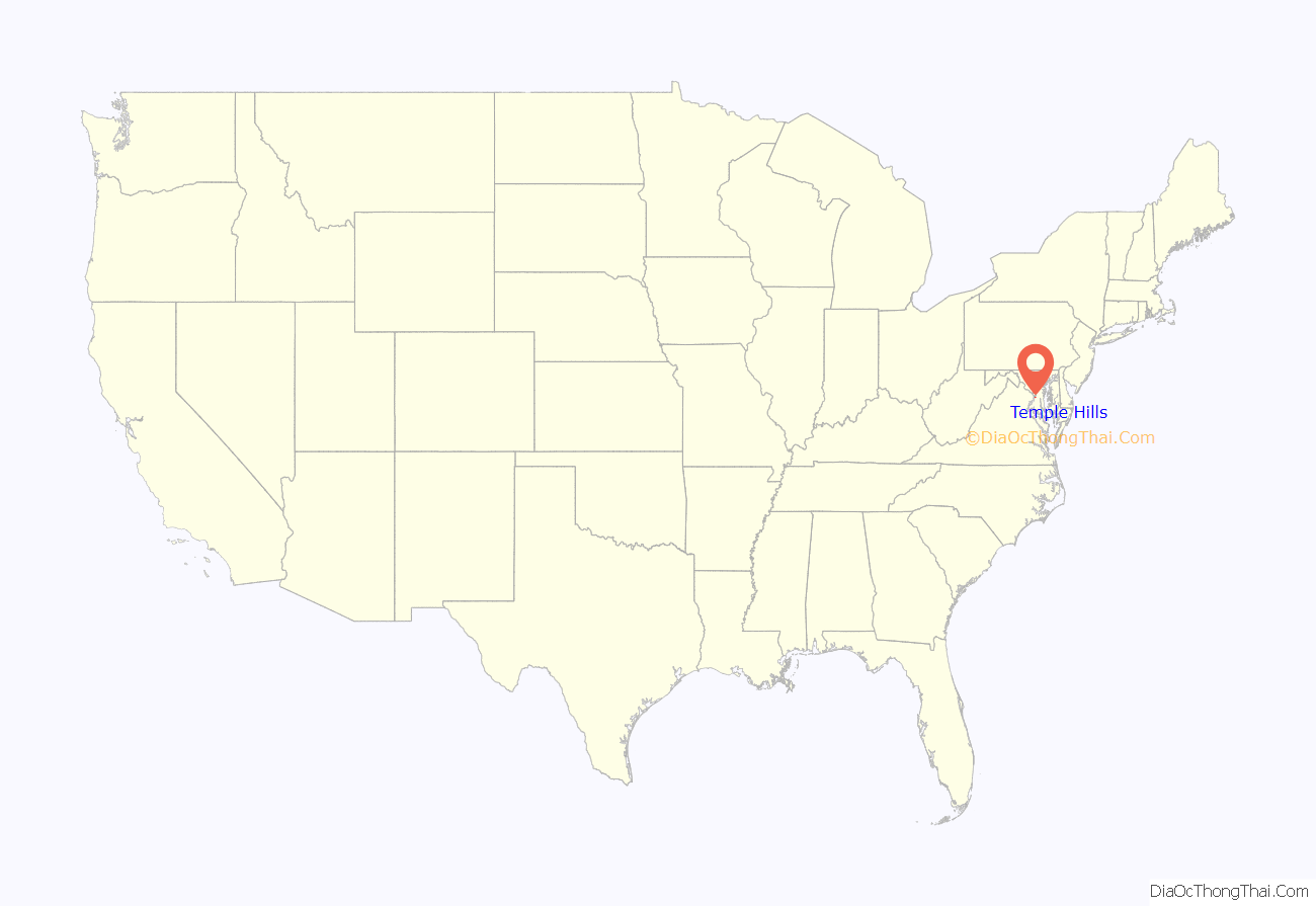
Temple Hills location map. Where is Temple Hills CDP?
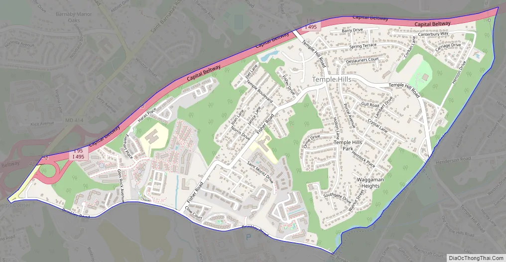
Temple Hills Road Map
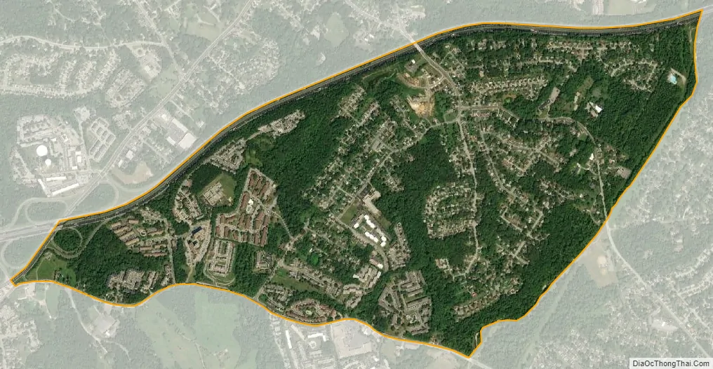
Temple Hills city Satellite Map
Geography
Temple Hills is located at 38°48′38″N 76°56′47″W / 38.81056°N 76.94639°W / 38.81056; -76.94639 (38.810580, −76.946360).
According to the United States Census Bureau, the CDP has a total area of 1.4 square miles (3.6 km), all land.
See also
Map of Maryland State and its subdivision: Map of other states:- Alabama
- Alaska
- Arizona
- Arkansas
- California
- Colorado
- Connecticut
- Delaware
- District of Columbia
- Florida
- Georgia
- Hawaii
- Idaho
- Illinois
- Indiana
- Iowa
- Kansas
- Kentucky
- Louisiana
- Maine
- Maryland
- Massachusetts
- Michigan
- Minnesota
- Mississippi
- Missouri
- Montana
- Nebraska
- Nevada
- New Hampshire
- New Jersey
- New Mexico
- New York
- North Carolina
- North Dakota
- Ohio
- Oklahoma
- Oregon
- Pennsylvania
- Rhode Island
- South Carolina
- South Dakota
- Tennessee
- Texas
- Utah
- Vermont
- Virginia
- Washington
- West Virginia
- Wisconsin
- Wyoming


