Oxon Hill is an unincorporated area and census-designated place (CDP) in southern Prince George’s County, Maryland, United States. Oxon Hill is a suburb of Washington, located southeast of the downtown district and east of Alexandria, Virginia. It contains the new 300-acre (120 ha) National Harbor development on the shore of the Potomac River.
For the 1990 and 2000 censuses, the United States Census Bureau defined a census-designated place consisting of Oxon Hill and the adjacent community of Glassmanor, designated Oxon Hill-Glassmanor, for statistical purposes. As of the 2010 census, Oxon Hill was delineated separately and had a population of 17,722. Per the 2020 census, the population was 18,791.
| Name: | Oxon Hill CDP |
|---|---|
| LSAD Code: | 57 |
| LSAD Description: | CDP (suffix) |
| State: | Maryland |
| County: | Prince George’s County |
| Total Area: | 6.45 sq mi (16.70 km²) |
| Land Area: | 6.44 sq mi (16.68 km²) |
| Water Area: | 0.01 sq mi (0.02 km²) |
| Total Population: | 18,791 |
| Population Density: | 2,918.31/sq mi (1,126.74/km²) |
| ZIP code: | 20745 |
| Area code: | 301, 240 |
| FIPS code: | 2459500 |
Online Interactive Map
Click on ![]() to view map in "full screen" mode.
to view map in "full screen" mode.
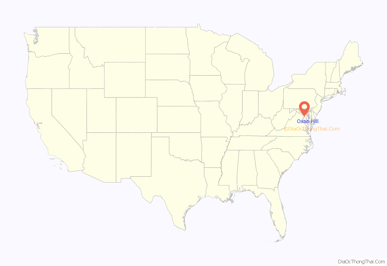
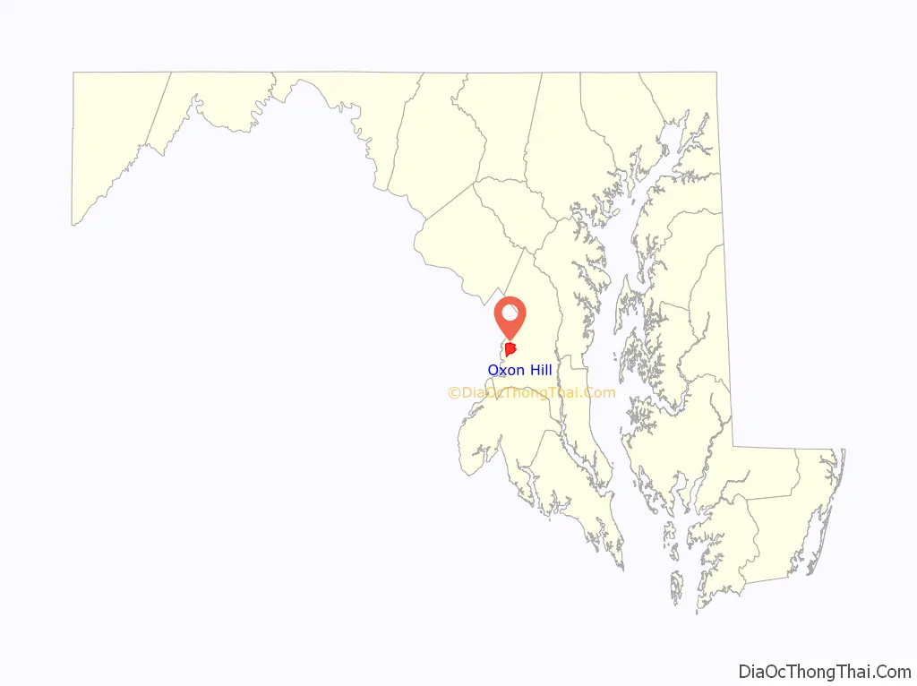
Oxon Hill location map. Where is Oxon Hill CDP?
History
Oxon Hill was named for the colonial 18th century manor home of Thomas Addison (which burned in 1895 but was replaced in 1929 by a large 49-room neo-Georgian-style home called Oxon Hill Manor, standing on a bluff over the Potomac River). The current Manor is now owned by the Maryland-National Capital Park and Planning Commission and is used for cultural activities, as well as being rented for weddings and special events. “Oxon” is an abbreviation for the Latin Oxoniensis, meaning “of Oxford.” The area now known as Oxon Hill reminded Addison of the area near Oxford, England. The Revolutionary patriot John Hanson died while visiting the first Manor, and may be buried there in an unmarked grave.
Oxon Hill Manor, the Butler House, Oxon Cove Park, and St. Ignatius Church are listed on the National Register of Historic Places.
Today the community is bisected by the busy Capital Beltway (I-95/495), and is near the interstate Woodrow Wilson Bridge. The enlarged bridge was opened December 15, 2008, and highway interchanges and ramps near the bridge were also re-aligned and re-configured. Prior to that date, traffic backed up into Oxon Hill daily for decades as 250,000–300,000 vehicles a day crossed the Wilson Bridge.
Oxon Hill includes many garden apartment and townhouse communities along with single-family detached homes built mostly between the 1940s when suburban development began, through the early 1990s (except for the newer National Harbor condominiums), including the incorporated town Forest Heights. Oxon Hill’s two principal shopping centers (“Rivertowne”, built about 1985 which includes a K-Mart, Safeway, Staples, Ross Stores Inc. and Home Depot, and “Eastover”, built about 1955) attract neighborhood customers as well as shoppers from nearby Southeast Washington, D.C. Eastover, located at the D.C./state line, is a hub of many bus routes, some of them operating 24 hours a day, and has a Prince George’s County Police station. The apartment communities closest to the D.C. line are informally called by their original name “Glassmanor“, although rental companies have officially given them newer names. Rather unusual community features of Oxon Hill are a nursing home and a large cultural center, both operated for an ethnic Filipino population who are numerous in Oxon Hill and Fort Washington. A Walmart was scheduled to open in 2014 but has since been delayed for site layout revisions.
Until about 1960, the community used the mailing address Washington, D.C., before getting its own postal designation. About 1980, the United States Postal Service detached the two-thirds of greater Oxon Hill that was furthest from Washington, D.C. and re-defined that part as a new postal designation, Fort Washington, MD. To make mail sorting easier at that time, the new postal boundary line separating the two Maryland communities was drawn along already existing zip code boundaries. (The former zip 20021 portion of Oxon Hill remained Oxon Hill with the new code 20745, while everything in the former zip 20022 portion of Oxon Hill about 1980 was automatically renamed the new Fort Washington 20744.) Illogically, this partitioning reassigned some areas that seem to be almost in the heart of Oxon Hill (such as all of the Bock Road, Tucker Road, Murray Hills, and Brinkley Road areas, including several large prominent churches, Rosecroft Raceway, the ice rink, and ironically even Oxon Hill Middle School) to Fort Washington mailing addresses, which can cause confusion.
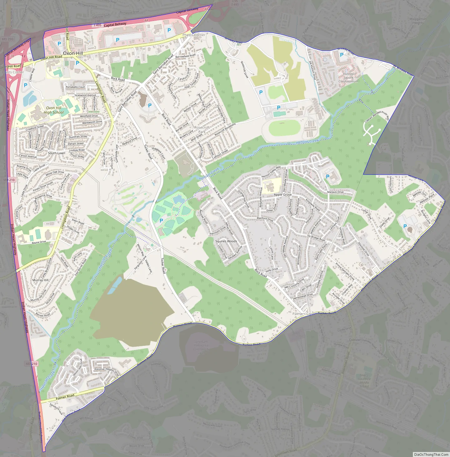
Oxon Hill Road Map
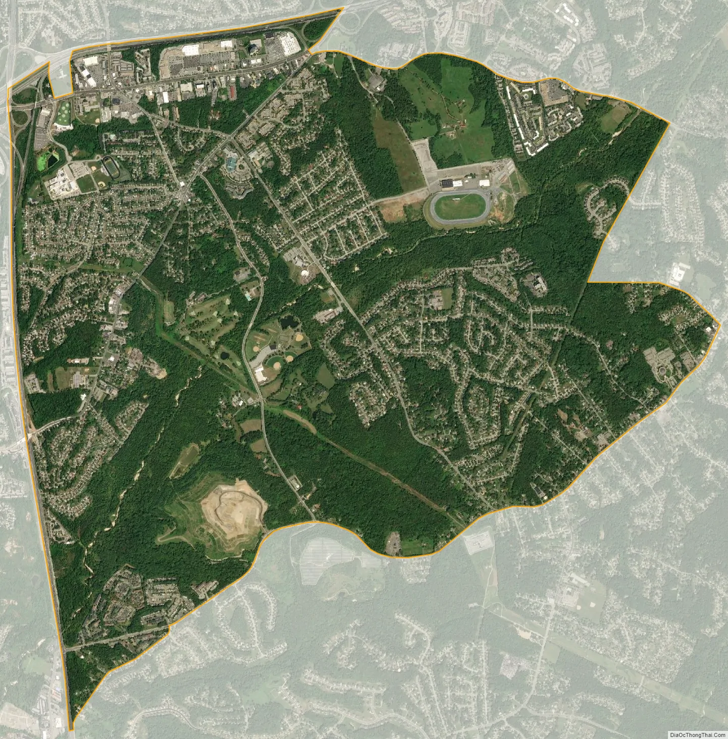
Oxon Hill city Satellite Map
Geography
Oxon Hill is located in Prince George’s County along Maryland Route 210 (Indian Head Highway) and Maryland Route 414 (Oxon Hill Road), less than 2 miles (3 km) south of the boundary of Washington. The CDP lies directly south of the Capital Beltway (I-495/I-95), just east of the Woodrow Wilson Bridge over the Potomac River.
According to the U.S. Census Bureau, the total area of Oxon Hill is 6.6 square miles (17.2 km), of which 6.6 square miles (17.1 km) is land and 0.01 square miles (0.03 km), or 0.20%, is water.
See also
Map of Maryland State and its subdivision: Map of other states:- Alabama
- Alaska
- Arizona
- Arkansas
- California
- Colorado
- Connecticut
- Delaware
- District of Columbia
- Florida
- Georgia
- Hawaii
- Idaho
- Illinois
- Indiana
- Iowa
- Kansas
- Kentucky
- Louisiana
- Maine
- Maryland
- Massachusetts
- Michigan
- Minnesota
- Mississippi
- Missouri
- Montana
- Nebraska
- Nevada
- New Hampshire
- New Jersey
- New Mexico
- New York
- North Carolina
- North Dakota
- Ohio
- Oklahoma
- Oregon
- Pennsylvania
- Rhode Island
- South Carolina
- South Dakota
- Tennessee
- Texas
- Utah
- Vermont
- Virginia
- Washington
- West Virginia
- Wisconsin
- Wyoming


