Towson (/ˈtaʊsən/) is an unincorporated community and a census-designated place in Baltimore County, Maryland, United States. The population was 55,197 as of the 2010 census. It is the county seat of Baltimore County and the second-most populous unincorporated county seat in the United States (after Ellicott City, the seat of nearby Howard County, southwest of Baltimore).
| Name: | Towson CDP |
|---|---|
| LSAD Code: | 57 |
| LSAD Description: | CDP (suffix) |
| State: | Maryland |
| County: | Baltimore County |
| Elevation: | 463 ft (141 m) |
| Total Area: | 14.29 sq mi (37.01 km²) |
| Land Area: | 14.15 sq mi (36.66 km²) |
| Water Area: | 0.14 sq mi (0.35 km²) |
| Total Population: | 59,553 |
| Population Density: | 4,207.80/sq mi (1,624.62/km²) |
| ZIP code: | 21286,21204,21252,21212 (county) |
| Area code: | 410, 443, and 667 |
| FIPS code: | 2478425 |
| GNISfeature ID: | 0591420 |
Online Interactive Map
Click on ![]() to view map in "full screen" mode.
to view map in "full screen" mode.
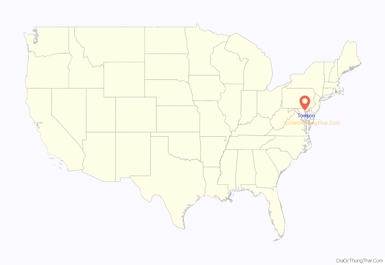
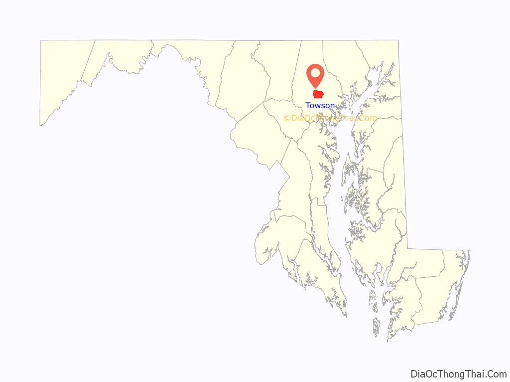
Towson location map. Where is Towson CDP?
History
1600s
The first inhabitants of the future Towson and central Baltimore County region were the Susquehannock people, who hunted in the area. Their region included all of Baltimore County, though their primary settlement was farther northeast along the Susquehanna River.
1700s
Towson was settled in 1752 when Pennsylvania brothers, William and Thomas Towson, began farming an area of Sater’s Hill, northeast of the present-day York and Joppa roads. William’s son, Ezekiel, opened the Towson Hotel to serve the growing number of farmers bringing their produce and livestock to the port of Baltimore. He built the hotel at current-day Shealy Avenue and York Road, near the area’s main crossroads. The village became known as “Towsontown”. The property in West Towson came from two land grants: 400-acre Gott’s Hope in 1719, and Gunner’s Range in 1706.
In 1790, businessman Capt. Charles Ridgely completed the Hampton Mansion just north of Towsontown, the largest private house in America at the time. The Ridgelys lived there for six generations, until 1948. It is now preserved as the Hampton National Historic Site and open to the public.
1800s
Grafton Marsh, a surgeon during the War of 1812, and his brother Josiah Marsh settled their families in a collection of early houses known as Gott’s Hope that was part of a group along Joppa Road. They consolidated four of the structures into a larger dwelling that they called “Marshmont”. The brothers went into business together as medical practitioners. Neither had any heirs but were joined in practice later by their nephew, Dr. Grafton Marsh Bosley, who eventually inherited the medical practice, the Marshmont compound, and a 140-acre farm. The farm extended west of York Road, south of Joppa Road, north of the Sheppard Pratt Hospital, and east of Woodbine Avenue. In 1869, Bosley and his wife Margaret Nicholson then built a new home in an area of the property known as “Highlands” or “Highland Park”, which they named “Uplands”.
The ratification of the second Maryland Constitution of 1851 provided for the jurisdictional separation of the former Baltimore Town, founded in 1729. Baltimore Town had served as the county seat since 1767, now the City of Baltimore, since its incorporation in 1796–97 by the General Assembly of Maryland. Several tortured sets of negotiations occurred to divide the various assets of the city and the county, such as the downtown courthouse of 1805, the city/county jail of 1801 along the Jones Falls (at East Madison Street) and the almshouse, which was also jointly owned. After a series of elections and referendums, on February 13, 1854, Towson became, by popular vote, the choice of the remaining, now mostly rural, eastern, northern and western portions of the county as the new county seat of Baltimore County.
The Baltimore County Courthouse, still in use by 2015, with its various annexes (and the separate county courts and administrative building), was originally designed by the local city architectural firm of Dixon, Balbirnie and Dixon. It was completed within a year, constructed of limestone and marble donated by the well-known Ridgely family of nearby Hampton Mansion, on land donated by Towson doctor Grafton Marsh Bosley. The courthouse was subsequently enlarged in 1910 through additional designs for north and south wings by well-known and regarded city architects, Baldwin & Pennington. Additional expansions later in 1926 and 1958 eventually created an H-shaped plan for the courthouse. An additional modernistic Baltimore County Courts Building, with room for the new charter government since 1956 and administration of a county executive and county council, plus administrative and executive departments, was erected in 1970–71 across a plaza to the west of the older historic courthouse.
The old Baltimore County Jail was built in 1855, and was later replaced in the 1980s by a new modern Baltimore County Detention Center, north of the town on Kenilworth Drive, with an addition constructed in the 2010s.
From 1850 to 1874, another notable land owner, Amos Matthews, had a farm of 150 acres (0.61 km) that—with the exception of the 17-acre (69,000 m) largely natural parcel where the Kelso Home for Girls (currently Towson YMCA), was later erected —was wholly developed into the neighborhoods of West Towson, Southland Hills and other subdivisions, beginning in the middle 1920s.
During the Civil War, Towson was the scene of two minor engagements. Many local citizens were sympathetic to the Southern Confederate cause, so much so that Ady’s Hotel (later named the Towson Hotel) and the current site of the 1920s-era Towson Theatre (later the Recher Theatre), flew the Southern flag. The Union Army found it necessary to overtake the town by force on June 2, 1861. During the raid, the Union Army seized weapons from citizens at Ady’s Hotel. A local paper, in jest, refers to the “strongly fortified and almost impregnable city of Towsontown” and downplays the need for the attack, stating, “the distinguished Straw, with only two hundred and fifty men, has taken a whole city and nearly frightened two old women out of their wits.”
The second engagement took place around July 12, 1864, between Union and Confederate forces. On July 10, 1864, a 135-man Confederate cavalry detachment attacked the Northern Central Railway to the north in nearby Cockeysville, under orders from Gen. Bradley T. Johnson, of Frederick, Maryland. The First and Second Maryland Cavalry, led by Baltimore County native and pre-war member of the Towson Horse Guards, Maj. Harry W. Gilmor, of Glen Ellen, attacked strategic targets throughout Baltimore and Harford counties, including cutting telegraph wires along Harford Road, capturing two trains and a Union general, and destroying a railroad bridge in Joppa, Maryland. Following what became known as Gilmor’s Raid, the cavalry encamped in Towson overnight at Ady’s Hotel, where his men rested and Gilmor met with friends.
The next day, a large federal cavalry unit was dispatched from Baltimore to overtake Gilmor’s forces. Though outnumbered by more than two to one, the Confederate cavalry attacked the federal unit, breaking the federal unit and chasing them down York Road to around current-day Woodbourne Avenue, within Baltimore city limits. Gilmor’s forces traveled south along York Road as far south as Govans, before heading west to rejoin Gen. Johnson’s main force.
Following the war, Gilmor served as the Baltimore City Police Commissioner in the 1870s.
The Towson fire of 1878 destroyed most of the 500 block along the York Turnpike, causing an estimated $38,000 in damage.
During the summer of 1894, the Towson Water Company laid wooden pipes and installed fire hydrants connected to an artesian well near Aigburth Vale. On November 2, 1894, Towson was supplied with electric service through connection with the Mount Washington Electric Light and Power Company.
1900s
At the beginning of the century, Towson remained largely a rural community. Land continued to be sold by the acre, rather than as home parcels. Most residences lay within Towson proper: no houses existed west of Central Avenue along Allegheny or Pennsylvania Avenues, and there were only three homes along the West Chesapeake Avenue corridor.
In the 1910s, the Maryland State Normal School (MSNS) (now known as Towson University) was relocated to Towson. The Maryland Legislature had established the MSNS in 1865 as Maryland’s first teacher-training school, or normal school. The institution officially opened its doors on January 15, 1866, however as time passed enrollment in the school grew exponentially, which rendered the facilities inadequate. In 1910, the General Assembly formed a committee to oversee site selection, budget, and design plans for a new campus. It settled on an 80-acre (320,000 m) site in Towson. The General Assembly financed the $600,000 move in 1912. Construction then began in 1913 on the Administration Building, now known as Stephens Hall. In September 1915, the new campus, comprising Stephens Hall, Newell Hall, and the power plant, began classes. The college underwent numerous name changes, settling on Towson University in 1997.
As the growth of Baltimore’s suburbs became more pronounced after World War II, considerable office development took place in Towson’s central core area. Many of the large Victorian and colonial-style residences in the vicinity of the Court House were demolished in the 1980s and 1990s to make way for offices and parking.
In 1839, Epsom Chapel became the first Christian house of worship in Towson, used by various denominations. Due to population growth in the late 19th and early 20th centuries, several churches were built to serve the community, such as Calvary Baptist Church, Immaculate Conception Catholic Church, Trinity Episcopal Church, First Methodist Church, and Towson Presbyterian Church. Epsom Chapel was demolished in 1950 when Goucher College sold a portion of its property for development of the Towson Plaza shopping center, now Towson Town Center. First Methodist Church moved in 1958 to land also acquired from Goucher College, and is now Towson United Methodist Church.
Author Robert Coston, who grew up in the area of Towson now called “Historic East Towson”, recalled in an interview the unique African-American history of that area during the mid-century:
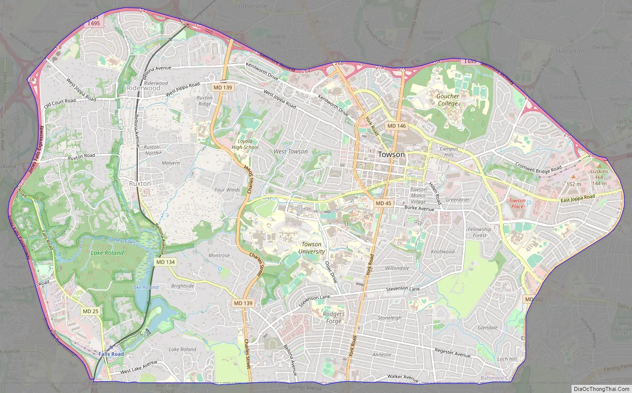
Towson Road Map
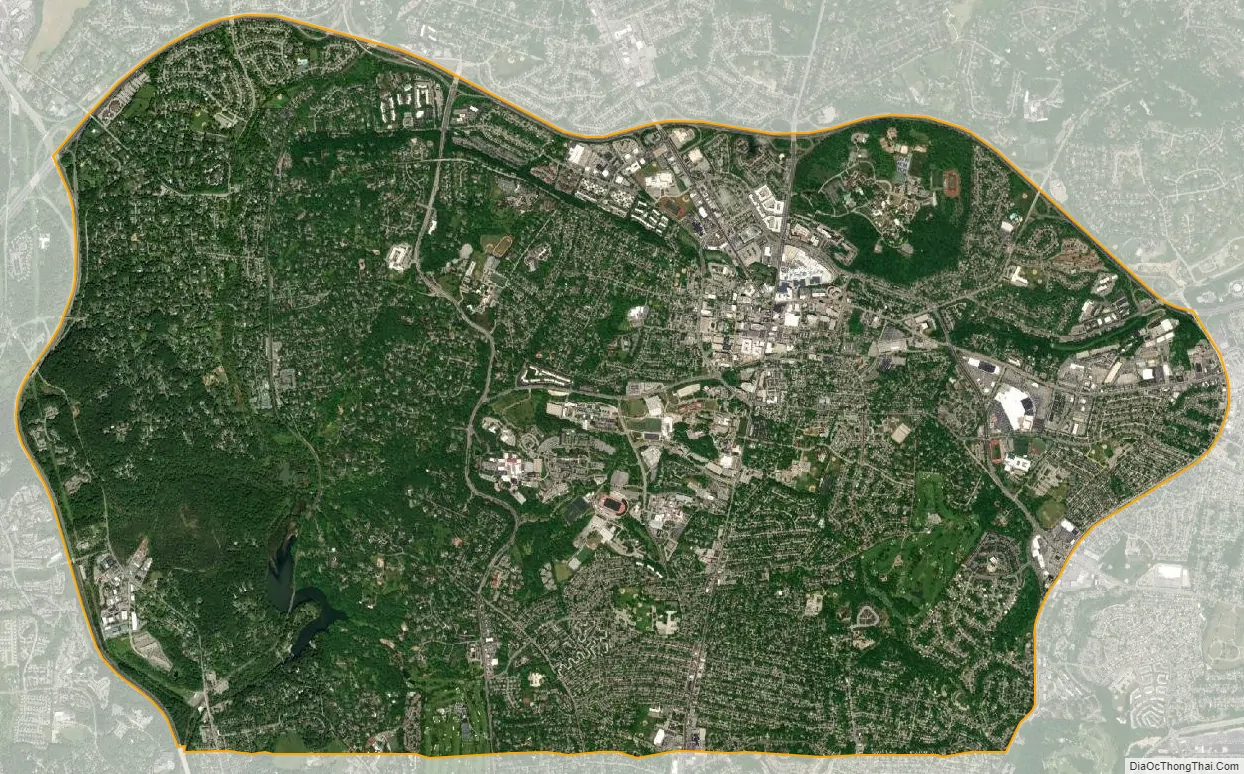
Towson city Satellite Map
Geography
Towson is located at 39°23′35″N 76°36′34″W / 39.39306°N 76.60944°W / 39.39306; -76.60944 (39.392980, −76.609562).
According to the United States Census Bureau, the CDP has a total area of 14.2 square miles (37 km), of which 14.0 square miles (36 km) is land and 0.2 square miles (0.52 km) (1.06%) is water.
The community is located immediately north of Baltimore City, inside the Beltway (I-695), east of I-83 and along York Road. Its census boundaries include Pikesville to the west, Lutherville and Hampton to the north, Parkville to the east, and Baltimore to the south.
Major neighborhoods in Towson include: Anneslie, Idlewylde, Greenbriar, Southland Hills, Rodgers Forge, Stoneleigh, Wiltondale, Towson Manor Village, Hunt Crest Estates, Knollwood-Donnybrook, East Towson, Loch Raven Village and West Towson. Ruxton, which lies to the west, is sometimes considered a part of Towson. Eudowood is a Towson neighborhood named after Eudocia, the wife of Dr. John T. Stansbury, on whose former estate it is situated.
Climate
The climate in this area is characterized by hot, humid summers and generally mild to cool winters. According to the Köppen Climate Classification system Towson has a humid subtropical climate, abbreviated “Cfa” on climate maps.
See also
Map of Maryland State and its subdivision: Map of other states:- Alabama
- Alaska
- Arizona
- Arkansas
- California
- Colorado
- Connecticut
- Delaware
- District of Columbia
- Florida
- Georgia
- Hawaii
- Idaho
- Illinois
- Indiana
- Iowa
- Kansas
- Kentucky
- Louisiana
- Maine
- Maryland
- Massachusetts
- Michigan
- Minnesota
- Mississippi
- Missouri
- Montana
- Nebraska
- Nevada
- New Hampshire
- New Jersey
- New Mexico
- New York
- North Carolina
- North Dakota
- Ohio
- Oklahoma
- Oregon
- Pennsylvania
- Rhode Island
- South Carolina
- South Dakota
- Tennessee
- Texas
- Utah
- Vermont
- Virginia
- Washington
- West Virginia
- Wisconsin
- Wyoming


