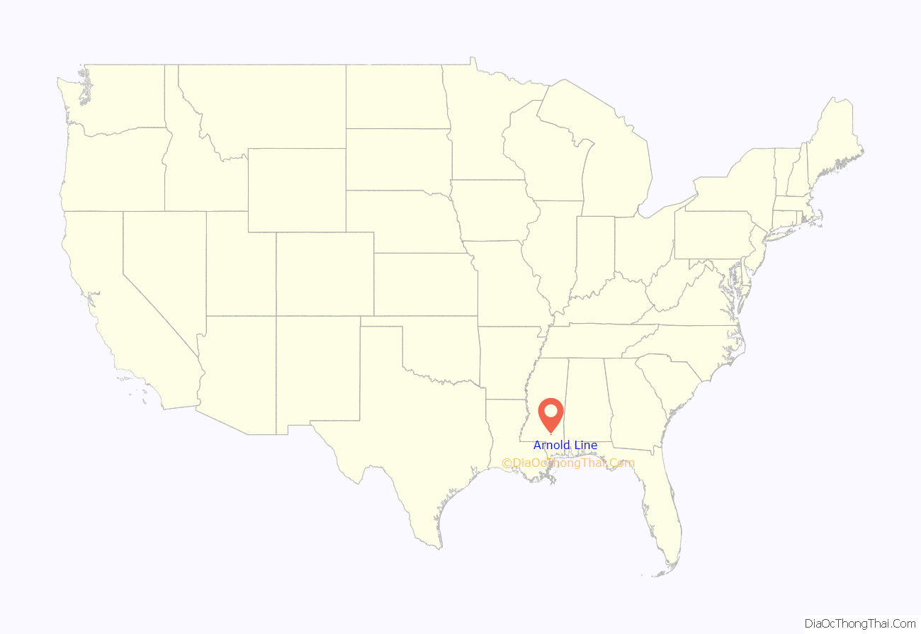
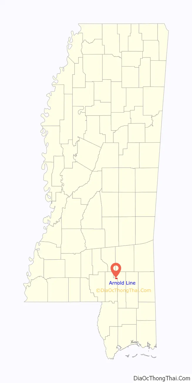
Arnold Line is an unincorporated area and census-designated place (CDP) in Lamar County, Mississippi, United States. As of the 2020 census it had a population of 2,333. It is part of the Hattiesburg Metropolitan Statistical Area.
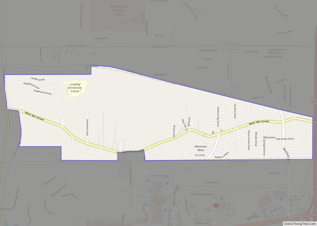
It is in the northeast part of Lamar County and is bordered to the north, east, and south by the city of Hattiesburg. The center of Hattiesburg is 5 miles (8 km) to the east in Forrest County. West Hattiesburg is 1 mile (1.6 km) to the south of Arnold Line.
| Name: | Arnold Line CDP |
|---|---|
| LSAD Code: | 57 |
| LSAD Description: | CDP (suffix) |
| State: | Mississippi |
| County: | Lamar County |
| Elevation: | 213 ft (65 m) |
| Total Area: | 1.66 sq mi (4.31 km²) |
| Land Area: | 1.66 sq mi (4.31 km²) |
| Water Area: | 0.00 sq mi (0.00 km²) |
| Total Population: | 2,333 |
| Population Density: | 1,402.89/sq mi (541.70/km²) |
| ZIP code: | 39401 |
| Area code: | 601 |
| FIPS code: | 2802060 |
| GNISfeature ID: | 666381 |
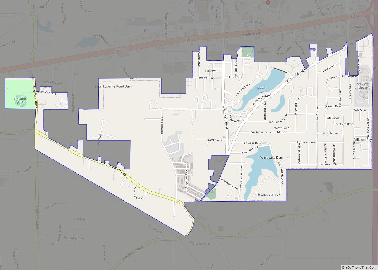
Online Interactive Map
Click on ![]() to view map in "full screen" mode.
to view map in "full screen" mode.
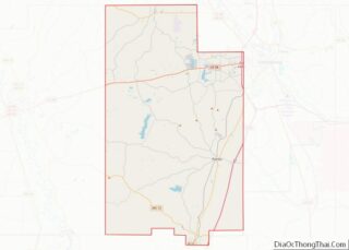
Arnold Line location map. Where is Arnold Line CDP?
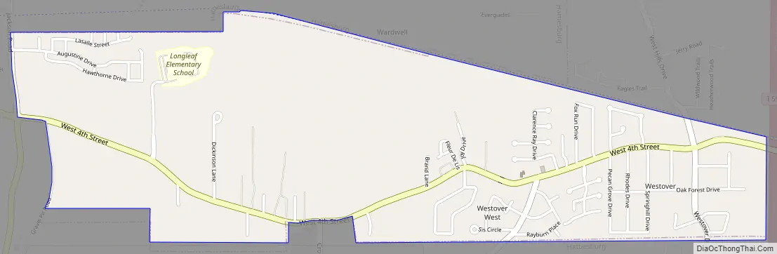
Arnold Line Road Map
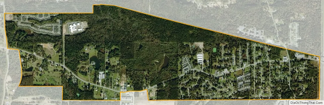
Arnold Line city Satellite Map
See also
Map of Mississippi State and its subdivision:- Adams
- Alcorn
- Amite
- Attala
- Benton
- Bolivar
- Calhoun
- Carroll
- Chickasaw
- Choctaw
- Claiborne
- Clarke
- Clay
- Coahoma
- Copiah
- Covington
- Desoto
- Forrest
- Franklin
- George
- Greene
- Grenada
- Hancock
- Harrison
- Hinds
- Holmes
- Humphreys
- Issaquena
- Itawamba
- Jackson
- Jasper
- Jefferson
- Jefferson Davis
- Jones
- Kemper
- Lafayette
- Lamar
- Lauderdale
- Lawrence
- Leake
- Lee
- Leflore
- Lincoln
- Lowndes
- Madison
- Marion
- Marshall
- Monroe
- Montgomery
- Neshoba
- Newton
- Noxubee
- Oktibbeha
- Panola
- Pearl River
- Perry
- Pike
- Pontotoc
- Prentiss
- Quitman
- Rankin
- Scott
- Sharkey
- Simpson
- Smith
- Stone
- Sunflower
- Tallahatchie
- Tate
- Tippah
- Tishomingo
- Tunica
- Union
- Walthall
- Warren
- Washington
- Wayne
- Webster
- Wilkinson
- Winston
- Yalobusha
- Yazoo
- Alabama
- Alaska
- Arizona
- Arkansas
- California
- Colorado
- Connecticut
- Delaware
- District of Columbia
- Florida
- Georgia
- Hawaii
- Idaho
- Illinois
- Indiana
- Iowa
- Kansas
- Kentucky
- Louisiana
- Maine
- Maryland
- Massachusetts
- Michigan
- Minnesota
- Mississippi
- Missouri
- Montana
- Nebraska
- Nevada
- New Hampshire
- New Jersey
- New Mexico
- New York
- North Carolina
- North Dakota
- Ohio
- Oklahoma
- Oregon
- Pennsylvania
- Rhode Island
- South Carolina
- South Dakota
- Tennessee
- Texas
- Utah
- Vermont
- Virginia
- Washington
- West Virginia
- Wisconsin
- Wyoming