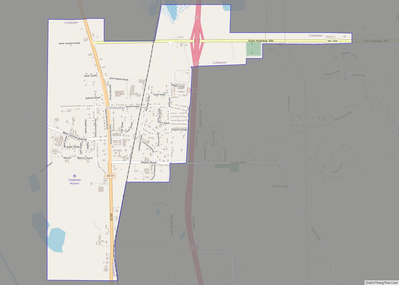
Coldwater is a town in Tate County, Mississippi, United States, and is part of the Memphis Metropolitan Area. The population was 1,677 at the 2010 census.
| Name: | Coldwater town |
|---|---|
| LSAD Code: | 43 |
| LSAD Description: | town (suffix) |
| State: | Mississippi |
| County: | Tate County |
| Elevation: | 249 ft (76 m) |
| Total Area: | 2.38 sq mi (6.16 km²) |
| Land Area: | 2.38 sq mi (6.15 km²) |
| Water Area: | 0.01 sq mi (0.01 km²) |
| Total Population: | 1,381 |
| Population Density: | 581.47/sq mi (224.55/km²) |
| ZIP code: | 38618 |
| Area code: | 662 |
| FIPS code: | 2814900 |
| GNISfeature ID: | 0668665 |
| Website: | coldwaterms.org |
Online Interactive Map
Click on ![]() to view map in "full screen" mode.
to view map in "full screen" mode.
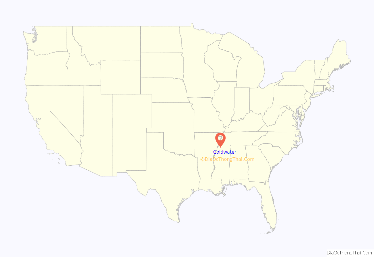
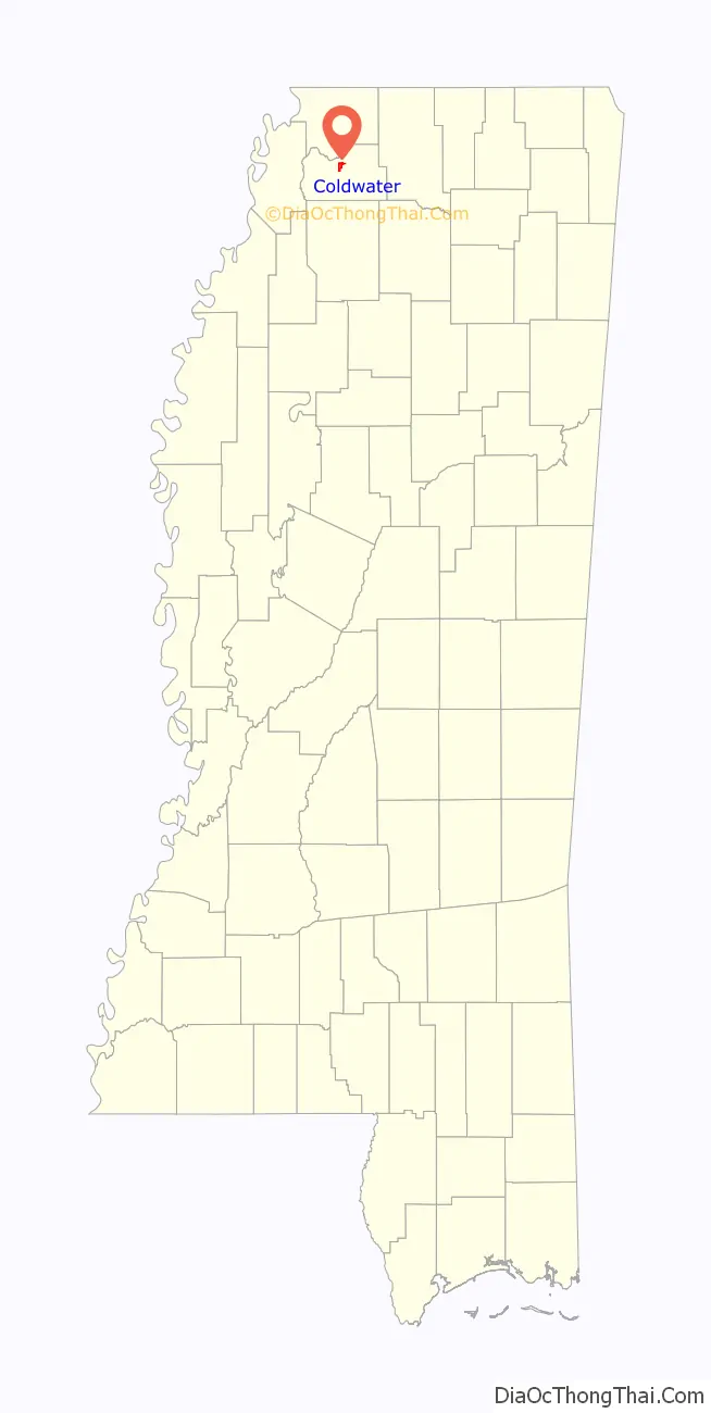
Coldwater location map. Where is Coldwater town?
History
The town square of Coldwater is approximately two miles south of the Coldwater River, hence the name. The original town began in 1856, called the village of Elm Grove. Construction of the Mississippi and Tennessee Railroad through here in 1858 stimulated development. Rows of stores and other businesses developed on both sides of the tracks, along with houses of worship. Coldwater was officially incorporated in 1872. At that time, the Town was located in DeSoto County and was a mile square, with the railroad depot at the center. The area was developed for cotton plantations and Coldwater became a trading center.
In 1873 during Reconstruction, the legislature organized Tate County from portions of DeSoto, Marshall and Tunica counties. Coldwater fell into the new county. The Town began to grow with an influx of settlers from Virginia, the Carolinas, Alabama, and other areas seeking a better life for themselves and their families. There were 397 residents of Coldwater according to the 1890 census. By 1884, there were 96 small schools in Tate County: 54 white and 42 black. They were mostly one teacher, one-room log houses with split logs for seats.
Coldwater steadily grew in numbers. However, periodic river flooding plagued the town, although it was also the basis of the farmland’s fertility. The Army Corps of Engineers built the Arkabutla Lake and Dam project along the Coldwater River in the early 1940s. Town residents believed they needed to move and the Town was relocated and reconstructed on land about a mile and a half south of its original location.
The site of the old town of Coldwater is 229 feet (70 m) MSL. Parts of it are underwater year round.
Radio station WREC was founded in Coldwater by Hoyt B. Wooten. It broadcast news talk information. The station is now called WREG-TV and broadcasts news on a major news network.
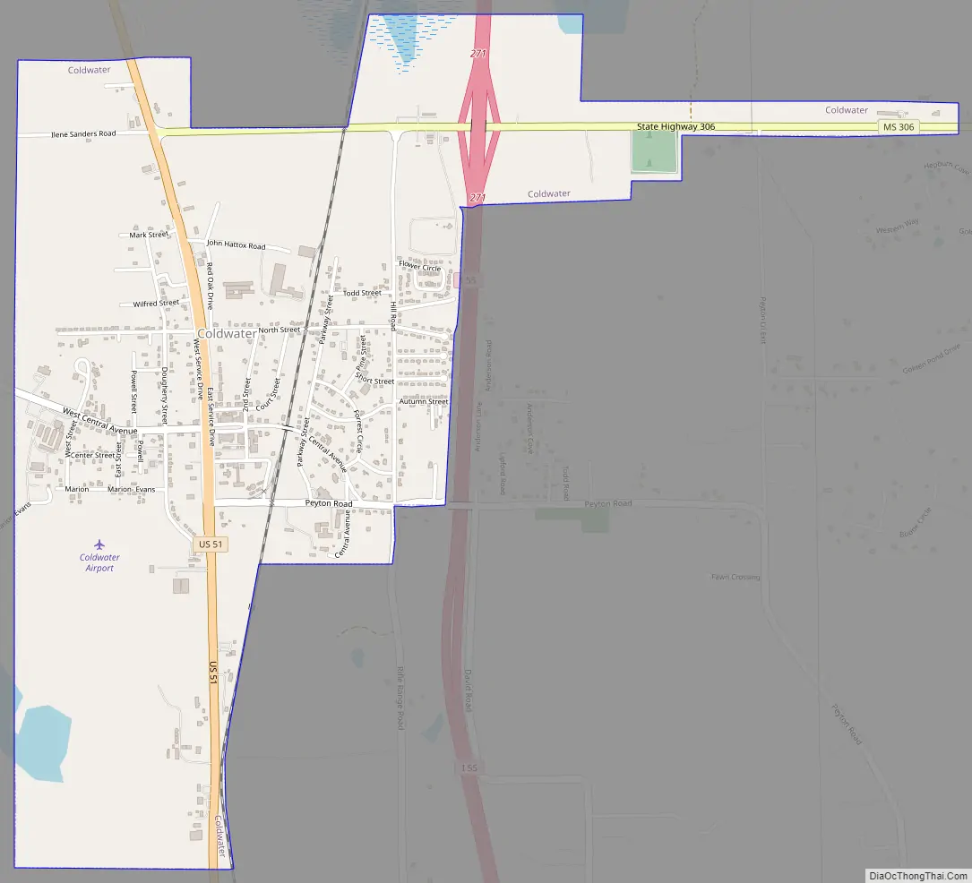
Coldwater Road Map
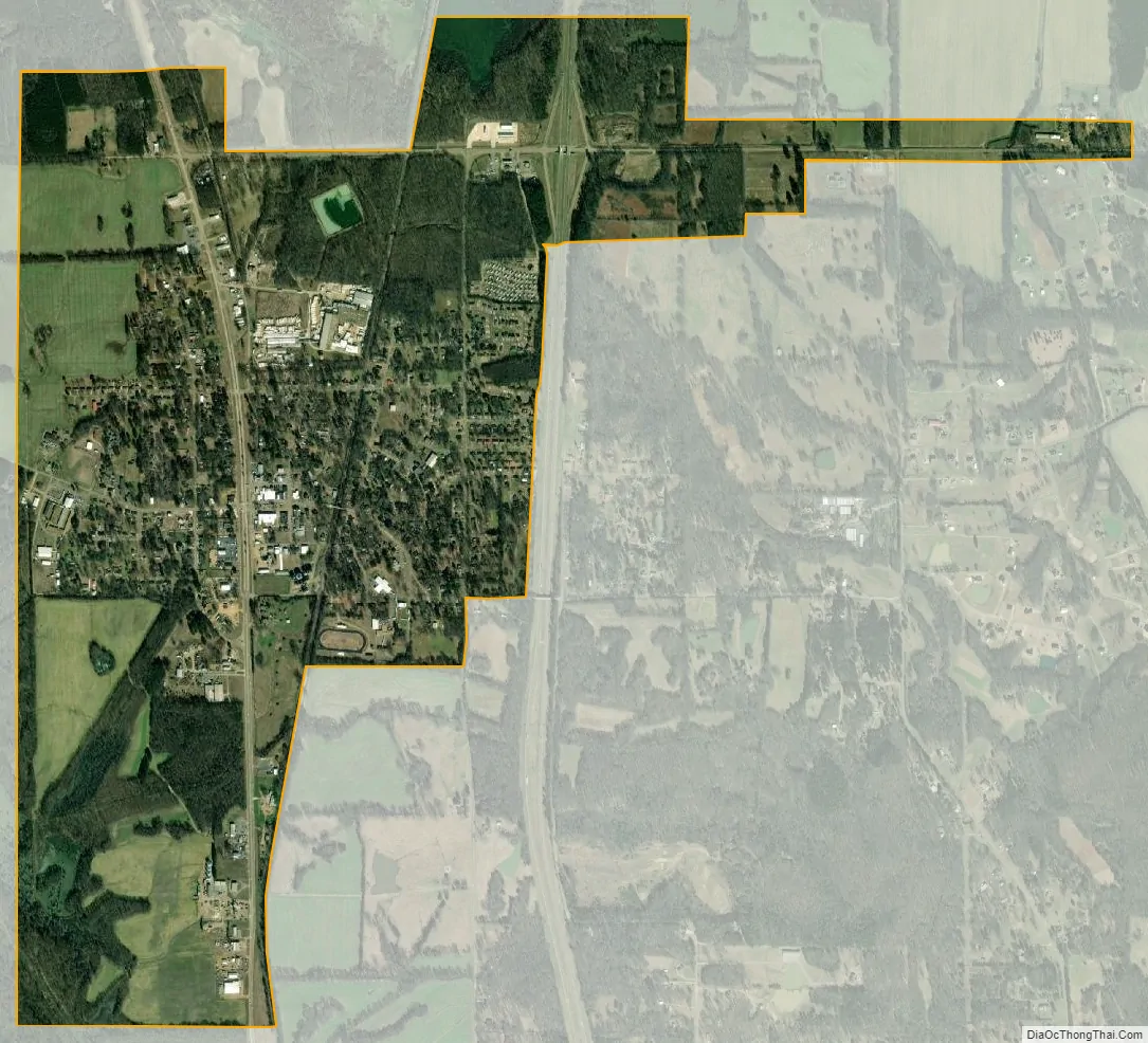
Coldwater city Satellite Map
Geography
According to the United States Census Bureau, the town has a total area of 2.4 square miles (6.2 km), of which 2.4 square miles (6.1 km) is land and 0.42% water.
See also
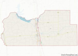
Map of Mississippi State and its subdivision:- Adams
- Alcorn
- Amite
- Attala
- Benton
- Bolivar
- Calhoun
- Carroll
- Chickasaw
- Choctaw
- Claiborne
- Clarke
- Clay
- Coahoma
- Copiah
- Covington
- Desoto
- Forrest
- Franklin
- George
- Greene
- Grenada
- Hancock
- Harrison
- Hinds
- Holmes
- Humphreys
- Issaquena
- Itawamba
- Jackson
- Jasper
- Jefferson
- Jefferson Davis
- Jones
- Kemper
- Lafayette
- Lamar
- Lauderdale
- Lawrence
- Leake
- Lee
- Leflore
- Lincoln
- Lowndes
- Madison
- Marion
- Marshall
- Monroe
- Montgomery
- Neshoba
- Newton
- Noxubee
- Oktibbeha
- Panola
- Pearl River
- Perry
- Pike
- Pontotoc
- Prentiss
- Quitman
- Rankin
- Scott
- Sharkey
- Simpson
- Smith
- Stone
- Sunflower
- Tallahatchie
- Tate
- Tippah
- Tishomingo
- Tunica
- Union
- Walthall
- Warren
- Washington
- Wayne
- Webster
- Wilkinson
- Winston
- Yalobusha
- Yazoo
- Alabama
- Alaska
- Arizona
- Arkansas
- California
- Colorado
- Connecticut
- Delaware
- District of Columbia
- Florida
- Georgia
- Hawaii
- Idaho
- Illinois
- Indiana
- Iowa
- Kansas
- Kentucky
- Louisiana
- Maine
- Maryland
- Massachusetts
- Michigan
- Minnesota
- Mississippi
- Missouri
- Montana
- Nebraska
- Nevada
- New Hampshire
- New Jersey
- New Mexico
- New York
- North Carolina
- North Dakota
- Ohio
- Oklahoma
- Oregon
- Pennsylvania
- Rhode Island
- South Carolina
- South Dakota
- Tennessee
- Texas
- Utah
- Vermont
- Virginia
- Washington
- West Virginia
- Wisconsin
- Wyoming