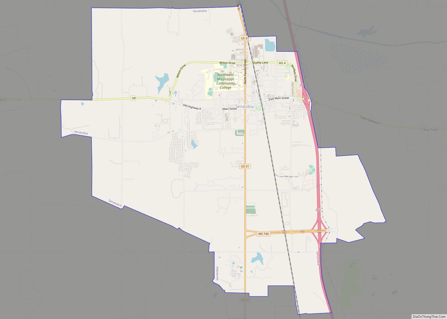
Senatobia is a city in, and the county seat of, Tate County, Mississippi, United States, and is the 16th largest municipality in the Memphis Metropolitan Area. The population was 8,165 at the 2010 census. Senatobia is home to Northwest Mississippi Community College, a state community college providing two-year academic and technical degree programs. Northwest’s system-wide enrollment exceeds 8,000 on three campuses in Senatobia, Southaven and Oxford. Also located in Senatobia is the Baddour Center, a residential care facility for intellectually disabled adults.
| Name: | Senatobia city |
|---|---|
| LSAD Code: | 25 |
| LSAD Description: | city (suffix) |
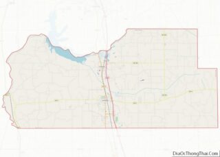
| State: | Mississippi |
| County: | Tate County |
| Elevation: | 289 ft (88 m) |
| Total Area: | 15.64 sq mi (40.51 km²) |
| Land Area: | 15.56 sq mi (40.30 km²) |
| Water Area: | 0.08 sq mi (0.21 km²) |
| Total Population: | 8,354 |
| Population Density: | 536.96/sq mi (207.32/km²) |
| ZIP code: | 38668 |
| Area code: | 662 |
| FIPS code: | 2866440 |
| GNISfeature ID: | 0677513 |
| Website: | http://www.cityofsenatobia.com |
Online Interactive Map
Click on ![]() to view map in "full screen" mode.
to view map in "full screen" mode.
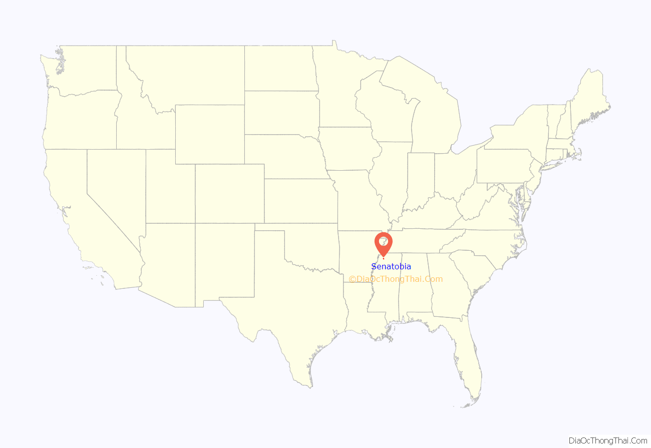
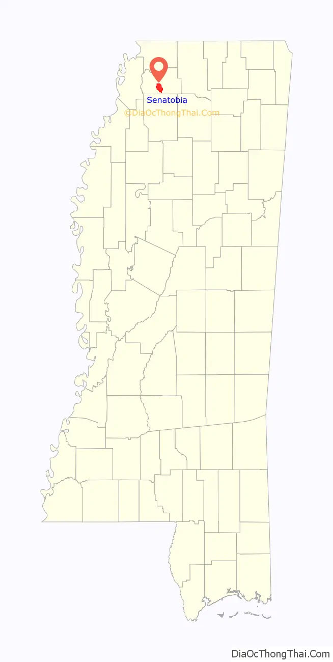
Senatobia location map. Where is Senatobia city?
History
On April 13, 1834, early settler James Peters purchased two sections of land from the Chickasaw Nation for the sum of $1.25 per acre. This land was later developed as the town of Senatobia. The community took its name from Senatobia Creek.
The Downtown Senatobia Historic District, the core of Senatobia’s central business district developed in 1856 after the opening of the Tennessee and Mississippi Railroad. Two nearby settlements, Tatumsville and Tatesville were both abandoned, with those populations moving to Senatobia in favor of easier transportation.
Senatobia received its charter as a municipality in 1860. During the Civil War, the town’s business section was burned twice by Federal troops. Tate County was organized in 1873, during the Reconstruction era, with Senatobia becoming the county seat in 1873 for the newly formed county.
Two Academy Award-nominated films have been partially filmed in the town: The Client (1994) and The People vs. Larry Flynt (1996).
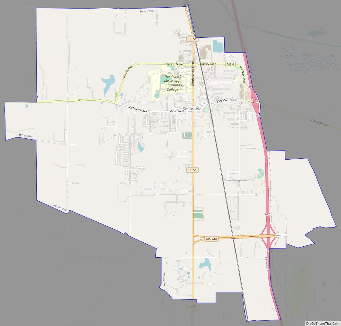
Senatobia Road Map
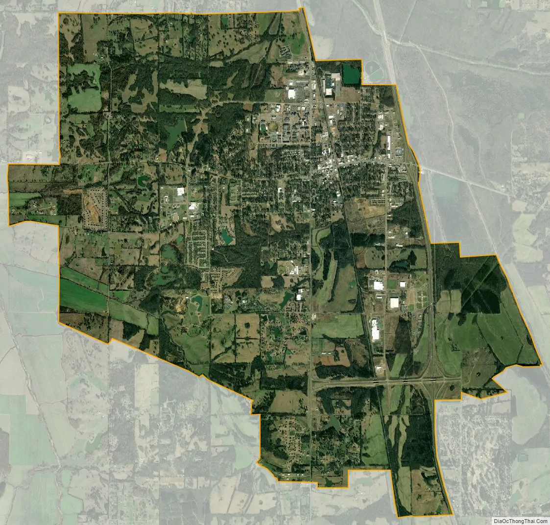
Senatobia city Satellite Map
Geography
According to the United States Census Bureau, the city has a total area of 10.8 square miles (28 km), of which 10.8 square miles (28 km) is land and 0.04 square miles (0.10 km) (0.28%) is water.
See also
Map of Mississippi State and its subdivision:- Adams
- Alcorn
- Amite
- Attala
- Benton
- Bolivar
- Calhoun
- Carroll
- Chickasaw
- Choctaw
- Claiborne
- Clarke
- Clay
- Coahoma
- Copiah
- Covington
- Desoto
- Forrest
- Franklin
- George
- Greene
- Grenada
- Hancock
- Harrison
- Hinds
- Holmes
- Humphreys
- Issaquena
- Itawamba
- Jackson
- Jasper
- Jefferson
- Jefferson Davis
- Jones
- Kemper
- Lafayette
- Lamar
- Lauderdale
- Lawrence
- Leake
- Lee
- Leflore
- Lincoln
- Lowndes
- Madison
- Marion
- Marshall
- Monroe
- Montgomery
- Neshoba
- Newton
- Noxubee
- Oktibbeha
- Panola
- Pearl River
- Perry
- Pike
- Pontotoc
- Prentiss
- Quitman
- Rankin
- Scott
- Sharkey
- Simpson
- Smith
- Stone
- Sunflower
- Tallahatchie
- Tate
- Tippah
- Tishomingo
- Tunica
- Union
- Walthall
- Warren
- Washington
- Wayne
- Webster
- Wilkinson
- Winston
- Yalobusha
- Yazoo
- Alabama
- Alaska
- Arizona
- Arkansas
- California
- Colorado
- Connecticut
- Delaware
- District of Columbia
- Florida
- Georgia
- Hawaii
- Idaho
- Illinois
- Indiana
- Iowa
- Kansas
- Kentucky
- Louisiana
- Maine
- Maryland
- Massachusetts
- Michigan
- Minnesota
- Mississippi
- Missouri
- Montana
- Nebraska
- Nevada
- New Hampshire
- New Jersey
- New Mexico
- New York
- North Carolina
- North Dakota
- Ohio
- Oklahoma
- Oregon
- Pennsylvania
- Rhode Island
- South Carolina
- South Dakota
- Tennessee
- Texas
- Utah
- Vermont
- Virginia
- Washington
- West Virginia
- Wisconsin
- Wyoming