Hollandale is a city in Washington County, Mississippi, United States. The population was 2,323 at the 2020 census.
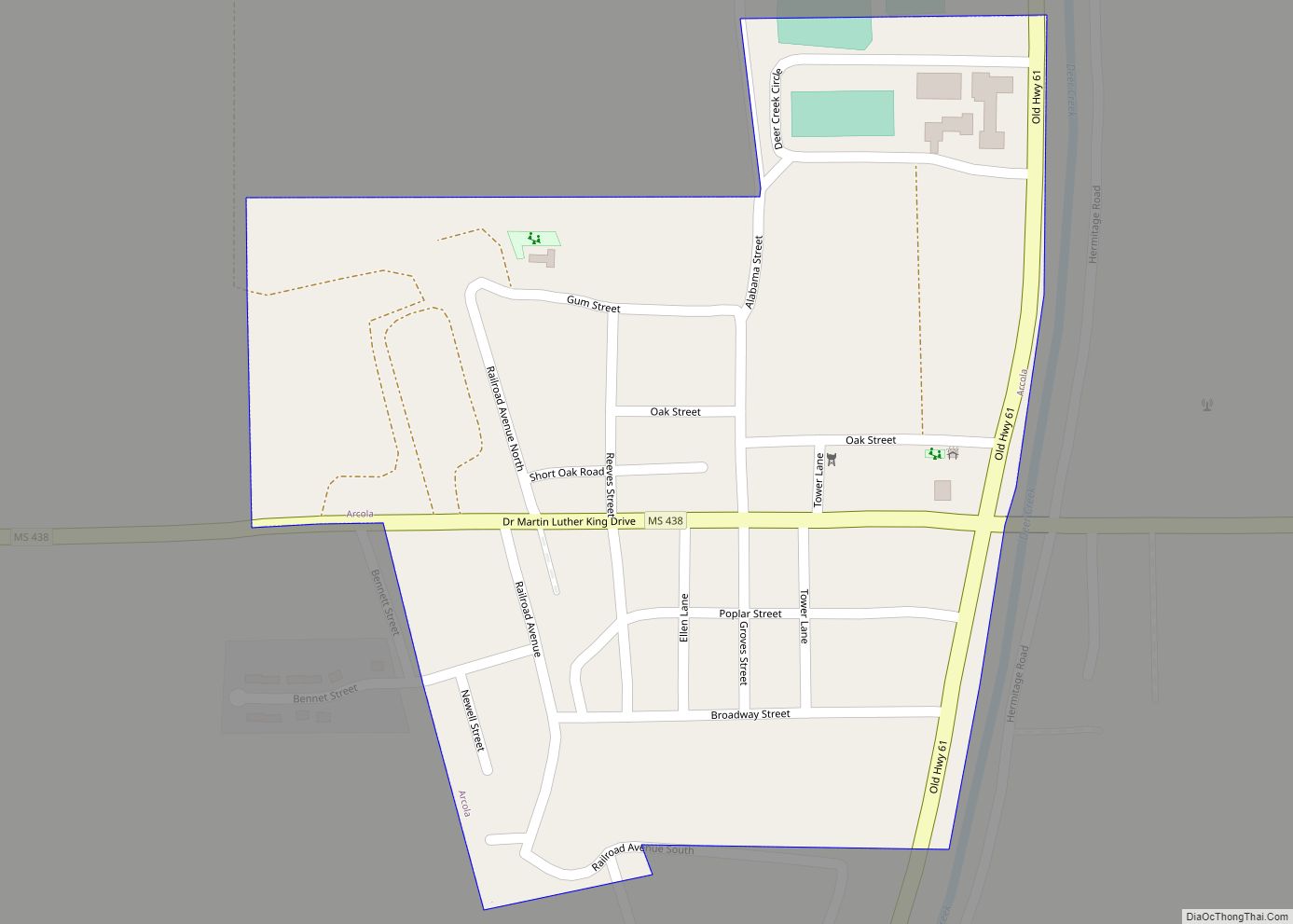
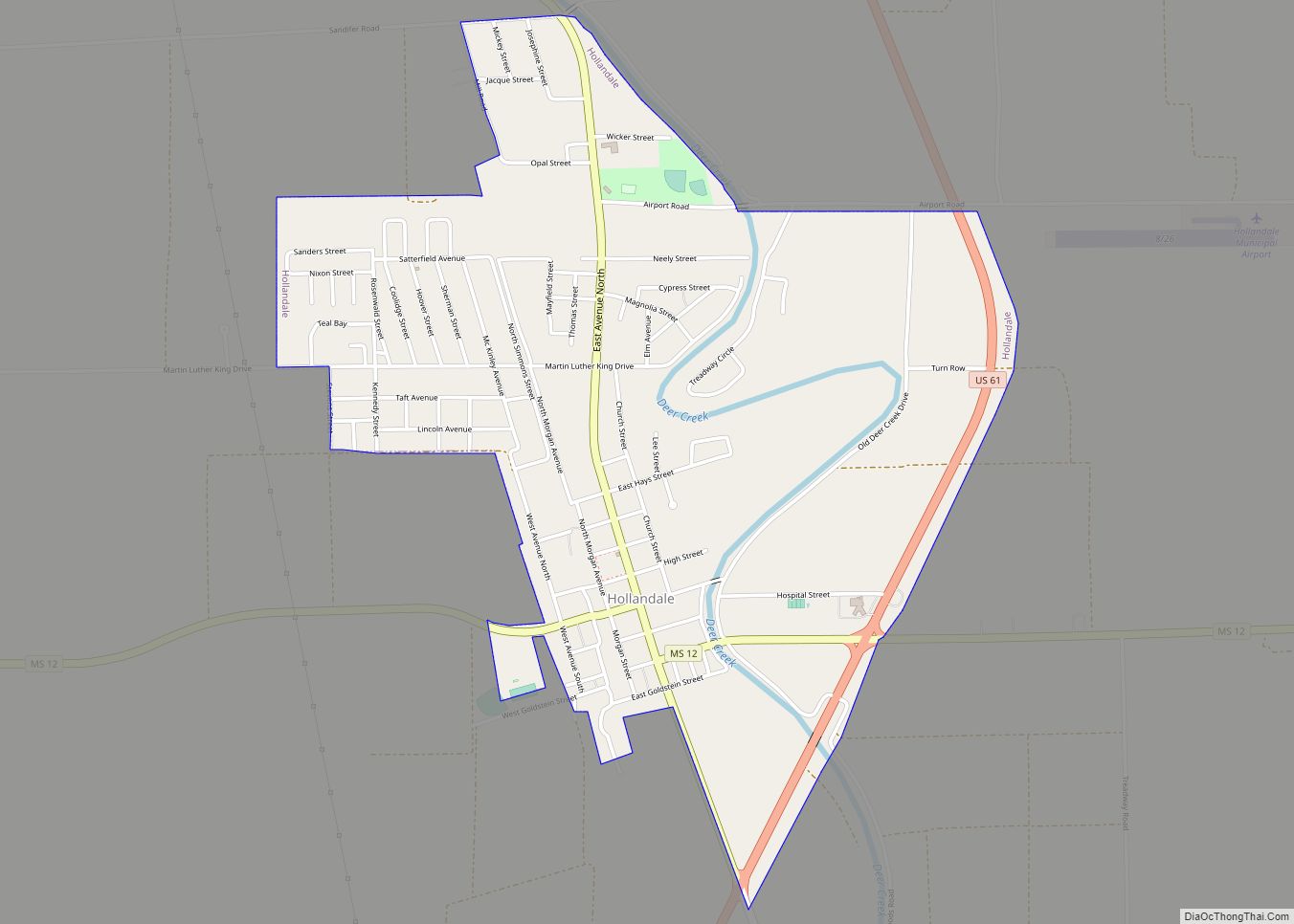
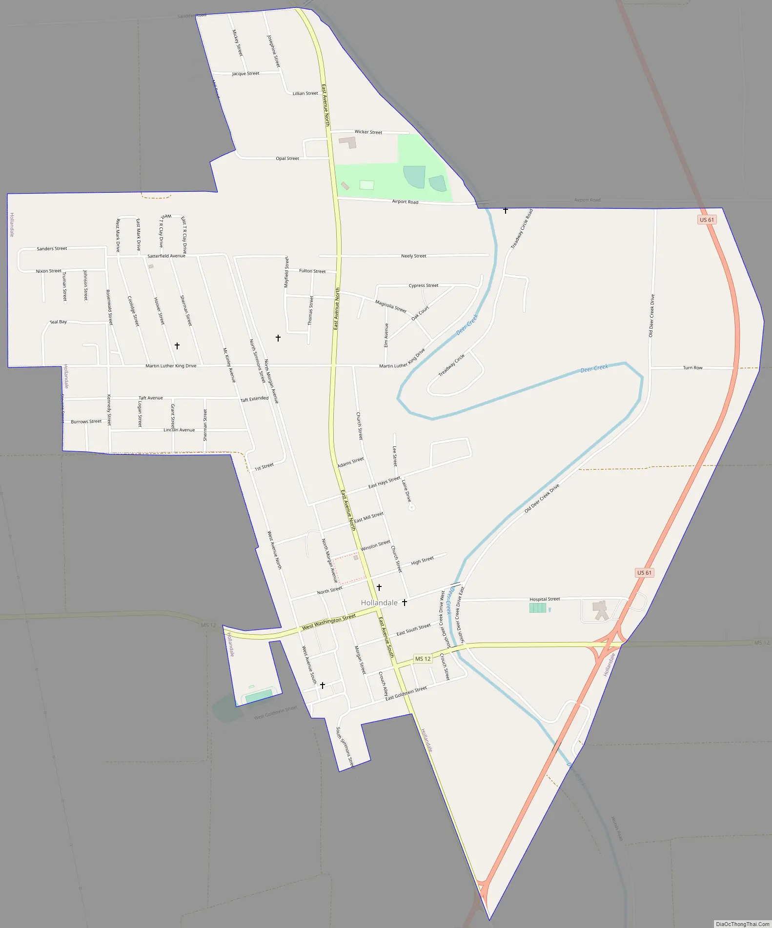
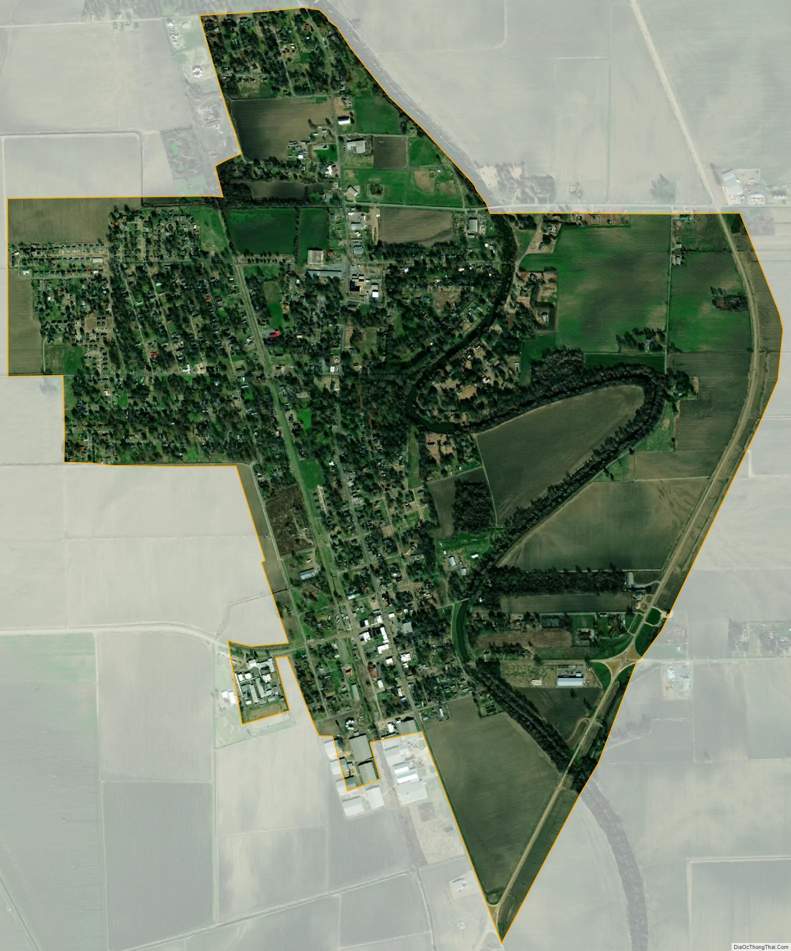
Deer Creek flows through Hollandale, and the Leroy Percy State Park is west of the city along Mississippi Highway 12. The Hollandale Municipal Airport is northeast of the city.
A 2008 study by the University of North Carolina described Hollandale as “a small community that has been mired in poverty for decades.”
| Name: | Hollandale city |
|---|---|
| LSAD Code: | 25 |
| LSAD Description: | city (suffix) |
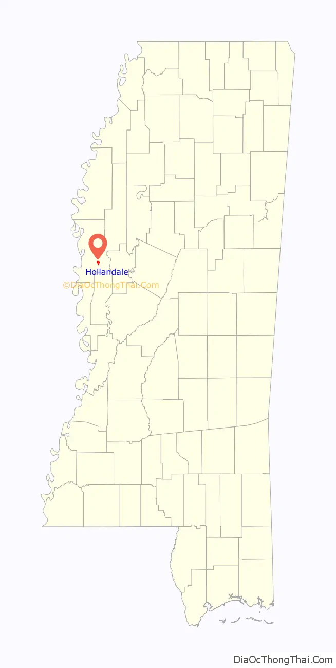
| State: | Mississippi |
| County: | Washington County |
| Elevation: | 115 ft (35 m) |
| Total Area: | 2.22 sq mi (5.74 km²) |
| Land Area: | 2.22 sq mi (5.74 km²) |
| Water Area: | 0.00 sq mi (0.00 km²) |
| Total Population: | 2,323 |
| Population Density: | 1,048.29/sq mi (404.83/km²) |
| ZIP code: | 38748 |
| Area code: | 662 |
| FIPS code: | 2832900 |
| GNISfeature ID: | 0671293 |
Online Interactive Map
Click on ![]() to view map in "full screen" mode.
to view map in "full screen" mode.
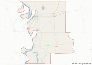
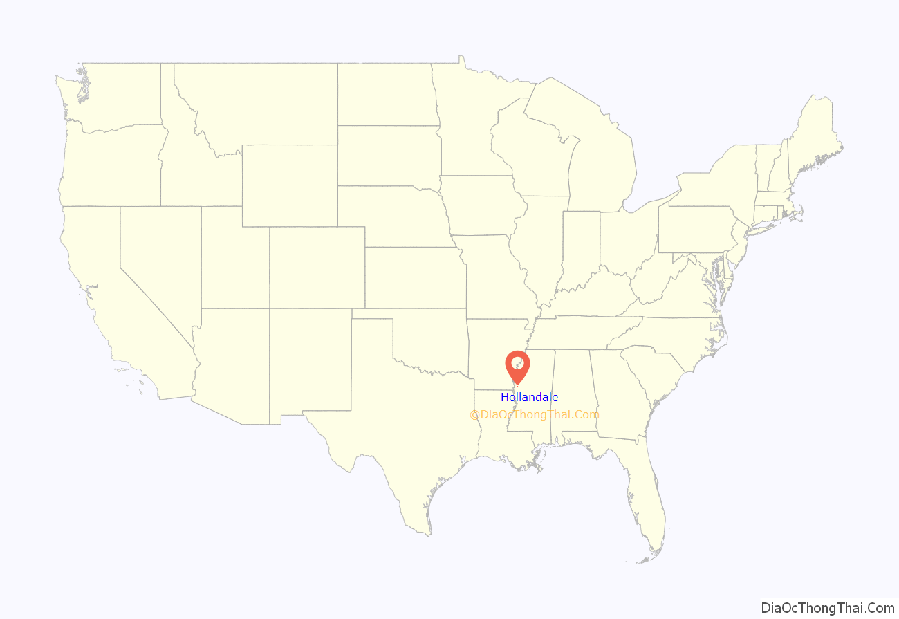
Hollandale location map. Where is Hollandale city?
History
Hollandale was named for Dr. Holland, the original owner of the town site.
Hollandale was incorporated in 1890, and almost completely destroyed by fire in 1904.
A one-room school house in Hollandale was founded by Emory Peter “E.P.” Simmons in 1891. One of the first schools for African-American children in the area, it was used until 1923, when financial support from the Rosenwald Fund enabled the construction of a larger brick school. Simmons worked as an educator and administrator for 52 years, and Simmons High School in Hollandale is named in his honor.
Thomas Roosevelt “T.R.” Sanders was a noted community leader. Sanders was principal of Simmons High School for 33 years, and the first superintendent of the Hollandale Colored School District. Sanders developed ‘Sanders Estates’, the town’s first subdivision, and organized an association which provided running water to neighboring Sharkey County. Sanders was the first African-American in Mississippi to receive a master’s degree in educational administration.
During the Civil Rights Movement, Hollandale was noted for having passed an ordinance forbidding white civil rights workers from living with black citizens.
A marker on the Mississippi Blues Trail dedicated to musician Sam Chatmon is located in Hollandale, as is a marker on the Mississippi Country Music Trail dedicated to Ben Peters.
Hollandale resident Capt. Kermit O. Evans was recognized by the U.S. Congress in 2007 after losing his life in Operation Iraqi Freedom.
The Farm Fresh Catfish processing plant was located in Hollandale until it closed in 2004, laying off 240 workers. The Delta & Pine Land Company of Mississippi, a cotton and soybean producer owned by Monsanto, continues to be a major employer.
Hollandale Road Map
Hollandale city Satellite Map
Geography
According to the United States Census Bureau, the city has a total area of 2.2 square miles (5.7 km), all of it land.
See also
Map of Mississippi State and its subdivision:- Adams
- Alcorn
- Amite
- Attala
- Benton
- Bolivar
- Calhoun
- Carroll
- Chickasaw
- Choctaw
- Claiborne
- Clarke
- Clay
- Coahoma
- Copiah
- Covington
- Desoto
- Forrest
- Franklin
- George
- Greene
- Grenada
- Hancock
- Harrison
- Hinds
- Holmes
- Humphreys
- Issaquena
- Itawamba
- Jackson
- Jasper
- Jefferson
- Jefferson Davis
- Jones
- Kemper
- Lafayette
- Lamar
- Lauderdale
- Lawrence
- Leake
- Lee
- Leflore
- Lincoln
- Lowndes
- Madison
- Marion
- Marshall
- Monroe
- Montgomery
- Neshoba
- Newton
- Noxubee
- Oktibbeha
- Panola
- Pearl River
- Perry
- Pike
- Pontotoc
- Prentiss
- Quitman
- Rankin
- Scott
- Sharkey
- Simpson
- Smith
- Stone
- Sunflower
- Tallahatchie
- Tate
- Tippah
- Tishomingo
- Tunica
- Union
- Walthall
- Warren
- Washington
- Wayne
- Webster
- Wilkinson
- Winston
- Yalobusha
- Yazoo
- Alabama
- Alaska
- Arizona
- Arkansas
- California
- Colorado
- Connecticut
- Delaware
- District of Columbia
- Florida
- Georgia
- Hawaii
- Idaho
- Illinois
- Indiana
- Iowa
- Kansas
- Kentucky
- Louisiana
- Maine
- Maryland
- Massachusetts
- Michigan
- Minnesota
- Mississippi
- Missouri
- Montana
- Nebraska
- Nevada
- New Hampshire
- New Jersey
- New Mexico
- New York
- North Carolina
- North Dakota
- Ohio
- Oklahoma
- Oregon
- Pennsylvania
- Rhode Island
- South Carolina
- South Dakota
- Tennessee
- Texas
- Utah
- Vermont
- Virginia
- Washington
- West Virginia
- Wisconsin
- Wyoming