Leland is a city in Washington County, Mississippi, United States. It is located within the Mississippi Delta, on the banks of Deer Creek. The population was 4,481 at the 2010 census. It was once a railway town and had long been a center of cotton culture, which is still an important commodity crop in the rural area. It was once considered the second-largest city in Washington County in 1920 due to its rapid growth of residents, businesses, and schools.
Since before the Civil War, farming has been the basis of the local economy. There are several privately-owned farms within and around the boundaries of the town. Mississippi State University and the United States Department of Agriculture (USDA) maintain an agriculture research station at Stoneville on Leland’s outskirts. Other agricultural companies in the area are Lauren Farms BASF Stoneville Cotton, Bayer Crops Science, GreenPoint Ag, Azlin Seed Service, Corteva Agriscience™, Pettiet Agricultural Services, Inc., Nutrien Ag Solutions, K-I Chemical U.S.A., Greenland Planting Company, Ayers-Delta Implement, Edward’s Flying Service, Essie Patterson Farm Trucking, and Southern Seed Association. Cotton, soybeans, rice and corn are the leading commodity crops along with catfish.
A number of national and regionally noted blues musicians are from Leland. There are five Mississippi Blues Trail markers in Leland commemorating the small town’s significant contribution to blues history. Highway 61, mentioned in numerous blues recordings, runs through the town and gives its name to the community’s blues museum. Leland is the burial place of the folk artist and blues musician James “Son” Thomas, who lived for many years near the railroad tracks. Thomas is buried beneath a gravestone donated by Mt. Zion Memorial Fund, to which musician John Fogerty of Creedence Clearwater Revival was a yearly contributor.
Blues musician Johnny Winter spent part of his childhood in Leland. Winter’s grandfather and father, a former mayor of Leland, operated J.D. Winter & Sons, a cotton business. One of the Blues Trail markers in Leland is dedicated to Winter.
The community is the childhood home of puppeteer Jim Henson, who was born in nearby Greenville, but raised in Leland. Here he created the character of Kermit the Frog, a Muppet. The city has a museum along the banks of Deer Creek celebrating Henson’s accomplishments called the Jim Henson Exhibit.
Leland was selected as the site for the Mississippi Wildlife Heritage Museum, opened in 2016.
| Name: | Leland city |
|---|---|
| LSAD Code: | 25 |
| LSAD Description: | city (suffix) |
| State: | Mississippi |
| County: | Washington County |
| Incorporated: | February 20, 1886 |
| Elevation: | 125 ft (38 m) |
| Total Area: | 3.63 sq mi (9.41 km²) |
| Land Area: | 3.58 sq mi (9.28 km²) |
| Water Area: | 0.05 sq mi (0.13 km²) |
| Total Population: | 3,988 |
| Population Density: | 1,113.03/sq mi (429.70/km²) |
| ZIP code: | 38756 |
| Area code: | 662 |
| FIPS code: | 2840280 |
| GNISfeature ID: | 0672400 |
| Website: | www.lelandchamber.com |
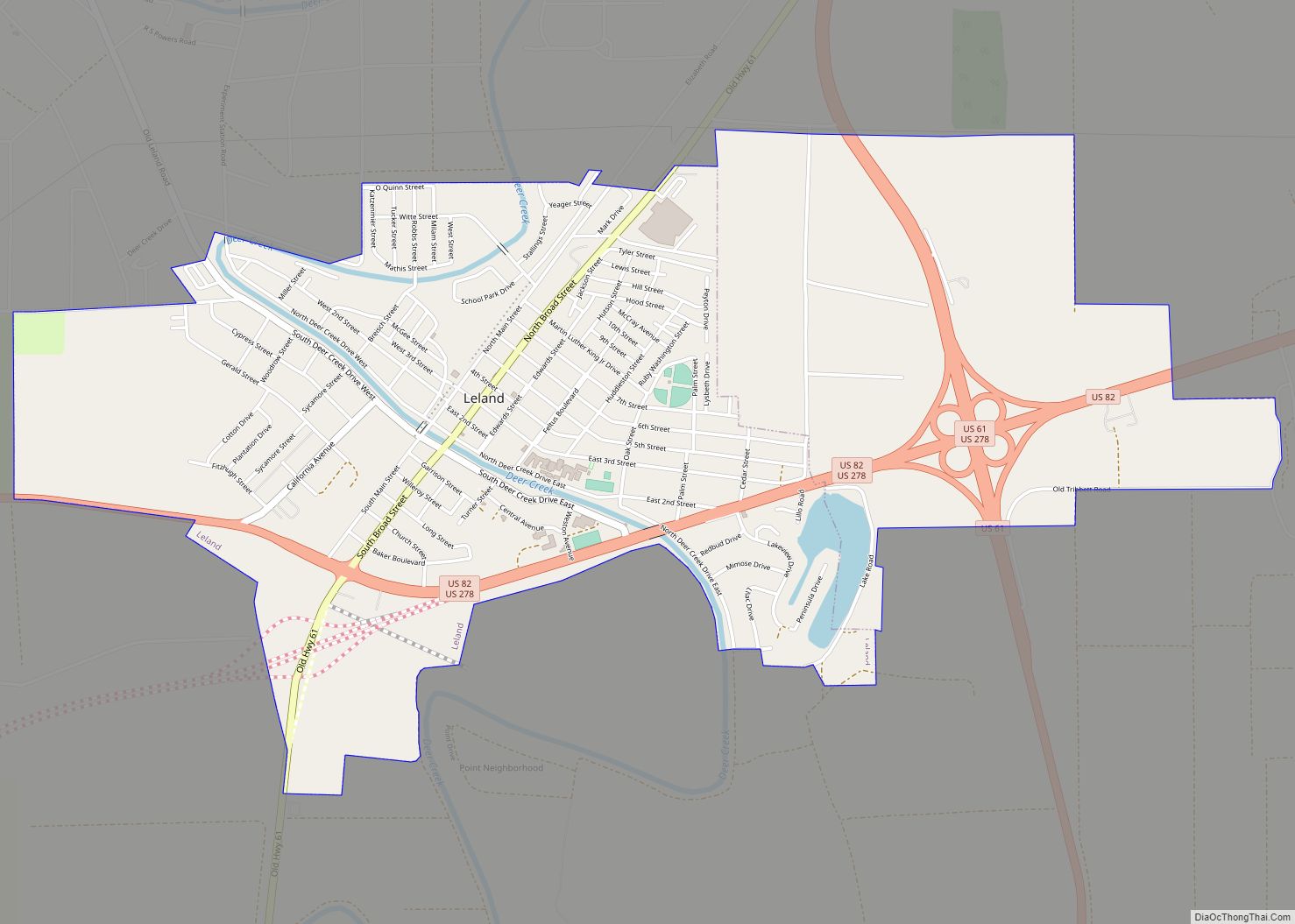
Online Interactive Map
Click on ![]() to view map in "full screen" mode.
to view map in "full screen" mode.
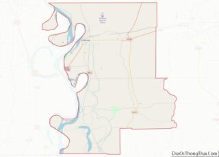
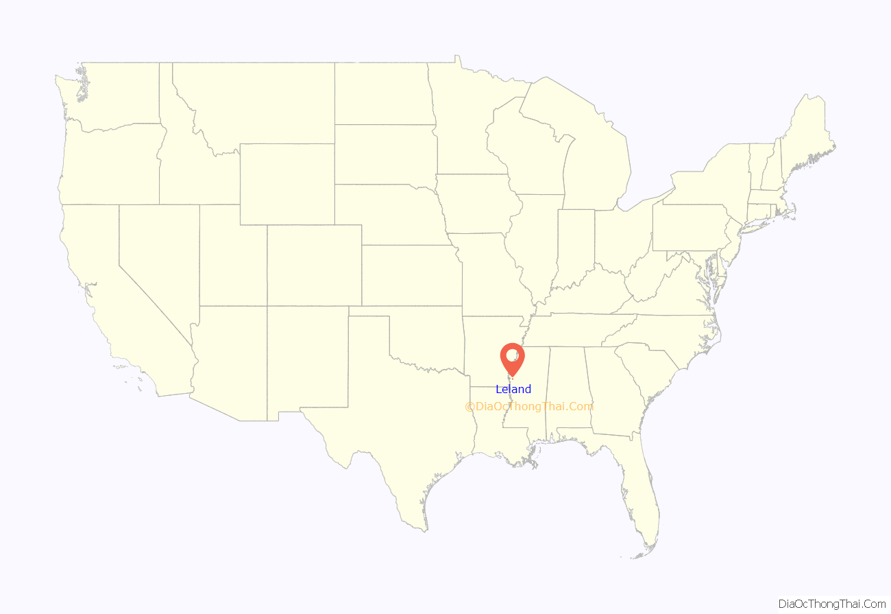
Leland location map. Where is Leland city?
History
1800-1900: Founding
The area in which Leland sits was once part of the Choctaw territory in the early 1800s. After the Second Choctaw Cession, which came from the Treaty of Doak’s Stand of 1820, the land was fought over by the United States government and the Choctaw Indians during the American Civil War in which the Choctaw Indians sided with the Confederacy in order to fight the Union for the return of their land.
The territory that the town was built on was first settled on in 1834 by Samuel and Susan Jones, Mary Neely, and Malinda Breeland. A few years later, they deeded the land to the families of Connerly and Buckner. They made their home on the bank of Deer Creek on the Three Oaks Plantation. Soon other settlers came to live in Leland and the Stoneville area. To travel between both places at the time, people used boats to navigate on Deer Creek. There was even a drawbridge that wad built by Leland settlers to be more closely connected with the people of Stoneville.
Years later, the Buckner and Connerly families moved away and sold their land to Judge James Ruckus and William Yerger. The new owners maintained the land until the American Civil War. In 1869, their heirs quit claimed the land for release mortgages which passed to the hands of the Bank of Kentucky. After seven years, Mississippi native Captain James Alexander Ventress Feltus (1840-1908) bought the 900 acres of land for $12,000.
Captain James A.V. Feltus built his home at the “Three Oaks” and deeded a 100 foot right-of-way on the land to the Memphis and Vicksburg Railroad Company; however, no railway was built until 1885, when the right of way was given to the Louisville, New Orleans and Texas Railroad Company. Leland was one of two cities considered for a terminus of several railroad lines, most notably, the Louisville, New Orleans & Texas Railway. Captain John C. Calhoun, an enterprising and liberal owner of the Leland Plantation, pushed efforts to make Leland a primary candidate for the terminus.
Captain Feltus dedicated the original town of Leland by signing deeds that created streets from First to Eighth Streets, which included Main and Broad Streets as the east and west boundaries of the town. Accounts state that Captain Feltus named the town after Miss Leland McCutcheon, the mother of Feltus’ friend, Ruben Armstrong and fiancé of young traveling railroad auditor C.E. Armstrong. It would seem that both accounts state that both men asked Captain Feltus to name the town in her honor. The first store built in the town of Leland was the Greenley’s Mens Store, owned by J.C. Greenley.
In January of 1886, the citizens of the town drafted a charter to incorporate the town of Leland and sent it by mail to the representatives at Jackson, Mississippi. By February of that year, the charter was amended in bills H.B. 642 and H.B. 643 and was well on its way to making the town officially recognized as a city; it was approved on February 20, 1886.
As the town continued to progress, it established its first newspaper publication, The Leland Record, and businesses became established, e.g. retail, banks, law firms, other railway companies, grocers, innkeepers, landlords and more.
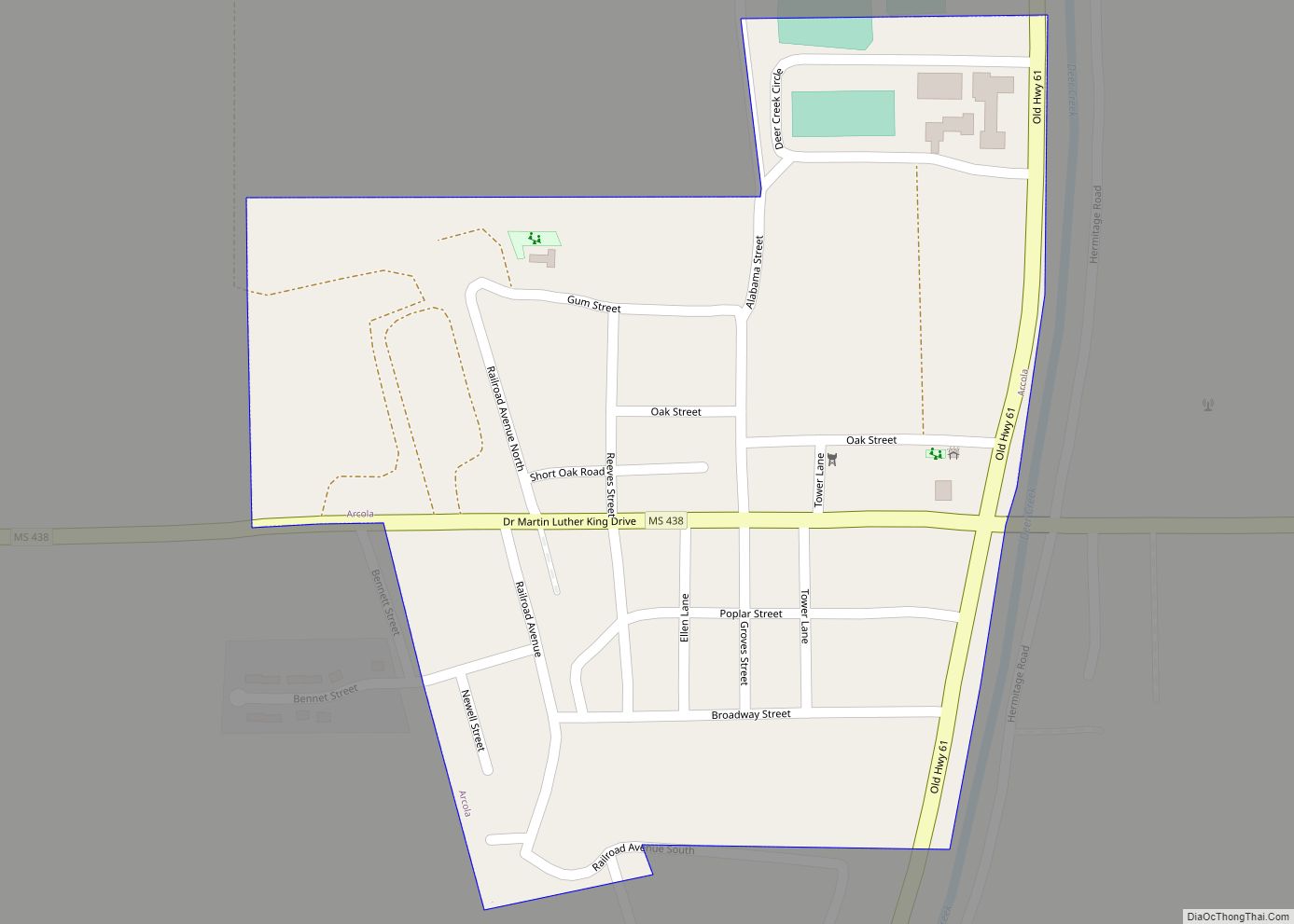
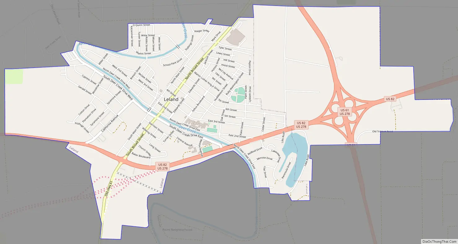
Leland Road Map
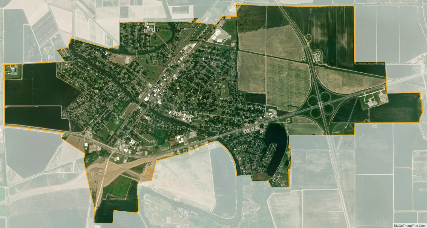
Leland city Satellite Map
Geography
According to the United States Census Bureau, the city has a total area of 2.1 square miles (5.4 km), of which 2.1 square miles (5.4 km) is land and 0.04 square miles (0.10 km) (1.44%) is water.
See also
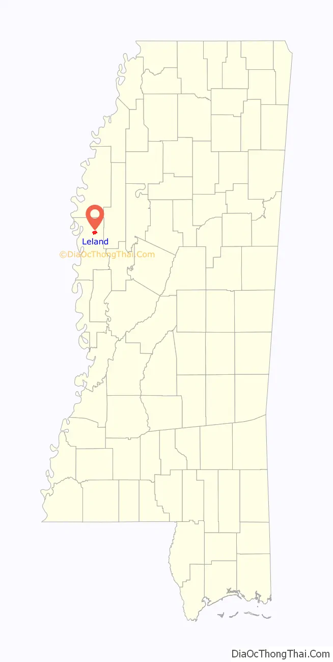
Map of Mississippi State and its subdivision:- Adams
- Alcorn
- Amite
- Attala
- Benton
- Bolivar
- Calhoun
- Carroll
- Chickasaw
- Choctaw
- Claiborne
- Clarke
- Clay
- Coahoma
- Copiah
- Covington
- Desoto
- Forrest
- Franklin
- George
- Greene
- Grenada
- Hancock
- Harrison
- Hinds
- Holmes
- Humphreys
- Issaquena
- Itawamba
- Jackson
- Jasper
- Jefferson
- Jefferson Davis
- Jones
- Kemper
- Lafayette
- Lamar
- Lauderdale
- Lawrence
- Leake
- Lee
- Leflore
- Lincoln
- Lowndes
- Madison
- Marion
- Marshall
- Monroe
- Montgomery
- Neshoba
- Newton
- Noxubee
- Oktibbeha
- Panola
- Pearl River
- Perry
- Pike
- Pontotoc
- Prentiss
- Quitman
- Rankin
- Scott
- Sharkey
- Simpson
- Smith
- Stone
- Sunflower
- Tallahatchie
- Tate
- Tippah
- Tishomingo
- Tunica
- Union
- Walthall
- Warren
- Washington
- Wayne
- Webster
- Wilkinson
- Winston
- Yalobusha
- Yazoo
- Alabama
- Alaska
- Arizona
- Arkansas
- California
- Colorado
- Connecticut
- Delaware
- District of Columbia
- Florida
- Georgia
- Hawaii
- Idaho
- Illinois
- Indiana
- Iowa
- Kansas
- Kentucky
- Louisiana
- Maine
- Maryland
- Massachusetts
- Michigan
- Minnesota
- Mississippi
- Missouri
- Montana
- Nebraska
- Nevada
- New Hampshire
- New Jersey
- New Mexico
- New York
- North Carolina
- North Dakota
- Ohio
- Oklahoma
- Oregon
- Pennsylvania
- Rhode Island
- South Carolina
- South Dakota
- Tennessee
- Texas
- Utah
- Vermont
- Virginia
- Washington
- West Virginia
- Wisconsin
- Wyoming