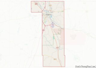
Rawls Springs is an unincorporated community and census-designated place (CDP) located in Forrest County, Mississippi, United States. As of the 2020 census it had a population of 1,202. Rawls Springs is approximately 6.5 miles (10.5 km) northwest of Hattiesburg near U.S. Route 49 and a part of the Hattiesburg, Mississippi Metropolitan Statistical Area.
Rawls Springs is located on the former Illinois Central Gulf Railroad.
A post office operated under the name Rawles Springs from 1905 to 1927.
| Name: | Rawls Springs CDP |
|---|---|
| LSAD Code: | 57 |
| LSAD Description: | CDP (suffix) |
| State: | Mississippi |
| County: | Forrest County |
| Elevation: | 174 ft (53 m) |
| Total Area: | 1.84 sq mi (4.76 km²) |
| Land Area: | 1.83 sq mi (4.73 km²) |
| Water Area: | 0.01 sq mi (0.03 km²) |
| Total Population: | 1,202 |
| Population Density: | 658.27/sq mi (254.21/km²) |
| ZIP code: | 39402 |
| Area code: | 601 |
| FIPS code: | 2861080 |
| GNISfeature ID: | 676496 |
Online Interactive Map
Click on ![]() to view map in "full screen" mode.
to view map in "full screen" mode.
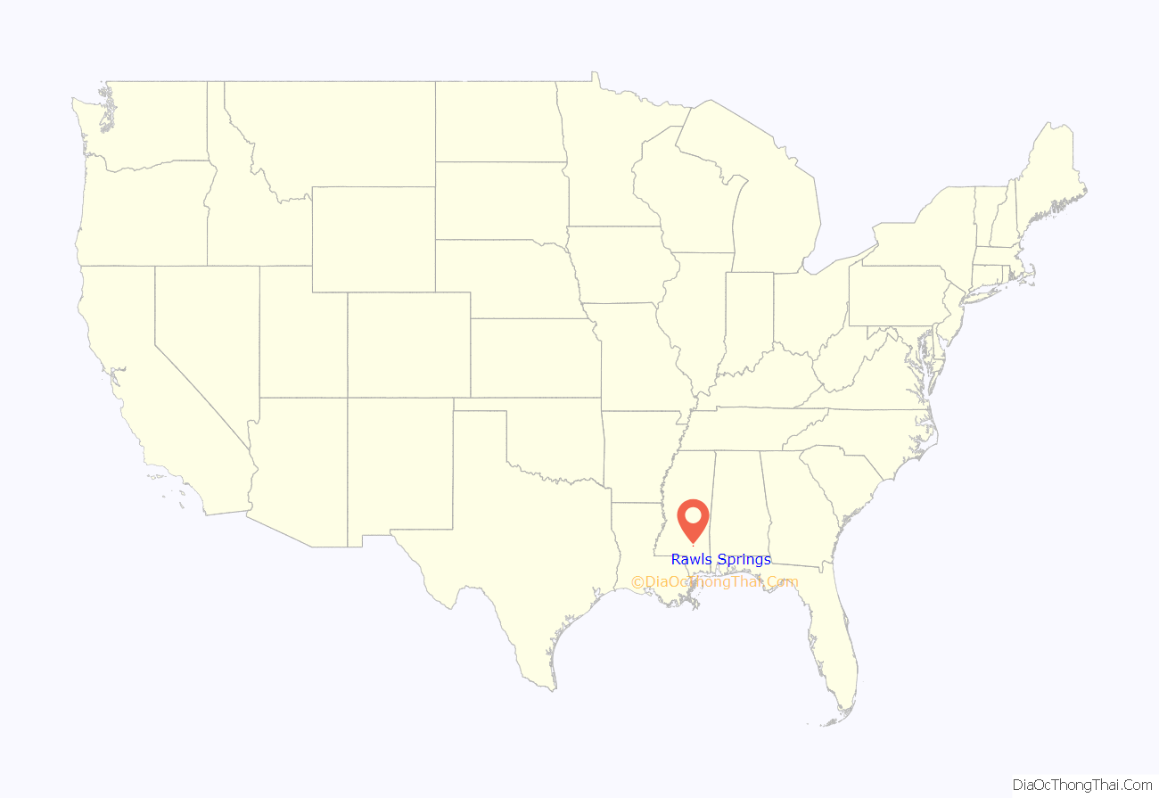
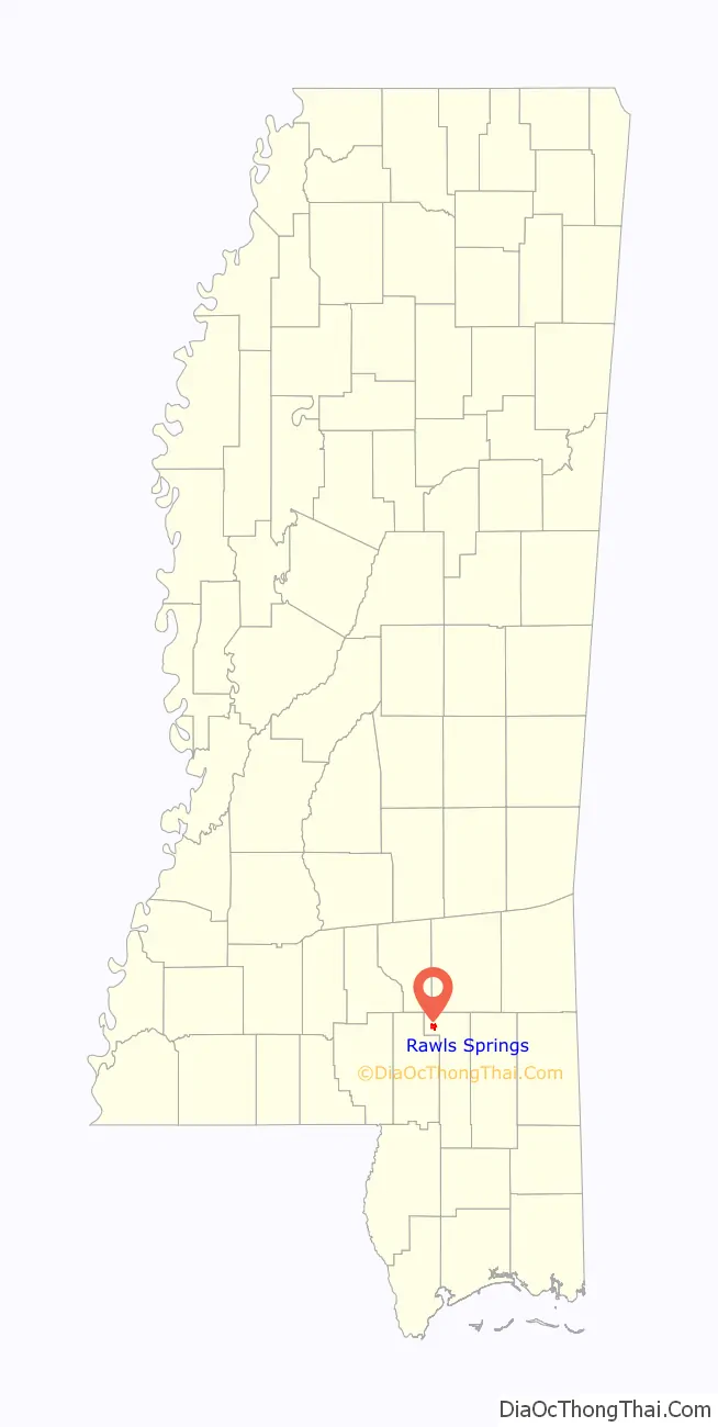
Rawls Springs location map. Where is Rawls Springs CDP?
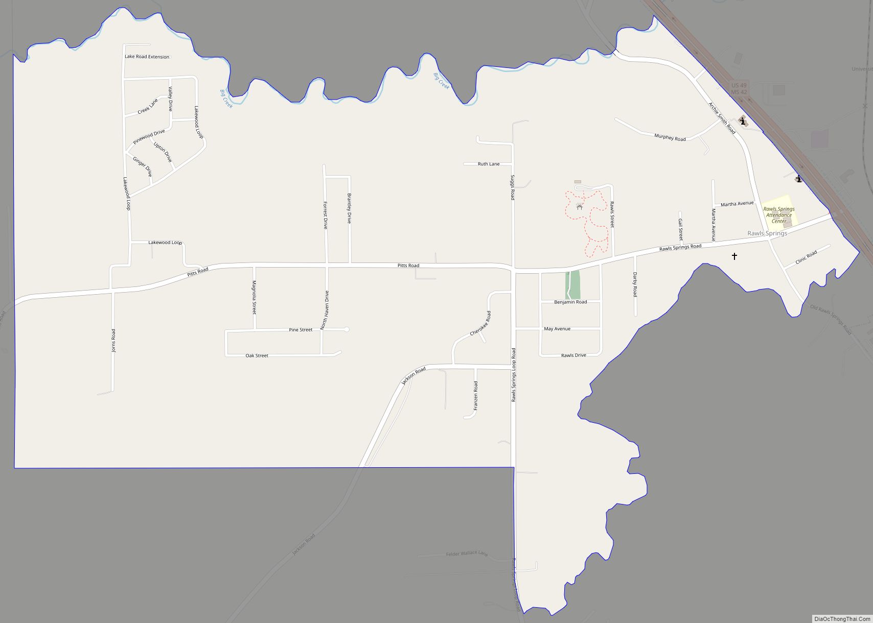
Rawls Springs Road Map

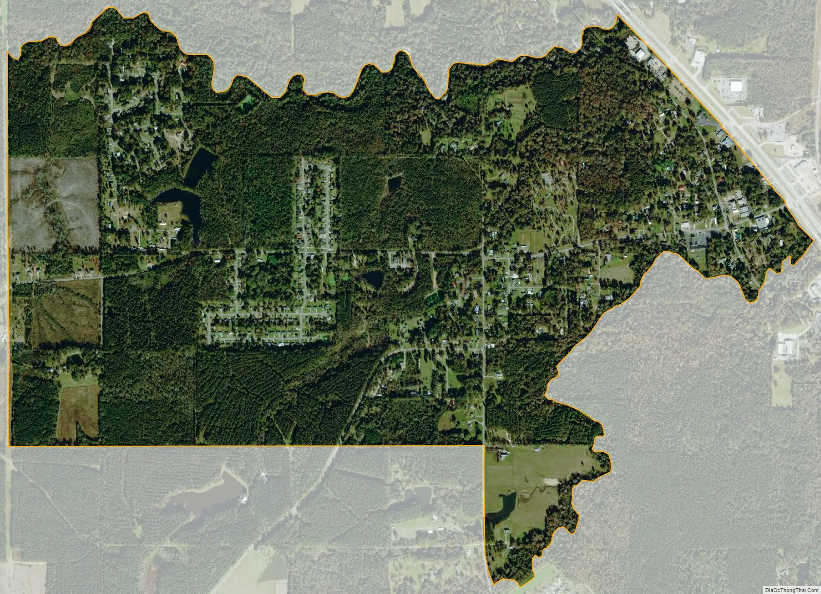
Rawls Springs city Satellite Map
See also
Map of Mississippi State and its subdivision:- Adams
- Alcorn
- Amite
- Attala
- Benton
- Bolivar
- Calhoun
- Carroll
- Chickasaw
- Choctaw
- Claiborne
- Clarke
- Clay
- Coahoma
- Copiah
- Covington
- Desoto
- Forrest
- Franklin
- George
- Greene
- Grenada
- Hancock
- Harrison
- Hinds
- Holmes
- Humphreys
- Issaquena
- Itawamba
- Jackson
- Jasper
- Jefferson
- Jefferson Davis
- Jones
- Kemper
- Lafayette
- Lamar
- Lauderdale
- Lawrence
- Leake
- Lee
- Leflore
- Lincoln
- Lowndes
- Madison
- Marion
- Marshall
- Monroe
- Montgomery
- Neshoba
- Newton
- Noxubee
- Oktibbeha
- Panola
- Pearl River
- Perry
- Pike
- Pontotoc
- Prentiss
- Quitman
- Rankin
- Scott
- Sharkey
- Simpson
- Smith
- Stone
- Sunflower
- Tallahatchie
- Tate
- Tippah
- Tishomingo
- Tunica
- Union
- Walthall
- Warren
- Washington
- Wayne
- Webster
- Wilkinson
- Winston
- Yalobusha
- Yazoo
- Alabama
- Alaska
- Arizona
- Arkansas
- California
- Colorado
- Connecticut
- Delaware
- District of Columbia
- Florida
- Georgia
- Hawaii
- Idaho
- Illinois
- Indiana
- Iowa
- Kansas
- Kentucky
- Louisiana
- Maine
- Maryland
- Massachusetts
- Michigan
- Minnesota
- Mississippi
- Missouri
- Montana
- Nebraska
- Nevada
- New Hampshire
- New Jersey
- New Mexico
- New York
- North Carolina
- North Dakota
- Ohio
- Oklahoma
- Oregon
- Pennsylvania
- Rhode Island
- South Carolina
- South Dakota
- Tennessee
- Texas
- Utah
- Vermont
- Virginia
- Washington
- West Virginia
- Wisconsin
- Wyoming