Stonewall is a town in Clarke County, Mississippi, United States. The population was 1,088 at the 2010 census.
| Name: | Stonewall town |
|---|---|
| LSAD Code: | 43 |
| LSAD Description: | town (suffix) |
| State: | Mississippi |
| County: | Clarke County |
| Elevation: | 230 ft (70 m) |
| Total Area: | 2.66 sq mi (6.90 km²) |
| Land Area: | 2.65 sq mi (6.88 km²) |
| Water Area: | 0.01 sq mi (0.02 km²) |
| Total Population: | 879 |
| Population Density: | 331.07/sq mi (127.81/km²) |
| ZIP code: | 39363 |
| Area code: | 601 |
| FIPS code: | 2870760 |
| GNISfeature ID: | 0678313 |
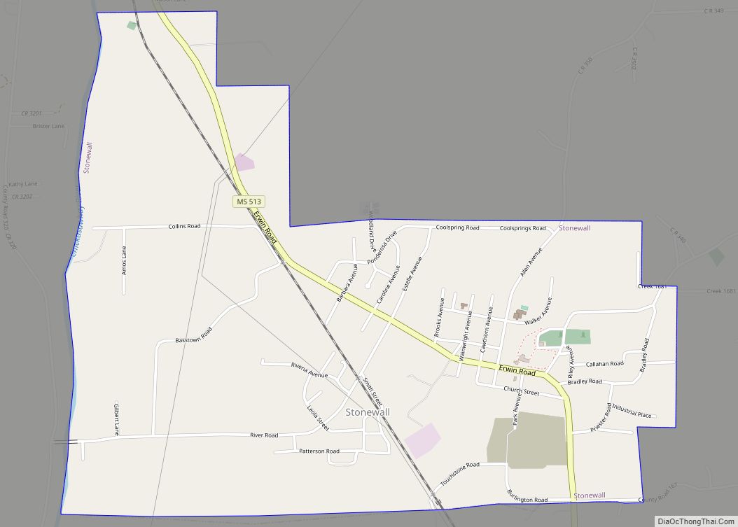
Online Interactive Map
Click on ![]() to view map in "full screen" mode.
to view map in "full screen" mode.
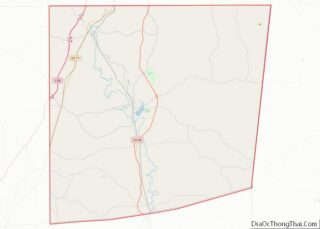
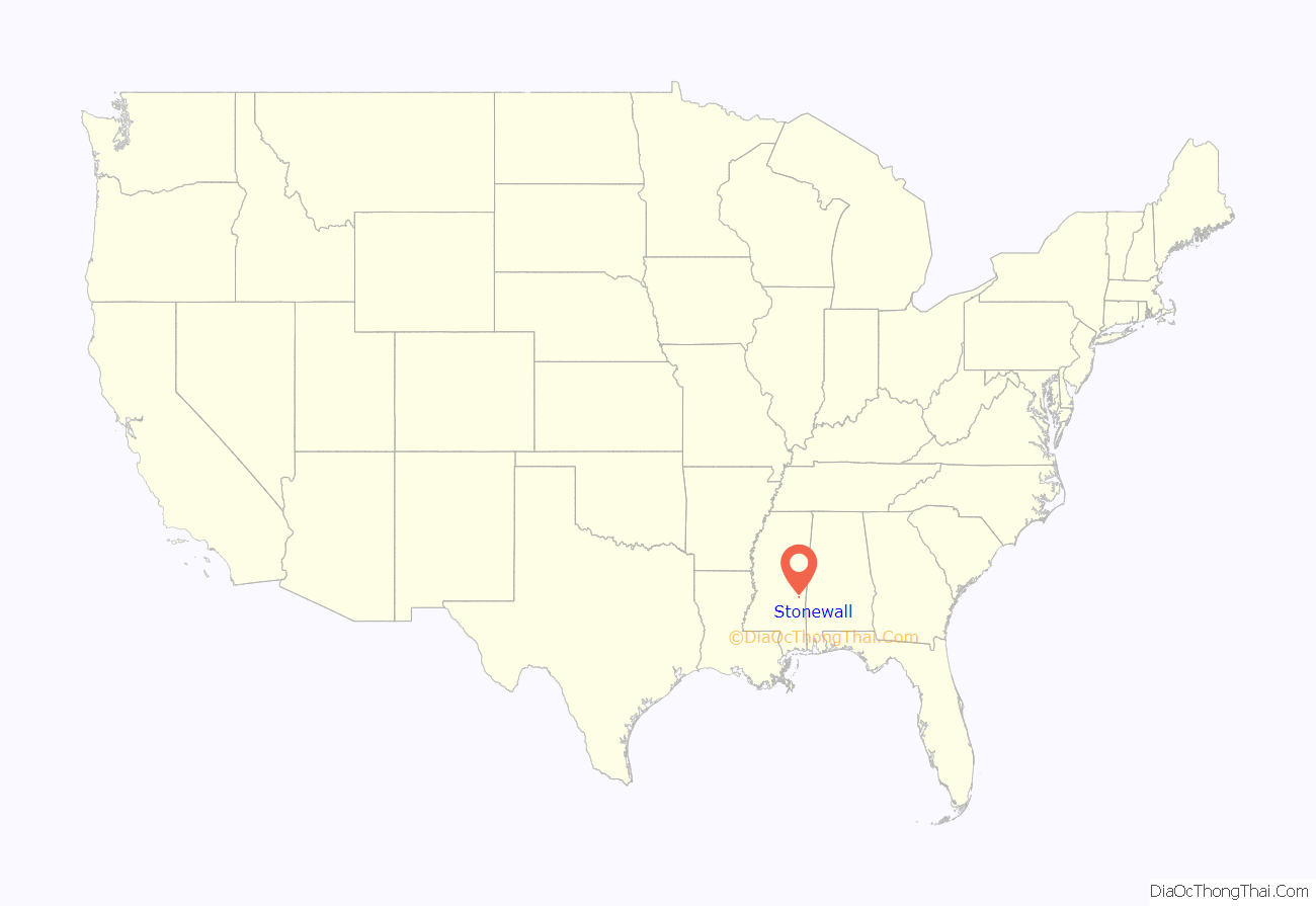
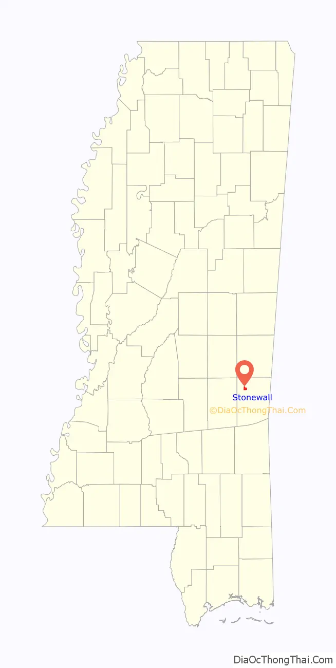
Stonewall location map. Where is Stonewall town?
History
A cotton mill was established here in 1868. The town was named after Confederate Army General Stonewall Jackson.
Stonewall’s major industry from 1868 until 2002 was the cotton mill which operated as Burlington Industries from 1962 onward. In 2002, Burlington announced that it would be closing the Stonewall plant and put 850 people out of work.
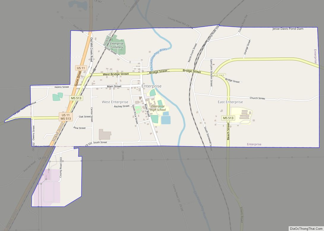
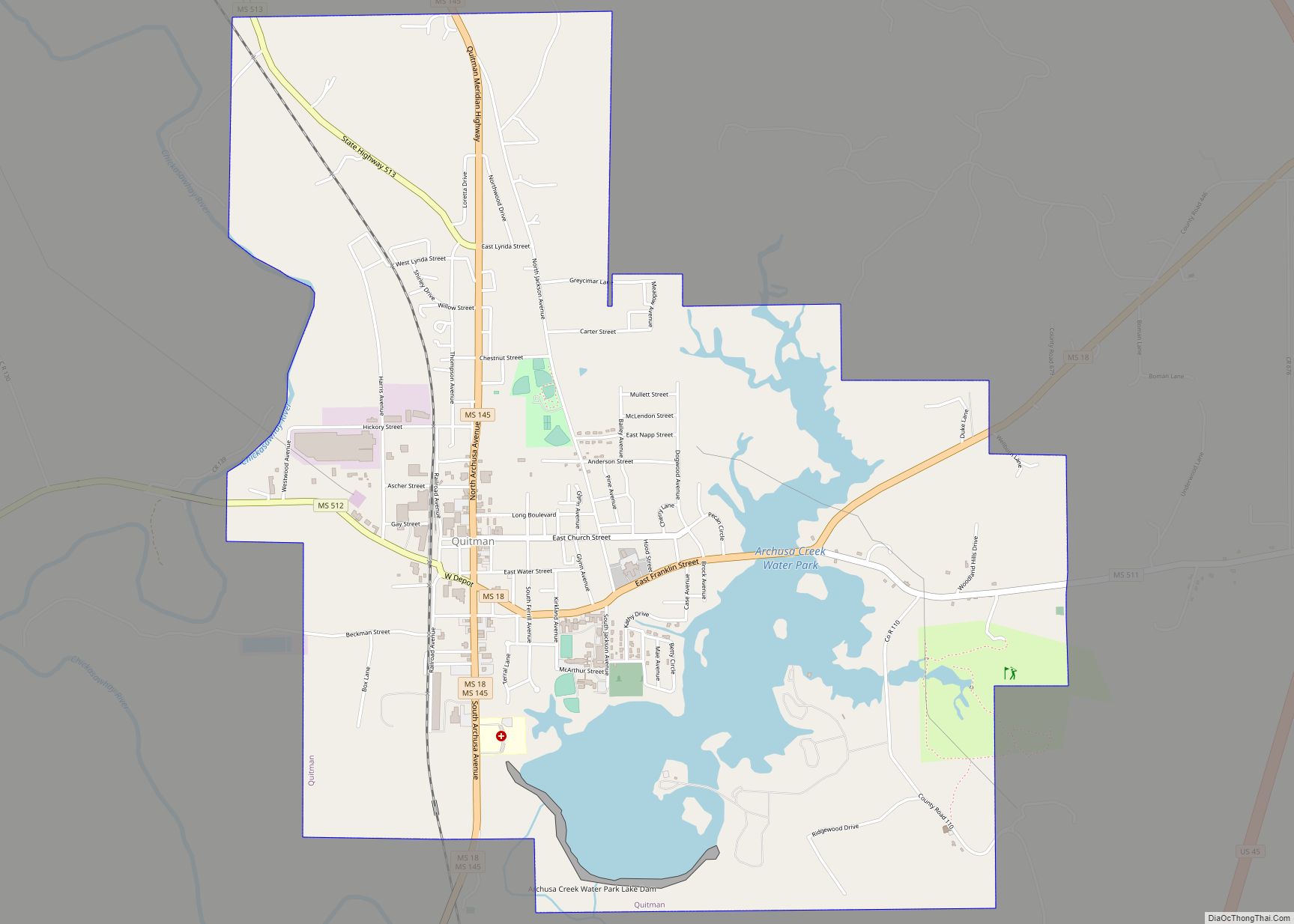
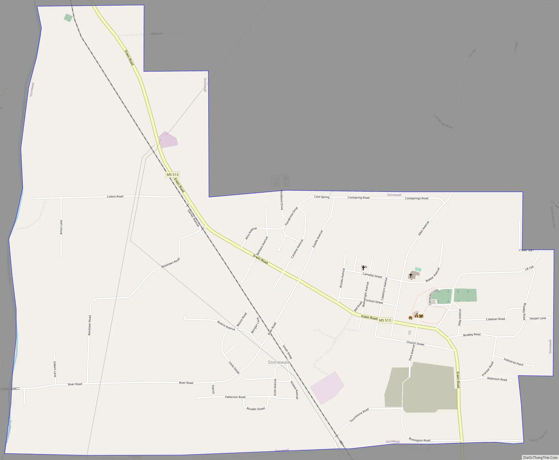
Stonewall Road Map
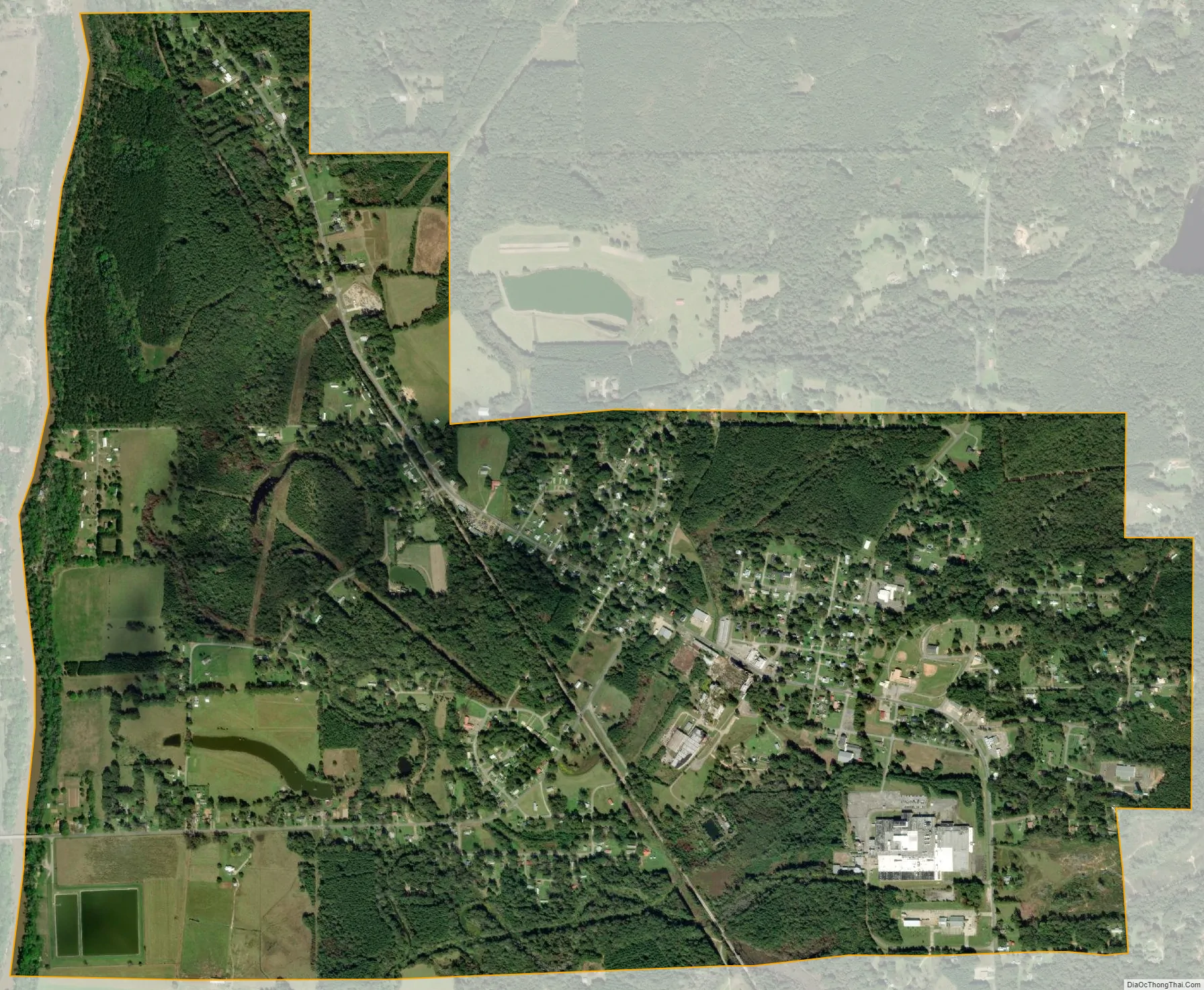
Stonewall city Satellite Map
Geography
The Chickasawhay River forms the western boundary of the town. The town of Enterprise is 3 miles (5 km) to the northwest on Mississippi Highway 513, while Quitman, the county seat, is 9 miles (14 km) to the southeast.
According to the United States Census Bureau, the town has a total area of 2.7 square miles (6.9 km), of which 0.008 square miles (0.02 km), or 0.36%, is water.
See also
Map of Mississippi State and its subdivision:- Adams
- Alcorn
- Amite
- Attala
- Benton
- Bolivar
- Calhoun
- Carroll
- Chickasaw
- Choctaw
- Claiborne
- Clarke
- Clay
- Coahoma
- Copiah
- Covington
- Desoto
- Forrest
- Franklin
- George
- Greene
- Grenada
- Hancock
- Harrison
- Hinds
- Holmes
- Humphreys
- Issaquena
- Itawamba
- Jackson
- Jasper
- Jefferson
- Jefferson Davis
- Jones
- Kemper
- Lafayette
- Lamar
- Lauderdale
- Lawrence
- Leake
- Lee
- Leflore
- Lincoln
- Lowndes
- Madison
- Marion
- Marshall
- Monroe
- Montgomery
- Neshoba
- Newton
- Noxubee
- Oktibbeha
- Panola
- Pearl River
- Perry
- Pike
- Pontotoc
- Prentiss
- Quitman
- Rankin
- Scott
- Sharkey
- Simpson
- Smith
- Stone
- Sunflower
- Tallahatchie
- Tate
- Tippah
- Tishomingo
- Tunica
- Union
- Walthall
- Warren
- Washington
- Wayne
- Webster
- Wilkinson
- Winston
- Yalobusha
- Yazoo
- Alabama
- Alaska
- Arizona
- Arkansas
- California
- Colorado
- Connecticut
- Delaware
- District of Columbia
- Florida
- Georgia
- Hawaii
- Idaho
- Illinois
- Indiana
- Iowa
- Kansas
- Kentucky
- Louisiana
- Maine
- Maryland
- Massachusetts
- Michigan
- Minnesota
- Mississippi
- Missouri
- Montana
- Nebraska
- Nevada
- New Hampshire
- New Jersey
- New Mexico
- New York
- North Carolina
- North Dakota
- Ohio
- Oklahoma
- Oregon
- Pennsylvania
- Rhode Island
- South Carolina
- South Dakota
- Tennessee
- Texas
- Utah
- Vermont
- Virginia
- Washington
- West Virginia
- Wisconsin
- Wyoming