Tylertown is a town in Walthall County, Mississippi, United States. It is the county seat of Walthall County. The population was 1,609 at the 2010 census.
| Name: | Tylertown town |
|---|---|
| LSAD Code: | 43 |
| LSAD Description: | town (suffix) |
| State: | Mississippi |
| County: | Walthall County |
| Elevation: | 295 ft (90 m) |
| Total Area: | 3.29 sq mi (8.51 km²) |
| Land Area: | 3.28 sq mi (8.49 km²) |
| Water Area: | 0.01 sq mi (0.02 km²) |
| Total Population: | 1,515 |
| Population Density: | 462.03/sq mi (178.38/km²) |
| ZIP code: | 39667 |
| Area code: | 601 |
| FIPS code: | 2875160 |
| GNISfeature ID: | 0690939 |
| Website: | http://www.co.walthall.ms.us/town-of-tylertown.html |
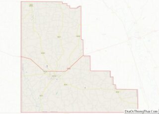
Online Interactive Map
Click on ![]() to view map in "full screen" mode.
to view map in "full screen" mode.
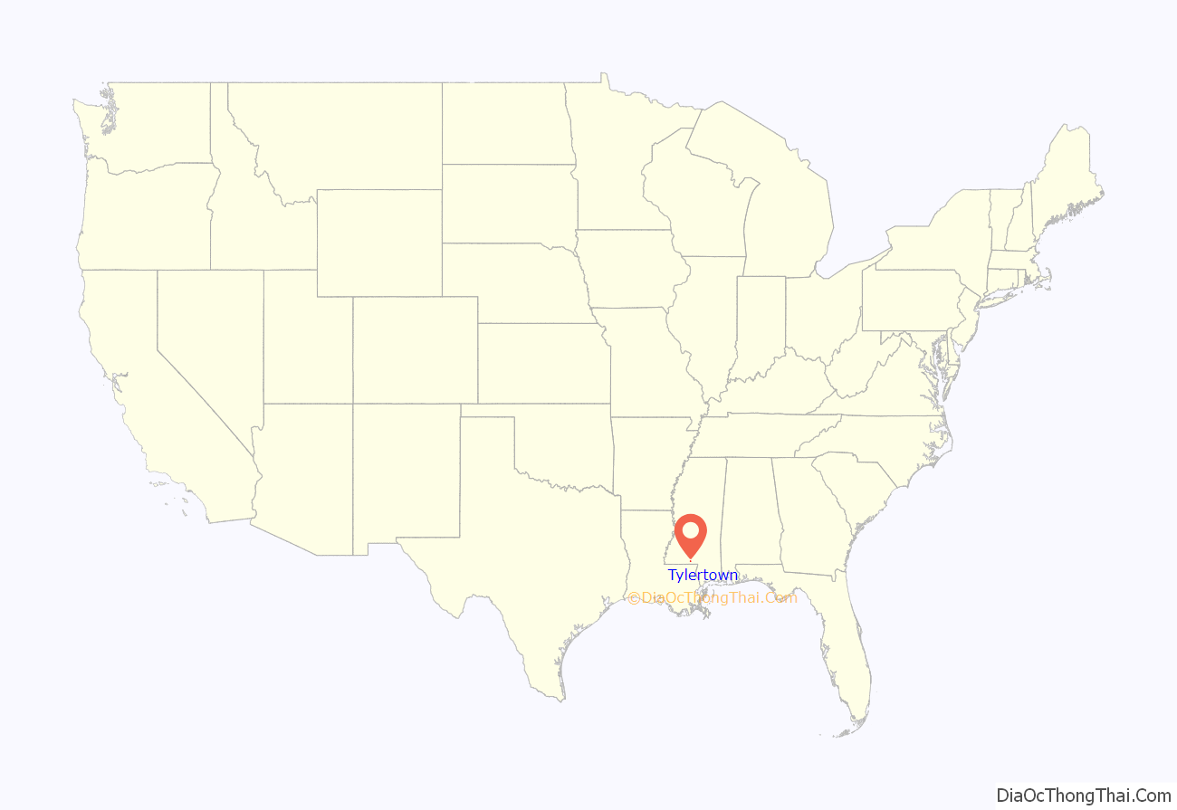
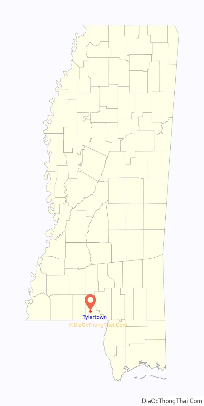
Tylertown location map. Where is Tylertown town?
History
The town of Tylertown was first known as the Magee Settlement. It was settled by emigrants of the Magee and Thornhill families, who came from South Carolina. J. Thornhill acquired the first tract of land for the settlement on September 20, 1816, after Native Americans were pushed out of the area. Cullen Conerly went there in 1850 and bought out the Garland Hart store and established a post office which was called Conerly’s post office. The store and post office served as the social center of the community for over a half century.
The town bore the name Conerly’s from 1848 to 1879. It was renamed as Tyler Town in honor of William G. Tyler; the name was shortened to one word in 1894. Cullen Conerly sold his mercantile interest to his brother-in-law Benjamin Lampton. He laid the foundation of the mercantile business of Tylertown. Tylertown was part of Pike County until 1912, when Walthall County was formed from Pike and Marion counties. The Tylertown Times (local newspaper) was started in 1907. Tylertown Insurance Agency, Inc. has been serving Tylertown’s insurance needs since 1924. Luter’s Supply, established in 1944, is a retail center for tubs, showers, and whirlpools. Jones Furniture opened in 1939. Tylertown’s oldest pharmacy, Pigott’s Drug Store, has been around since 1919. WTYL radio station came to Tylertown in 1969.
In interesting story about Tylertown and Walthall County was related in Maury Klein’s book “A Call to Arms” (Bloomsbury Press, Paperback edition, 2015). It seems that during World War II, the production and growing of food became problematic as both the United States and its allies were in need of great amounts of food. Production was lagging and crops were rotting in the fields for lack of crop pickers – farm laborers either marched off to war or to factories where wages were far superior to those earned picking cotton – and the need for more of everything was needed. Walthall County responded to the call to grow more of everything. The farmers left behind produced what was termed “barn-bursting harvests, including 23 percent more cotton, 146 percent more hay, 110 percent more eggs, and a whopping 619 percent more truck crops. To celebrate, they decided to hold a “Food for Freedom Thanksgiving” early in October in Tylertown (population 1,100) the county seat and only post office”.
According to Klein, the farming crowd came together in Tylertown and came bearing 5,000 fried chickens, 350 turkeys and enough food to feed a small army. Claude Wickard, head of the Food Requirements Committee, appeared in Tylertown that day and extolled the virtues of the small farmer and told them that their endeavors were the “only road that leads to victory”. Klein, p. 449.
Tylertown Road Map
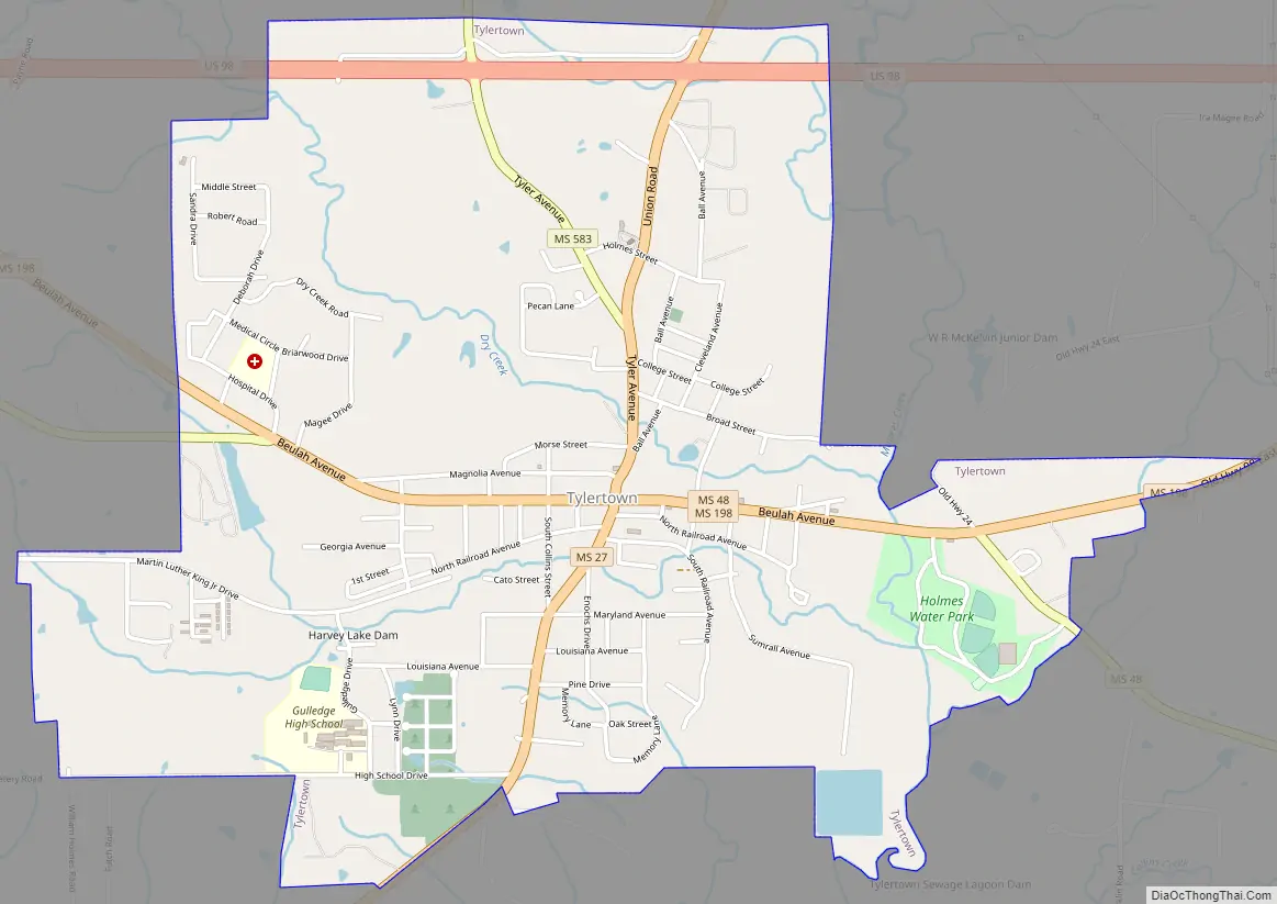
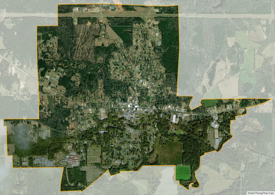
Tylertown city Satellite Map
Geography
Tylertown is located at 31°6′58″N 90°8′34″W / 31.11611°N 90.14278°W / 31.11611; -90.14278 (31.116209, -90.142817).
According to the United States Census Bureau, the town has a total area of 3.1 square miles (8.0 km), of which 3.0 square miles (7.8 km) is land and 0.33% is water.
See also
Map of Mississippi State and its subdivision:- Adams
- Alcorn
- Amite
- Attala
- Benton
- Bolivar
- Calhoun
- Carroll
- Chickasaw
- Choctaw
- Claiborne
- Clarke
- Clay
- Coahoma
- Copiah
- Covington
- Desoto
- Forrest
- Franklin
- George
- Greene
- Grenada
- Hancock
- Harrison
- Hinds
- Holmes
- Humphreys
- Issaquena
- Itawamba
- Jackson
- Jasper
- Jefferson
- Jefferson Davis
- Jones
- Kemper
- Lafayette
- Lamar
- Lauderdale
- Lawrence
- Leake
- Lee
- Leflore
- Lincoln
- Lowndes
- Madison
- Marion
- Marshall
- Monroe
- Montgomery
- Neshoba
- Newton
- Noxubee
- Oktibbeha
- Panola
- Pearl River
- Perry
- Pike
- Pontotoc
- Prentiss
- Quitman
- Rankin
- Scott
- Sharkey
- Simpson
- Smith
- Stone
- Sunflower
- Tallahatchie
- Tate
- Tippah
- Tishomingo
- Tunica
- Union
- Walthall
- Warren
- Washington
- Wayne
- Webster
- Wilkinson
- Winston
- Yalobusha
- Yazoo
- Alabama
- Alaska
- Arizona
- Arkansas
- California
- Colorado
- Connecticut
- Delaware
- District of Columbia
- Florida
- Georgia
- Hawaii
- Idaho
- Illinois
- Indiana
- Iowa
- Kansas
- Kentucky
- Louisiana
- Maine
- Maryland
- Massachusetts
- Michigan
- Minnesota
- Mississippi
- Missouri
- Montana
- Nebraska
- Nevada
- New Hampshire
- New Jersey
- New Mexico
- New York
- North Carolina
- North Dakota
- Ohio
- Oklahoma
- Oregon
- Pennsylvania
- Rhode Island
- South Carolina
- South Dakota
- Tennessee
- Texas
- Utah
- Vermont
- Virginia
- Washington
- West Virginia
- Wisconsin
- Wyoming