Secaucus (/ˈsiːkɔːkəs/ SEE-kaw-kəs) is a town in Hudson County, in the U.S. state of New Jersey. As of the 2020 United States census, the town’s population was 22,181, an increase of 5,917 (+36.4%) from the 2010 census count of 16,264, which in turn reflected an increase of 333 (+2.1%) from the 15,931 counted in the 2000 census.
Located within the New Jersey Meadowlands, it is the most suburban of the county’s municipalities, though large parts of the town are dedicated to light manufacturing, retail, and transportation uses, as well as protected areas.
Secaucus is a derivation of the Algonquian words for “black” (seke or sukit) and “snake” (achgook), or “place of snakes”, or sekakes, referring to snakes.
| Name: | Secaucus town |
|---|---|
| LSAD Code: | 43 |
| LSAD Description: | town (suffix) |
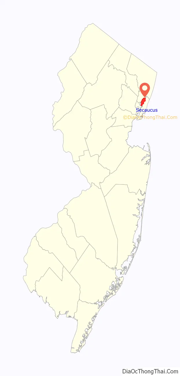
| State: | New Jersey |
| County: | Hudson County |
| Incorporated: | March 12, 1900 (as borough) |
| Elevation: | 7 ft (2 m) |
| Total Area: | 6.54 sq mi (16.95 km²) |
| Land Area: | 5.83 sq mi (15.09 km²) |
| Water Area: | 0.72 sq mi (1.86 km²) 10.96% |
| Total Population: | 22,181 |
| Population Density: | 3,807.2/sq mi (1,470.0/km²) |
| Area code: | 201 |
| FIPS code: | 3466570 |
| GNISfeature ID: | 0885392 |
| Website: | www.secaucusnj.gov |
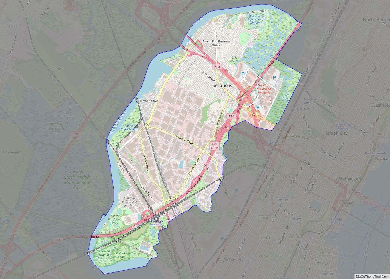
Online Interactive Map
Click on ![]() to view map in "full screen" mode.
to view map in "full screen" mode.
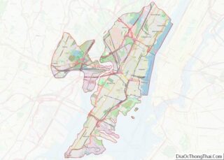
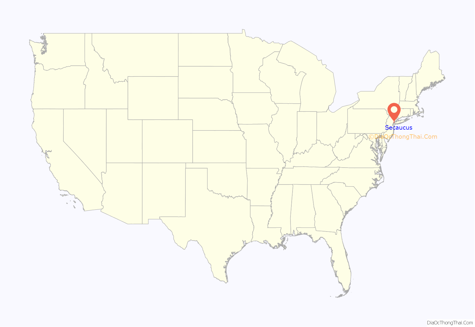
Secaucus location map. Where is Secaucus town?
History
Sikakes, once an island, was part of the territory purchased by Director-General of New Netherland, Peter Stuyvesant in 1658. The territory was part of what is considered to be the oldest municipality in the state of New Jersey which was first chartered in 1660 as Bergen in the province of New Netherland and, in 1683, became Bergen Township.
Settlement had begun by at least 1733 by the Smith family, whose namesake Abel I. Smith Burial Ground is part of the lore of Secaucus.
Secaucus was originally formed as a borough by an act of the New Jersey Legislature on March 12, 1900, from portions of North Bergen. On June 7, 1917, Secaucus was incorporated as a town, replacing Secaucus borough, based on the results of a referendum held on June 5, 1917.
Secaucus was originally an agricultural community specializing in flowers. It later became known for its pig farms in the first half of the 20th century. In the early 1900s the town was home to approximately 55 pig farms, which reached a peak of nearly 250,000 pigs in World War II, outnumbering humans 16 to 1. These farms served the meat demands of Newark and New York, and made the farmers wealthy. Many of them were local politicians, most notably pork peddler Henry B. Krajewski, who ran for New Jersey senator, three times for governor and twice for U.S. President. The town’s pig farms, rendering plants, and junk yards gave the town a reputation for being one of the most odorous in the New York metropolitan area. An ordinance passed in 1947 prohibited new farms, and in the 1950s the pig farms began to dwindle, partially after 11 of the farms were acquired for construction of the New Jersey Turnpike, which would carry tourists who would not appreciate the odor; the last farms were shut down by court order in the late 1950s.
In 1963, debris from the demolition of Pennsylvania Station was dumped in the Secaucus Meadowlands. In later decades Secaucus became more of a commuter town. In a non-binding referendum in 1969, 90% of voters in Secaucus chose to leave Hudson County and join Bergen County, as that county was more similar in character and had lower taxes. However, only the state has the authority to change county lines, so it never came to fruition. Today it remains the most suburban town in Hudson County. Despite being geographically located within Hudson County, Secaucus Public Library is a member of the Bergen County Cooperative Library System.
On February 9, 1996, two NJ Transit commuter trains collided at Bergen Junction in Secaucus when a train operating on the Bergen Line ran a signal and sideswiped a train running on the Main Line. The accident occurred during the morning rush hour just south of the current Secaucus Junction station. With three fatalities, the incident is NJ Transit’s deadliest accident and was the first to involve fatalities of the passenger and crew on NJ Transit.
New Jersey Monthly magazine ranked Secaucus as its 182nd best place to live in its 2010 rankings of the “Best Places To Live” in New Jersey, after ranking the borough 11th in its 2008 rankings.
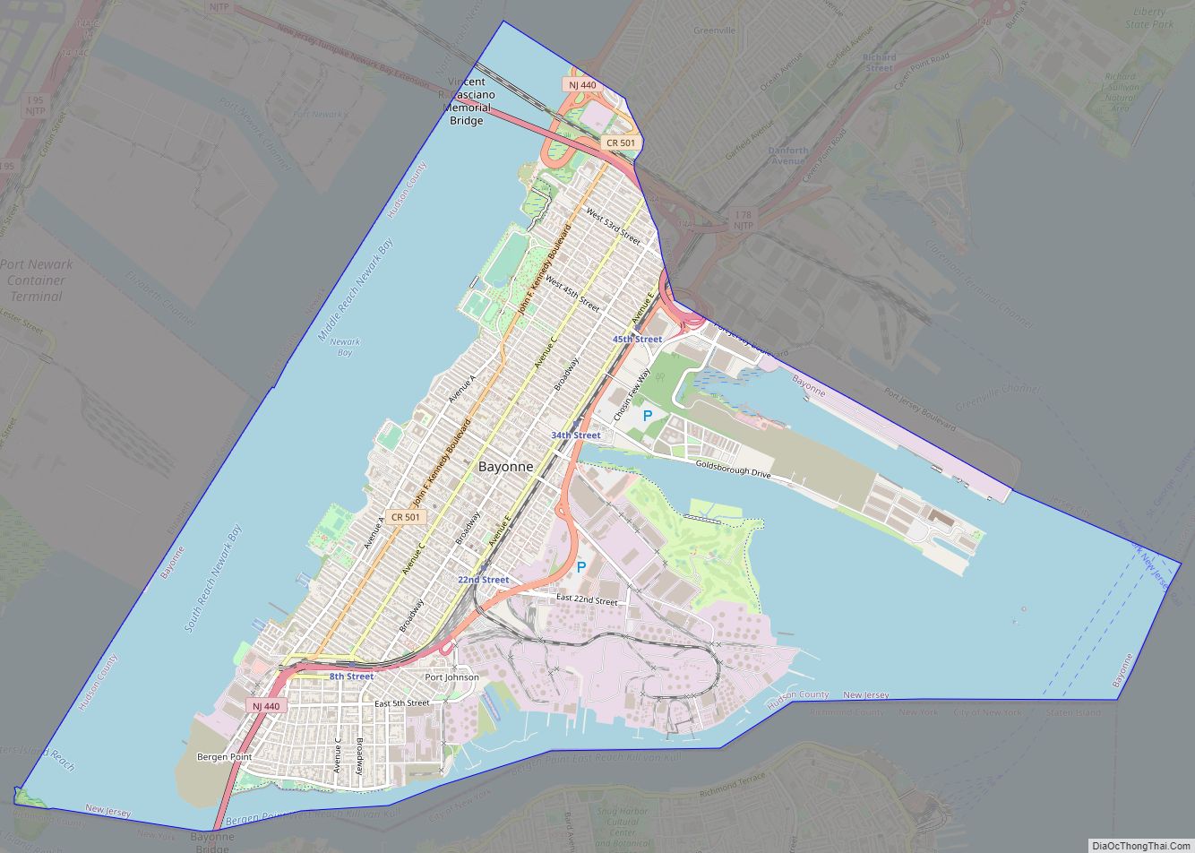
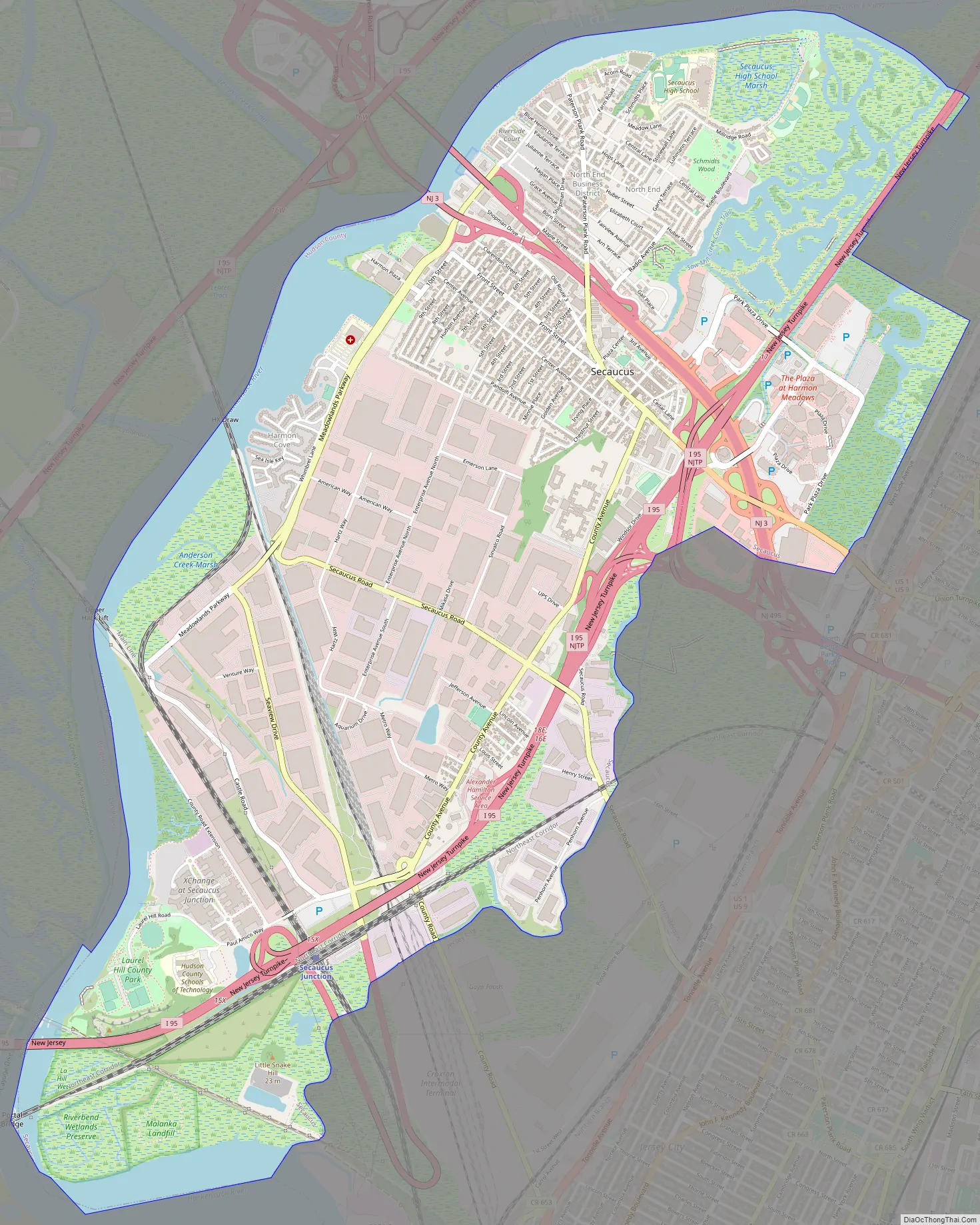
Secaucus Road Map
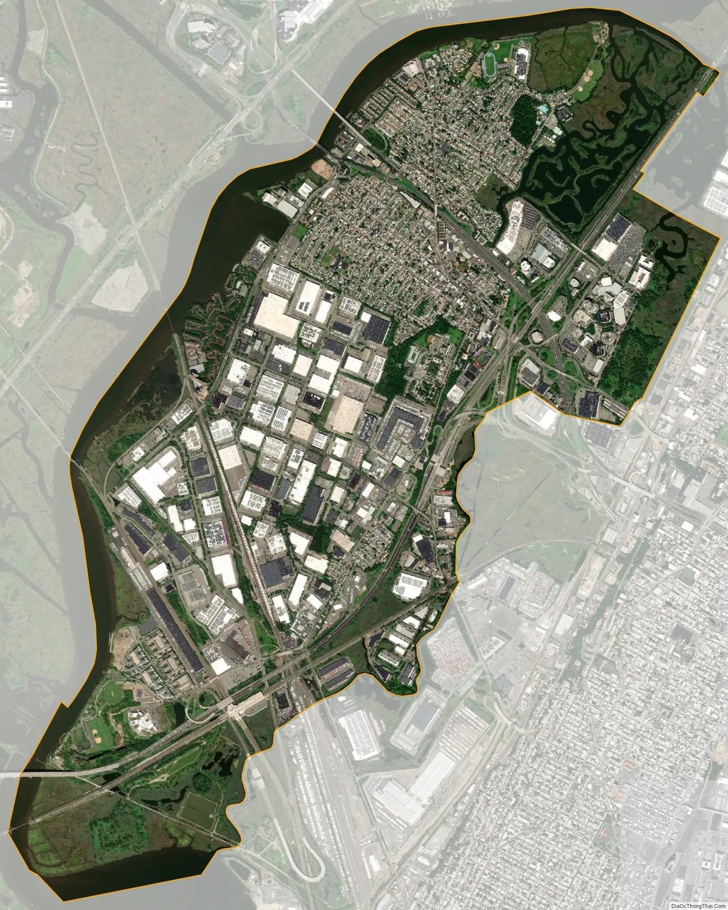
Secaucus city Satellite Map
Geography
Secaucus is an island in the New Jersey Meadowlands. The Hackensack River runs along western side of town. Penhorn Creek and Cromakill Creek are its eastern borders.
According to the United States Census Bureau, the town had a total area of 6.54 square miles (16.95 km), including 5.83 square miles (15.09 km) of land and 0.72 square miles (1.86 km) of water (10.96%).
At the southern end of Secaucus is Snake Hill (officially known as Laurel Hill), an igneous rock diabase intrusion jutting up some 150 feet (46 m) from the Meadowlands below, near the New Jersey Turnpike.
Being partly surrounded by the meadowlands, Secaucus provides opportunities to observe the recovery of natural marshes in the town’s post-industrial, post-agricultural age. Some marsh areas in the northeast part of town have been filled to provide a new commercial area, and some to build footpaths for nature walks with signs illustrating birds and other wildlife to be seen there. At 27.4%, it has the most open “green” space in of any town in Hudson County.
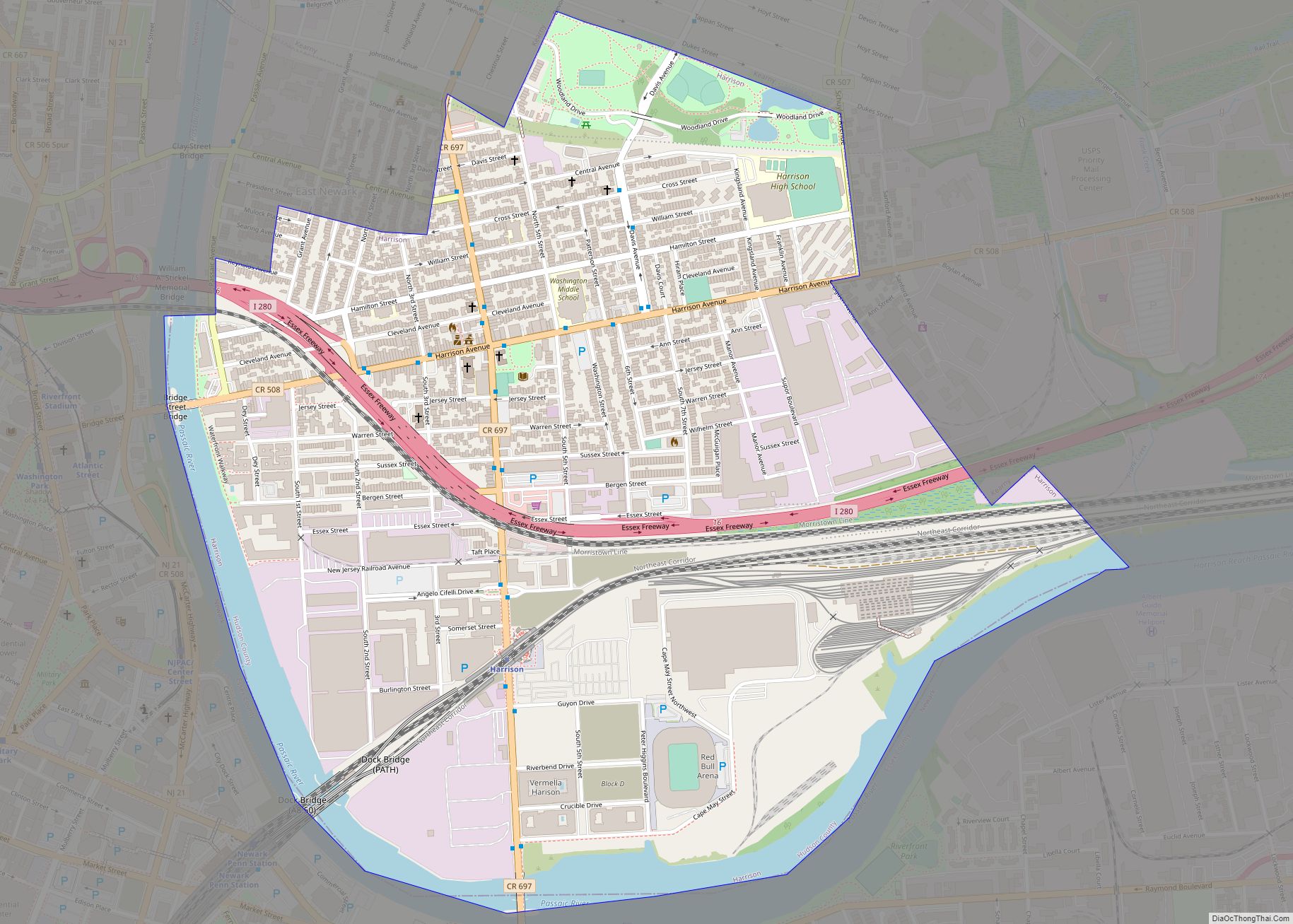
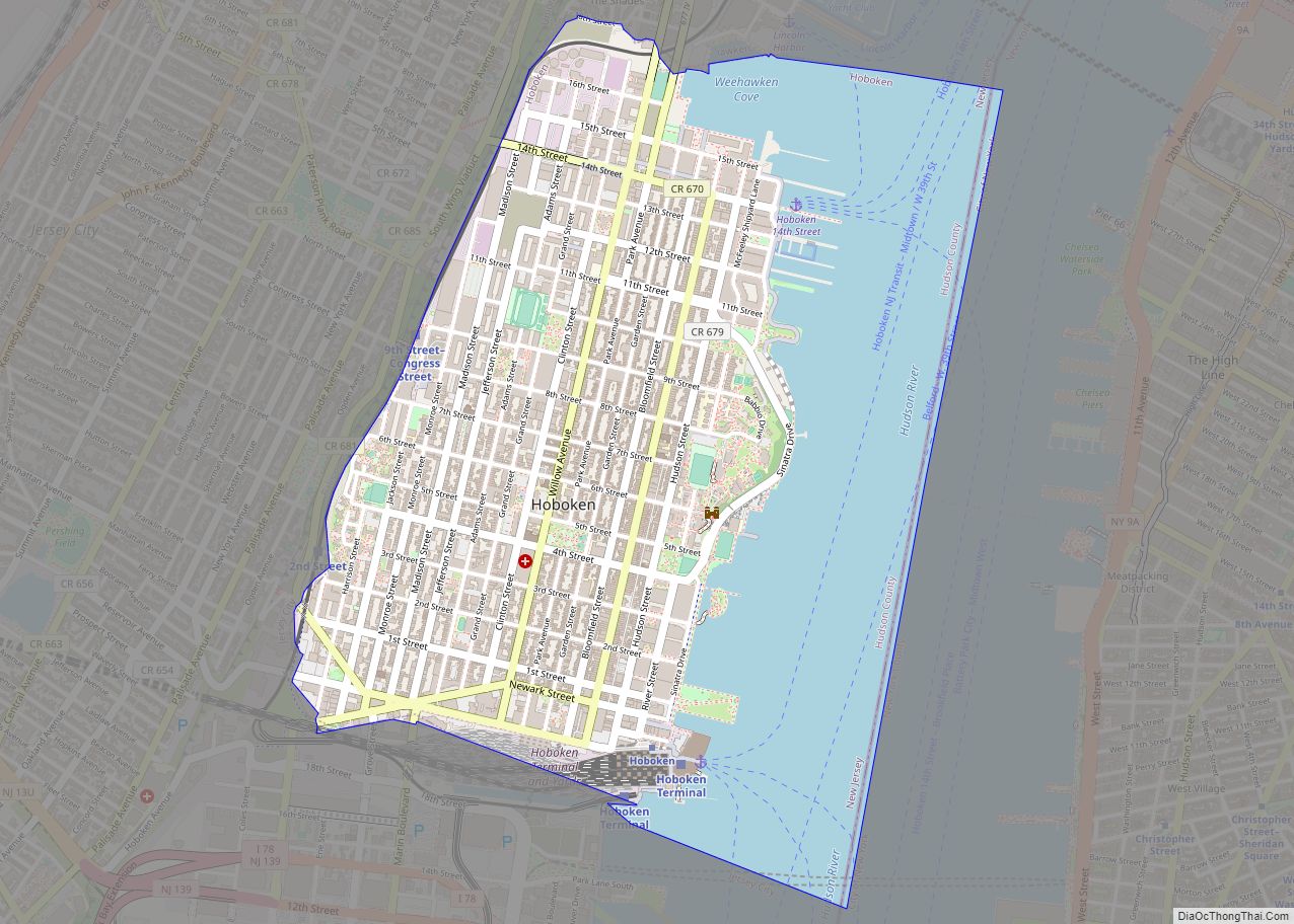
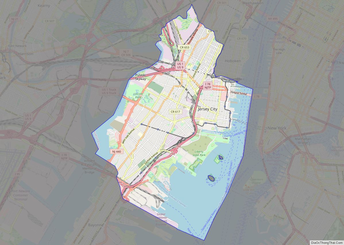
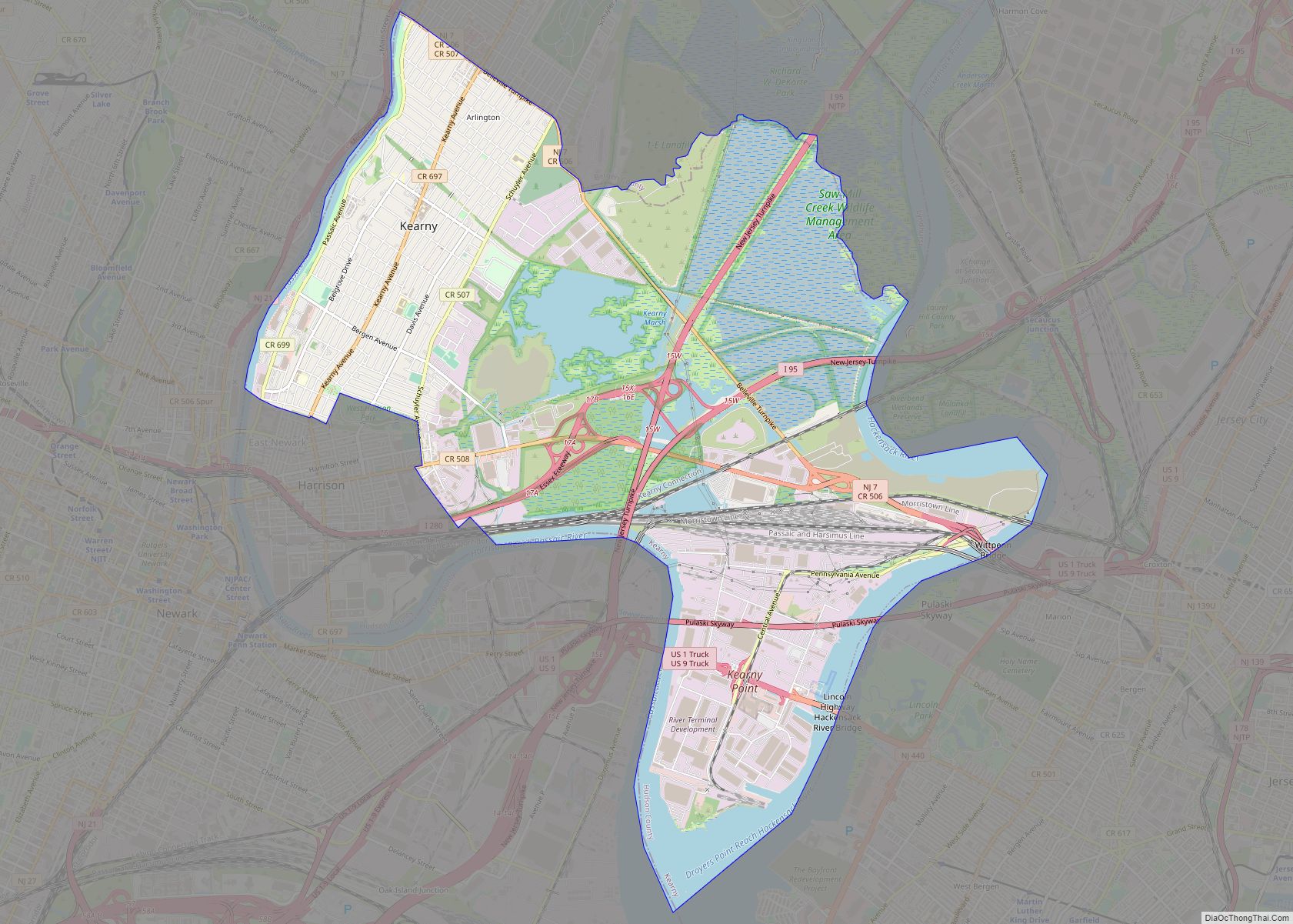
Secaucus borders the municipalities of Jersey City, Kearny and North Bergen in Hudson County; and Carlstadt, East Rutherford, Lyndhurst, Rutherford in Bergen County.
Unincorporated communities, localities and place names located partially or completely within the town include:
- County Avenue – from Municipal Building to Secaucus Junction
- Harmon Cove – along the Hackensack River and Meadowlands Turnpike
- Harmon Meadow – site of Mill Creek Mall and Meadowlands Convention Center
- Laurel Hill
- Little Snake Hill
- Mill Creek Marsh
- North End – north of New Jersey Route 3; home of Secaucus High School, Schmiddt’s Woods, and Mill Creek Marsh
- Riverbend – a wetlands preserve at the meander in the Hackensack River
- Secaucus Junction – NJ Transit’s central rail hub
- Secaucus Plaza Central Business District at Paterson Plank Road south of Route 3
- Snake Hill – site of Laurel Hill County Park
Subsections
As its name suggests, the North End in Secaucus, New Jersey, is the section of town north of New Jersey Route 3 and the Secaucus Plaza Central Business District, to which it is connected by Paterson Plank Road. The Hackensack River and its tributary Mill Creek create the other borders for the district.
The North End is one of the older, traditional residential neighborhoods of Secaucus, which itself has been transformed to a commuter town and retail and outlet shopping area in the late 20th century. It is home to Secaucus High School, whose athletic fields are used by the Bergen County Scholastic League. Nearby Schmiddt’s Wood is one of the last original hardwood forests in urban North Jersey. As part of the New Jersey Meadowlands District, the areas along the river are characterized by wetlands preservation and restoration areas. Mill Creek Marsh is park administered by the New Jersey Meadowlands Commission and will eventually connect to the Secaucus Greenway. It southern counterpart is known as Riverbend. The Mill Creek Mall, also north of Route 3, but on the other side of Mill Creek close to New Jersey Turnpike Eastern Spur is part of Harmon Meadow
Harmon Cove is the western section of Secaucus, New Jersey along the Hackensack River, south of New Jersey Route 3. The name is portmanteau taken from Hartz Mountain, a corporation that owns much land in the New Jersey Meadowlands, which originally developed the area as a gated community in the 1970s with townhouses and highrise residential buildings. Part of the Hackensack RiverWalk Secaucus Greenway passes through the neighborhood, which is north of Anderson Marsh and Snake Hill, home to Hudson County’s Laurel Hill Park.
NJ Transit maintained a Harmon Cove station from 1978 until the re-routing of the Bergen County Line and the opening of Secaucus Junction in August 2003. The HX Draw is used by the line to cross the river. NJ Transit bus 329 serves the area. The Hudson Regional Hospital and several hotels are located in Harmon Cove, whose main thoroughfare is Meadowlands Parkway, along which office and manufacturing buildings are found. The Harmon Cove Outlet Center is an outlet shopping district further inland from the Hackensack riverfront. Hartz Mountain Industries operates many facilities and properties in Harmon Cove.
See also
Map of New Jersey State and its subdivision: Map of other states:- Alabama
- Alaska
- Arizona
- Arkansas
- California
- Colorado
- Connecticut
- Delaware
- District of Columbia
- Florida
- Georgia
- Hawaii
- Idaho
- Illinois
- Indiana
- Iowa
- Kansas
- Kentucky
- Louisiana
- Maine
- Maryland
- Massachusetts
- Michigan
- Minnesota
- Mississippi
- Missouri
- Montana
- Nebraska
- Nevada
- New Hampshire
- New Jersey
- New Mexico
- New York
- North Carolina
- North Dakota
- Ohio
- Oklahoma
- Oregon
- Pennsylvania
- Rhode Island
- South Carolina
- South Dakota
- Tennessee
- Texas
- Utah
- Vermont
- Virginia
- Washington
- West Virginia
- Wisconsin
- Wyoming