North Arlington is a borough in Bergen County, in the U.S. state of New Jersey. As of the 2020 United States census, the borough’s population was 16,457, an increase of 1,065 (+6.9%) from the 2010 census count of 15,392, which in turn reflected an increase of 211 (+1.4%) from the 15,181 counted in the 2000 census.
As the site of Holy Cross Cemetery, which has interred almost 290,000 individuals since its establishment in 1915, and with another Jewish cemetery including several thousand more burials, North Arlington has almost 20 times more dead people than living, with more burials than the living population of Newark, the state’s largest city. Holy Cross has an average of 2,600 interments each year, of which about 65% are burials, with the remainder split between entombment in mausoleums or crypts and burial of cremated remains. Expansion of the mausoleum will bring its capacity to nearly 36,000 interments, with the cemetery’s total capacity of about 750,000 expected to last past the year 2090. The cemetery covers 208 acres (84 ha) and was assessed at $185 million, though its non-profit status means that the municipality generates no tax revenue from a property that covers almost an eighth of the borough’s land area.
North Arlington was ranked eighth by Money magazine on its list of “Best Places to Live 2017”, which cited the borough’s healthy economy, affordable homes and a high quality of life.
| Name: | North Arlington borough |
|---|---|
| LSAD Code: | 21 |
| LSAD Description: | borough (suffix) |
| State: | New Jersey |
| County: | Bergen County |
| Incorporated: | March 9, 1896 |
| Elevation: | 85 ft (26 m) |
| Total Area: | 2.53 sq mi (6.55 km²) |
| Land Area: | 2.48 sq mi (6.43 km²) |
| Water Area: | 0.04 sq mi (0.12 km²) 1.78% |
| Total Population: | 16,457 |
| Population Density: | 6,625.2/sq mi (2,558.0/km²) |
| ZIP code: | 07031 |
| Area code: | 201 |
| FIPS code: | 3452320 |
| GNISfeature ID: | 0885323 |
| Website: | www.narlington.org |
Online Interactive Map
Click on ![]() to view map in "full screen" mode.
to view map in "full screen" mode.
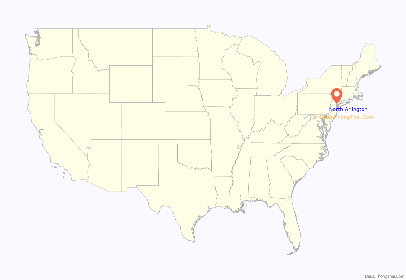
North Arlington location map. Where is North Arlington borough?

History
North Arlington was originally part of an area called “New Barbadoes Neck”.
Copper was mined at the Schuyler Copper Mine in present-day North Arlington during the 18th and 19th centuries. It was one of the first true copper mines in North America.
In 1755, the first steam engine in North America was assembled in North Arlington. The Newcomen steam engine was imported from England by John Schuyler to pump water out of his copper mine. He hired engineer Josiah Hornblower to assemble the machinery.
North Arlington was formed by a referendum passed on March 9, 1896, and incorporated as a borough by an act of the New Jersey Legislature on March 11, 1896, from area taken from Union Township. It was called North Arlington because it was north of the Arlington section of Kearny, which had been named from the Arlington Station on the Erie Railroad.
North Arlington, together with Lyndhurst and Rutherford, was the site of the EnCap project, an effort to remediate landfills on the 785-acre (3.18 km) site and construct homes and golf courses on top of the cleaned up site. On May 27, 2008, the New Jersey Meadowlands Commission terminated its agreement with EnCap Golf Holdings, the company that had the contract to redevelop the site, after the company had missed targets to clean up the landfills as part of the project.
On November 18, 2015, North Arlington approved plans for FedEx to build a 139,000-square-foot (12,900 m) freight distribution facility on a former steel dumping ground on Porete Avenue. FedEx pledged to build a new access road to Porete Avenue from Belleville Turnpike, complete with a signalized traffic light, as part of construction. The company planned to hire 225 people to work at the facility. FedEx planned to complete the building by early 2017.
North Arlington Road Map

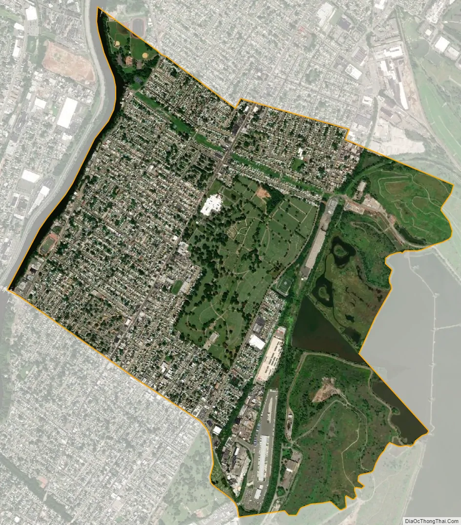
North Arlington city Satellite Map
Geography
According to the United States Census Bureau, the borough had a total area of 2.53 square miles (6.55 km), including 2.48 square miles (6.43 km) of land and 0.05 square miles (0.12 km) of water (1.78%).
The borough borders the municipalities of Lyndhurst in Bergen County; Belleville in Essex County; and Kearny in Hudson County.
Route 7 (Belleville Turnpike) occupies much of the border of between Bergen County to the north and Hudson County to the south, with North Arlington on one side and Kearny on the other. The bordering neighborhood in Kearny is called Arlington, from which the name North Arlington is derived. Cemeteries lie along both sides of the route, with North Arlington Jewish Cemetery in Bergen and Arlington Memorial Park in Hudson.
See also
Map of New Jersey State and its subdivision: Map of other states:- Alabama
- Alaska
- Arizona
- Arkansas
- California
- Colorado
- Connecticut
- Delaware
- District of Columbia
- Florida
- Georgia
- Hawaii
- Idaho
- Illinois
- Indiana
- Iowa
- Kansas
- Kentucky
- Louisiana
- Maine
- Maryland
- Massachusetts
- Michigan
- Minnesota
- Mississippi
- Missouri
- Montana
- Nebraska
- Nevada
- New Hampshire
- New Jersey
- New Mexico
- New York
- North Carolina
- North Dakota
- Ohio
- Oklahoma
- Oregon
- Pennsylvania
- Rhode Island
- South Carolina
- South Dakota
- Tennessee
- Texas
- Utah
- Vermont
- Virginia
- Washington
- West Virginia
- Wisconsin
- Wyoming


