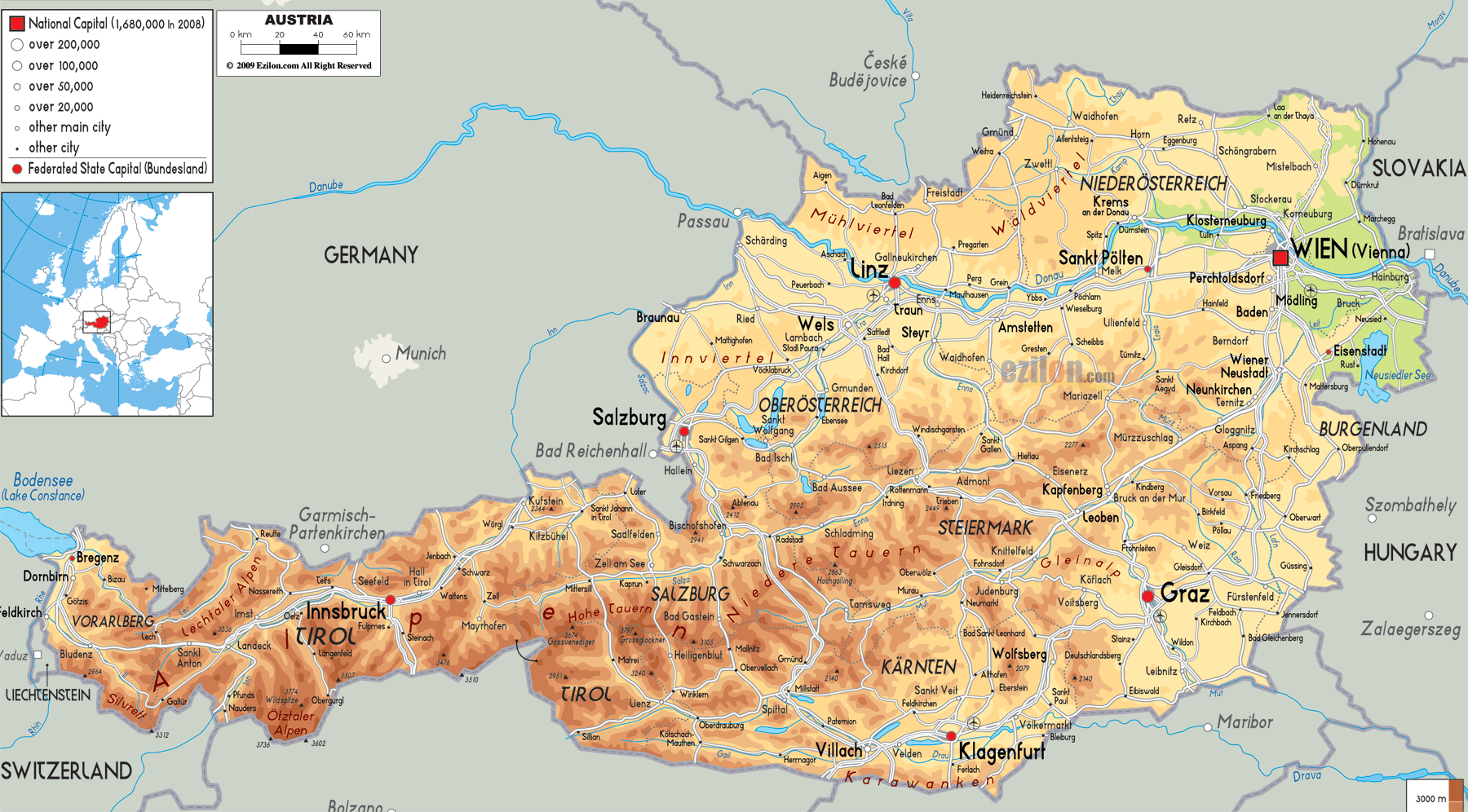
Austria occupies an area of 83,879 sq. km (32,386 sq mi) in south-central Europe. As observed on the physical map of Austria, the country had diverse topography with a large part of the land being mountainous.
In essence, Austria has three main geographical areas. The Lowlands of the east and southeast are the country’s agriculture center. A sliver of lowland also fronts the Lake Constance area on its border with Switzerland. In the Hill Country, north of the Danube River, the land rises into forested hills and lower mountains up to its border with the Czech Republic.
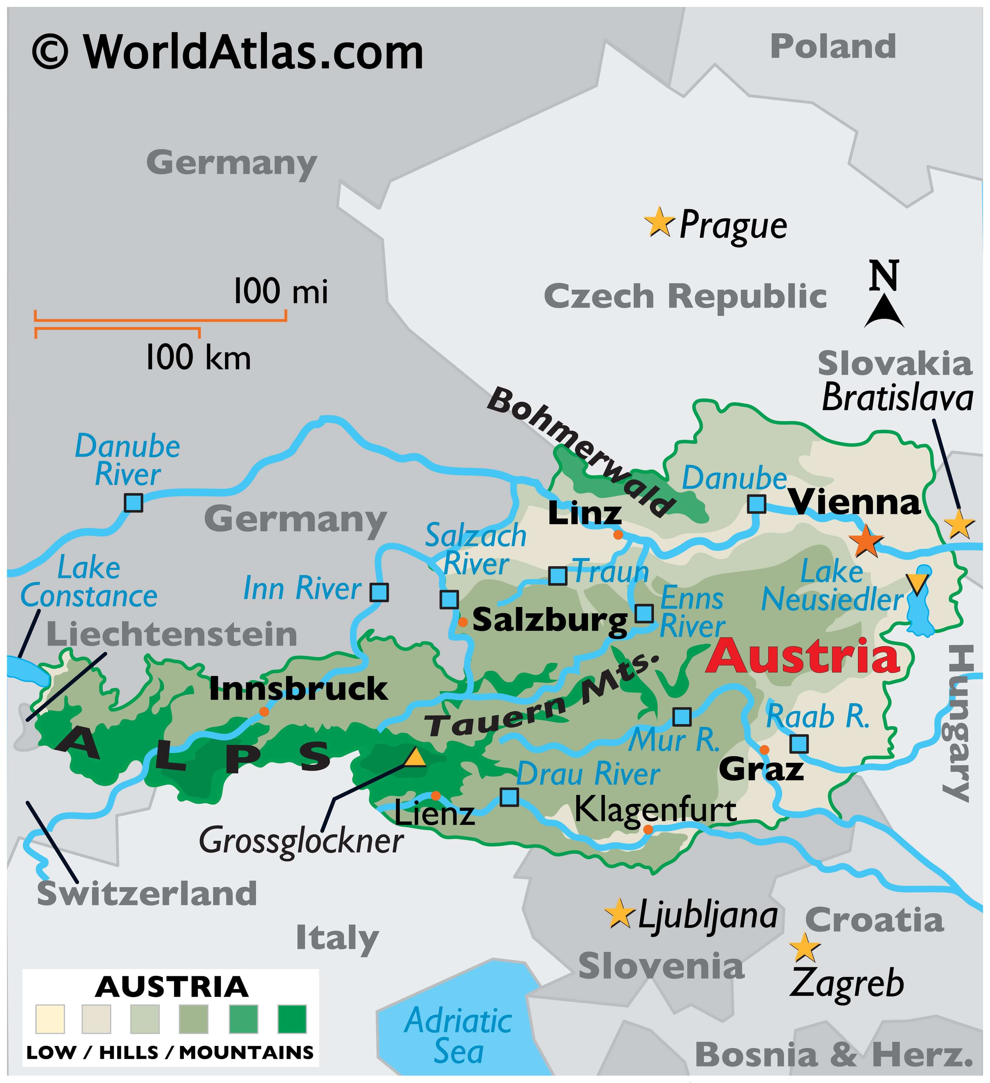
Most of Austria (70%), is covered by the Alpine Region, central and west, as the Alps extend on into Austria from Switzerland. In this region several branches of the Alps dominate. The major ones include the Bavarian, Carnic and Otztaler ranges. The tallest peaks are in the central Tauern Range. The country’s highest point, at 12,460 ft. (3,798 m), is located there. A yellow upright triangle marks the position of this mountain on the map. The Tauern Range eventually slopes into the Danube River Valley, and into the eastern lowlands, from Vienna, south to its border with Slovenia.
The Danube (1,771 miles) (2,850 km), is the most significant river in the country. It’s the second longest river in Europe, and a vital waterway for commerce. Additional rivers of size include the Drau, Enns, Inn, Mur, Raab and Traun. Dozens and dozens of lakes run amidst the mountain ranges, especially in the south and to the immediate east of Salzburg. The largest in the county is Lake Neusiedler.
At 115.45 m (378.8 ft), Lake Neusiedl hosts the lowest point in Austria.
| Flag: |  |
|---|---|
| Legal Name: | Republic of Austria |
| Capital Value: | Vienna |
| Largest City: |
Wien (Vienna) (1,929,944) |
| Demonym(s): | Austrian |
| Government: | Federal parliamentary republic |
| Legislature: | Parliament |
| Total Area: | 83,871 km² |
| Land Area: | 82,445 km² |
| Water Area: | 1,426 km² |
| Population: | 8,877,067 |
| Density: | 107.6/km (278.7/sq mi) (106th) |
| GDP: | $446.31 Billion |
| GDP Per Capita: | $50,277.28 |
| Currency Value: | Euros (EUR) |
| Driving side: | right |
| Calling code: | +43 |
| Internet TLD: | .at |
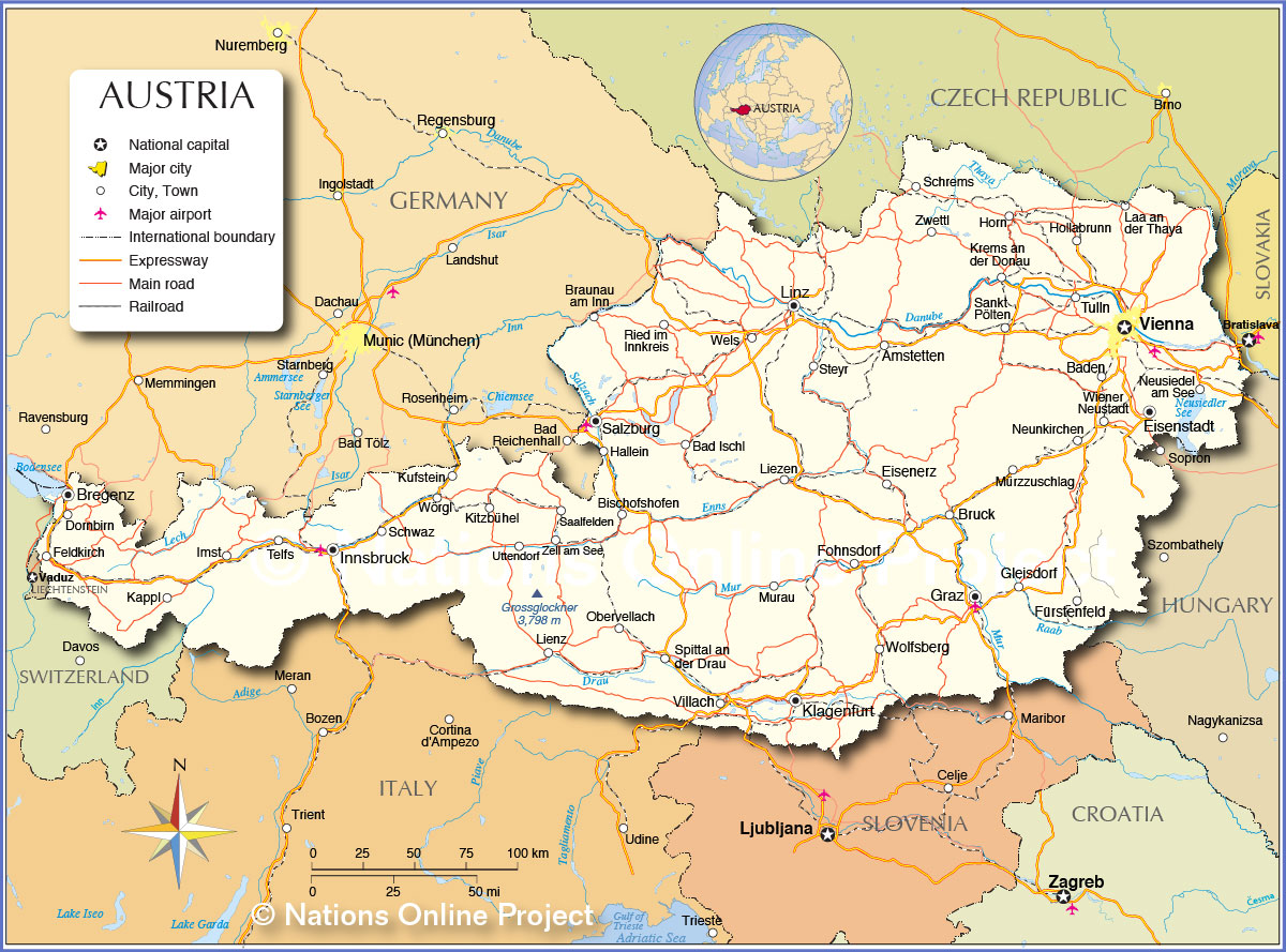
Explore the beauty of Austria with this interactive map. Discover its major cities, rivers, lakes, roads, and highways. Get a closer look with the satellite and elevation map to view the stunning Alps, Tauern Mountains, and the Danube Valley.
This comprehensive and detailed map of Austria will give you a better understanding of the country and its geography.
Online Interactive Political Map
Click on ![]() to view map in "full screen" mode.
to view map in "full screen" mode.
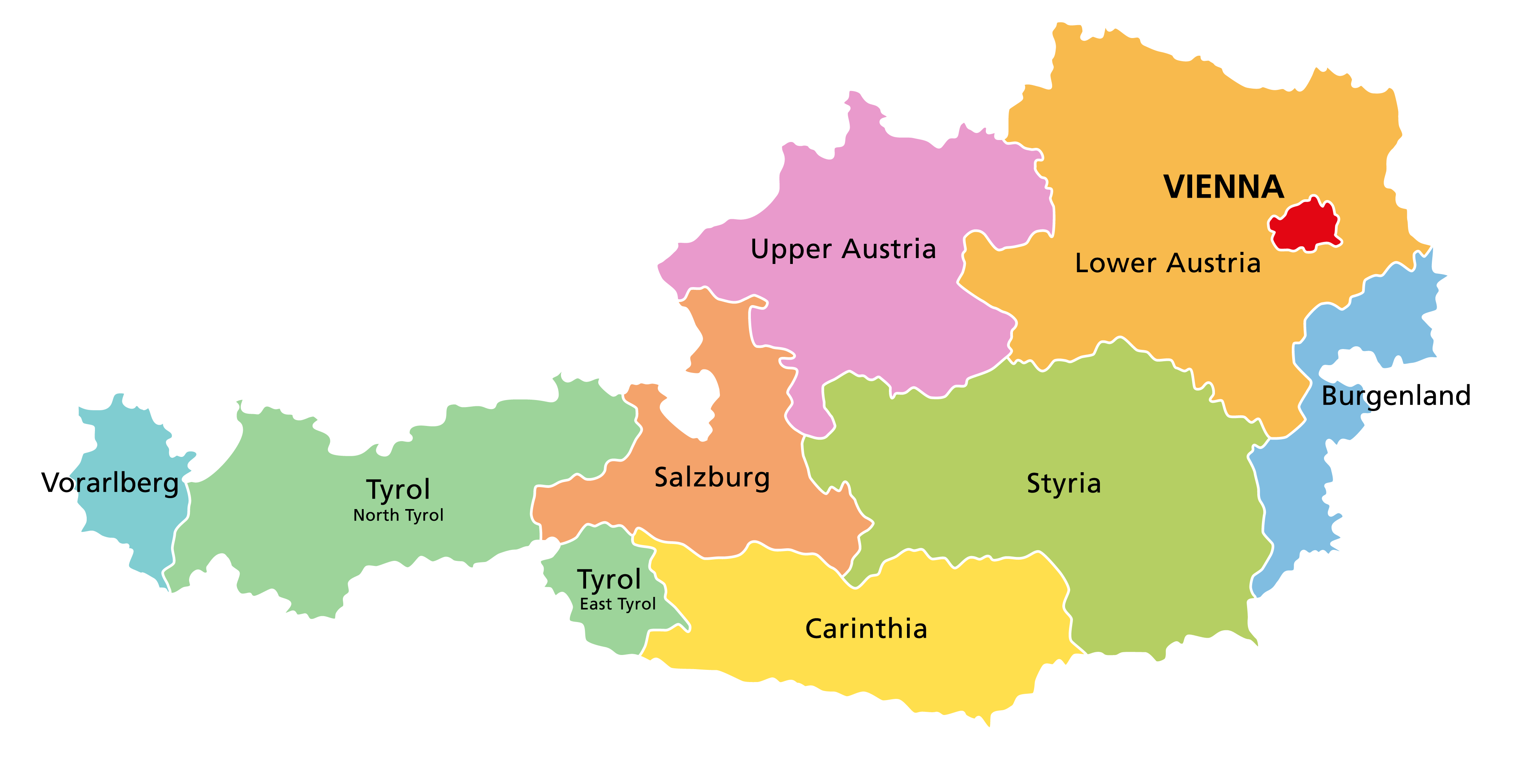
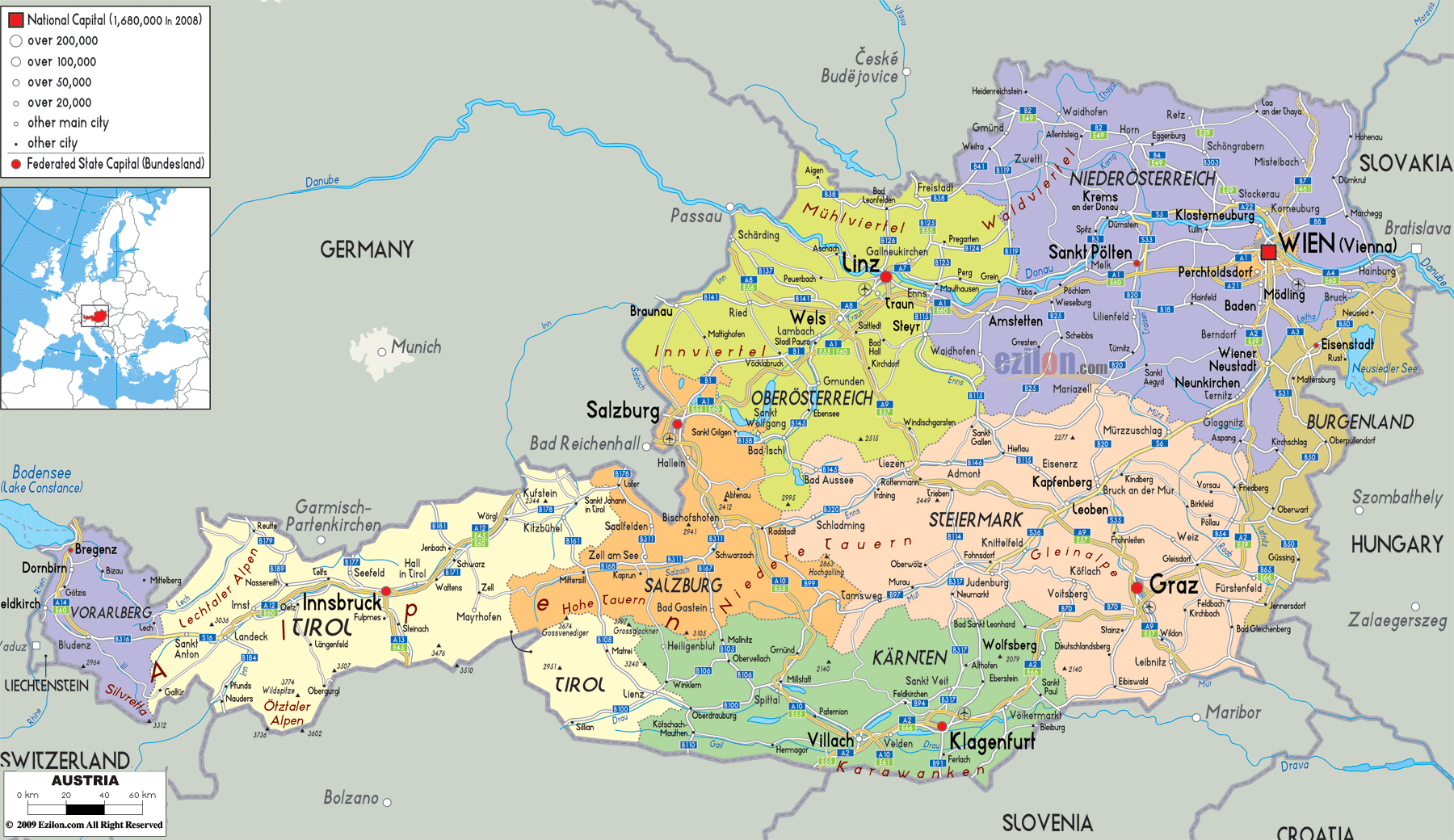
Austria (officially, the Republic of Austria) is divided into 9 federated states (Bundeslander). In alphabetical order, the states are: Burgenland, Carinthia, Lower Austria, Salzburg, Styria, Tyrol, Upper Austria, Vienna and Vorarlberg. These states are further subdivided into a total of 94 districts of which, 79 are district commissions and 15 are statutory cities.
Located in the north eastern part of the country, Vienna – is the capital, the largest and the most populous city of Austria. It is also the administrative, cultural and economic center of the country.
Location Maps
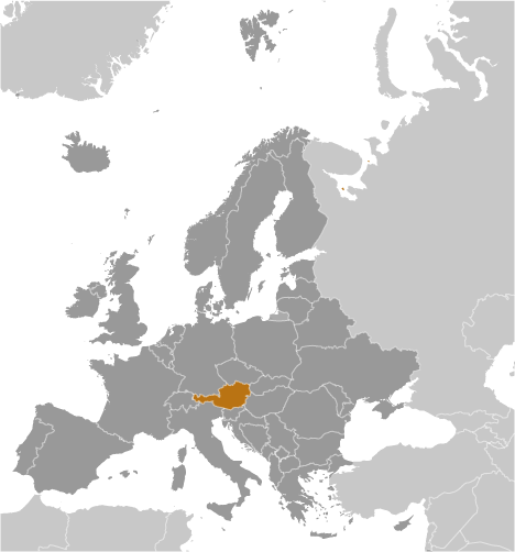
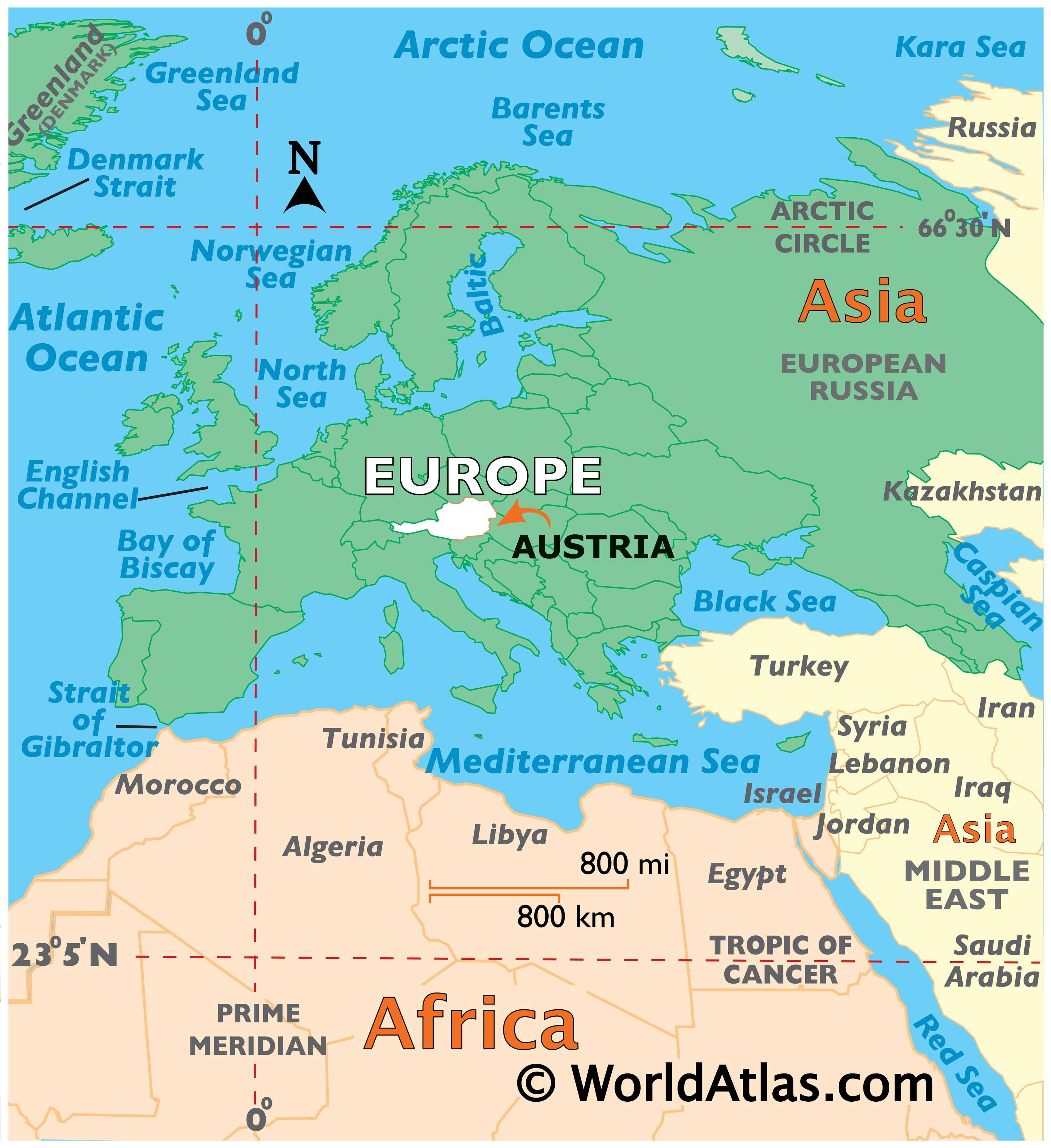
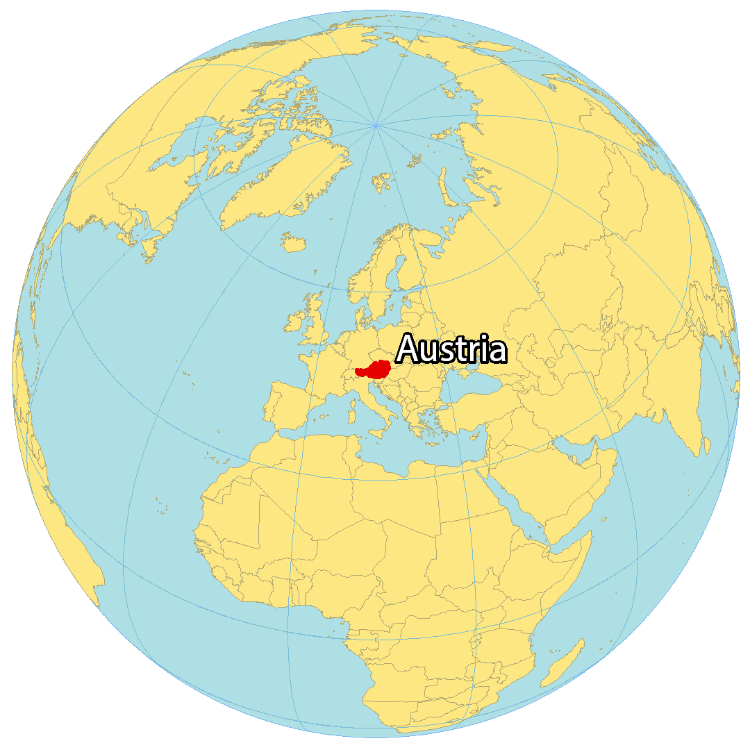
Where is Austria?
Austria is a landlocked country, renowned for its mountainous landscape due to its central location in the Alps. In the northeast, Austria is generally flat or gently sloping. This is where the majority of Austria’s population is concentrated, including its most populous and capital city, Vienna.
The nation is located in Central Europe with Italy and Slovenia to the south, Hungary to the southeast, Slovakia to the east, the Czech Republic to the north, Germany to the northwest, as well as Switzerland and Liechtenstein to the west.
High Definition Political Map of Austria
Physical Map of Austria

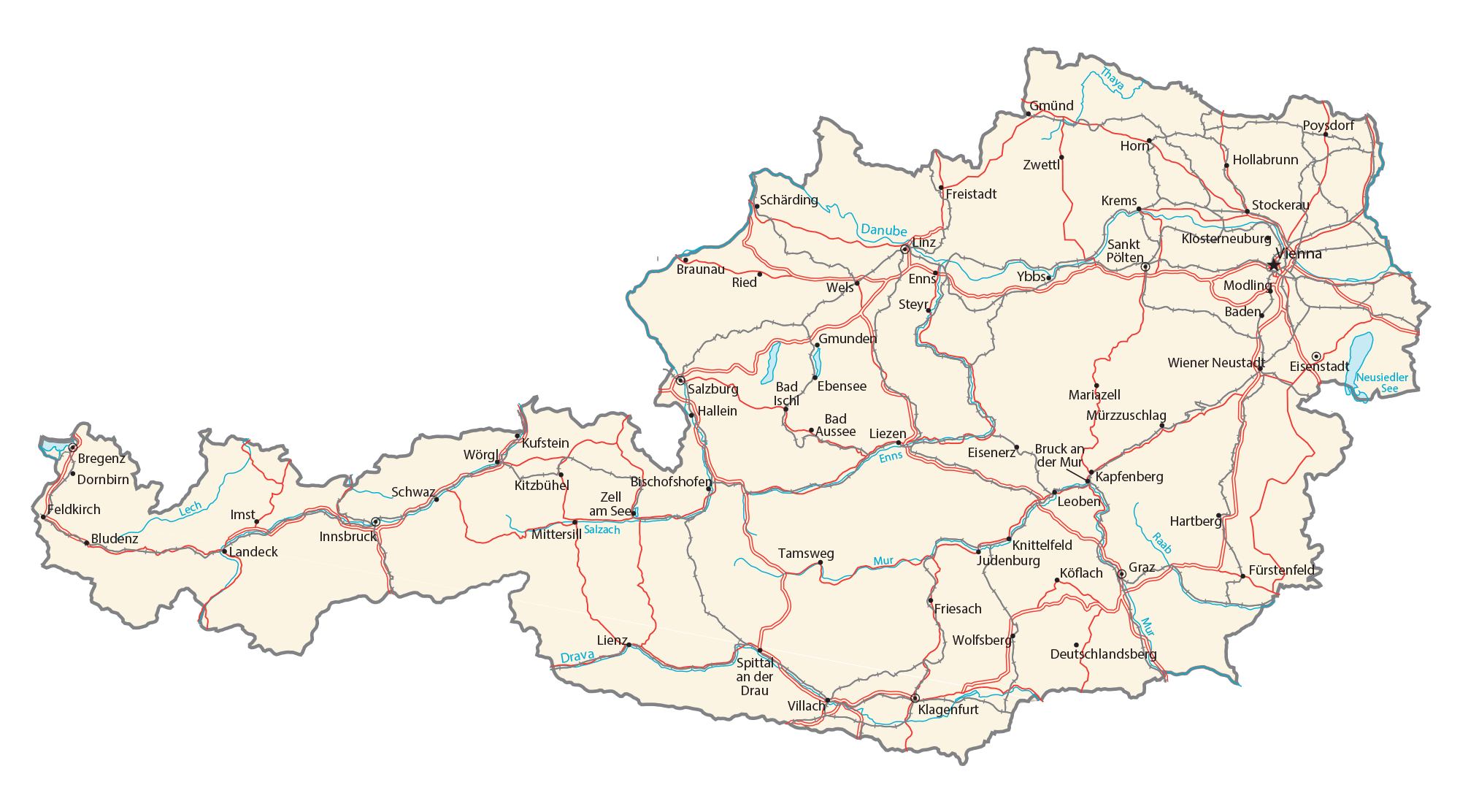
Transportation Map of Austria
