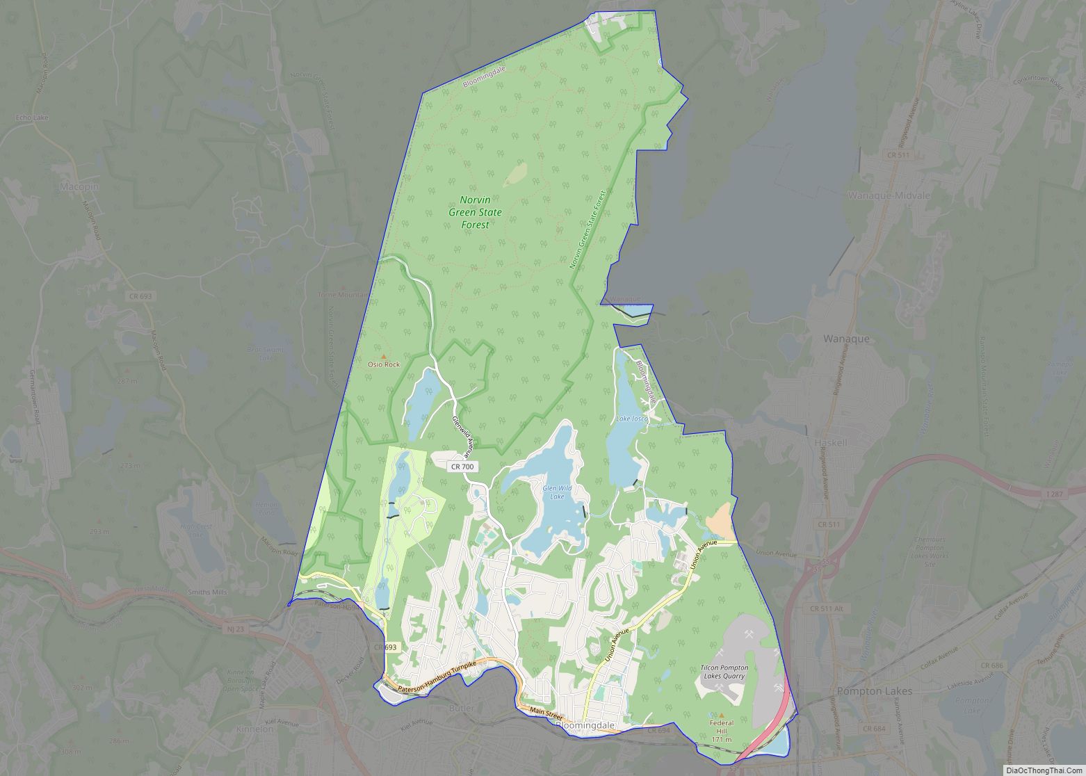
Ringwood is a borough in Passaic County, in the U.S. state of New Jersey. As of the 2020 United States census, the borough’s population was 11,735, a decrease of 493 (−4.0%) from the 2010 census count of 12,228, which in turn reflected a decrease of 168 (−1.4%) from the 12,396 counted in the 2000 Census.
It is the home of Ringwood State Park which contains the New Jersey Botanical Garden at Skylands (plus Skylands Manor), the Shepherd Lake Recreation Area and historic Ringwood Manor.
The Borough of Ringwood was incorporated by an act of the New Jersey Legislature on February 23, 1918, from a “portion of the Township of Pompton”, as one of three boroughs formed from Pompton Township, joining Bloomingdale and Wanaque, based on the results of a referendum held on March 22, 1918. The first organizational meeting of the borough council took place in the existing Borough Hall on May 6, 1918. The borough was named for an iron mining company in the area.
| Name: | Ringwood borough |
|---|---|
| LSAD Code: | 21 |
| LSAD Description: | borough (suffix) |
| State: | New Jersey |
| County: | Passaic County |
| Incorporated: | March 22, 1918 |
| Elevation: | 282 ft (86 m) |
| Total Area: | 28.50 sq mi (73.80 km²) |
| Land Area: | 25.59 sq mi (66.28 km²) |
| Water Area: | 2.90 sq mi (7.52 km²) 10.20% |
| Total Population: | 11,735 |
| Population Density: | 458.6/sq mi (177.1/km²) |
| ZIP code: | 07456 |
| Area code: | 973 exchange: 962 |
| FIPS code: | 3463150 |
| GNISfeature ID: | 0885370 |
| Website: | www.ringwoodnj.net |
Online Interactive Map
Click on ![]() to view map in "full screen" mode.
to view map in "full screen" mode.
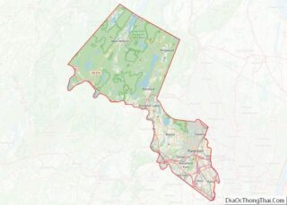
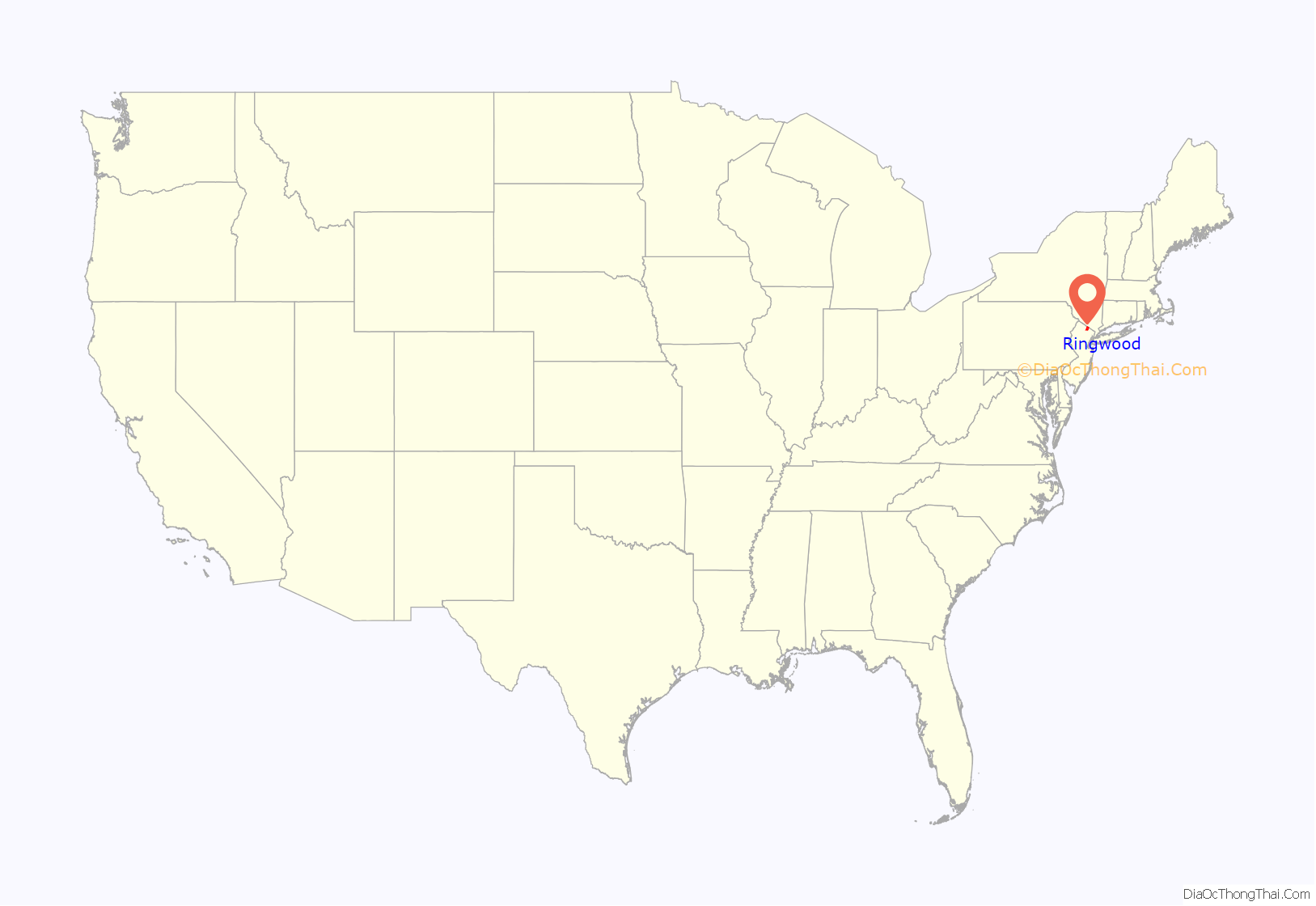
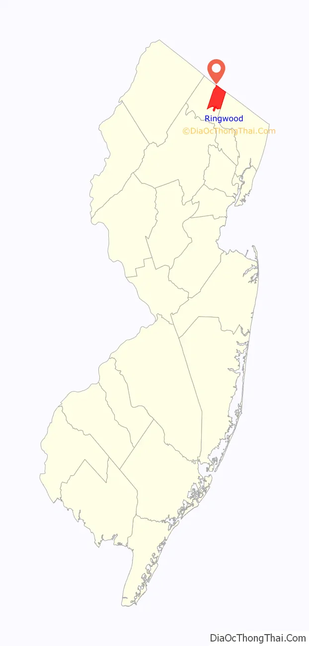
Ringwood location map. Where is Ringwood borough?
History
The Lenape, an Algonquian language-speaking tribe of Native Americans who occupied much of the mid-Atlantic coastal areas and the interior mountains including along the Delaware River resided in the area of present-day Ringwood when Europeans first entered the area. Some retreated to the mountains to escape colonial encroachment.
Colonists called the local band the Ramapough, and named the Ramapo River and other regional features after them. Their descendants and Afro-Dutch migrants from New York were among the people who formed the multiracial group known as the Ramapough Mountain Indians, recognized in 1980 as the “Ramapough Lenape Nation” Native American tribe by the state of New Jersey, though the federal government has denied their application for formal recognition.
Early in the 18th century, colonists discovered iron in the area. The Ogden family built a blast furnace in Ringwood in 1742. By 1765, Peter Hasenclever used Ringwood as the center of his ironmaking operations, which included 150,000 acres (610 km) in New Jersey, New York and Nova Scotia. Iron mining was prominent in the area from the 18th century until the Great Depression, and iron shafts and pits, landfills and other elements still exist. The London, Roomy, Peters and Hope mines were all originally opened by Peter Hasenclever’s London Company.
A number of well-known ironmasters owned and lived at Ringwood Manor from the 1740s to the late 19th century. During the American Revolutionary War, Robert Erskine managed ironmaking operations from Ringwood, and became George Washington’s first geographer and Surveyor-General, producing maps for the Continental Army. Washington visited the Manor House several times. Ringwood iron was used in the famous Hudson River Chain, and for tools and hardware for the army. One of the Manor’s last owners was Abram S. Hewitt, ironmaster, educator, lawyer, U.S. Congressman, and Mayor of New York City. The Manor is part of a National Historic Landmark District.
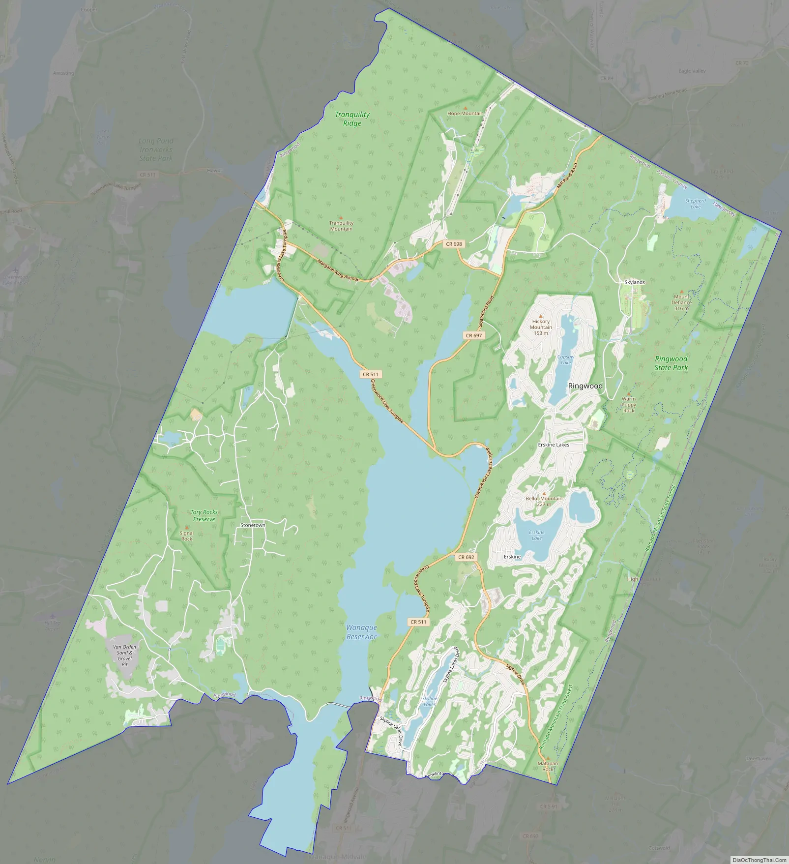
Ringwood Road Map
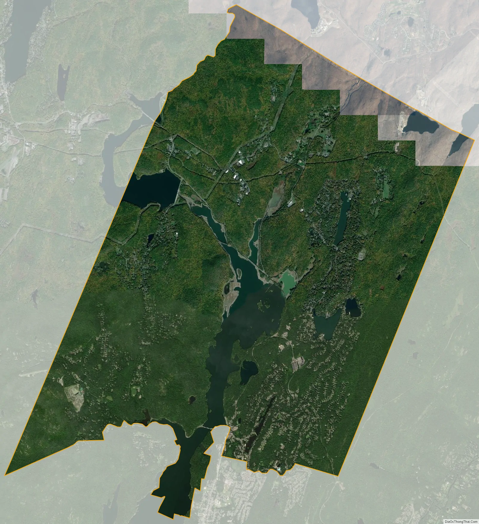
Ringwood city Satellite Map
Geography
According to the United States Census Bureau, Ringwood had a total area of 28.49 square miles (73.8 km), including 25.59 square miles (66.3 km) of land and 2.91 square miles (7.5 km) of water (10.20%).
Unincorporated communities, localities and place names located partially or completely within the borough include Brushwood Pond, Cupsaw Lake, Skyline Lake, Conklintown, Erskine, Harrison Mountain Lake, Lake Erskine, Monks, Negro Pond, Sheppard Pond, Stonetown, Upper Lake and Weyble Pond.
The borough borders Bloomingdale, Wanaque and West Milford in Passaic County; Mahwah and Oakland in Bergen County; Tuxedo and Warwick in Orange County, New York; and Ramapo in Rockland County, New York.
The town is split by the Wanaque Reservoir, which provides water to urban areas in Northeastern New Jersey.
Climate
Ringwood has a hot summer continental climate (Köppen climate classification Dfa).
See also
Map of New Jersey State and its subdivision: Map of other states:- Alabama
- Alaska
- Arizona
- Arkansas
- California
- Colorado
- Connecticut
- Delaware
- District of Columbia
- Florida
- Georgia
- Hawaii
- Idaho
- Illinois
- Indiana
- Iowa
- Kansas
- Kentucky
- Louisiana
- Maine
- Maryland
- Massachusetts
- Michigan
- Minnesota
- Mississippi
- Missouri
- Montana
- Nebraska
- Nevada
- New Hampshire
- New Jersey
- New Mexico
- New York
- North Carolina
- North Dakota
- Ohio
- Oklahoma
- Oregon
- Pennsylvania
- Rhode Island
- South Carolina
- South Dakota
- Tennessee
- Texas
- Utah
- Vermont
- Virginia
- Washington
- West Virginia
- Wisconsin
- Wyoming