Upper Saddle River is a borough in Bergen County, in the U.S. state of New Jersey. As of the 2020 United States census, the borough’s population was 8,353, an increase of 145 (+1.8%) from the 2010 census count of 8,208, which in turn reflected an increase of 467 (+6.0%) from the 7,741 counted in the 2000 census.
Upper Saddle River had a per capita income of $73,639 and was ranked 20th in New Jersey based on data from the 2006–2010 American Community Survey (ACS) from the United States Census Bureau, more than double the statewide average of $34,858. In the 2013–2017 ACS, Upper Saddle River had a median household income of $176,674 (ranked 8th in the state) and included 42.9% of households earning more than $200,000 annually.
| Name: | Upper Saddle River borough |
|---|---|
| LSAD Code: | 21 |
| LSAD Description: | borough (suffix) |
| State: | New Jersey |
| County: | Bergen County |
| Incorporated: | November 22, 1894 |
| Elevation: | 259 ft (79 m) |
| Total Area: | 5.27 sq mi (13.66 km²) |
| Land Area: | 5.25 sq mi (13.60 km²) |
| Water Area: | 0.02 sq mi (0.05 km²) 0.38% |
| Total Population: | 8,353 |
| Population Density: | 1,590.1/sq mi (613.9/km²) |
| ZIP code: | 07458 |
| Area code: | 201 |
| FIPS code: | 3475140 |
| GNISfeature ID: | 0885425 |
| Website: | www.usrtoday.org |
Online Interactive Map
Click on ![]() to view map in "full screen" mode.
to view map in "full screen" mode.
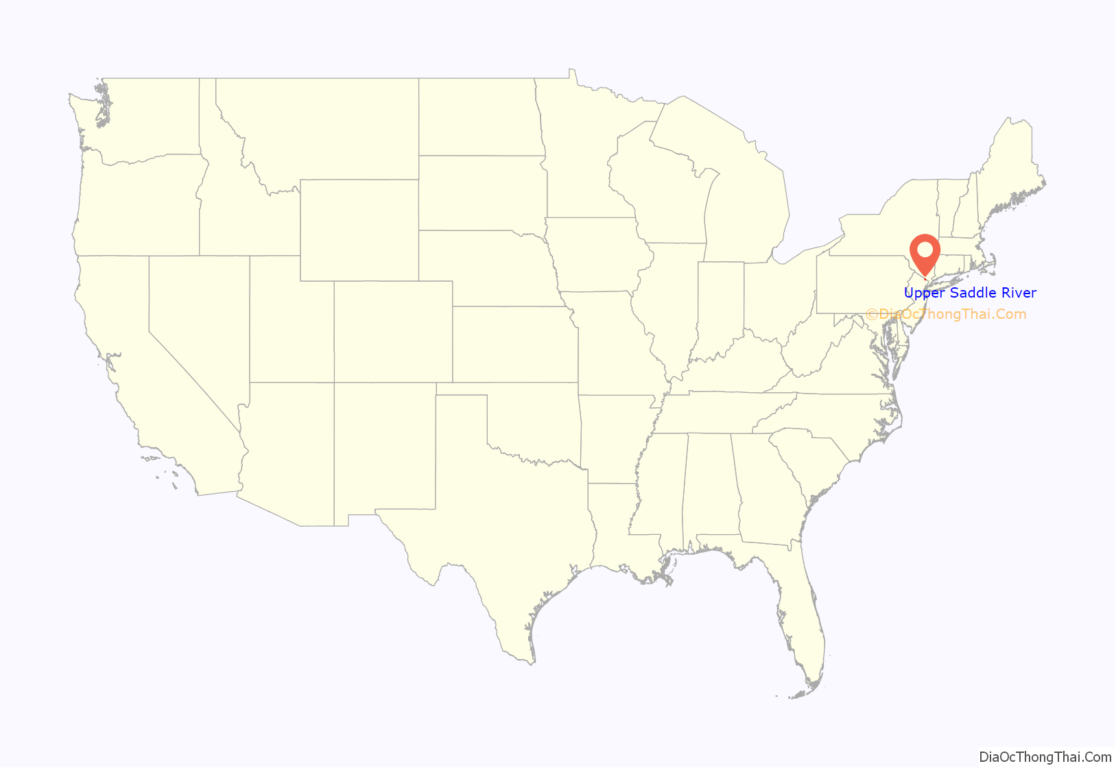
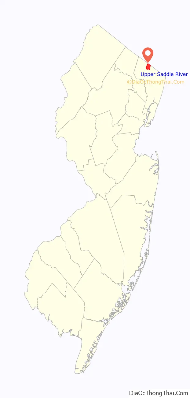
Upper Saddle River location map. Where is Upper Saddle River borough?
History
Upper Saddle River was originally settled by the Lenape Native Americans and was colonized in the 18th century principally by Dutch settlers who built mills along the Saddle River. The area was granted borough status in 1894 and remained principally rural until the 1950s. The suburban growth of New Jersey affected Upper Saddle River and surrounding municipalities, as the borough’s population increased tenfold from 1950 to 1970. The population has remained fairly constant since 1970.
Predominantly a residential community consisting of one-acre (4,000 m) lots, Upper Saddle River also contains a library, police station, fire station, ambulance corps, municipal hall, and three primary schools. Commerce and industry are concentrated along the town’s western border along Route 17. Postal service is shared with the neighboring borough of Saddle River.
Upper Saddle River was formed as a borough by an act of the New Jersey Legislature on November 22, 1894, from portions of Hohokus Township and Orvil Township, based on the results of a referendum held two days earlier. The borough was formed during the “Boroughitis” phenomenon then sweeping through Bergen County, in which 26 boroughs were formed in the county in 1894 alone. Upper Saddle River’s referendum passed on November 20, one day after the referendum passed for Saddle River. The name of the river, and hence the borough, is thought to come from early explorers who thought that the geography of the area resembled that of the Sadle Burn, the valley surrounding a stream in the Scottish area of Argyll.
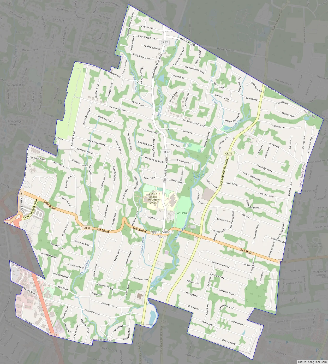
Upper Saddle River Road Map
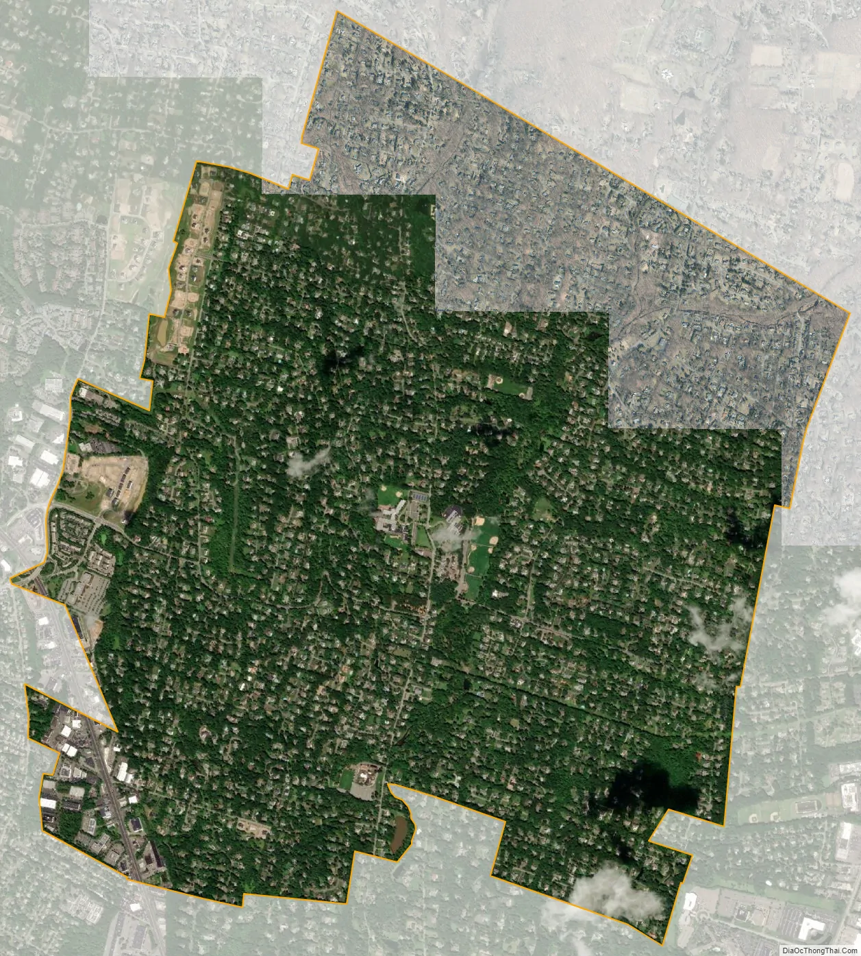
Upper Saddle River city Satellite Map
Geography
According to the United States Census Bureau, the borough had a total area of 5.27 square miles (13.66 km), including 5.25 square miles (13.60 km) of land and 0.02 square miles (0.05 km) of water (0.38%). The borough is bisected by the Saddle River, a tributary of the Passaic River.
Unincorporated communities, localities and place names located partially or completely within the township include Duffys Mills, Hoppers Mills and Posts Mills.
Upper Saddle River is bounded by seven municipalities: Mahwah, Montvale, Ramsey, Saddle River, as well as small portions of Woodcliff Lake in Bergen County, New Jersey; and both Airmont and Chestnut Ridge in the Town of Ramapo in Rockland County, New York.
The borough is served by several major highways, including the Garden State Parkway at exits 172 and 171 in Montvale and Woodcliff Lake, and Route 17, which runs through the borough, though some portions of Upper Saddle River are served by roads located in Saddle River, Ramsey and Mahwah.
See also
Map of New Jersey State and its subdivision: Map of other states:- Alabama
- Alaska
- Arizona
- Arkansas
- California
- Colorado
- Connecticut
- Delaware
- District of Columbia
- Florida
- Georgia
- Hawaii
- Idaho
- Illinois
- Indiana
- Iowa
- Kansas
- Kentucky
- Louisiana
- Maine
- Maryland
- Massachusetts
- Michigan
- Minnesota
- Mississippi
- Missouri
- Montana
- Nebraska
- Nevada
- New Hampshire
- New Jersey
- New Mexico
- New York
- North Carolina
- North Dakota
- Ohio
- Oklahoma
- Oregon
- Pennsylvania
- Rhode Island
- South Carolina
- South Dakota
- Tennessee
- Texas
- Utah
- Vermont
- Virginia
- Washington
- West Virginia
- Wisconsin
- Wyoming


