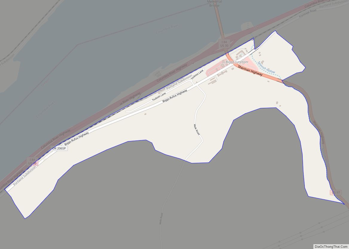
Biggs Junction is an unincorporated community in Sherman County, Oregon, United States. For statistical purposes, the United States Census Bureau has defined Biggs Junction as a census-designated place (CDP). The census definition of the area may not precisely correspond to local understanding of the area with the same name.
Biggs Junction is located on the south side of the Columbia River at the junction of Interstate 84/U.S. 30 and U.S. 97 where it crosses the Sam Hill Memorial Bridge over the river from Washington. The population was 22 at the 2010 census.
| Name: | Biggs Junction CDP |
|---|---|
| LSAD Code: | 57 |
| LSAD Description: | CDP (suffix) |
| State: | Oregon |
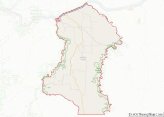
| County: | Sherman County |
| Elevation: | 220 ft (67 m) |
| Total Area: | 0.89 sq mi (2.30 km²) |
| Land Area: | 0.89 sq mi (2.30 km²) |
| Water Area: | 0.00 sq mi (0.00 km²) |
| Total Population: | 5 |
| Population Density: | 5.64/sq mi (2.18/km²) |
| ZIP code: | 97065 |
| FIPS code: | 4106400 |
| GNISfeature ID: | 1117690 |
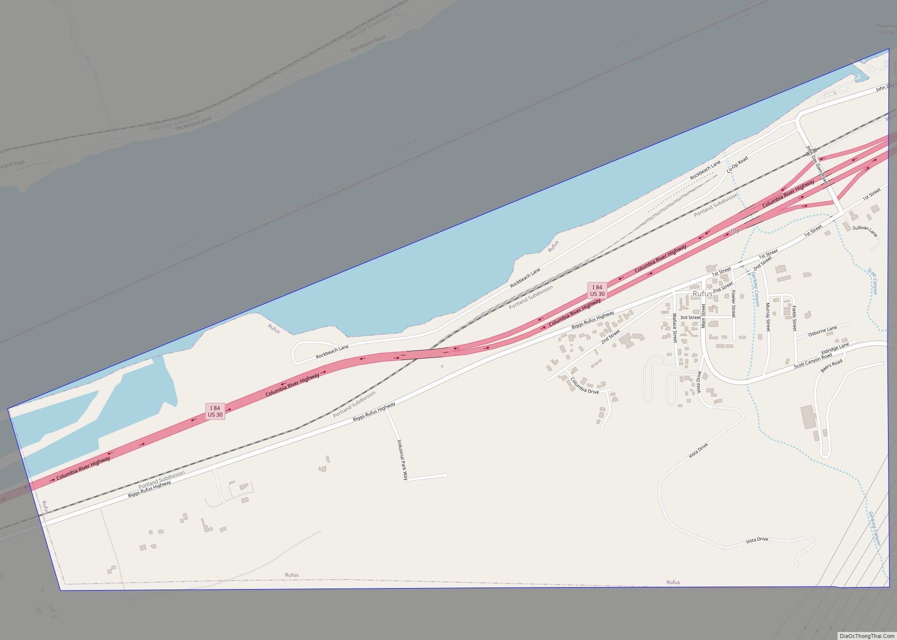
Online Interactive Map
Click on ![]() to view map in "full screen" mode.
to view map in "full screen" mode.
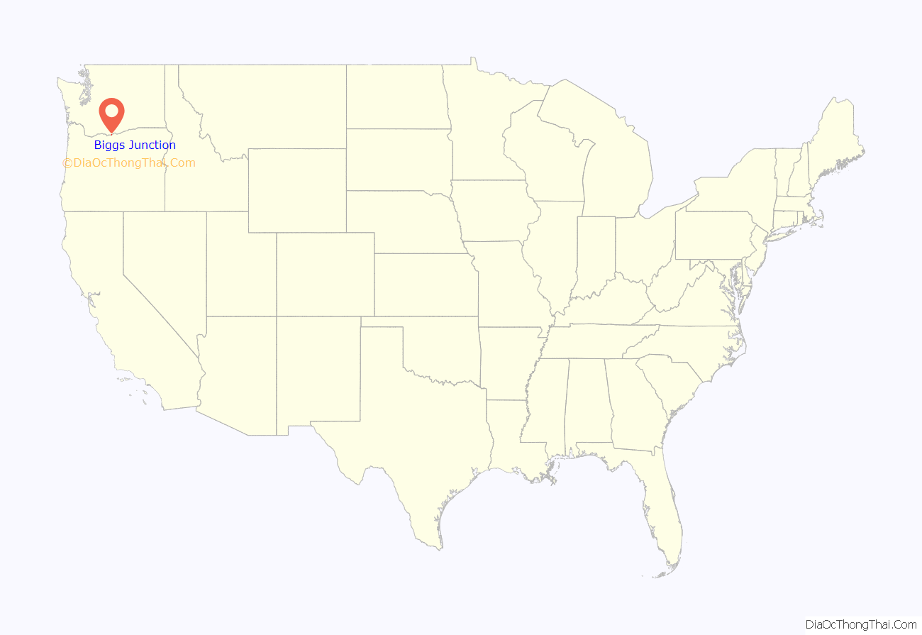
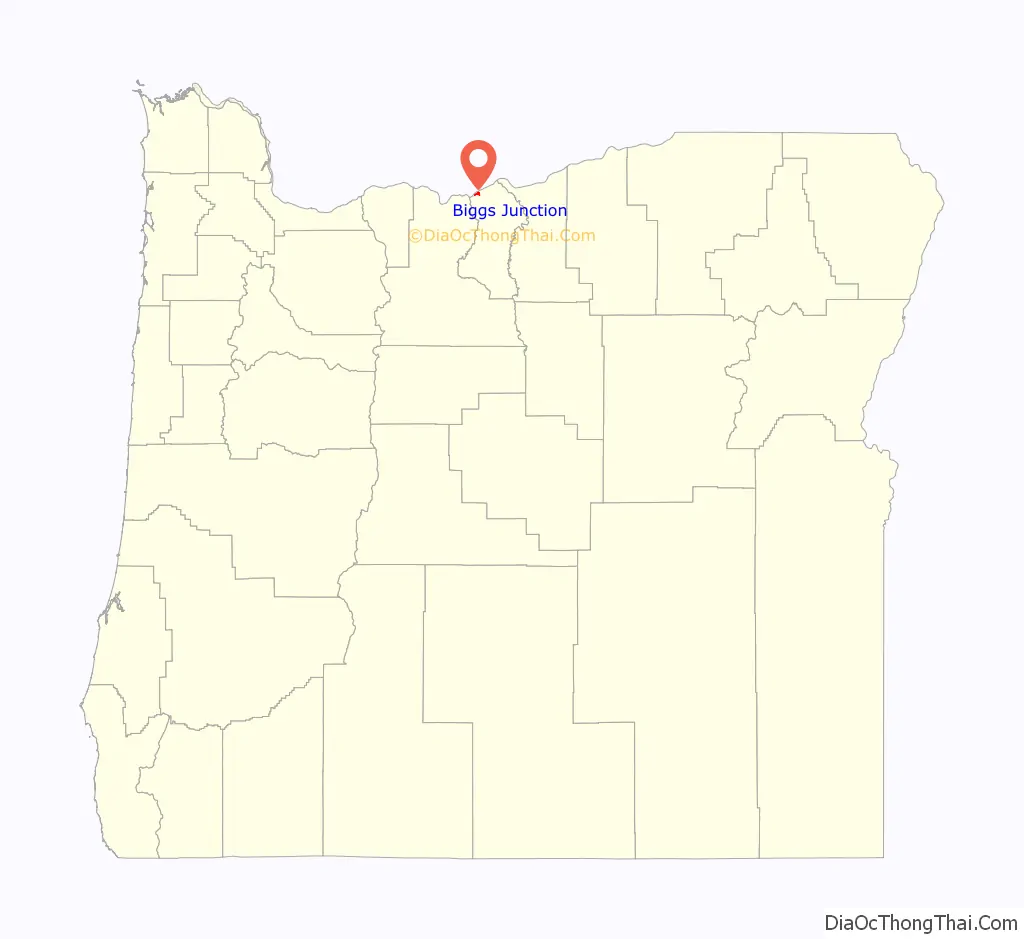
Biggs Junction location map. Where is Biggs Junction CDP?
History
Biggs is a station on the Union Pacific Railroad (UP) at what was once a junction with the UP’s Grass Valley line to Kent that has since been abandoned. Biggs was named for a nearby landowner, W. H. Biggs, who settled in Sherman County in 1880. W. H. Biggs was born on May 12, 1831; he was from Ohio. The rail line was originally owned by the Oregon Railway and Navigation Company (OR&N). In 1885 the OR&N station at Biggs was called Spanish Hollow, after the canyon that opens on the river there. The canyon was said to be named because a Spanish ox died there in the days of the Oregon Trail, which runs parallel to U.S. 97. Biggs is where travelers on the Oregon Trail would first see the Columbia River after their overland journey. The current community of Biggs Junction was named for the station, which is less than a mile west of the current junction, and its location at the intersection of I-84 and U.S. 97. Biggs post office was established in 1884 and closed in 1954.
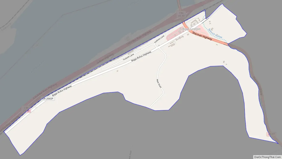
Biggs Junction Road Map
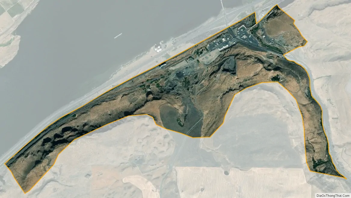
Biggs Junction city Satellite Map
Geography
According to the United States Census Bureau, the CDP has a total area of 0.8 square miles (2.1 km), all land.
Biggs Junction is across the Columbia River from Maryhill, Washington.
See also
Map of Oregon State and its subdivision: Map of other states:- Alabama
- Alaska
- Arizona
- Arkansas
- California
- Colorado
- Connecticut
- Delaware
- District of Columbia
- Florida
- Georgia
- Hawaii
- Idaho
- Illinois
- Indiana
- Iowa
- Kansas
- Kentucky
- Louisiana
- Maine
- Maryland
- Massachusetts
- Michigan
- Minnesota
- Mississippi
- Missouri
- Montana
- Nebraska
- Nevada
- New Hampshire
- New Jersey
- New Mexico
- New York
- North Carolina
- North Dakota
- Ohio
- Oklahoma
- Oregon
- Pennsylvania
- Rhode Island
- South Carolina
- South Dakota
- Tennessee
- Texas
- Utah
- Vermont
- Virginia
- Washington
- West Virginia
- Wisconsin
- Wyoming