Creswell is a city in the Willamette Valley of Lane County, Oregon, United States, located 13 miles (21 km) south of Eugene, Oregon. The population at the 2010 census was 5,031.
| Name: | Creswell city |
|---|---|
| LSAD Code: | 25 |
| LSAD Description: | city (suffix) |
| State: | Oregon |
| County: | Lane County |
| Incorporated: | 1909 |
| Elevation: | 542 ft (165.2 m) |
| Total Area: | 1.73 sq mi (4.48 km²) |
| Land Area: | 1.72 sq mi (4.44 km²) |
| Water Area: | 0.02 sq mi (0.04 km²) |
| Total Population: | 5,641 |
| Population Density: | 3,289.21/sq mi (1,269.94/km²) |
| ZIP code: | 97426 |
| Area code: | 541 |
| FIPS code: | 4116950 |
| GNISfeature ID: | 1119540 |
| Website: | www.ci.creswell.or.us |
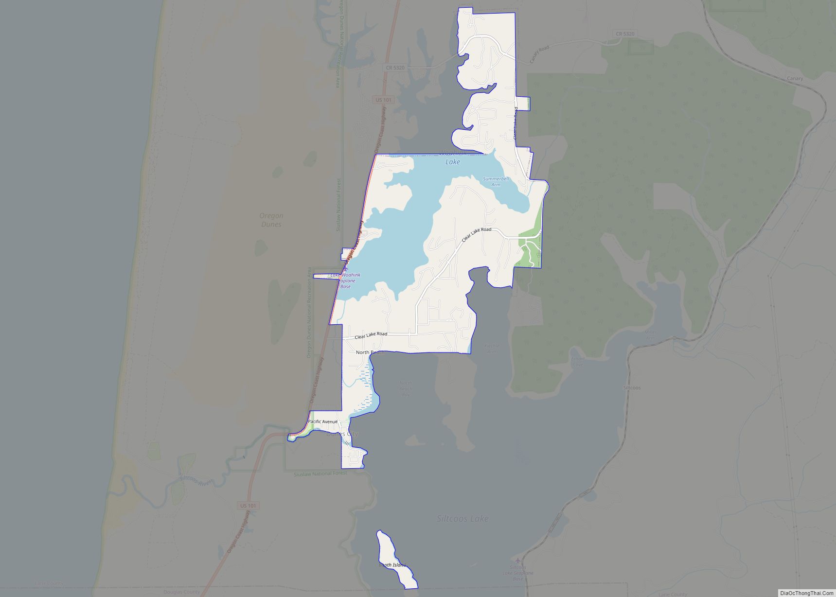
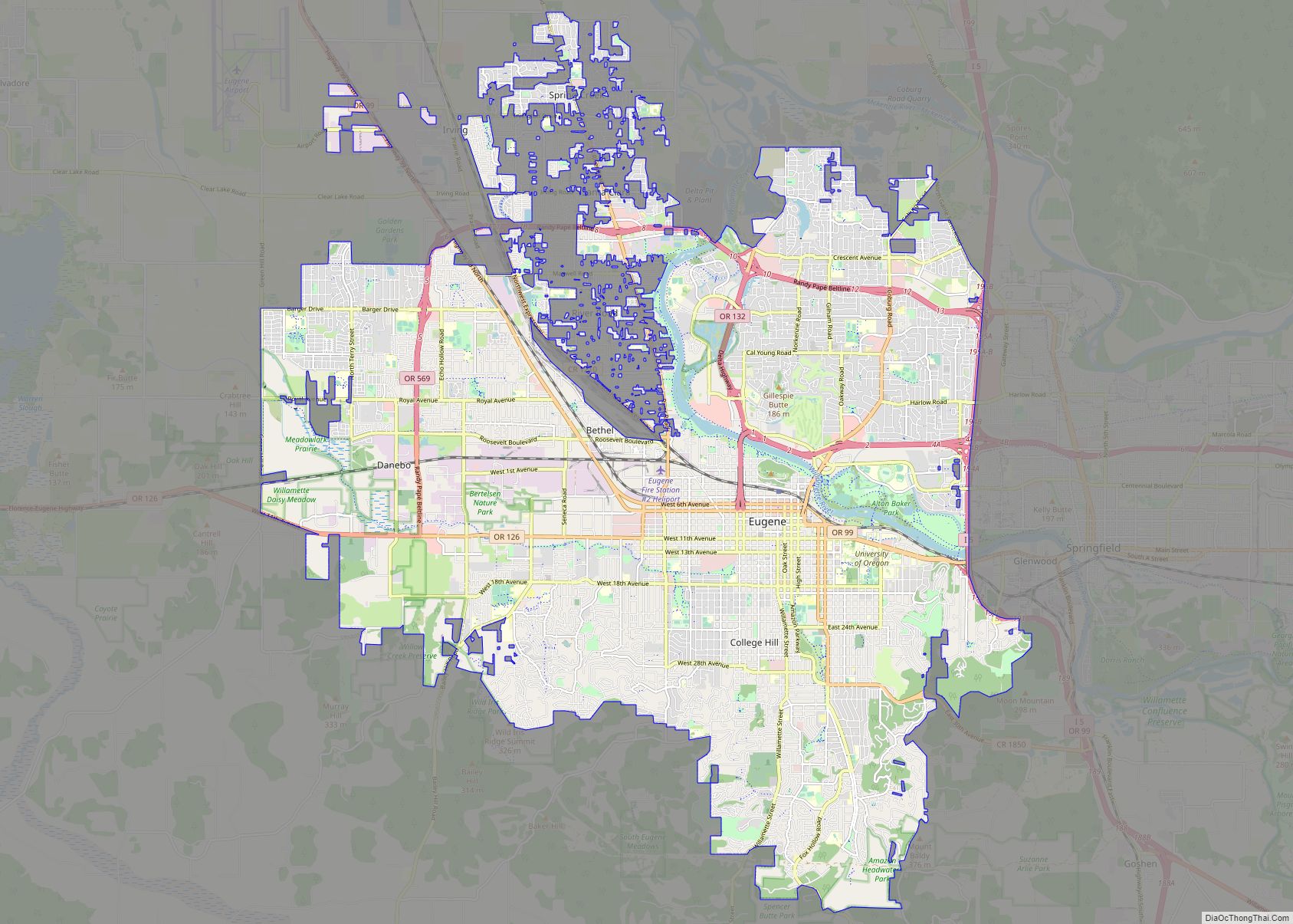
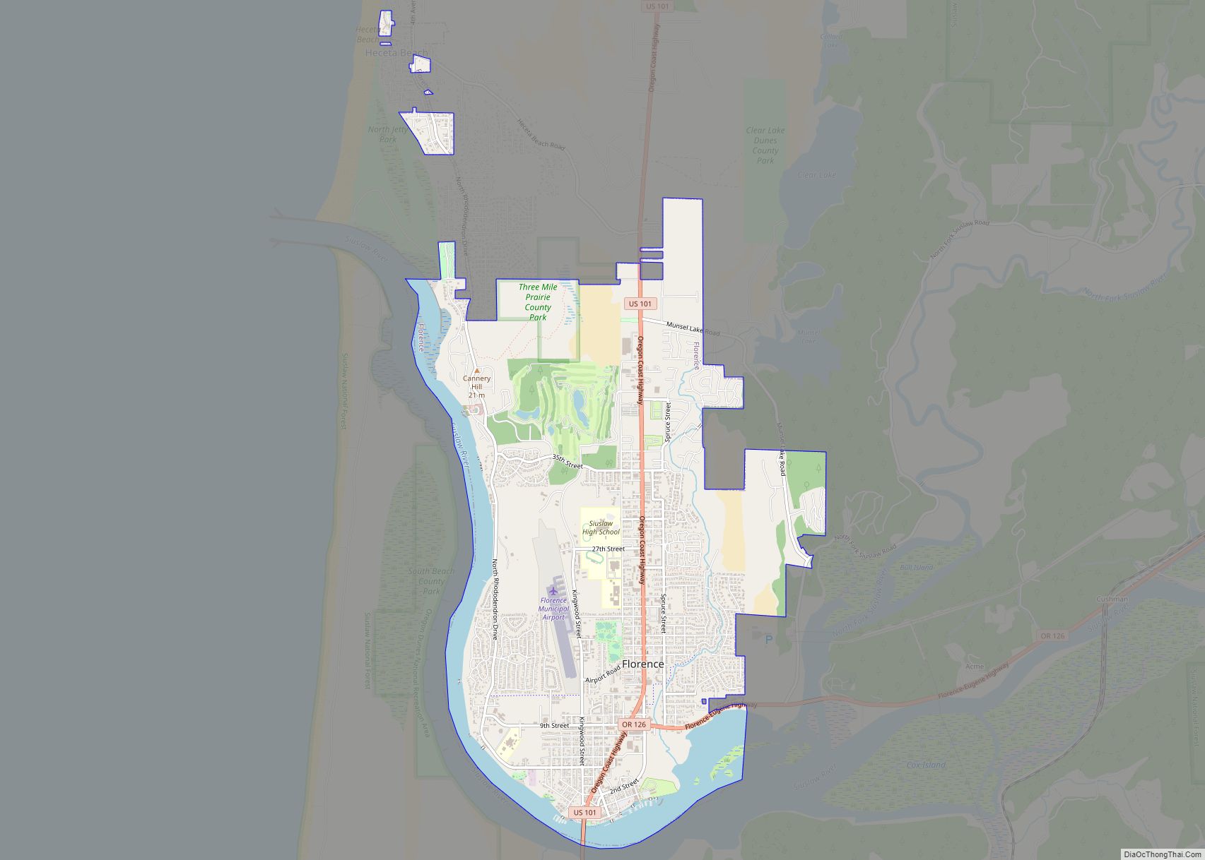
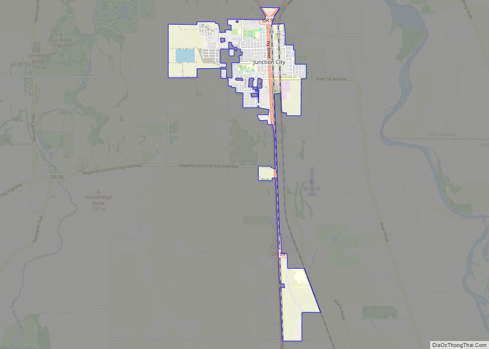
Online Interactive Map
Click on ![]() to view map in "full screen" mode.
to view map in "full screen" mode.
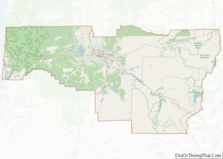
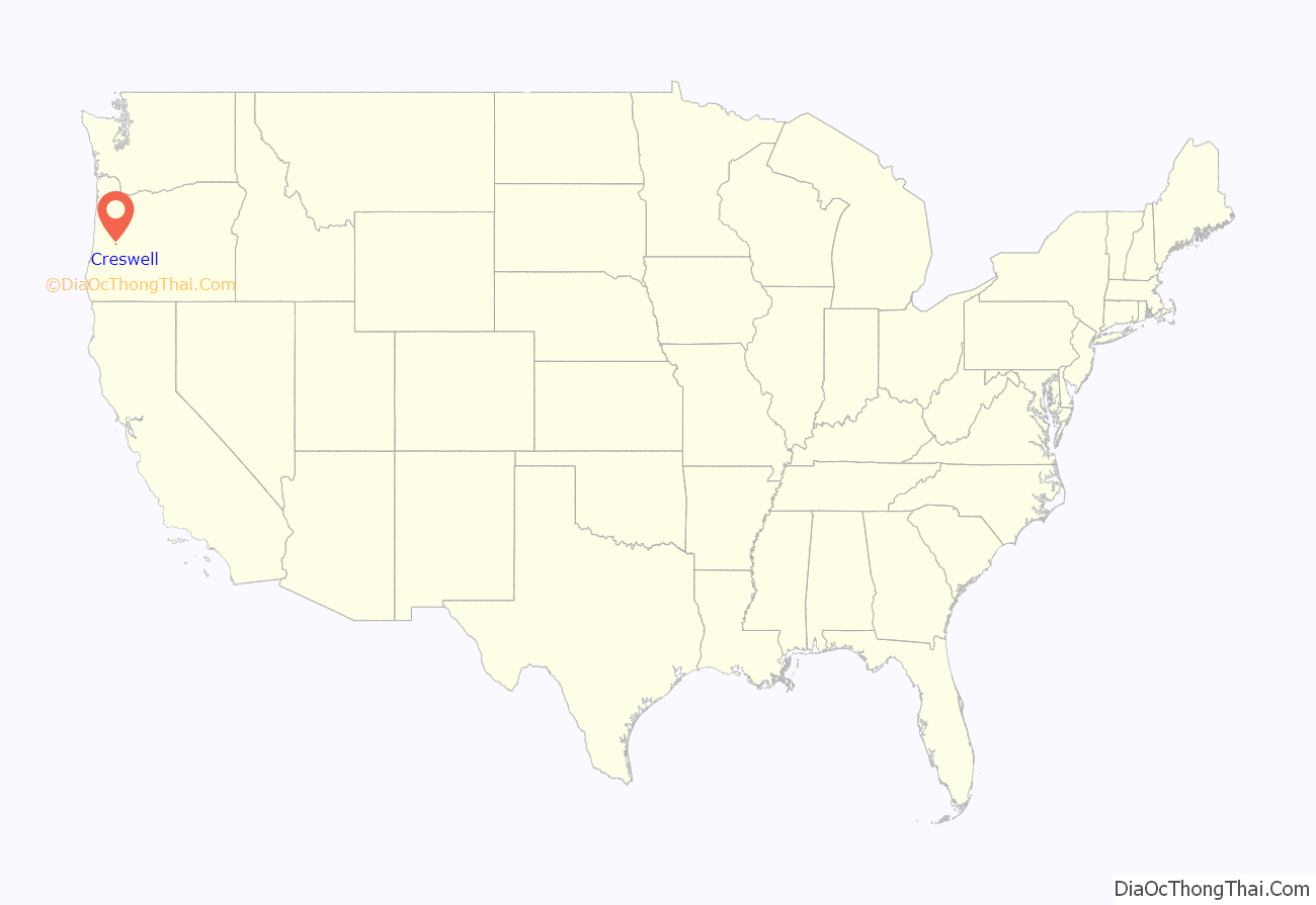
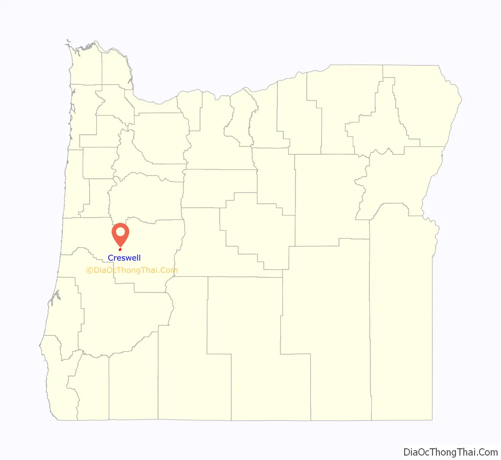
Creswell location map. Where is Creswell city?
History
The first store opened at Creswell in 1872, and a town sprang up around it. The city was named for John Creswell, 23rd United States Postmaster General. A post office has been in operation in Creswell since 1872.
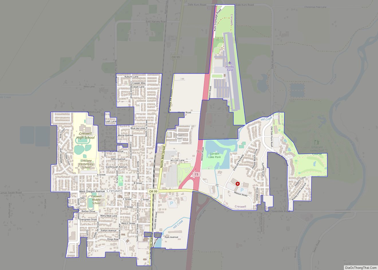
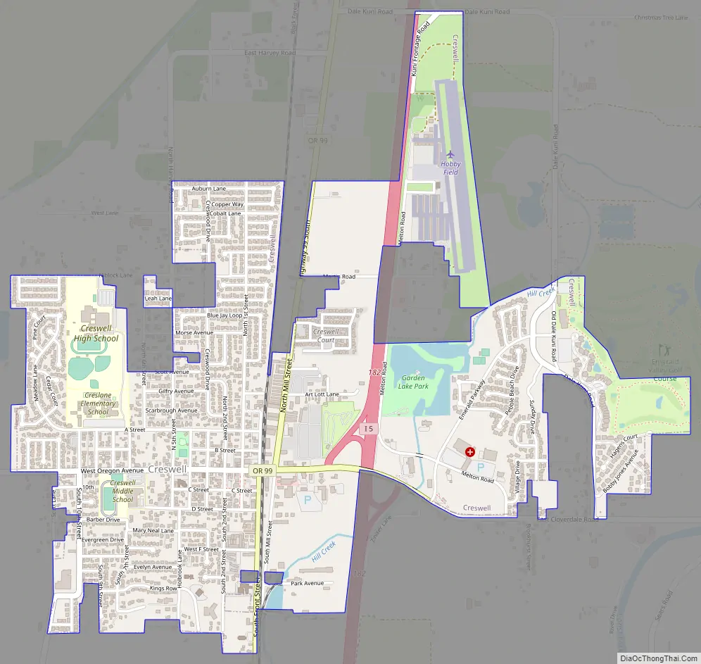
Creswell Road Map
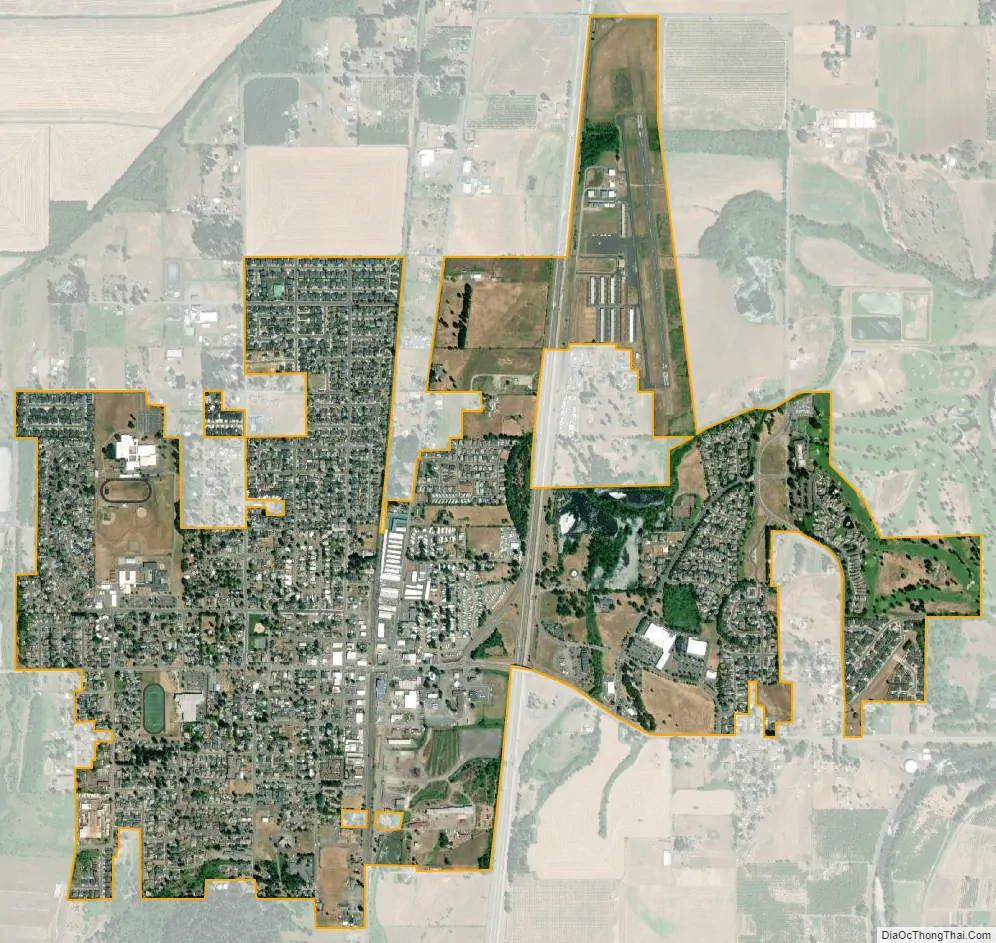
Creswell city Satellite Map
Geography
According to the United States Census Bureau, the city has a total area of 1.72 square miles (4.45 km), of which, 1.70 square miles (4.40 km) is land and 0.02 square miles (0.05 km) is water.
See also
Map of Oregon State and its subdivision: Map of other states:- Alabama
- Alaska
- Arizona
- Arkansas
- California
- Colorado
- Connecticut
- Delaware
- District of Columbia
- Florida
- Georgia
- Hawaii
- Idaho
- Illinois
- Indiana
- Iowa
- Kansas
- Kentucky
- Louisiana
- Maine
- Maryland
- Massachusetts
- Michigan
- Minnesota
- Mississippi
- Missouri
- Montana
- Nebraska
- Nevada
- New Hampshire
- New Jersey
- New Mexico
- New York
- North Carolina
- North Dakota
- Ohio
- Oklahoma
- Oregon
- Pennsylvania
- Rhode Island
- South Carolina
- South Dakota
- Tennessee
- Texas
- Utah
- Vermont
- Virginia
- Washington
- West Virginia
- Wisconsin
- Wyoming