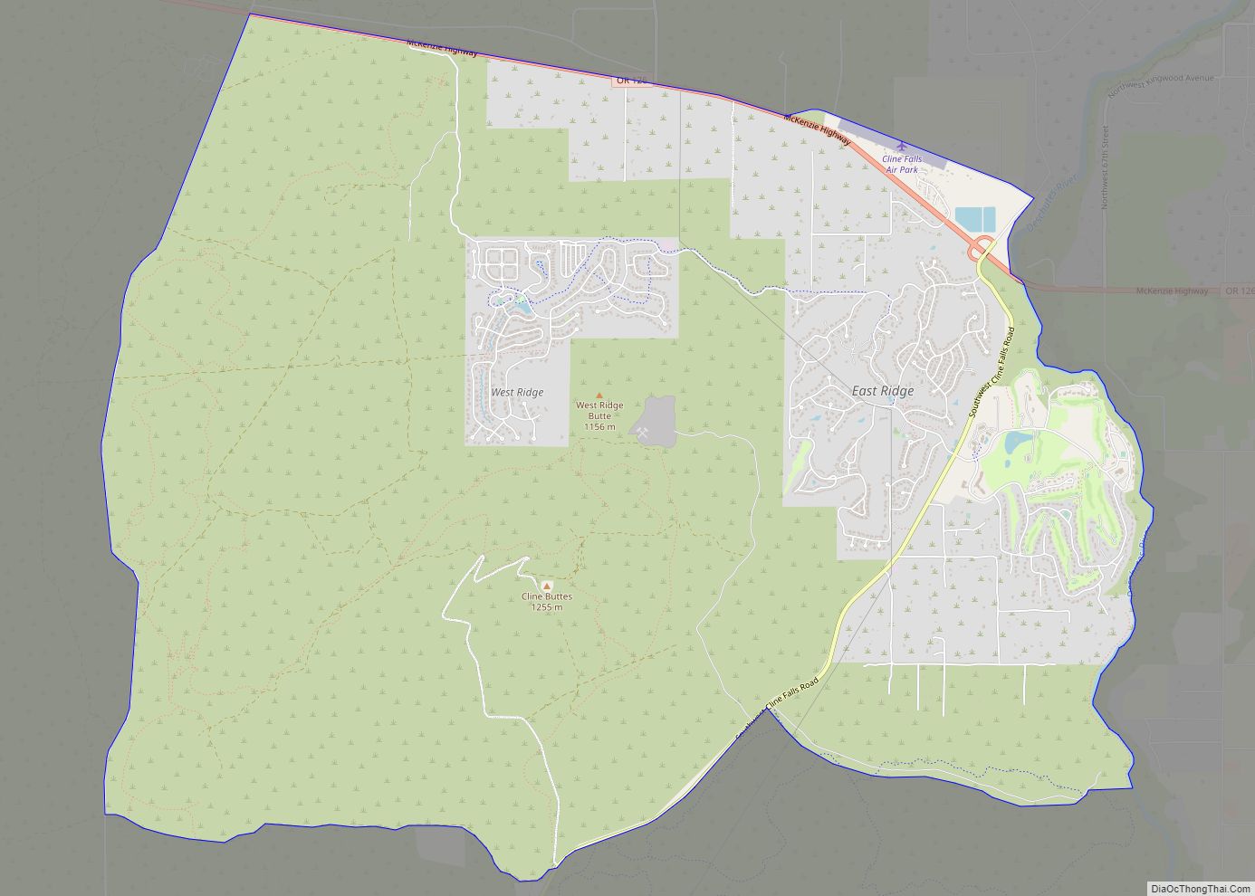
Eagle Crest Resort is a destination resort complex in the U.S. state of Oregon. The resort has a large hotel, a conference center, three golf courses, and three major housing developments each with multiple subdivisions. The resort is located west of Redmond in Central Oregon. The development covers 1,700 acres (6.9 km) on the east slopes of Cline Buttes running eastward to the Deschutes River plus a separate area on the northwest side of the butte.
The resort and the area around it is classified as the Eagle Crest census-designated place (CDP) and had a residential population of 1,696 at the 2010 census.
| Name: | Eagle Crest CDP |
|---|---|
| LSAD Code: | 57 |
| LSAD Description: | CDP (suffix) |
| State: | Oregon |
| County: | Deschutes County |
| Elevation: | 3,050 ft (930 m) |
| Total Area: | 15.20 sq mi (39.35 km²) |
| Land Area: | 15.20 sq mi (39.35 km²) |
| Water Area: | 0.00 sq mi (0.00 km²) |
| Total Population: | 2,761 |
| Population Density: | 181.70/sq mi (70.16/km²) |
| ZIP code: | 97756 |
| FIPS code: | 4121450 |
| Website: | www.eagle-crest.com |
Online Interactive Map
Click on ![]() to view map in "full screen" mode.
to view map in "full screen" mode.
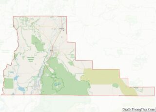
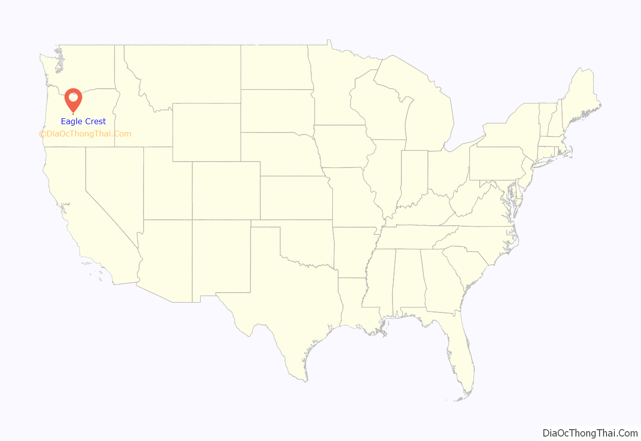
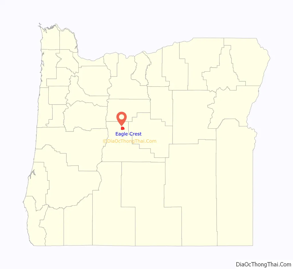
Eagle Crest location map. Where is Eagle Crest CDP?
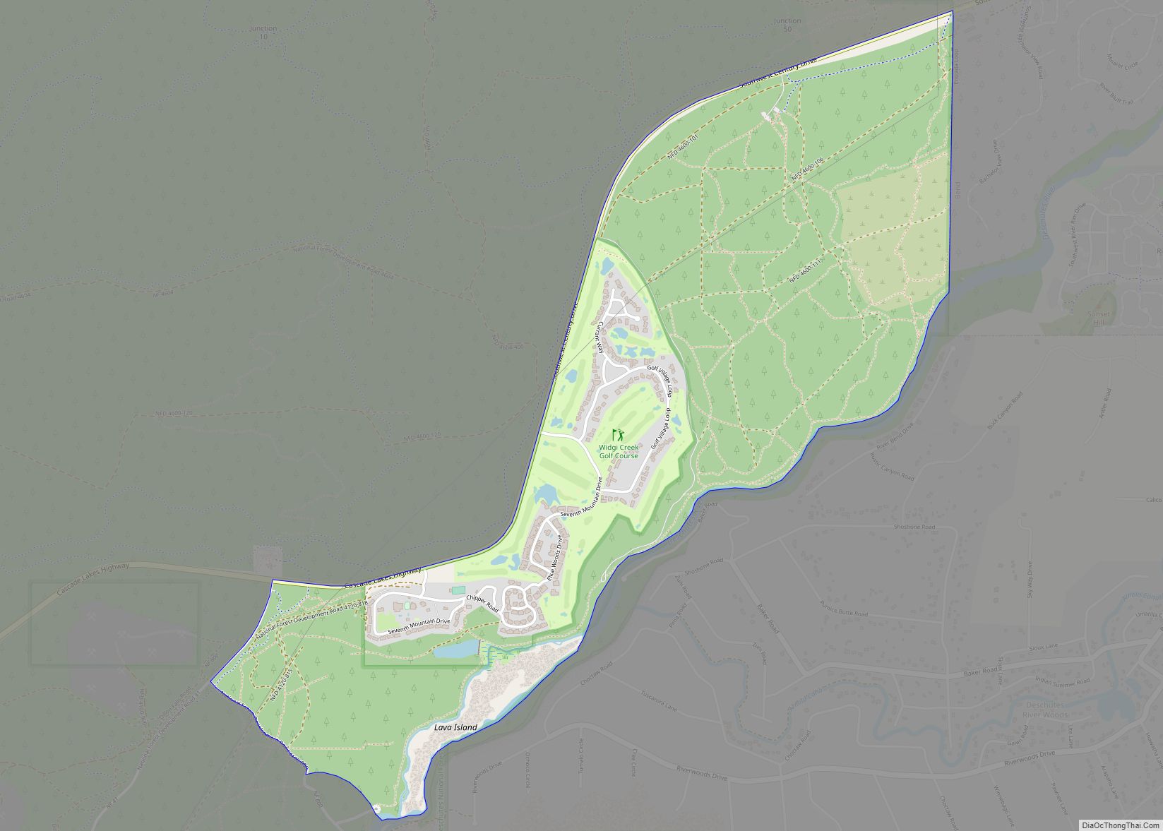
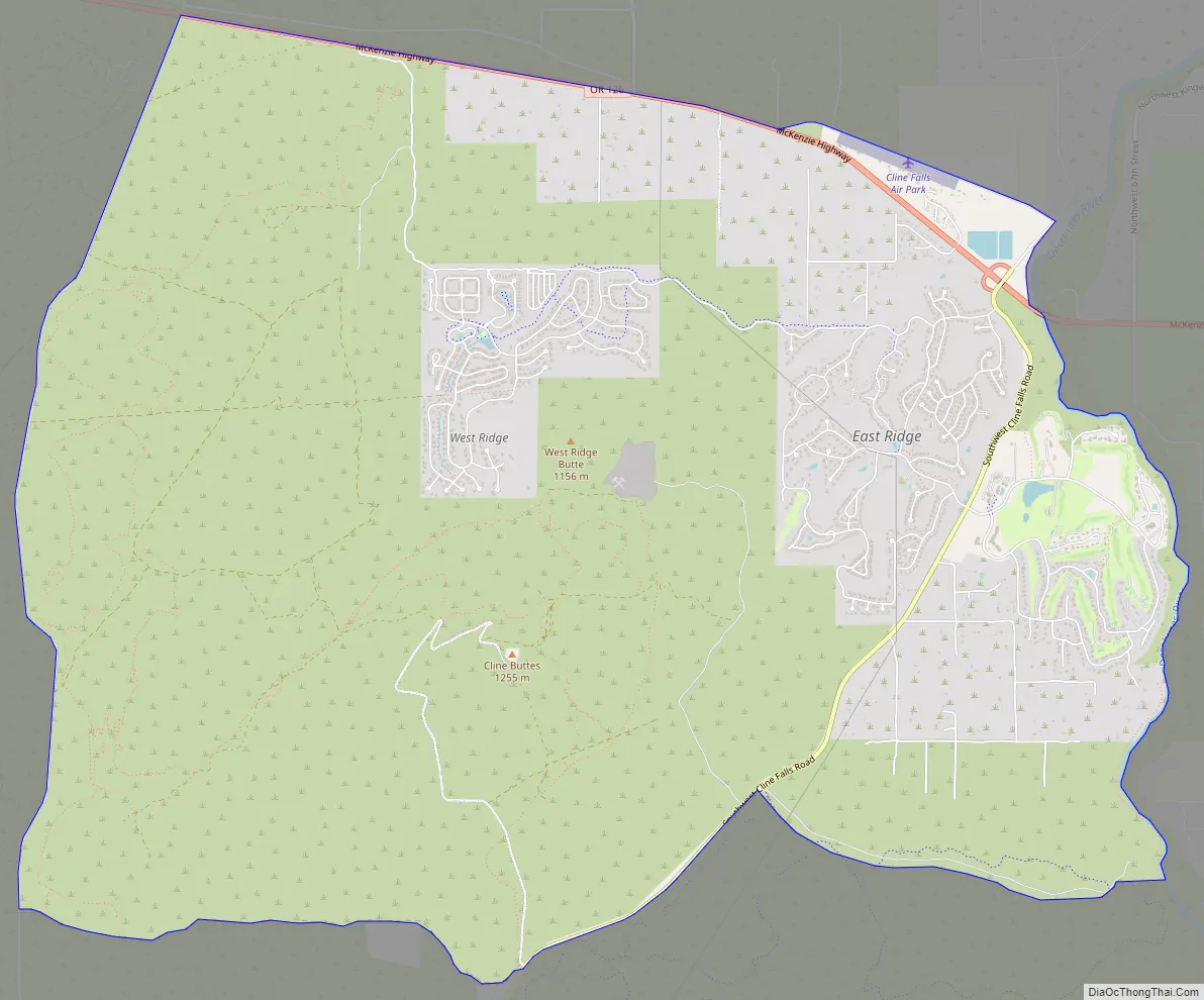
Eagle Crest Road Map
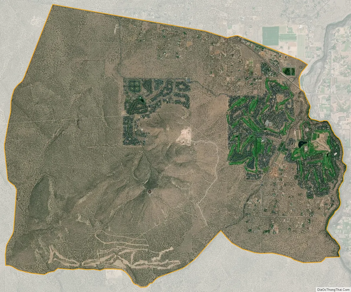
Eagle Crest city Satellite Map
Geography
Eagle Crest is located 6 miles (10 km) west of Redmond on west side of the Deschutes River. The Eagle Crest property includes the lower slope of Cline Butte on the eastern side, extending approximately one and a half miles to the Deschutes River, and one and a half miles north to south with Oregon Highway 126 as the northern boundary. The resort’s main entrance is just off the Cline Falls Highway, approximately one mile south of Highway 126. In addition to the resort’s main area east of Cline Butte, there is a large, separate parcel of Eagle Crest property northwest of the butte. This area has an entrance road connecting it directly to Highway 126. In total, Eagle Crest covers 1,700 acres (6.9 km).
The Eagle Crest CDP covers the area of the resort and surrounding land for a total area of 15.2 square miles (39.4 km), all of it land.
The portion of Eagle Crest east of Cline Butte is located on the Matson Plateau. This area is generally flat with gentle swales sloping gradually down hill to the east until it reaches the edge of the Deschutes River canyon. Most of the area, around Cline Butte, including all of Eagle Crest, is western juniper woodland. In addition to juniper, there are also some native stands of lodgepole pine in the area. The area’s ground cover is dominated by bitterbrush, sagebrush, gray rabbitbrush, and other high desert plants. The plateau ends at the cliff edge just above the Deschutes River. The river flows through a deep canyon with 100-foot (30 m) high basalt cliffs on both sides. Eagle Crest owns approximately one and a half miles of Deschutes River frontage on the west bank.
See also
Map of Oregon State and its subdivision: Map of other states:- Alabama
- Alaska
- Arizona
- Arkansas
- California
- Colorado
- Connecticut
- Delaware
- District of Columbia
- Florida
- Georgia
- Hawaii
- Idaho
- Illinois
- Indiana
- Iowa
- Kansas
- Kentucky
- Louisiana
- Maine
- Maryland
- Massachusetts
- Michigan
- Minnesota
- Mississippi
- Missouri
- Montana
- Nebraska
- Nevada
- New Hampshire
- New Jersey
- New Mexico
- New York
- North Carolina
- North Dakota
- Ohio
- Oklahoma
- Oregon
- Pennsylvania
- Rhode Island
- South Carolina
- South Dakota
- Tennessee
- Texas
- Utah
- Vermont
- Virginia
- Washington
- West Virginia
- Wisconsin
- Wyoming