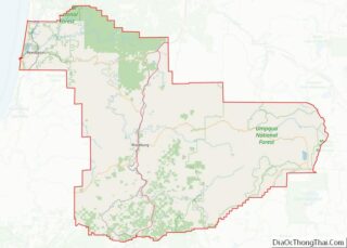
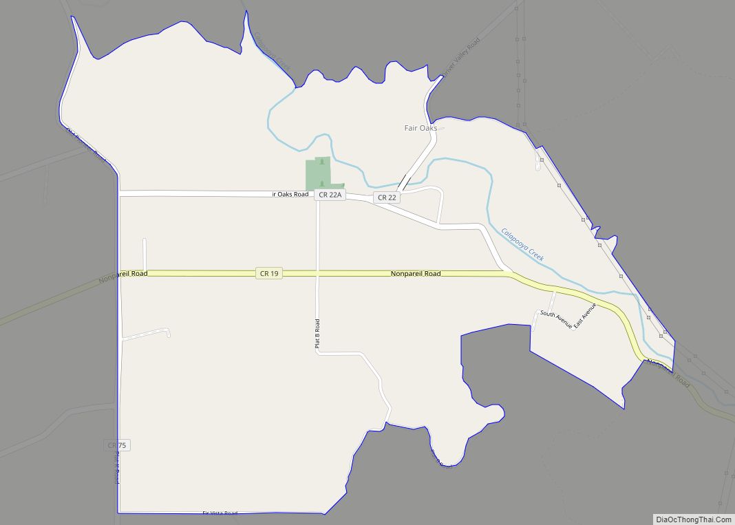
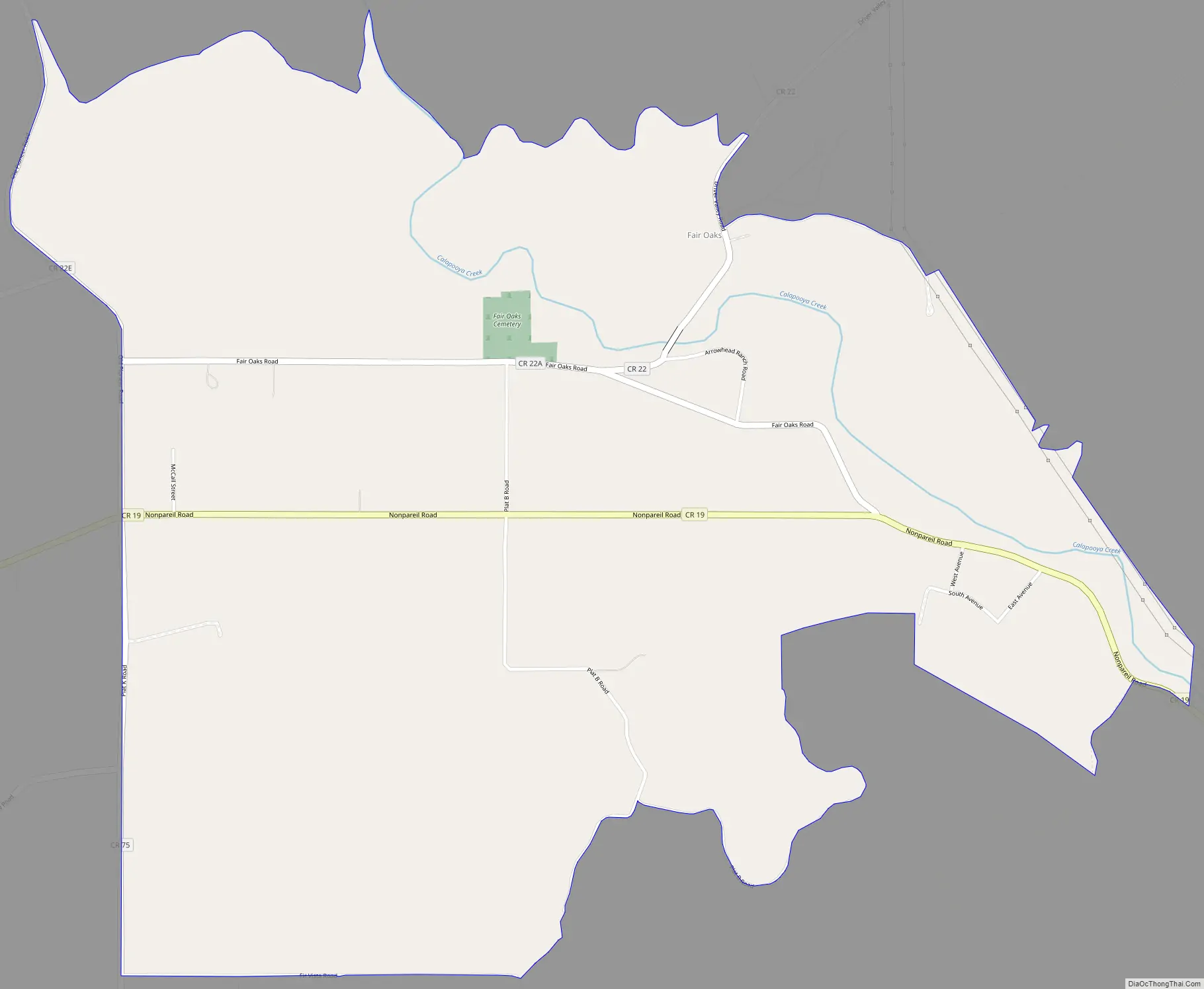
Fair Oaks is an unincorporated community and census-designated place in Douglas County, in the U.S. state of Oregon. It lies at the south end of Driver Valley and along Calapooya Creek, between Sutherlin and Nonpareil by road and upstream from Oakland along the creek. As of the 2010 census, it had a population of 278.
Fair Oaks was named for the oak trees in its vicinity. It had its own post office from 1878 through 1882, and thereafter Fair Oaks mail went via the post office at Oakland.
| Name: | Fair Oaks CDP |
|---|---|
| LSAD Code: | 57 |
| LSAD Description: | CDP (suffix) |
| State: | Oregon |
| County: | Douglas County |
| Elevation: | 633 ft (193 m) |
| Total Area: | 1.84 sq mi (4.77 km²) |
| Land Area: | 1.84 sq mi (4.77 km²) |
| Water Area: | 0.00 sq mi (0.00 km²) |
| Total Population: | 238 |
| Population Density: | 129.35/sq mi (49.95/km²) |
| Area code: | 541 |
| FIPS code: | 4124100 |
| GNISfeature ID: | 1136275 |
Online Interactive Map
Click on ![]() to view map in "full screen" mode.
to view map in "full screen" mode.
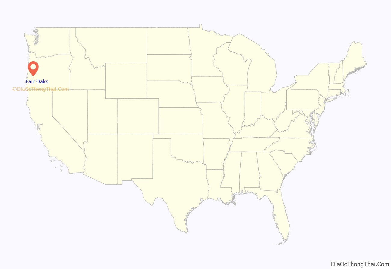
Fair Oaks location map. Where is Fair Oaks CDP?

Fair Oaks Road Map
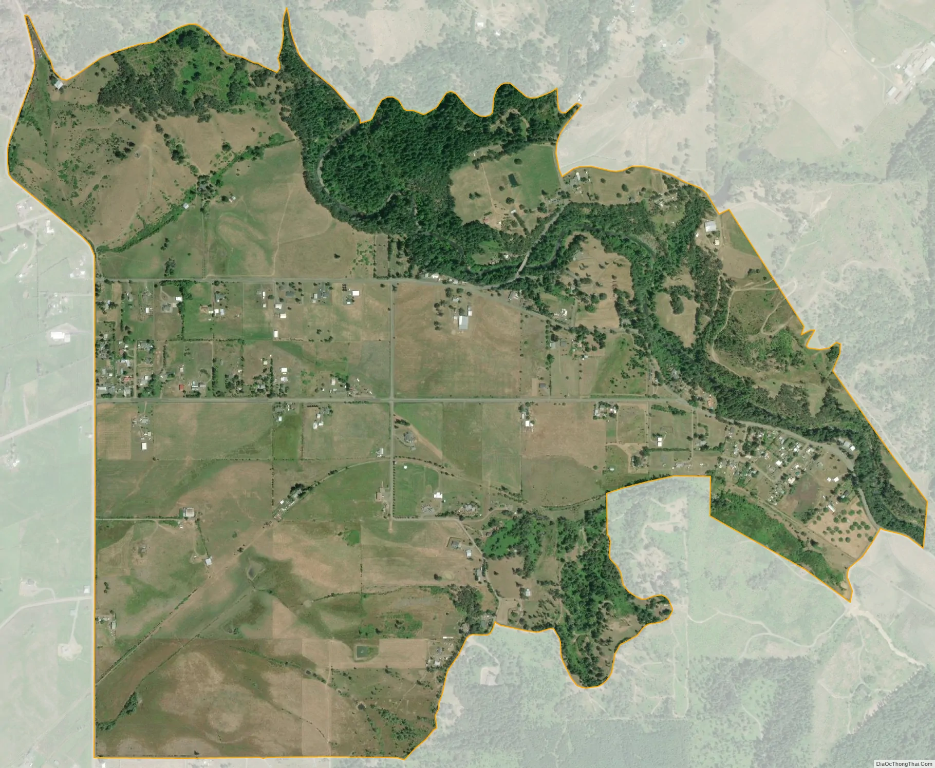
Fair Oaks city Satellite Map
See also
Map of Oregon State and its subdivision: Map of other states:- Alabama
- Alaska
- Arizona
- Arkansas
- California
- Colorado
- Connecticut
- Delaware
- District of Columbia
- Florida
- Georgia
- Hawaii
- Idaho
- Illinois
- Indiana
- Iowa
- Kansas
- Kentucky
- Louisiana
- Maine
- Maryland
- Massachusetts
- Michigan
- Minnesota
- Mississippi
- Missouri
- Montana
- Nebraska
- Nevada
- New Hampshire
- New Jersey
- New Mexico
- New York
- North Carolina
- North Dakota
- Ohio
- Oklahoma
- Oregon
- Pennsylvania
- Rhode Island
- South Carolina
- South Dakota
- Tennessee
- Texas
- Utah
- Vermont
- Virginia
- Washington
- West Virginia
- Wisconsin
- Wyoming