Hayesville is a census-designated place and unincorporated community in Marion County, Oregon, United States, just outside the city limits of Salem but within the city’s urban growth boundary. It is part of the Salem Metropolitan Statistical Area. For statistical purposes, the United States Census Bureau has defined Hayesville as a census-designated place (CDP). The census definition of the area may not precisely correspond to local understanding of the area with the same name. The population of the CDP was 21,891 at the 2020 census.
Hayesville is the home of Chemeketa Community College’s main campus.
| Name: | Hayesville CDP |
|---|---|
| LSAD Code: | 57 |
| LSAD Description: | CDP (suffix) |
| State: | Oregon |
| County: | Marion County |
| Elevation: | 184 ft (56 m) |
| Total Area: | 3.02 sq mi (7.82 km²) |
| Land Area: | 3.02 sq mi (7.82 km²) |
| Water Area: | 0.00 sq mi (0.00 km²) |
| Total Population: | 21,891 |
| Population Density: | 7,248.68/sq mi (2,798.74/km²) |
| FIPS code: | 4132850 |
| GNISfeature ID: | 1136366 |
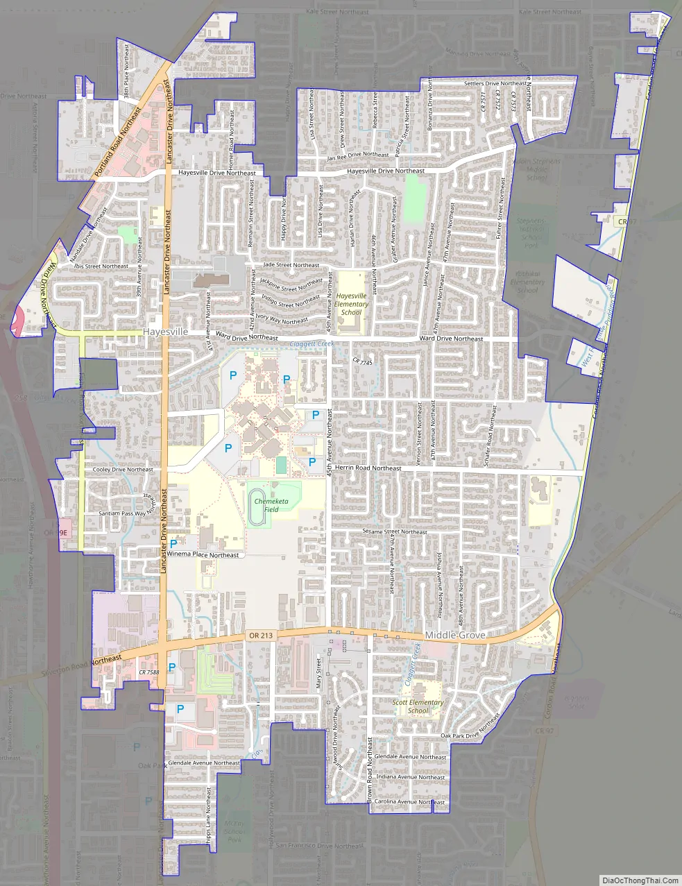
Online Interactive Map
Click on ![]() to view map in "full screen" mode.
to view map in "full screen" mode.
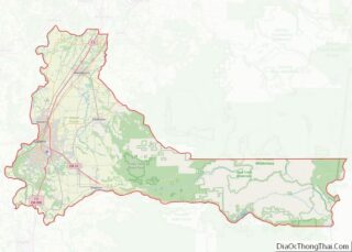
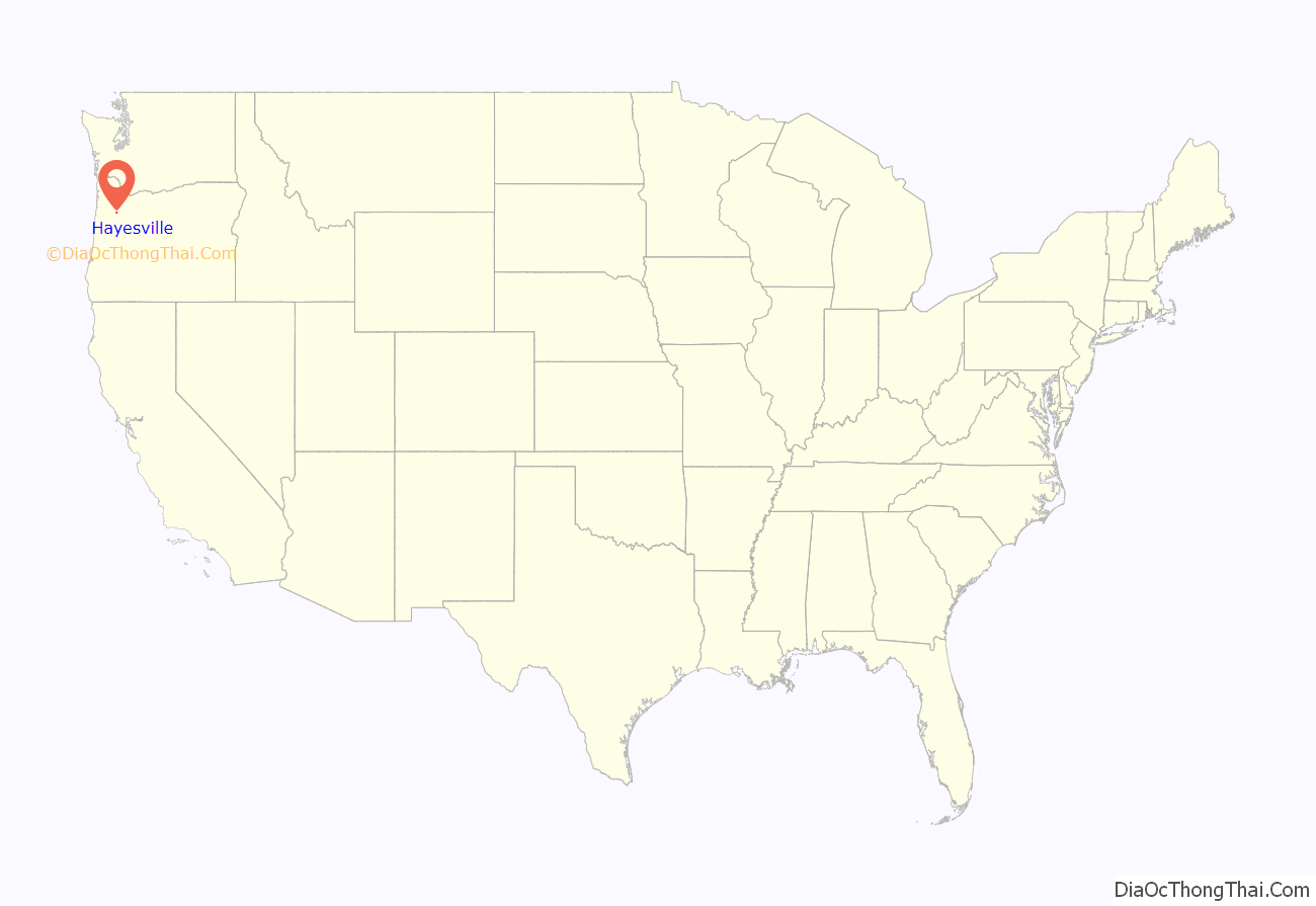
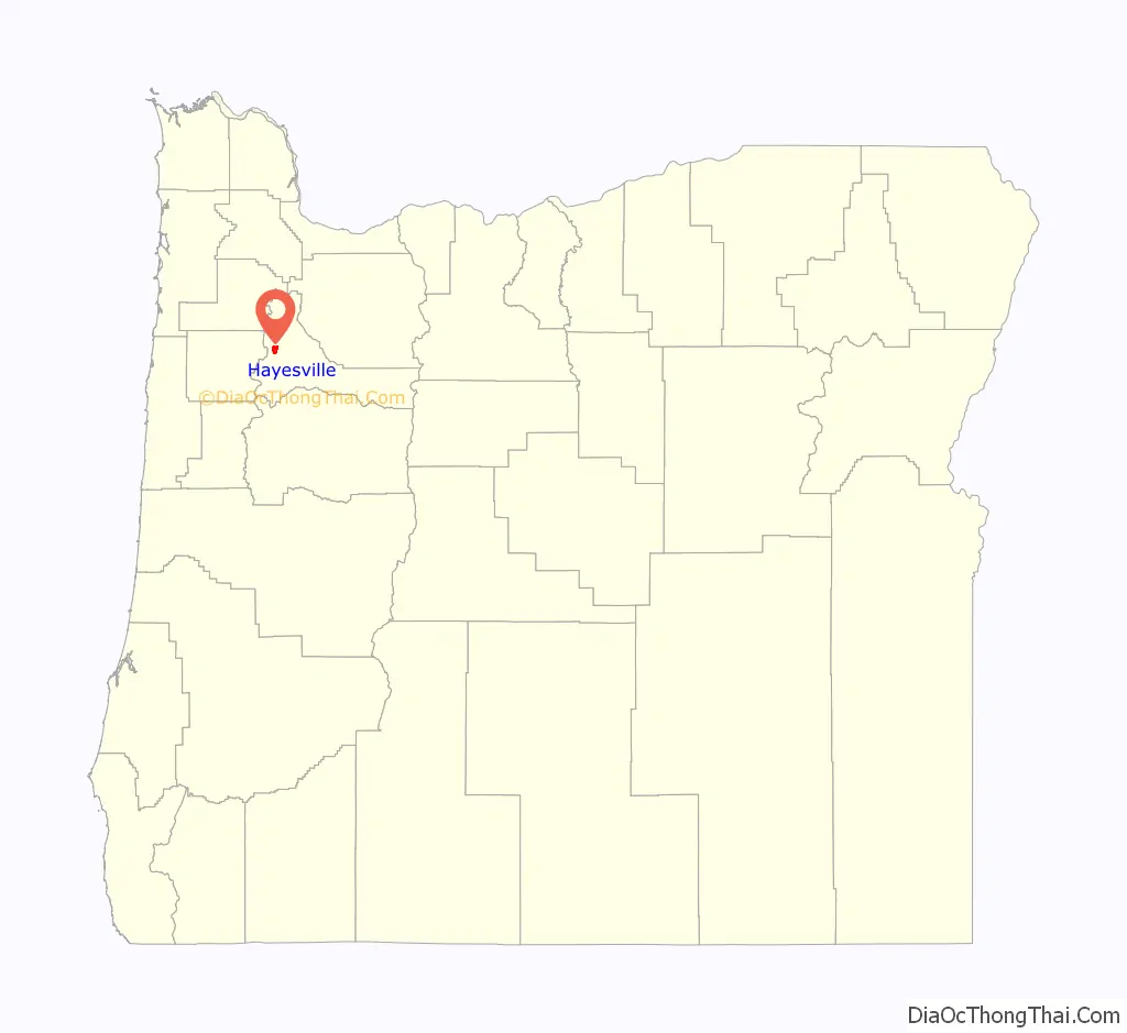
Hayesville location map. Where is Hayesville CDP?
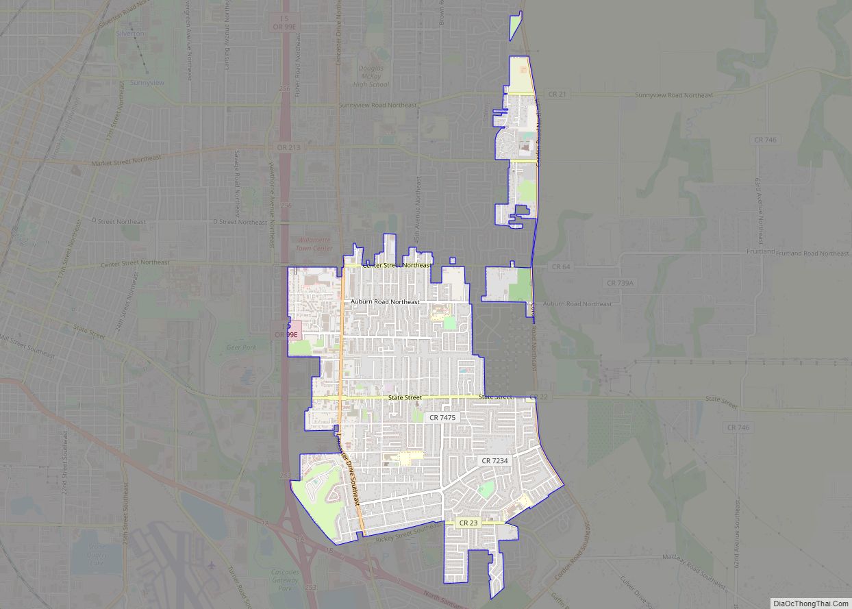
Hayesville Road Map
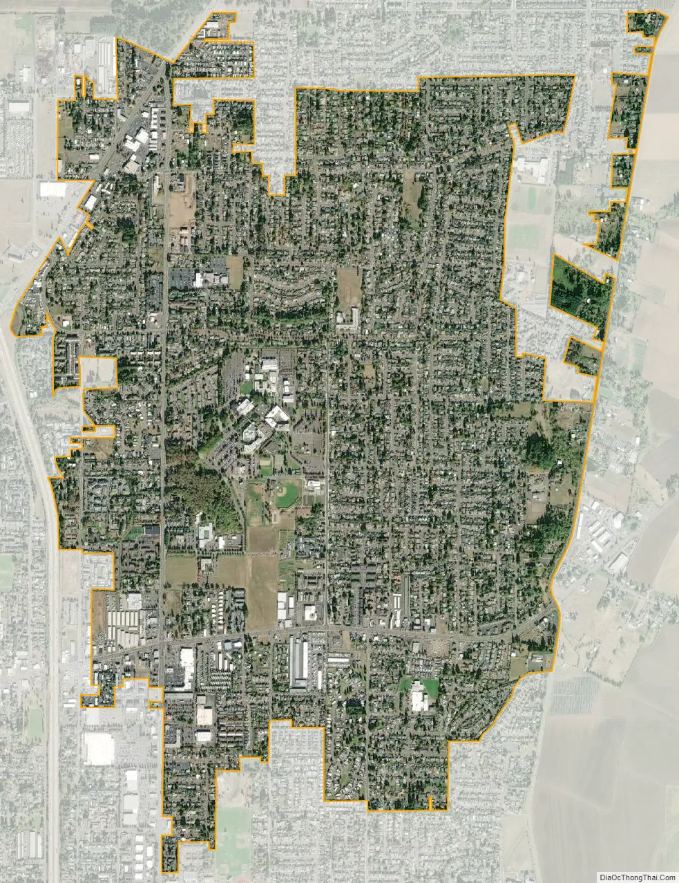
Hayesville city Satellite Map
Geography
According to the United States Census Bureau, the CDP has a total area of 3.9 square miles (10 km), all of it land.
See also
Map of Oregon State and its subdivision: Map of other states:- Alabama
- Alaska
- Arizona
- Arkansas
- California
- Colorado
- Connecticut
- Delaware
- District of Columbia
- Florida
- Georgia
- Hawaii
- Idaho
- Illinois
- Indiana
- Iowa
- Kansas
- Kentucky
- Louisiana
- Maine
- Maryland
- Massachusetts
- Michigan
- Minnesota
- Mississippi
- Missouri
- Montana
- Nebraska
- Nevada
- New Hampshire
- New Jersey
- New Mexico
- New York
- North Carolina
- North Dakota
- Ohio
- Oklahoma
- Oregon
- Pennsylvania
- Rhode Island
- South Carolina
- South Dakota
- Tennessee
- Texas
- Utah
- Vermont
- Virginia
- Washington
- West Virginia
- Wisconsin
- Wyoming