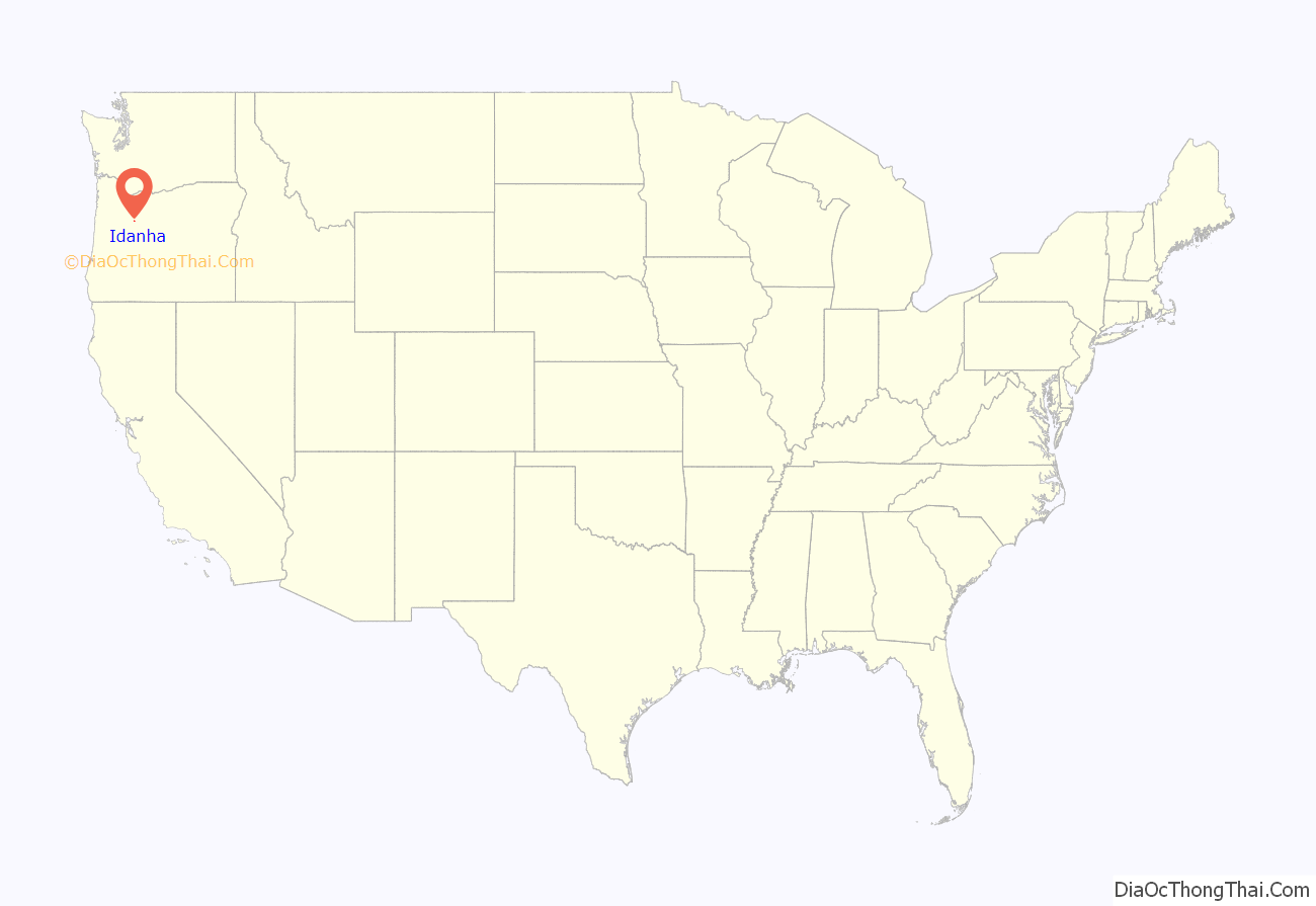
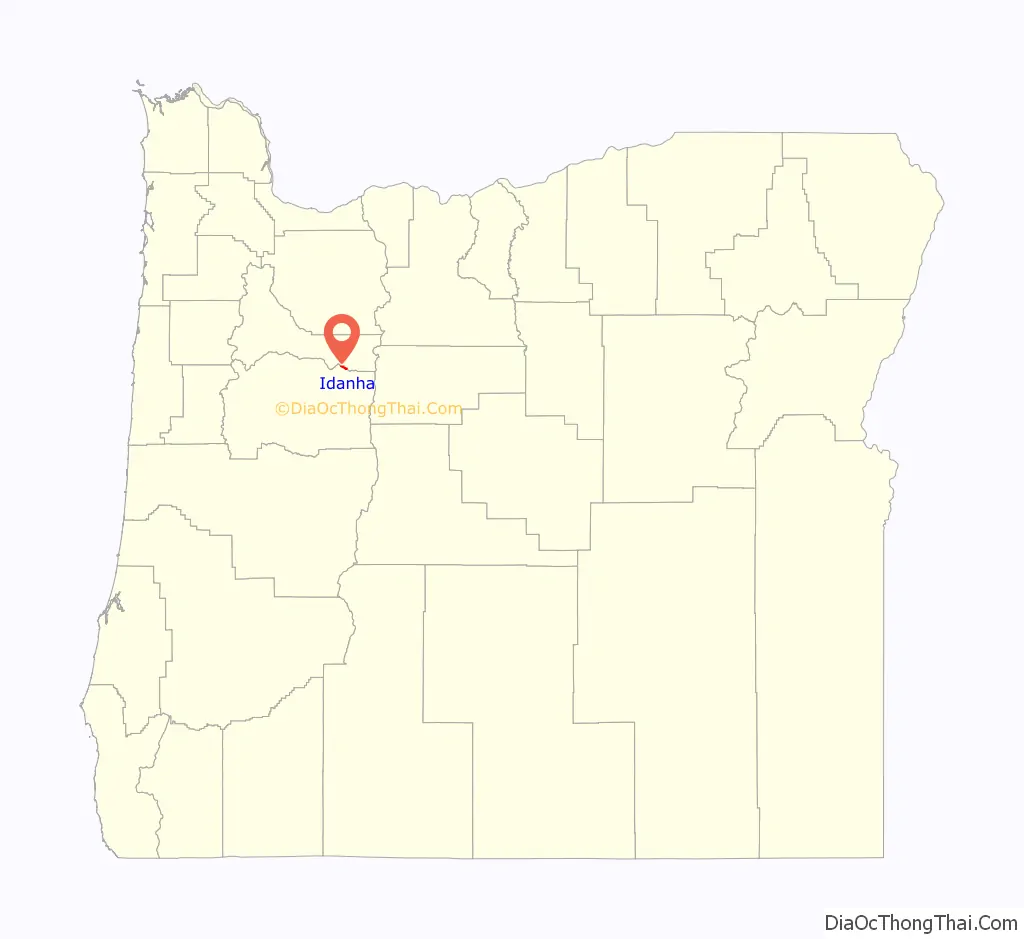
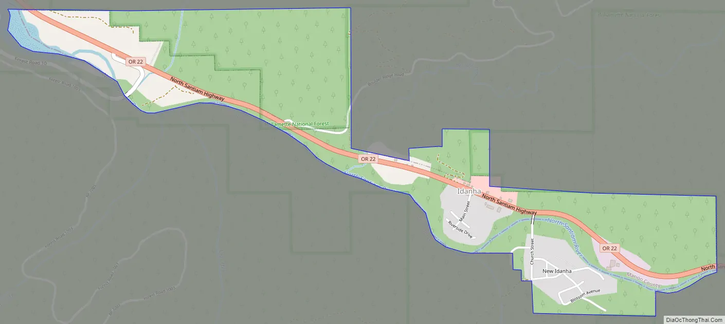
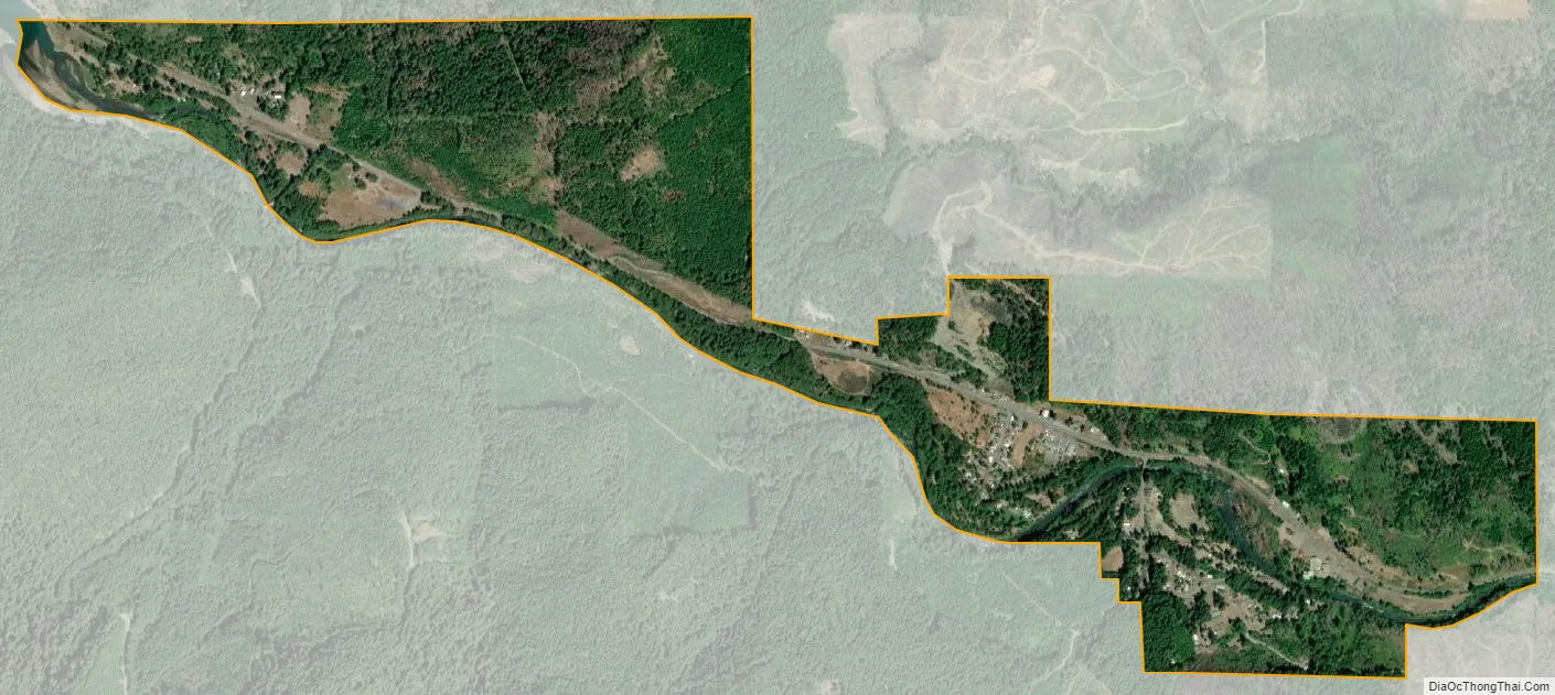
Idanha /ɪˈdænə/ is a city on the Marion County/Linn County line in Oregon, United States, on Oregon Route 22 and the Santiam River. The population was 156 at the 2020 census.
The Marion County portion of Idanha is part of the Salem Metropolitan Statistical Area, while the Linn County portion is part of the Albany–Lebanon Micropolitan Statistical Area.
| Name: | Idanha city |
|---|---|
| LSAD Code: | 25 |
| LSAD Description: | city (suffix) |
| State: | Oregon |
| County: | Linn County, Marion County |
| Incorporated: | 1949 |
| Elevation: | 1,718 ft (523.6 m) |
| Total Area: | 0.77 sq mi (2.00 km²) |
| Land Area: | 0.74 sq mi (1.92 km²) |
| Water Area: | 0.03 sq mi (0.08 km²) |
| Total Population: | 156 |
| Population Density: | 210.81/sq mi (81.44/km²) |
| ZIP code: | 97350 |
| Area code: | 503 |
| FIPS code: | 4135800 |
| GNISfeature ID: | 1143981 |
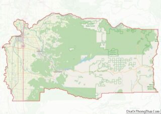
Online Interactive Map
Click on ![]() to view map in "full screen" mode.
to view map in "full screen" mode.
Idanha location map. Where is Idanha city?
Idanha Road Map
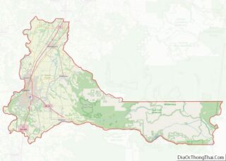
Idanha city Satellite Map
Geography
According to the United States Census Bureau, the city has a total area of 1.09 square miles (2.82 km), of which 1.06 square miles (2.75 km) is land and 0.03 square miles (0.08 km) is water.
Idanha encompasses the area of New Idanha in Linn County, which the USGS classifies as a separate populated place.
Climate
This region experiences warm and dry summers, with no average monthly temperatures above 71.6 °F (22.0 °C). According to the Köppen Climate Classification system, Idanha has a warm-summer Mediterranean climate, abbreviated “Csb” on climate maps.
See also
Map of Oregon State and its subdivision: Map of other states:- Alabama
- Alaska
- Arizona
- Arkansas
- California
- Colorado
- Connecticut
- Delaware
- District of Columbia
- Florida
- Georgia
- Hawaii
- Idaho
- Illinois
- Indiana
- Iowa
- Kansas
- Kentucky
- Louisiana
- Maine
- Maryland
- Massachusetts
- Michigan
- Minnesota
- Mississippi
- Missouri
- Montana
- Nebraska
- Nevada
- New Hampshire
- New Jersey
- New Mexico
- New York
- North Carolina
- North Dakota
- Ohio
- Oklahoma
- Oregon
- Pennsylvania
- Rhode Island
- South Carolina
- South Dakota
- Tennessee
- Texas
- Utah
- Vermont
- Virginia
- Washington
- West Virginia
- Wisconsin
- Wyoming