Mulino, Oregon is a hamlet and census-designated place (CDP) located in Clackamas County, Oregon, United States, on Oregon Route 213 between the cities of Oregon City and Molalla. As of the 2010 census it had a population of 2,103.
| Name: | Mulino CDP |
|---|---|
| LSAD Code: | 57 |
| LSAD Description: | CDP (suffix) |
| State: | Oregon |
| County: | Clackamas County |
| Elevation: | 240 ft (70 m) |
| Total Area: | 13.81 sq mi (35.76 km²) |
| Land Area: | 13.78 sq mi (35.68 km²) |
| Water Area: | 0.03 sq mi (0.09 km²) |
| Total Population: | 2,250 |
| Population Density: | 163.34/sq mi (63.06/km²) |
| ZIP code: | 97042 |
| FIPS code: | 4150450 |
| GNISfeature ID: | 1124527 |
| Website: | www.hamletofmulino.us// |
Online Interactive Map
Click on ![]() to view map in "full screen" mode.
to view map in "full screen" mode.
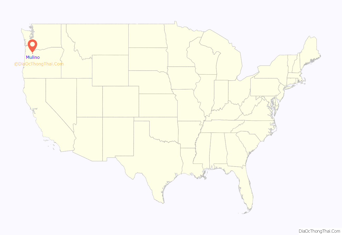
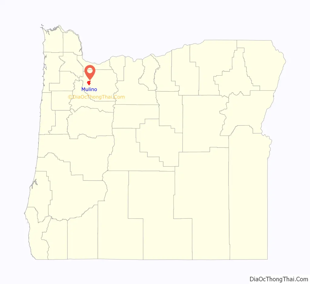
Mulino location map. Where is Mulino CDP?
History
The community was named after a flour mill erected there in 1851, when the community was known as “Howards Mill.” “Mulino” is a corruption of the Spanish word molino, or mill, and was chosen for the name when postal authorities objected that “Molino” was easily confused with nearby Molalla. The Mulino post office was established in 1882.
As of 2007, the mill building, remodeled into a private residence, still stands. According to a plaque given by the National Register of Historic Places, it is the oldest industrial building to remain standing in Oregon and the oldest building to serve continuously as the local post office. The mill, listed as Howard’s Gristmill, was added to the National Register of Historic Places in 1981.
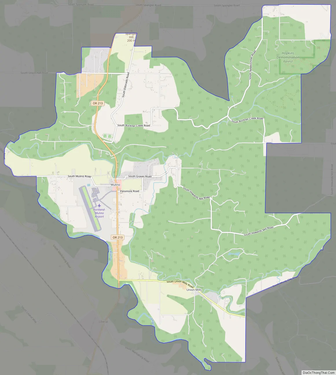
Mulino Road Map
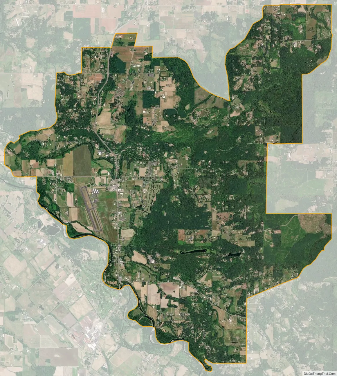
Mulino city Satellite Map
See also
Map of Oregon State and its subdivision: Map of other states:- Alabama
- Alaska
- Arizona
- Arkansas
- California
- Colorado
- Connecticut
- Delaware
- District of Columbia
- Florida
- Georgia
- Hawaii
- Idaho
- Illinois
- Indiana
- Iowa
- Kansas
- Kentucky
- Louisiana
- Maine
- Maryland
- Massachusetts
- Michigan
- Minnesota
- Mississippi
- Missouri
- Montana
- Nebraska
- Nevada
- New Hampshire
- New Jersey
- New Mexico
- New York
- North Carolina
- North Dakota
- Ohio
- Oklahoma
- Oregon
- Pennsylvania
- Rhode Island
- South Carolina
- South Dakota
- Tennessee
- Texas
- Utah
- Vermont
- Virginia
- Washington
- West Virginia
- Wisconsin
- Wyoming