Oakland is a city in Douglas County, Oregon, United States, located 2 miles (3 km) from Interstate 5. The population was 927 at the 2010 census.
| Name: | Oakland city |
|---|---|
| LSAD Code: | 25 |
| LSAD Description: | city (suffix) |
| State: | Oregon |
| County: | Douglas County |
| Incorporated: | 1878 |
| Elevation: | 456 ft (139 m) |
| Total Area: | 0.73 sq mi (1.89 km²) |
| Land Area: | 0.73 sq mi (1.89 km²) |
| Water Area: | 0.00 sq mi (0.00 km²) |
| Total Population: | 934 |
| Population Density: | 1,279.45/sq mi (493.67/km²) |
| ZIP code: | 97462 |
| Area code: | 541 |
| FIPS code: | 4154000 |
| GNISfeature ID: | 2411293 |
| Website: | www.oaklandoregon.org |
Online Interactive Map
Click on ![]() to view map in "full screen" mode.
to view map in "full screen" mode.
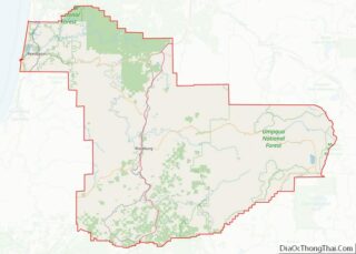
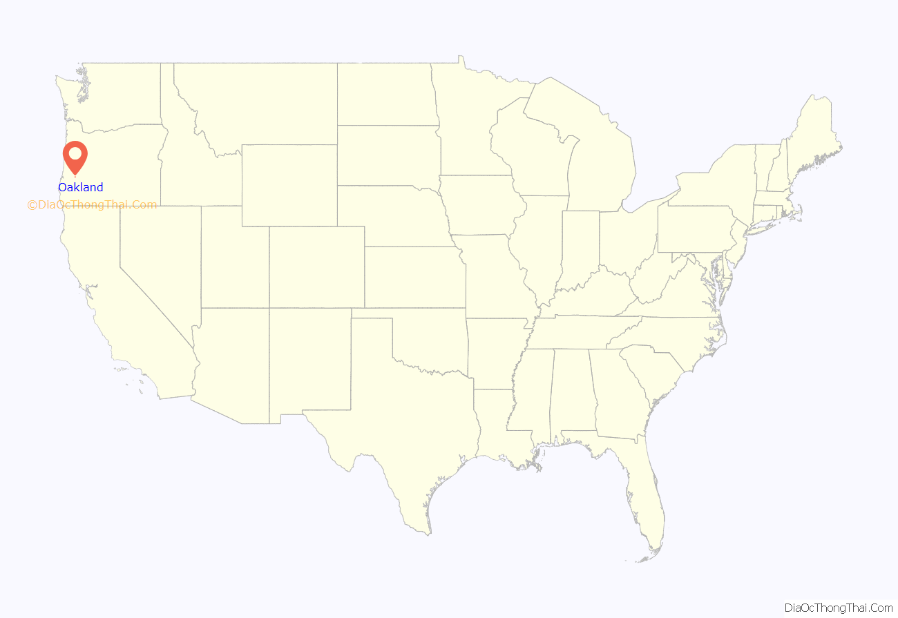
Oakland location map. Where is Oakland city?
History
Oakland was the first city to be placed on the state’s historic register, in May 1968. The city’s two-block business district consists of the original brick buildings built in the 1880s and 1890s. Stearns Hardware has been in operation since 1887, which has occupied the Stearns Hardware Building since it was built in 1891. Over 80 properties in the city were constructed between 1852 and 1890. The Oakland Historic District was listed on the National Register of Historic Places in March 1979.
Several films have been shot in Oakland, including Fire in the Sky, Didi’s Last Wish, and Grand Tour: Disaster in Time.
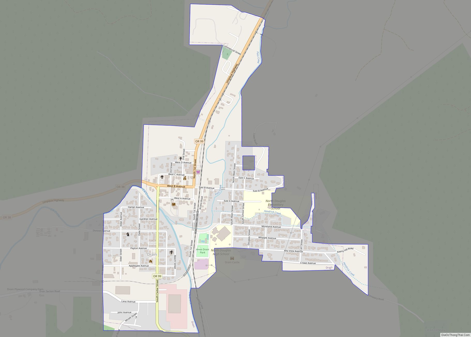
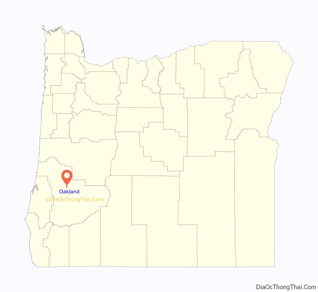
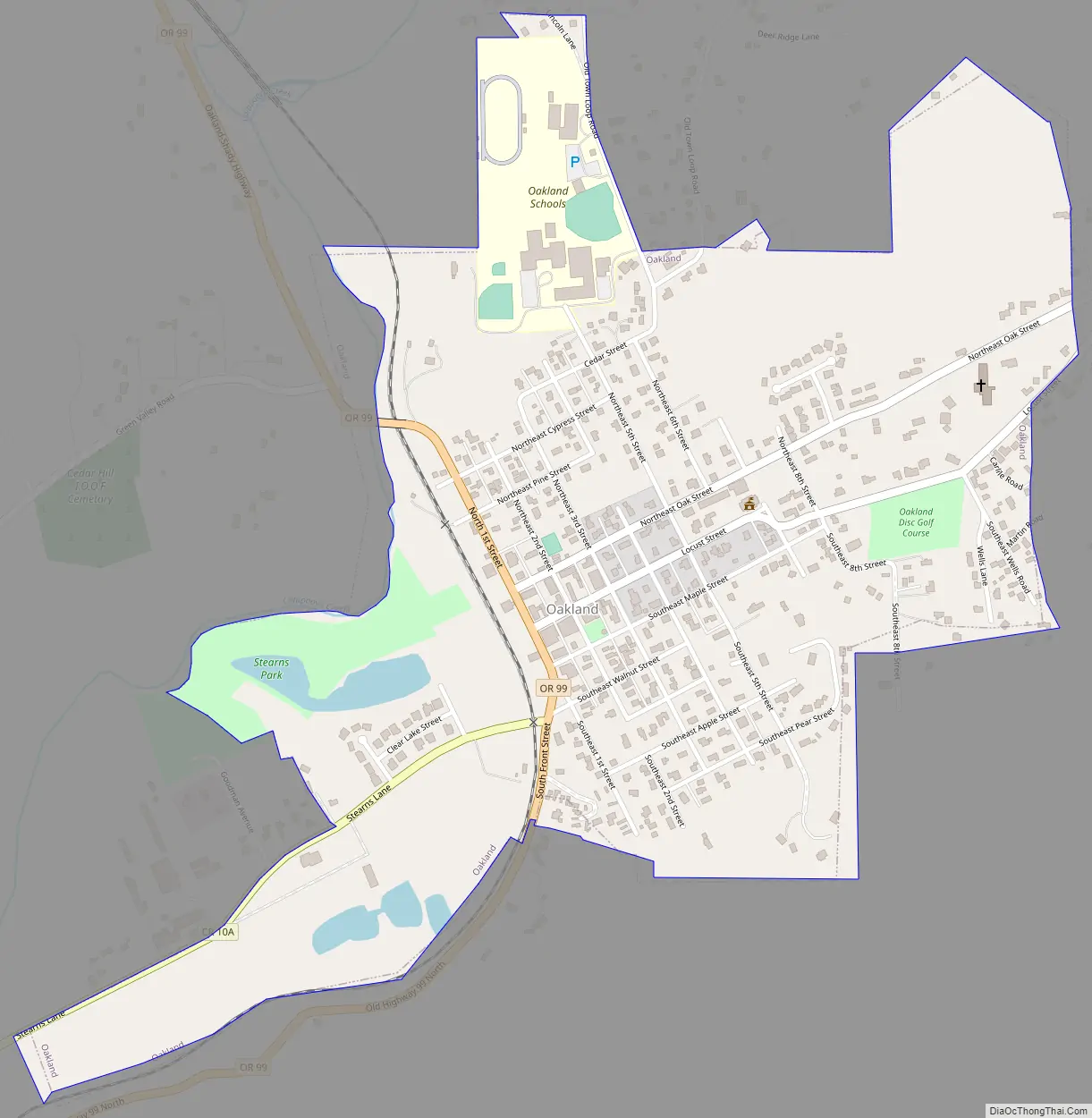
Oakland Road Map
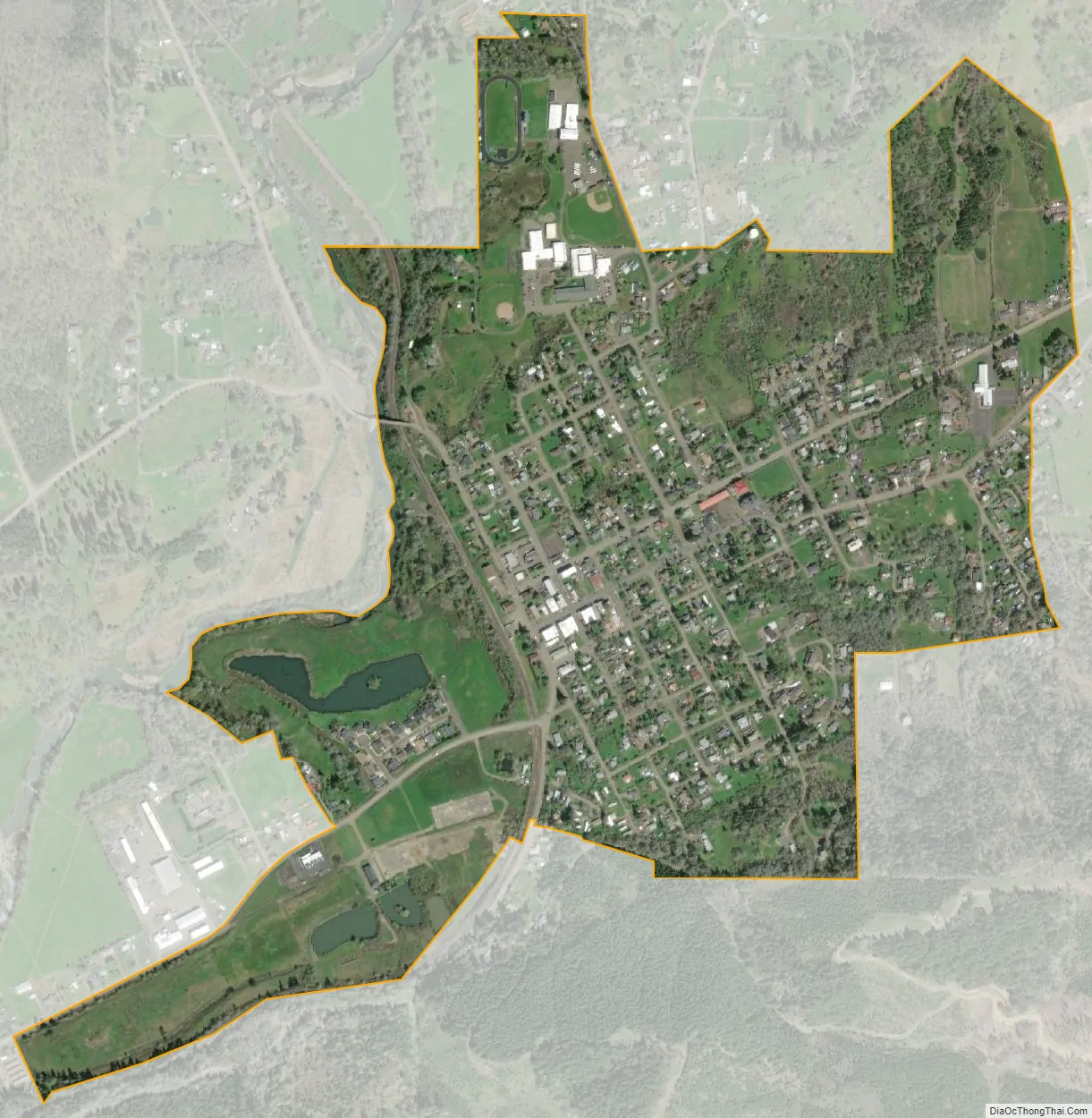
Oakland city Satellite Map
Geography
According to the United States Census Bureau, the city has a total area of 0.73 square miles (1.89 km), all of it land. Calapooya Creek, a tributary of the Umpqua River, flows by Oakland.
Climate
This region experiences warm (but not hot) and dry summers, with no average monthly temperatures above 71.6 °F (22.0 °C). According to the Köppen Climate Classification system, Oakland has a warm-summer Mediterranean climate, abbreviated “Csb” on climate maps.
See also
Map of Oregon State and its subdivision: Map of other states:- Alabama
- Alaska
- Arizona
- Arkansas
- California
- Colorado
- Connecticut
- Delaware
- District of Columbia
- Florida
- Georgia
- Hawaii
- Idaho
- Illinois
- Indiana
- Iowa
- Kansas
- Kentucky
- Louisiana
- Maine
- Maryland
- Massachusetts
- Michigan
- Minnesota
- Mississippi
- Missouri
- Montana
- Nebraska
- Nevada
- New Hampshire
- New Jersey
- New Mexico
- New York
- North Carolina
- North Dakota
- Ohio
- Oklahoma
- Oregon
- Pennsylvania
- Rhode Island
- South Carolina
- South Dakota
- Tennessee
- Texas
- Utah
- Vermont
- Virginia
- Washington
- West Virginia
- Wisconsin
- Wyoming