Stayton is a city in Marion County, Oregon, United States, located 12 miles (19 km) southeast of the state capital, Salem, on Oregon Route 22. It is south of Sublimity and east of Aumsville. Located on the North Santiam River, Stayton is a regional agricultural and light manufacturing center. The population was 8,244 at the 2020 census. Established in 1872, it was incorporated in 1891. Stayton is part of the Salem Metropolitan Statistical Area.
| Name: | Stayton city |
|---|---|
| LSAD Code: | 25 |
| LSAD Description: | city (suffix) |
| State: | Oregon |
| County: | Marion County |
| Incorporated: | 1891 |
| Elevation: | 452 ft (137.8 m) |
| Total Area: | 3.11 sq mi (8.05 km²) |
| Land Area: | 3.09 sq mi (8.01 km²) |
| Water Area: | 0.01 sq mi (0.04 km²) |
| Total Population: | 8,244 |
| Population Density: | 2,666.24/sq mi (1,029.32/km²) |
| ZIP code: | 97383 |
| Area code: | 503 and 971 |
| FIPS code: | 4170200 |
| GNISfeature ID: | 1127552 |
| Website: | www.staytonoregon.gov |
Online Interactive Map
Click on ![]() to view map in "full screen" mode.
to view map in "full screen" mode.
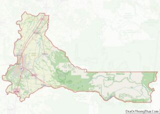
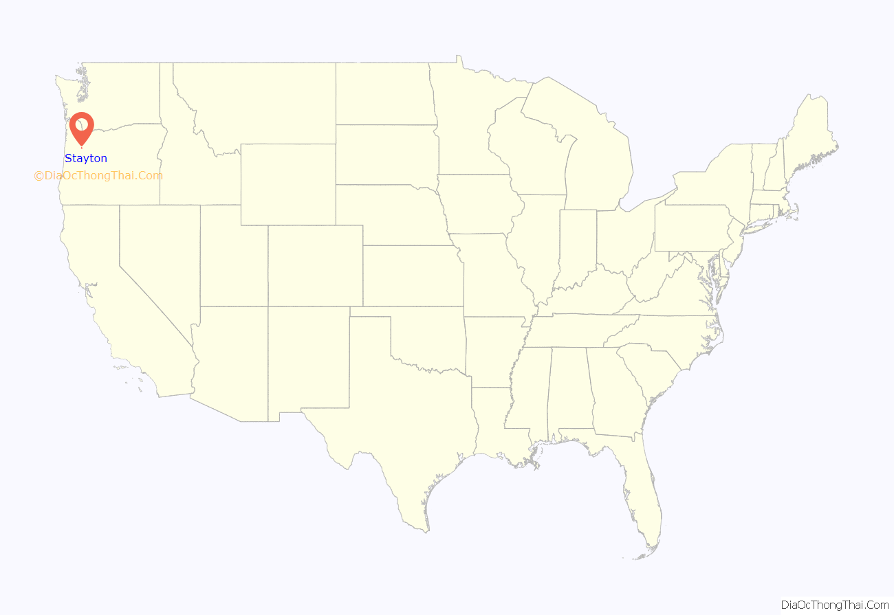
Stayton location map. Where is Stayton city?
History
Stayton was founded by Drury Smith Stayton, who purchased the town site in 1866 and built a carding mill and sawmill on a watercourse of the North Santiam River. In 1872, he platted the town site, and that same year the community received a post office. A ferry crossing of the Santiam River operated from 1876 until a bridge was constructed in 1888. By 1880, a laundry had been established by Kee Sing and Tom. The first newspaper, The Stayton Sun, was published in 1889 by T. H. McGill.
The founder of Stayton, Drury Stayton, originally wanted to name the city after his daughter, Florence Stayton. After his petition was denied by the post office because another city in Oregon was named Florence, he chose Stayton and named a street after his daughter. The city was incorporated as the Town of Stayton in 1891 after a failed attempt in 1884.
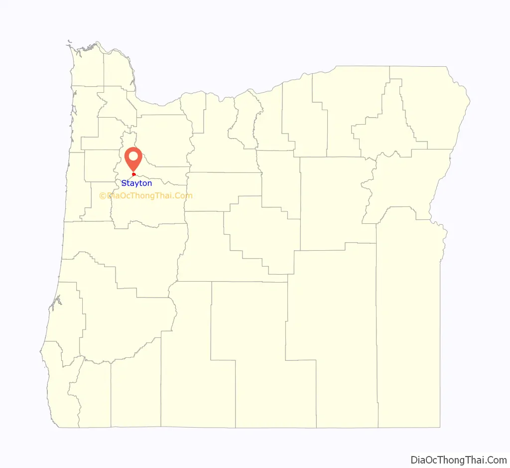
Stayton Road Map
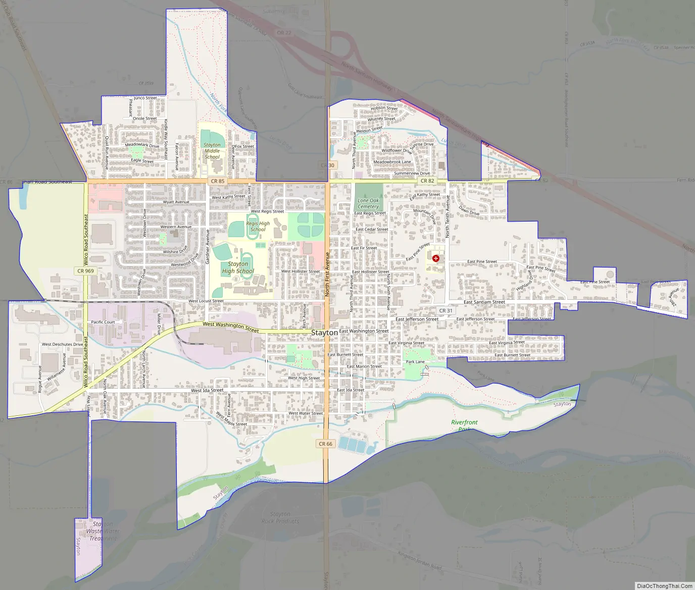
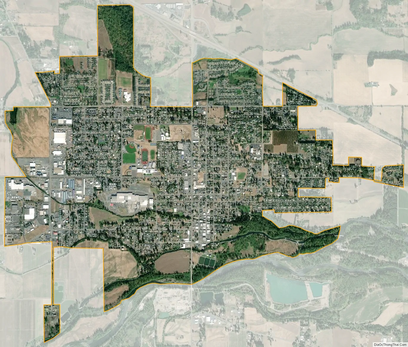
Stayton city Satellite Map
Geography
According to the United States Census Bureau, the city has a total area of 2.86 square miles (7.41 km), of which, 2.84 square miles (7.36 km) is land and 0.02 square miles (0.05 km) is water.
Climate
Stayton experiences a temperate climate that is usually described as oceanic with mild, damp winters and relatively dry, warm summers, like most of the Pacific Northwest.
Summers in Stayton are warm and relatively sunny but can, on occasion, be wet. The warmest month is August with a daytime average of 80.8 °F (27.1 °C) and an average low of 51 °F (10.6 °C). Because of its inland location, Stayton can experience heat waves, in July and August particularly, with air temperatures sometimes rising over 90 °F (32 °C).
Winters are described as somewhat mild and very wet. Cold snaps can occur and last for several days, and snowfall occurs a few times throughout the winter season; the city has been known to see major snow and ice storms. Spring can bring rather unpredictable weather, resulting from brief warm spells, to thunderstorms rolling off the Cascade Range.
The lowest temperature ever recorded in Stayton was −7 °F (−22 °C), on December 8, 1972. According to the Köppen Climate Classification system, Stayton has a warm-summer Mediterranean climate, abbreviated “Csb” on climate maps.
See also
Map of Oregon State and its subdivision: Map of other states:- Alabama
- Alaska
- Arizona
- Arkansas
- California
- Colorado
- Connecticut
- Delaware
- District of Columbia
- Florida
- Georgia
- Hawaii
- Idaho
- Illinois
- Indiana
- Iowa
- Kansas
- Kentucky
- Louisiana
- Maine
- Maryland
- Massachusetts
- Michigan
- Minnesota
- Mississippi
- Missouri
- Montana
- Nebraska
- Nevada
- New Hampshire
- New Jersey
- New Mexico
- New York
- North Carolina
- North Dakota
- Ohio
- Oklahoma
- Oregon
- Pennsylvania
- Rhode Island
- South Carolina
- South Dakota
- Tennessee
- Texas
- Utah
- Vermont
- Virginia
- Washington
- West Virginia
- Wisconsin
- Wyoming