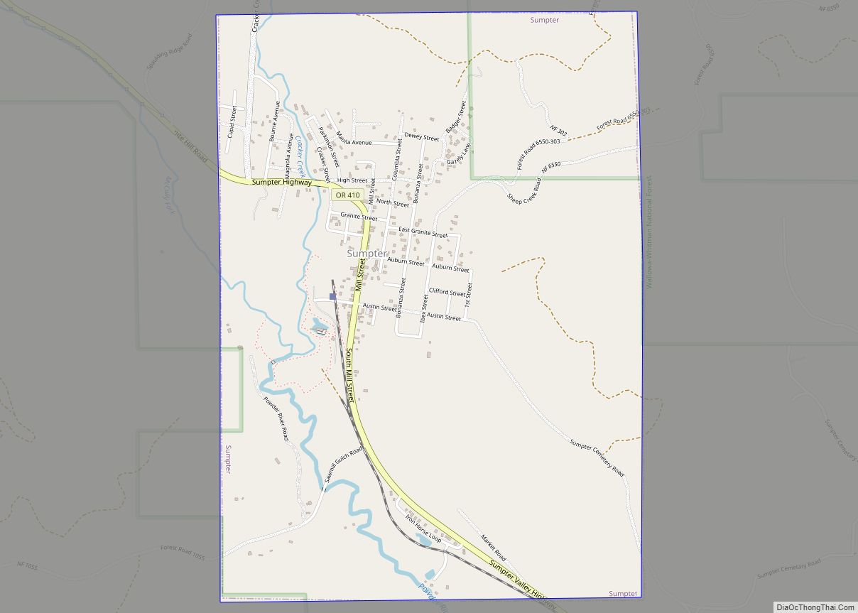
Sumpter is a city in Baker County, Oregon, United States. The population was 204 at the 2010 census. Sumpter is named after Fort Sumter by its founders. The name was inspired by a rock as smooth and round as a cannonball, which reminded a local resident of the American Civil War and Fort Sumter.
| Name: | Sumpter city |
|---|---|
| LSAD Code: | 25 |
| LSAD Description: | city (suffix) |
| State: | Oregon |
| County: | Baker County |
| Incorporated: | 1898 |
| Elevation: | 4,429 ft (1,350 m) |
| Total Area: | 2.18 sq mi (5.65 km²) |
| Land Area: | 2.18 sq mi (5.65 km²) |
| Water Area: | 0.00 sq mi (0.00 km²) |
| Total Population: | 204 |
| Population Density: | 93.49/sq mi (36.10/km²) |
| ZIP code: | 97877 |
| Area code: | 458 and 541 |
| FIPS code: | 4171000 |
| GNISfeature ID: | 1150647 |
| Website: | www.historicsumpter.com |
Online Interactive Map
Click on ![]() to view map in "full screen" mode.
to view map in "full screen" mode.
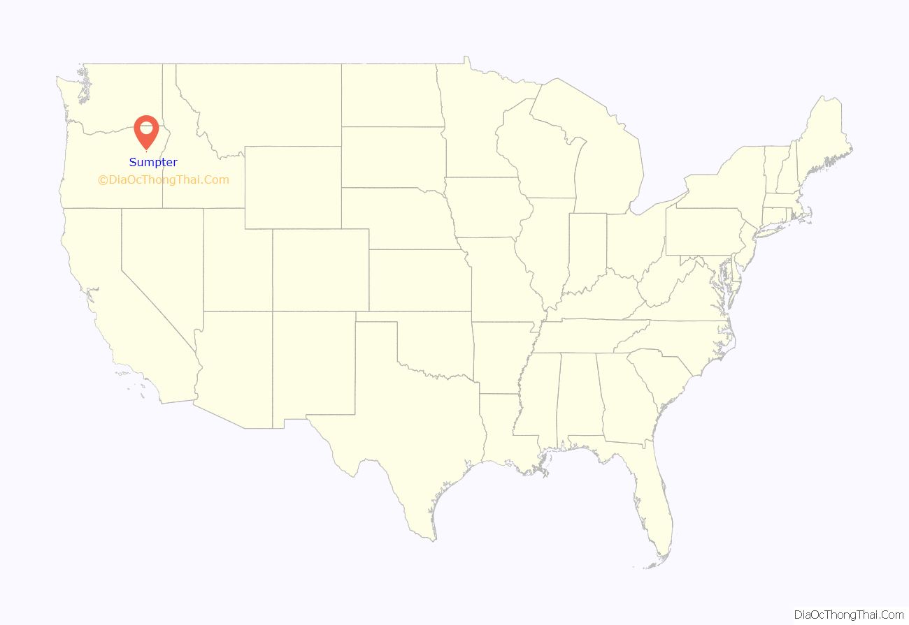
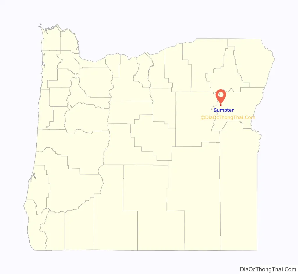
Sumpter location map. Where is Sumpter city?
History
The community was platted in 1889, becoming a mining boom town about 10 years later. Until transportation by rail became feasible in the area, Sumpter was little more than “a huddle of crude log cabins.”
A narrow gauge railway reached Sumpter in 1897. Built by David C. Eccles, the Sumpter Valley Railway (SVRy) ran 80 miles (130 km) from Baker City through Sumpter and on to Prairie City, which it reached in 1907. Until the line shut down in the 1930s, ranchers, mining interests, and timber companies used it to move freight.
Shortly after the SVRy arrived, the city expanded near a set of deep-shaft gold mines with a combined total of 12 miles (19 km) of tunnels. The population grew to more than 2,000. Sumpter had electric lights, churches, saloons, a brewery, sidewalks, three newspapers, and an opera house. However, as the mines played out, the city declined even before a devastating fire in 1917.
Dynamite was used to help put out the fire, which destroyed 12 blocks of the town’s buildings. A few of the surviving structures remain in the 21st century and are occupied by retail shops.
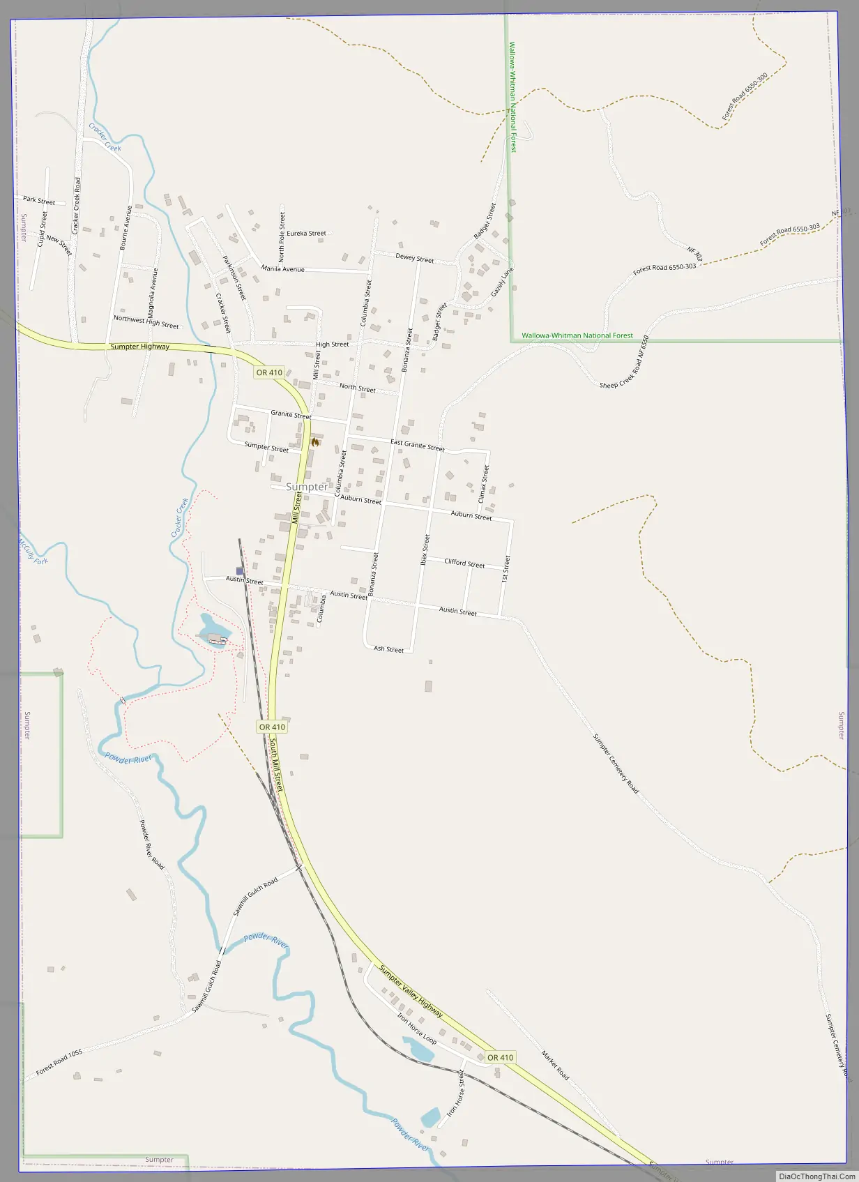
Sumpter Road Map
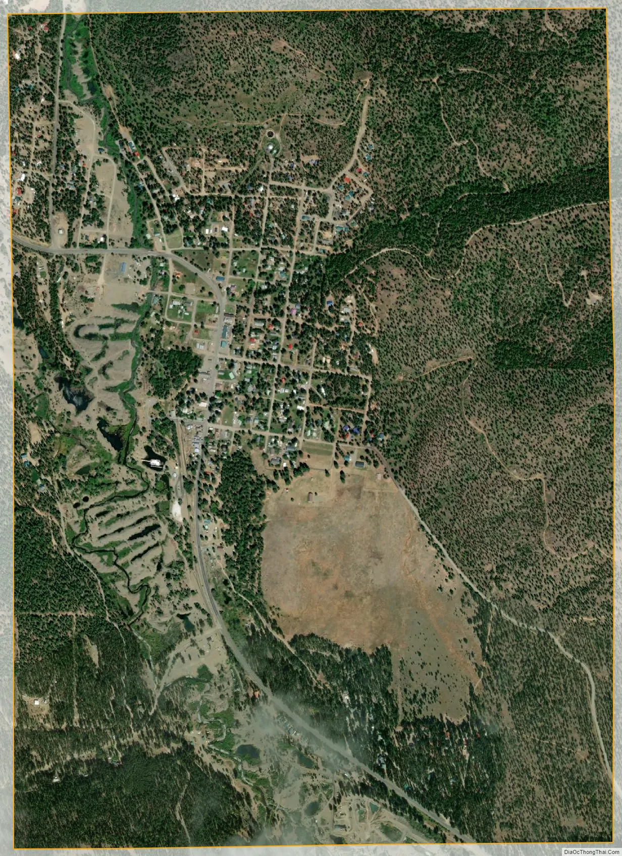
Sumpter city Satellite Map
Geography
Sumpter, about 4,400 feet (1,300 m) above sea level, is near the Wallowa–Whitman National Forest, the Blue Mountains, and a subrange of the Blue Mountains, the Elkhorn Mountains. McCully Fork and Cracker Creek meet to form the Powder River near Sumpter. According to the United States Census Bureau, the city has a total area of 2.18 square miles (5.65 km), all land.
Sumpter is along Oregon Route 410, also known as the Sumpter Highway. By highway, the city is 26 miles (42 km) from Baker City, 31 miles (50 km) from Interstate 84, and 333 miles (536 km) from Portland. A 106-mile (171 km) loop drive known as the Elkhorn Scenic Byway passes through Sumpter, connecting to Oregon Route 7 at its intersection with Route 410.
Climate
This climatic region is typified by large seasonal temperature differences, with warm to hot (and often humid) summers and cold (sometimes severely cold) winters. According to the Köppen Climate Classification system, Sumpter has a humid continental climate, abbreviated “Dfb” on climate maps.
See also
Map of Oregon State and its subdivision: Map of other states:- Alabama
- Alaska
- Arizona
- Arkansas
- California
- Colorado
- Connecticut
- Delaware
- District of Columbia
- Florida
- Georgia
- Hawaii
- Idaho
- Illinois
- Indiana
- Iowa
- Kansas
- Kentucky
- Louisiana
- Maine
- Maryland
- Massachusetts
- Michigan
- Minnesota
- Mississippi
- Missouri
- Montana
- Nebraska
- Nevada
- New Hampshire
- New Jersey
- New Mexico
- New York
- North Carolina
- North Dakota
- Ohio
- Oklahoma
- Oregon
- Pennsylvania
- Rhode Island
- South Carolina
- South Dakota
- Tennessee
- Texas
- Utah
- Vermont
- Virginia
- Washington
- West Virginia
- Wisconsin
- Wyoming