Tumalo (/ˈtʌməloʊ/ TUM-ə-loh) is an unincorporated community and census-designated place (CDP) in Deschutes County, Oregon, United States. As of the 2010 census it had a population of 488. In the Klamath language, tumolo means “wild plum,” a plentiful shrub in south central Oregon. Tumola means “ground fog,” which may have described Tumalo Creek. Tumallowa, the original name of Tumalo Creek, means “icy water.”
| Name: | Tumalo CDP |
|---|---|
| LSAD Code: | 57 |
| LSAD Description: | CDP (suffix) |
| State: | Oregon |
| County: | Deschutes County |
| Elevation: | 3,189 ft (972 m) |
| Total Area: | 1.71 sq mi (4.42 km²) |
| Land Area: | 1.71 sq mi (4.42 km²) |
| Water Area: | 0.00 sq mi (0.00 km²) |
| Total Population: | 558 |
| Population Density: | 326.89/sq mi (126.25/km²) |
| ZIP code: | 97703 |
| FIPS code: | 4175050 |
| GNISfeature ID: | 1166071 |
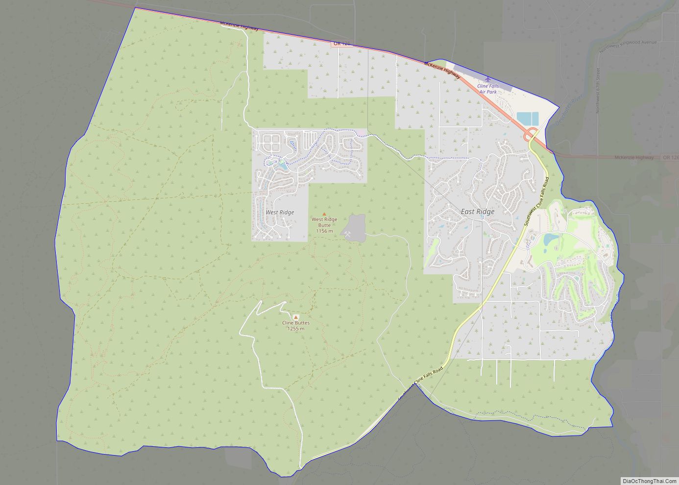
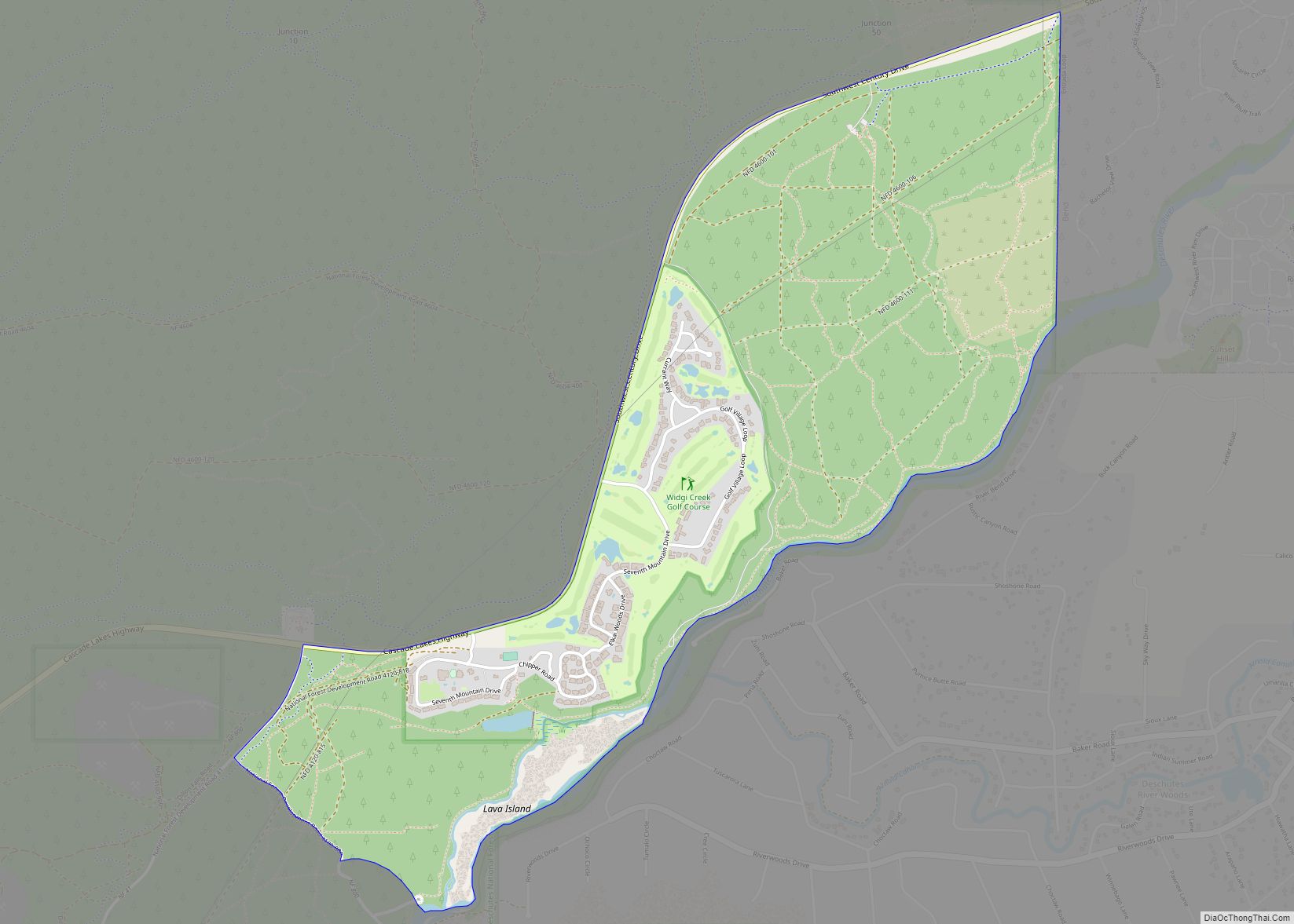
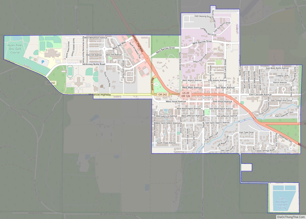
Online Interactive Map
Click on ![]() to view map in "full screen" mode.
to view map in "full screen" mode.
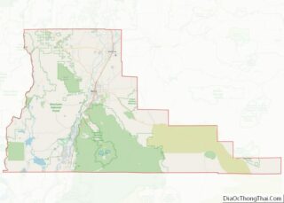
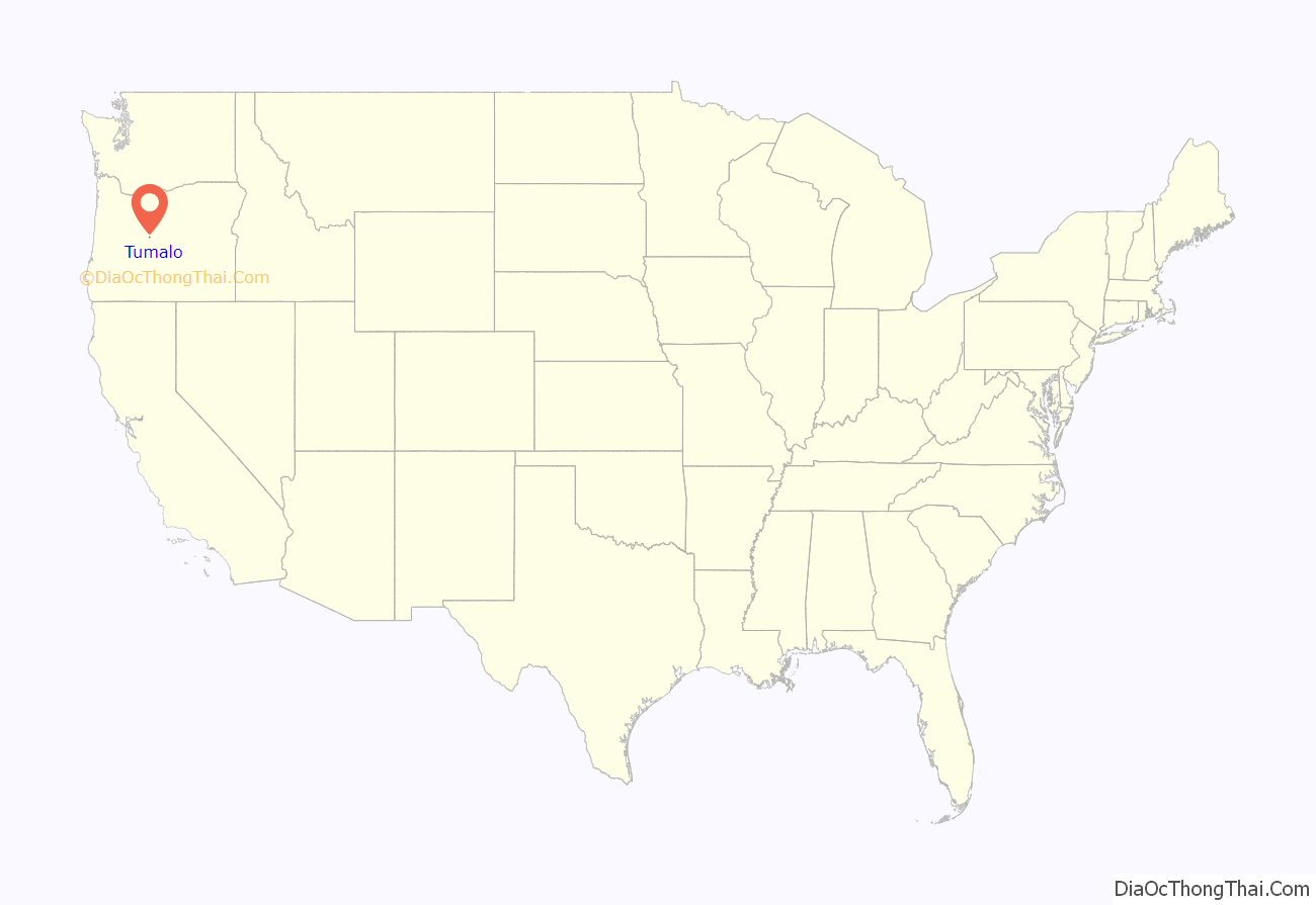
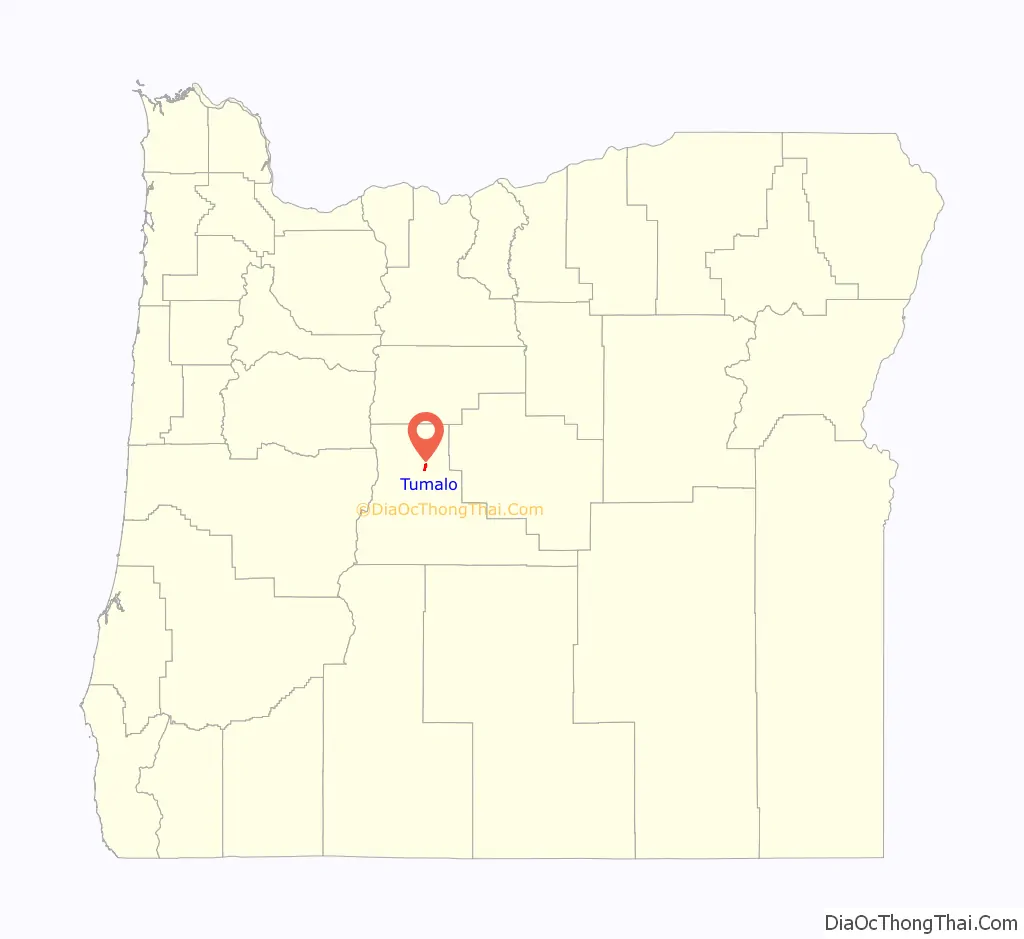
Tumalo location map. Where is Tumalo CDP?
History
The town was originally called “Laidlaw”, after W. A. Laidlaw, the town promoter. The Tumalo Irrigation Project and Tumalo post office had been established in 1904. Although the project ended and the Tumalo post office closed in 1913, by 1915 residents of Laidlaw changed the town name to “Tumalo”.
Due to population growth in the Bend area a new zip code was added effective July 1, 2015. The new zip code, 97703, changed the zip code of Tumalo from 97701 to 97703.
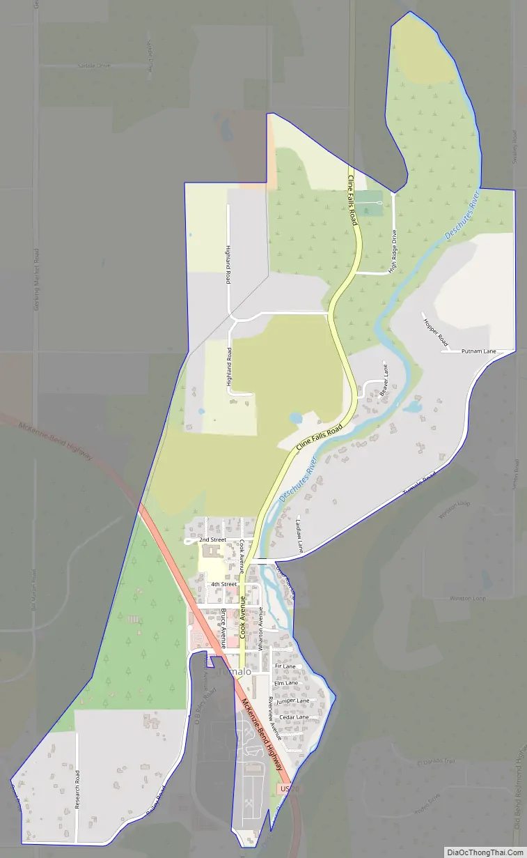
Tumalo Road Map
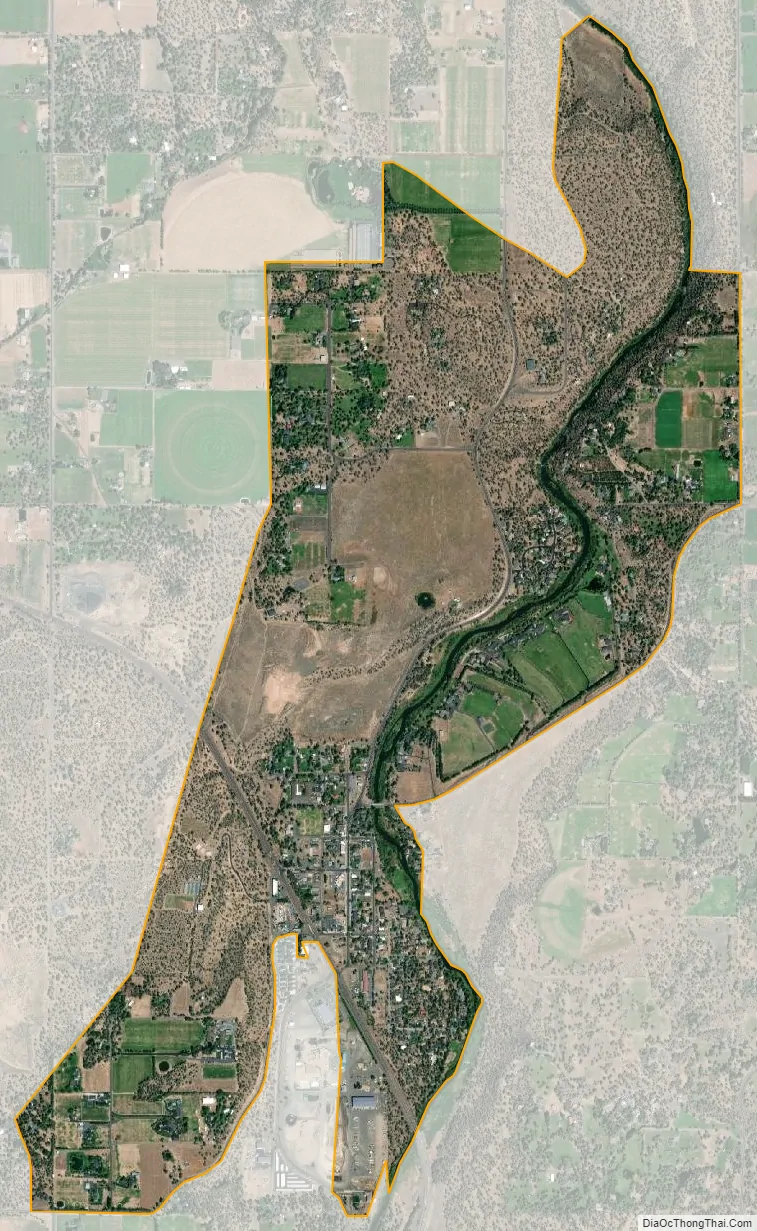
Tumalo city Satellite Map
Geography
Tumalo is in north-central Deschutes County on U.S. Route 20 between Sisters, 15 miles (24 km) to the northwest, and Bend, the county seat 7 miles (11 km) to the south. Eagle Crest Resort is 9 miles (14 km) to the northeast.
According to the U.S. Census Bureau, Tumalo has an area of 1.7 square miles (4.4 km), all of it land. The town lies along the Deschutes River. Tumalo Creek joins the Deschutes 3 miles (5 km) south of the town.
See also
Map of Oregon State and its subdivision: Map of other states:- Alabama
- Alaska
- Arizona
- Arkansas
- California
- Colorado
- Connecticut
- Delaware
- District of Columbia
- Florida
- Georgia
- Hawaii
- Idaho
- Illinois
- Indiana
- Iowa
- Kansas
- Kentucky
- Louisiana
- Maine
- Maryland
- Massachusetts
- Michigan
- Minnesota
- Mississippi
- Missouri
- Montana
- Nebraska
- Nevada
- New Hampshire
- New Jersey
- New Mexico
- New York
- North Carolina
- North Dakota
- Ohio
- Oklahoma
- Oregon
- Pennsylvania
- Rhode Island
- South Carolina
- South Dakota
- Tennessee
- Texas
- Utah
- Vermont
- Virginia
- Washington
- West Virginia
- Wisconsin
- Wyoming