Williams is an unincorporated community and census-designated place (CDP) in Josephine County, Oregon, United States. As of the 2010 census it had a population of 1,072.
There were three different post offices in the area named for their proximity to Williams Creek: Williams, Williamsburg and Williams Creek (in Jackson County). Williams Creek, which flows into the Applegate River, was named for Captain Robert Williams, who fought against Rogue River Indians along the creek during the Rogue River Wars of 1855–6. Williams post office was established in 1881 and is about six miles upstream from Provolt on Williams Creek, and two miles west of the Jackson-Josephine county line. The community is served by the Three Rivers School District; Williams Elementary School is located in the community.
| Name: | Williams CDP |
|---|---|
| LSAD Code: | 57 |
| LSAD Description: | CDP (suffix) |
| State: | Oregon |
| County: | Josephine County |
| Elevation: | 1,380 ft (420 m) |
| Total Area: | 11.32 sq mi (29.33 km²) |
| Land Area: | 11.32 sq mi (29.33 km²) |
| Water Area: | 0.00 sq mi (0.00 km²) |
| Total Population: | 1,102 |
| Population Density: | 97.32/sq mi (37.57/km²) |
| ZIP code: | 97544 |
| Area code: | 541 |
| FIPS code: | 4182450 |
| GNISfeature ID: | 1152385 |
Online Interactive Map
Click on ![]() to view map in "full screen" mode.
to view map in "full screen" mode.
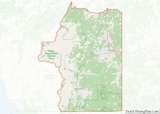
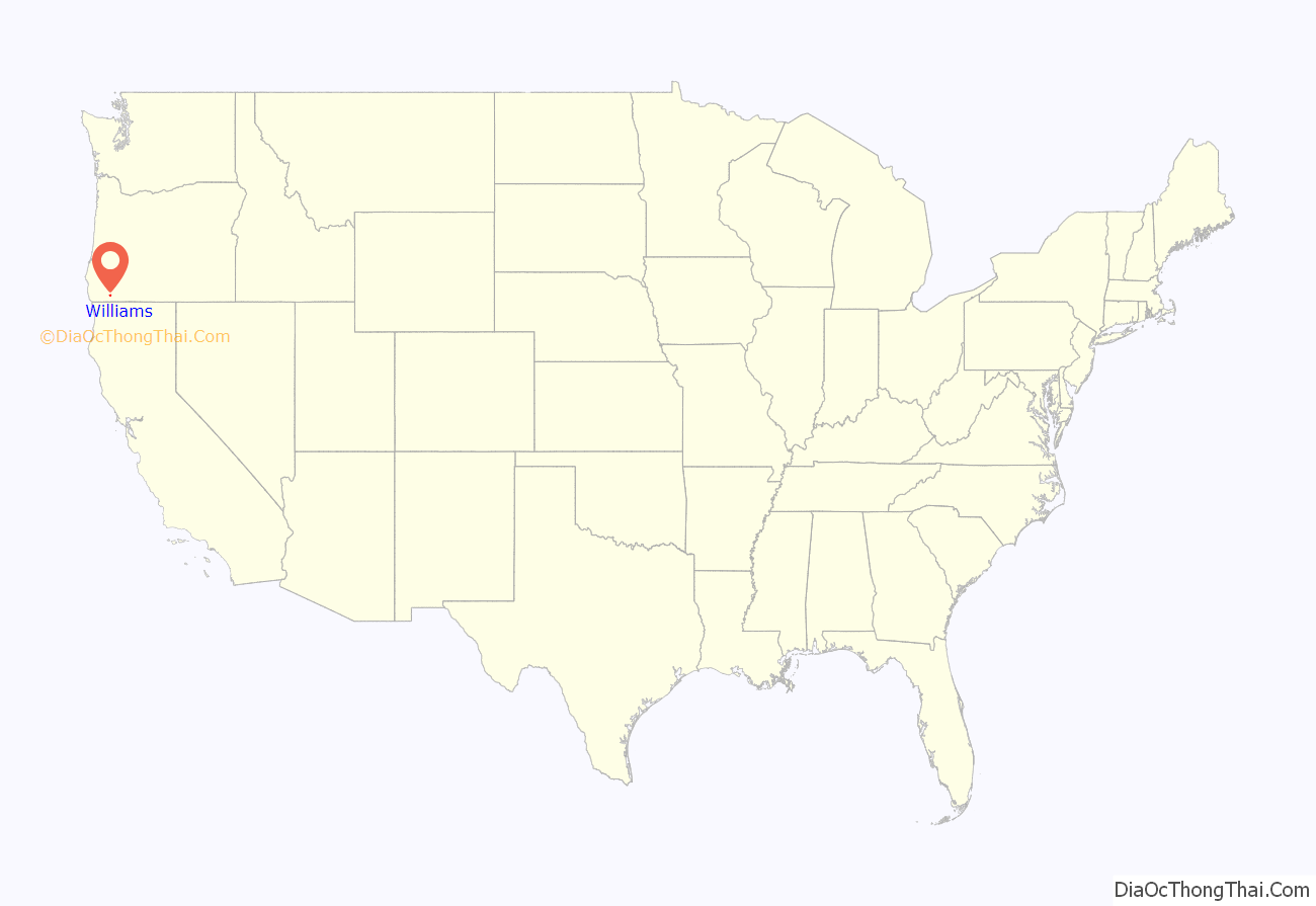
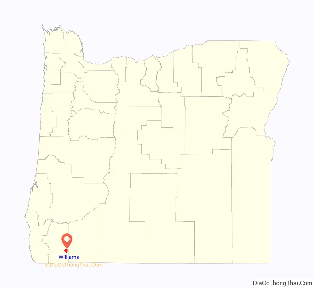
Williams location map. Where is Williams CDP?
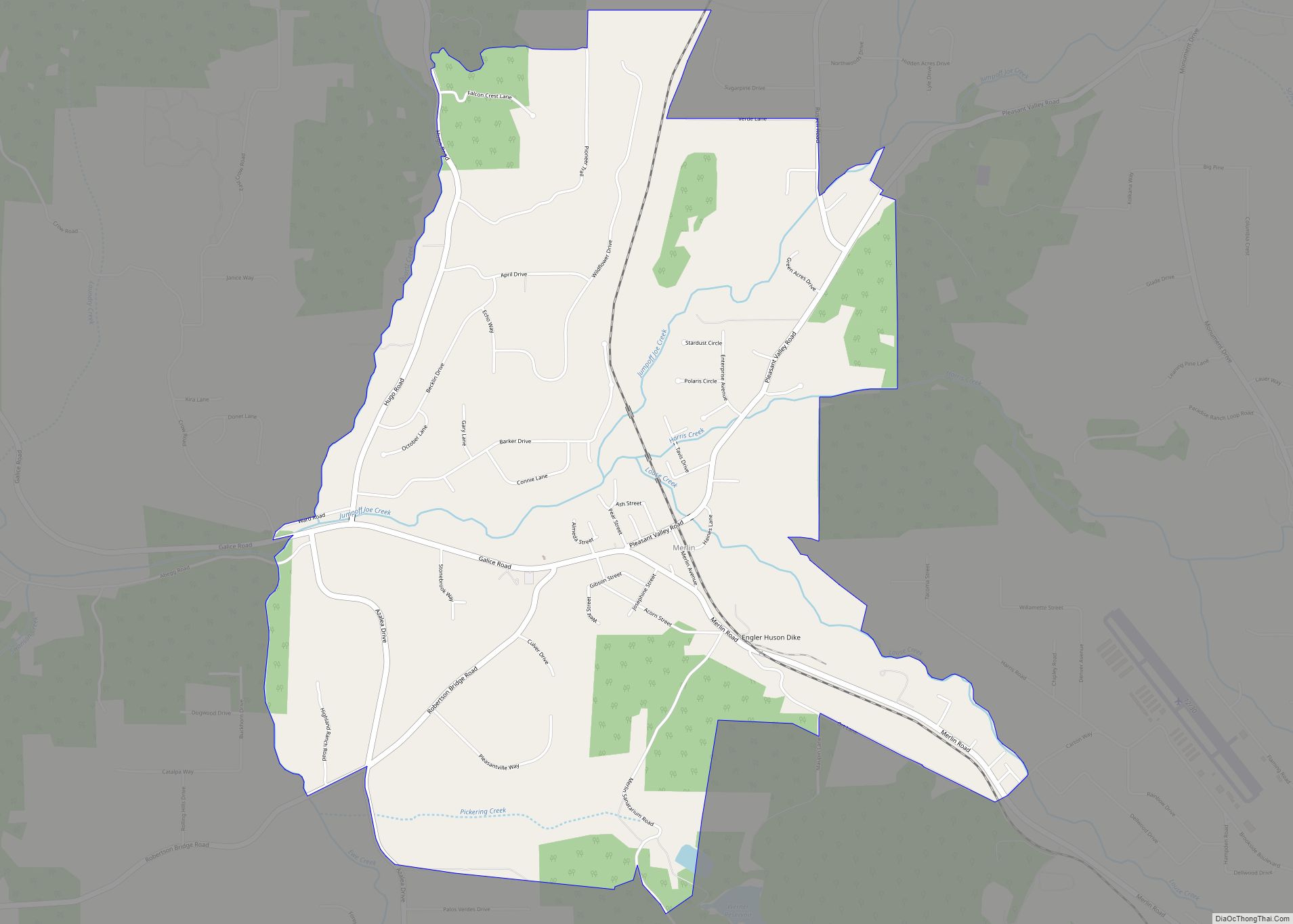
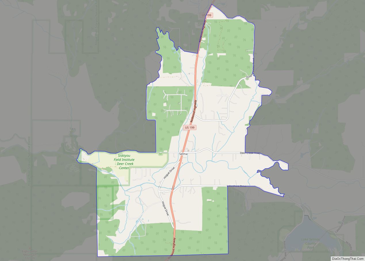
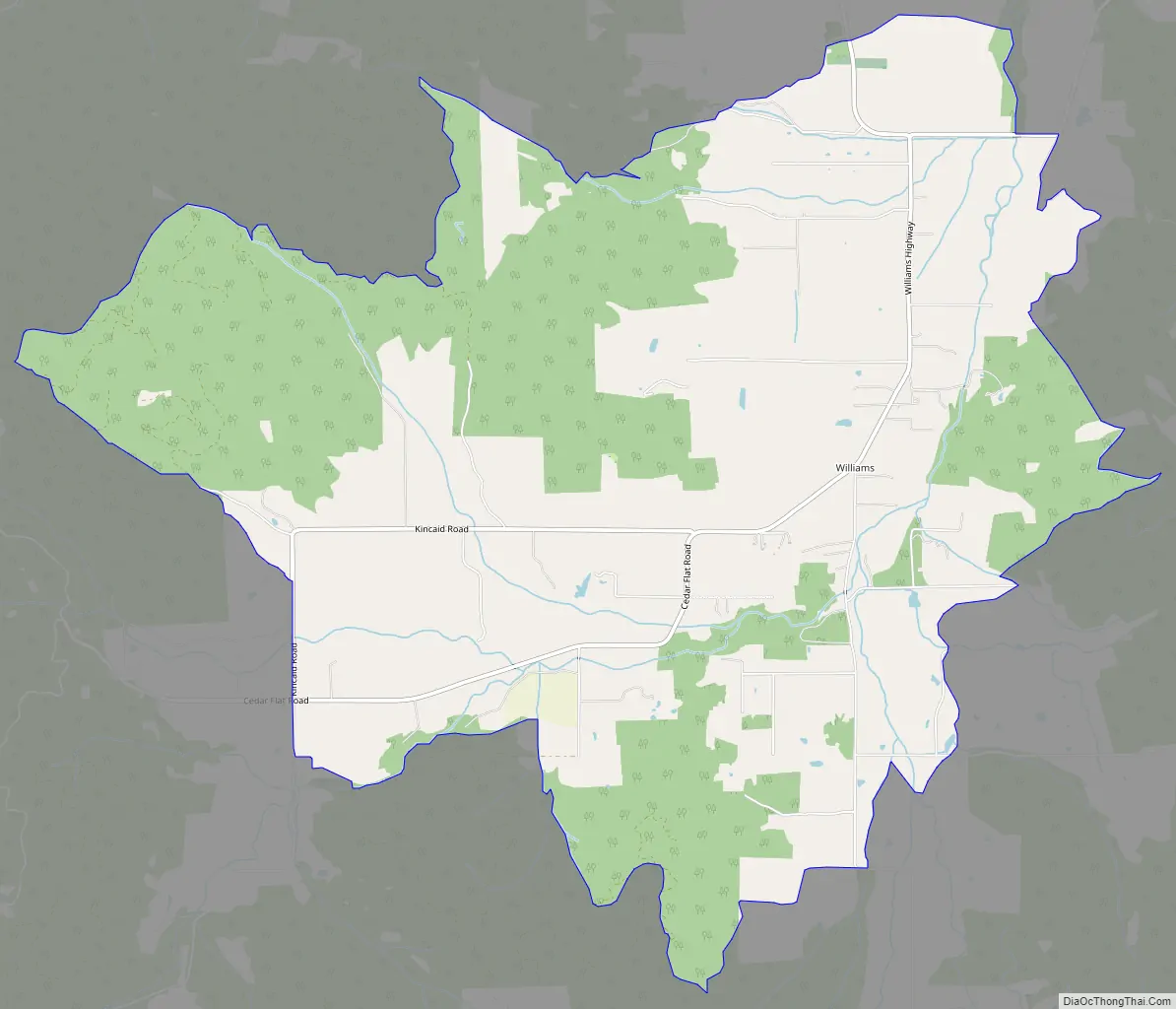
Williams Road Map
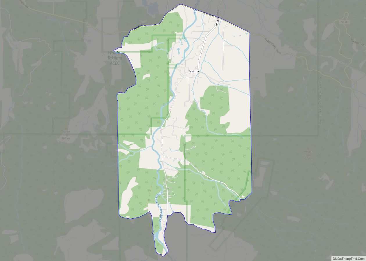
Williams city Satellite Map

Geography
Williams is in southeastern Josephine County, in the valley of Williams Creek, a north-flowing tributary of the Applegate River and part of the Rogue River watershed. It sits to the northeast of the Siskiyou Mountains and is 6 miles (10 km) south of Provolt and 19 miles (31 km) south of Grants Pass, the Josephine county seat.
According to the U.S. Census Bureau, the Williams CDP has an area of 11.3 square miles (29.3 km), all of it recorded as land.
See also
Map of Oregon State and its subdivision: Map of other states:- Alabama
- Alaska
- Arizona
- Arkansas
- California
- Colorado
- Connecticut
- Delaware
- District of Columbia
- Florida
- Georgia
- Hawaii
- Idaho
- Illinois
- Indiana
- Iowa
- Kansas
- Kentucky
- Louisiana
- Maine
- Maryland
- Massachusetts
- Michigan
- Minnesota
- Mississippi
- Missouri
- Montana
- Nebraska
- Nevada
- New Hampshire
- New Jersey
- New Mexico
- New York
- North Carolina
- North Dakota
- Ohio
- Oklahoma
- Oregon
- Pennsylvania
- Rhode Island
- South Carolina
- South Dakota
- Tennessee
- Texas
- Utah
- Vermont
- Virginia
- Washington
- West Virginia
- Wisconsin
- Wyoming