San Bernardino (/ˌsæn ˌbɜːrnəˈdiːnoʊ/; Spanish for “Saint Bernardino”) is a city and county seat of San Bernardino County, California, United States. Located in the Inland Empire region of Southern California, the city had a population of 222,101 in the 2020 census, making it the 18th-largest city in California. San Bernardino is the economic, cultural, and political hub of the San Bernardino Valley and the Inland Empire. The governments of El Salvador, Guatemala, and Mexico have established the metropolitan area’s only consulates in the downtown area of the city. Additionally, San Bernardino serves as an anchor city to the 3rd largest metropolitan area in California (after Los Angeles and San Francisco) and the 13th largest metropolitan area in the United States; the San Bernardino-Riverside MSA.
Furthermore, the city’s University District serves as a college town, as home to California State University, San Bernardino.
San Bernardino was named in 1810, when Spanish priest Francisco Dumetz led an expedition through the area. In 1839, the Mexican government granted Californio ranchero José del Carmen Lugo the right to settle the area, which was formalized when he was granted Rancho San Bernardino in 1842. Following the American Conquest of California, the community on the rancho incorporated as a city in 1854. The city grew significantly in the late 19th century as a commercial hub at the crossroads between Southern California and the American Southwest. Today, San Bernardino is an important hub for the Inland Empire and Southern California.
| Name: | San Bernardino city |
|---|---|
| LSAD Code: | 25 |
| LSAD Description: | city (suffix) |
| State: | California |
| County: | San Bernardino County |
| Incorporated: | August 10, 1869 |
| Elevation: | 1,053 (Downtown) ft (321 m) |
| Land Area: | 62.12 sq mi (160.88 km²) |
| Water Area: | 0.34 sq mi (0.88 km²) 0.74% |
| Population Density: | 3,473.94/sq mi (1,341.30/km²) |
| Area code: | 909, 840, 760 |
| FIPS code: | 0665000 |
| Website: | sbcity.org |
Discover the hidden gems of San Bernardino with this map collection. It includes a road map, reference map, and things to do. Take the tour of the city with the web map of San Bernardino provided by Google Maps.
Just 60 miles away from Los Angeles, San Bernardino is located in southwest California in the San Bernardino Valley. Notably, it’s home to the first original McDonald’s. The city has a rich history that you can explore in California. There are plenty of things to do in San Bernardino, whether you’re looking for cultural attractions or just some fun places to go shopping.
Explore the hidden gems of San Bernardino with this map collection. It includes a road map, reference map, and things to do. Take a tour of the city with the web map of San Bernardino provided by Google Maps and discover the city’s rich history and plenty of things to do.
Online Interactive Map
Click on ![]() to view map in "full screen" mode.
to view map in "full screen" mode.
This interactive map includes all the best items to see and do including its parks, attractions, and hotels. Find out where the best places to eat, drink, and explore are with our detailed map. Whether you’re looking for a vacation or a family adventure, this interactive map is ideal for visitors who want to explore the area ahead of time.
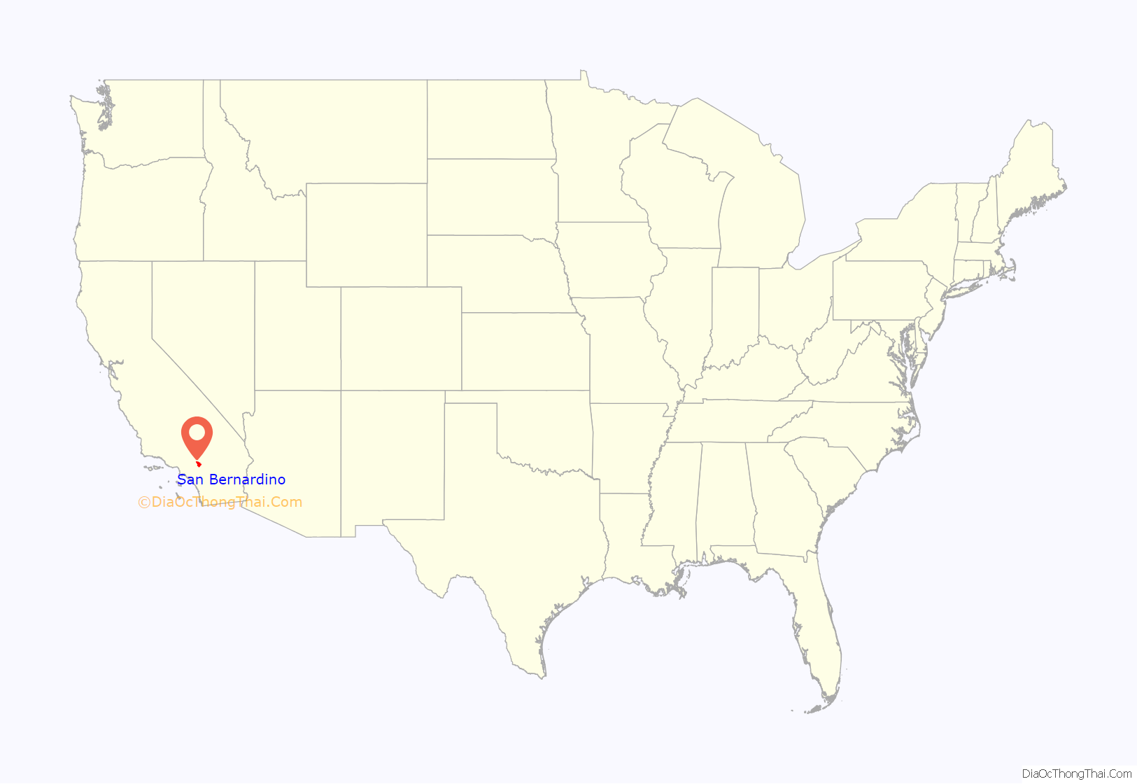
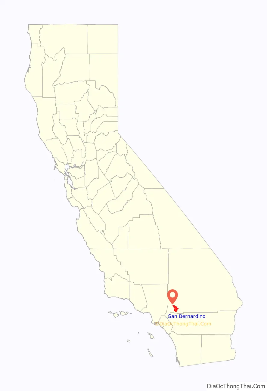
San Bernardino location map. Where is San Bernardino city?
History
Indigenous
The city of San Bernardino, California, occupies much of the San Bernardino Valley, a valley long inhabited by the Tongva. Several of their villages dotted the San Bernardino valley prior to the arrival of Europeans in the valley. Kaawchama was perhaps the most significant in the region, being a regional center for trade that was connected to villages in Southern California and the Colorado River through the Mohave Trail, that was used by the Mohave, Serrano, Cahuilla, Payomkawichum, and others. The village was located in the eastern expanse of Tovaangar, and was established along the Santa Ana River.
Spanish and Mexican era
With the establishment of Mission San Gabriel in 1771, Spanish missionaries traveling through the area expressed a desire to establish a supply station in the area, which became the Guachama Rancheria. The settlement was also referred to as Politana and became the first Spanish settlement in what they referred to as San Bernardino Valley, named for Bernardino of Siena, being established in 1810 as a mission chapel and supply station by the Mission San Gabriel .
Two years later the settlement was destroyed by local tribesmen, following powerful earthquakes that shook the region. Several years later, the Serrano and Mountain Cahuilla rebuilt the Guachama Rancheria, and in 1819 invited the missionaries to return to the valley. They did and established the San Bernardino de Sena Estancia. Serrano and Cahuilla people inhabited Politana until long after the 1830s decree of secularization and the 1842 inclusion into the Rancho San Bernardino land grant of the José del Carmen Lugo family.
Post-Conquest era
The area was not largely settled until 1851, following the American Conquest of California. The first Anglo-American colony was established by pioneers associated with the Church of Jesus Christ of Latter-day Saints or Mormons. Following the Mormon colonists’ purchase of Rancho San Bernardino, and the establishment of the town of San Bernardino in 1851, San Bernardino County was formed in 1853 from parts of Los Angeles County. Mormons laid out the town based on the “City of Zion” plan which was typical of Mormon urban planning. Mormon colonists developed irrigated, commercial farming and lumbering, supplying agricultural produce and lumber throughout Southern California.
The city was officially incorporated in 1857. Later that year, most of the colonists were recalled by Brigham Young in 1857 due to the Utah War. Once highly regarded in early California, news of the Mountain Meadows Massacre poisoned attitudes toward the Mormons. Some Mormons would stay in San Bernardino and some later returned from Utah, but a real estate consortium from El Monte and Los Angeles bought most of the lands of the old rancho and of the departing colonists. They sold these lands to new settlers who came to dominate the culture and politics in the county and San Bernardino became a typical American frontier town. Many of the new land owners disliked the sober Mormons, indulging in drinking at saloons now allowed in the town. Disorder, fighting and violence in the vicinity became common, reaching a climax in the 1859 Ainsworth – Gentry Affair.
In 1860 a gold rush began in the mountains nearby with the discovery of gold by William F. Holcomb in Holcomb Valley early 1860. Another strike followed in the upper reach of Lytle Creek. By the 1860s, San Bernardino had also become an important trading hub in Southern California. The city already on the Los Angeles – Salt Lake Road, became the starting point for the Mojave Road from 1858 and Bradshaw Trail from 1862 to the mines along the Colorado River and within the Arizona Territory in the gold rush of 1862–1864.
Near San Bernardino is a naturally formed arrowhead-shaped rock formation on the side of a mountain. It measures 1375 feet by 449 feet. According to the Native American legend regarding the landmark arrowhead, an arrow from Heaven burned the formation onto the mountainside in order to show tribes where they could be healed. During the mid-19th century, “Dr.” David Noble Smith claimed that a saint-like being appeared before him and told of a far-off land with exceptional climate and curative waters, marked by a gigantic arrowhead. Smith’s search for that unique arrowhead formation began in Texas, and eventually ended at Arrowhead Springs in California in 1857.
By 1889, word of the springs, along with the hotel on the site (and a belief in the effect on general health of the water from the springs) had grown considerably. Hotel guests often raved about the crystal-clear water from the cold springs, which prompted Seth Marshall to set up a bottling operation in the hotel’s basement. By 1905, water from the cold springs was being shipped to Los Angeles under the newly created “Arrowhead” trademark.
Indigenous people of the San Bernardino Valley and Mountains were collectively identified by Spanish explorers in the 19th century as Serrano, a term meaning highlander. Serrano living near what is now Big Bear Lake were called Yuhaviatam, or “People of the Pines”. In 1866, to clear the way for settlers and gold miners, state militia conducted a 32-day campaign slaughtering men, women, and children. Yuhaviatam leader Santos Manuel guided his people from their ancient homeland to a village site in the San Bernardino foothills. The United States government in 1891 established it as a tribal reservation and named it after Santos Manuel.
In 1867, the first Chinese immigrants arrived in San Bernardino.
In 1883, California Southern Railroad established a rail link through San Bernardino between Los Angeles and the rest of the country.
Modern era
In 1905, the city of San Bernardino passed its first charter.
Norton Air Force Base was established during World War II. In 1994, Norton Air Force Base closed to become San Bernardino International Airport.
In 1940, Richard and Maurice McDonald founded McDonald’s, along with its innovative restaurant concept, in the city.
San Bernardino won the All-America City award in 1977.
In 1989, a massive derailment took place at Duffy street, killing 4 people and destroying seven homes. Then on May 25, an underground petroleum pipeline ruptured, killing 2 more people and burning down 11 more homes.
In August 2012, San Bernardino filed for Chapter 9 bankruptcy, with more than $1 billion in debt. The move froze the city’s payments to creditors, including its pension payments to the California Public Employees Retirement System for nearly a year. San Bernardino became the largest city at the time to file for a Chapter 9 bankruptcy, superseded by Detroit’s filing in July 2013. Following a judge’s approval, the city emerged from bankruptcy in February 2017, making it one of the longest municipal bankruptcies in the United States.
On December 2, 2015, a terrorist attack left 14 people dead and 22 seriously injured.
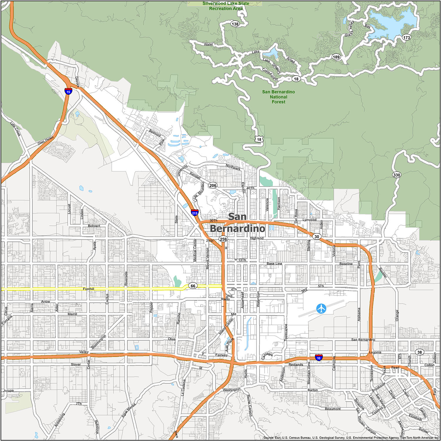
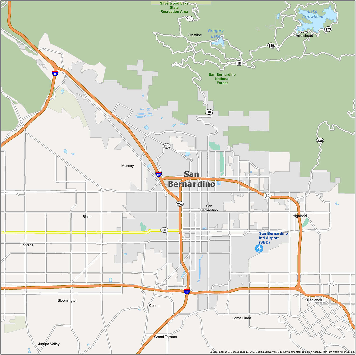
San Bernardino Road Map
Discover what San Bernardino has to offer and get to know the area before your visit with this road map. View it on your phone or tablet, download it or print it out, and get ready for a memorable journey. With this detailed city map and information, you will always remain on the right track. If you are planning a trip to San Bernardino, this road map is perfect for you. The following highways and roads are available in San Bernardino:
- Interstate Highways: I-10, I-215
- US Highways: 18, 30, 66, 206, 259, 330
- Expressways/Parkways: University Pky
- Major Roads: 2nd St, 5th St, 21st St, 30th St, Cajon Blvd, Foothill Blvd, Goodlett St, Herrington Ave, Highland Ave, Kendall Dr, Mount Vernon Ave, Mountain View Ave, Palm Ave, Rialto Ave, San Bernardino Ave, Waterman Ave
For any travel outside the city, take a look at the road map of California.
If you’re planning a trip to San Bernardino, California, you’ll be glad to know that there is a reference map of the area available to help you plan your trip. The map includes detailed information about the area, including airports, cities, census-designated places, forests, and parks.
The San Bernardino International Airport (SBD) is the main airport in the area. The cities in the area include Colton, Fontana, Grand Terrace, Highland, Jurupa Valley, Loma Linda, Redlands, Rialto, and San Bernardino. The census-designated places in the area are Bloomington and Crestline. The forests and parks in the area include the San Bernardino National Forest and the Silverwood Lake State Recreation Area.
With this reference map, you can easily plan your trip to San Bernardino, California and have a great time visiting the area.
10 things to do in San Bernardino city
If you’re looking for a great way to explore San Bernardino, our easy-to-use attractions map is the perfect tool. Our detailed maps show all the major attractions, parks, and landmarks in the area, so you can quickly and easily plan your next trip. Whether you’re looking for a quick day trip or a longer vacation, you’ll find plenty of things to do in San Bernardino.
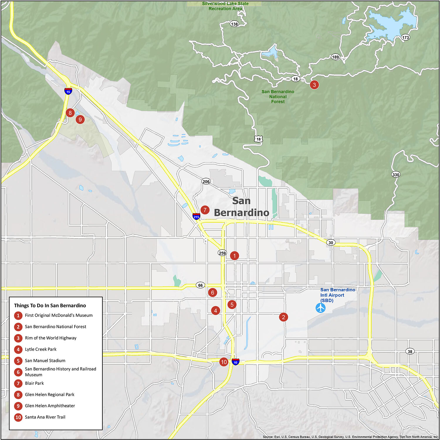
San Bernardino is a great place to explore with its many attractions, such as the first original McDonald’s Museum, San Bernardino National Forest, Rim of the World Highway, Lytle Creek Park, San Manuel Stadium, San Bernardino History and Railroad Museum, Blair Park, Glen Helen Regional Park, Glen Helen Amphitheater and Santa Ana River Trail. With so much to see and do, our attractions map makes it easy to find the perfect place to explore in San Bernardino.
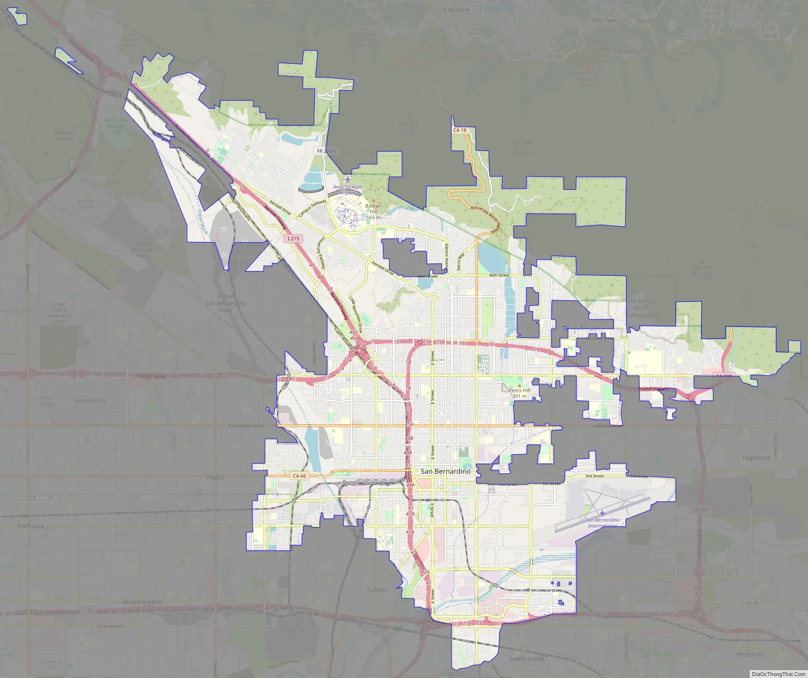
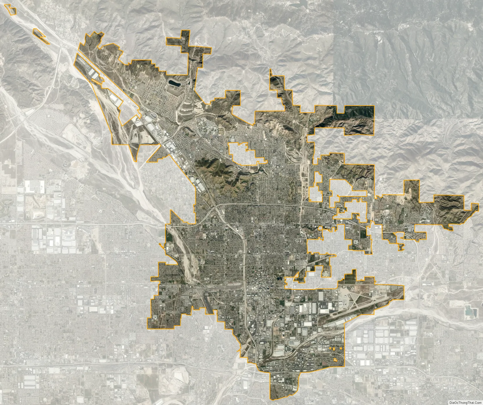
San Bernardino city Satellite Map
Geography
According to the United States Census Bureau, the city has a total area of 59.6 square miles (154 km), of which 59.2 square miles (153 km) is land and 0.4 square miles (1.0 km), or 0.74%, is water.
The city lies in the San Bernardino foothills and the eastern portion of the San Bernardino Valley, roughly 60 miles (97 km) east of Los Angeles. Some major geographical features of the city include the San Bernardino Mountains and the San Bernardino National Forest, in which the city’s northernmost neighborhood, Arrowhead Springs, is located; the Cajon Pass adjacent to the northwest border; City Creek, Lytle Creek, San Timoteo Creek, Twin Creek, Warm Creek (as modified through flood control channels) feed the Santa Ana River, which forms part of the city’s southern border south of San Bernardino International Airport. The city has several notable hills and mountains; among them are Perris Hill (named after Fred Perris, an early engineer, and the namesake of Perris, California); Kendall Hill (which is near California State University); and Little Mountain, which rises among Shandin Hills (generally bounded by Sierra Way, 30th Street, Kendall Drive, and Interstate 215).
San Bernardino is unique among Southern Californian cities because of its wealth of water, which is mostly contained in underground aquifers.
Seccombe Lake, named after a former mayor, is a manmade lake at Sierra Way and 5th Street.
Climate
San Bernardino features a hot-summer Mediterranean climate (Csa in the Köppen climate classification) with warm winters and hot, dry summers. Relative to other areas in Southern California, winters are colder, with frost and with chilly to cold morning temperatures common. The particularly arid climate during the summer prevents tropospheric clouds from forming, meaning temperatures rise to what is considered by NOAA scientists as Class Orange. Summer thus has temperatures approaching those typical of hot desert climates, with the highest recorded summer temperature at 118 °F (47.8 °C) on July 6, 2018. In the winter, snow flurries occur upon occasion. San Bernardino gets an average of 16 inches (406 mm) of rain, hail, or light snow showers each year. Arrowhead Springs, San Bernardino’s northernmost neighborhood gets snow, heavily at times, due to its elevation of about 3,000 feet (910 m) above sea level.
The seasonal Santa Ana winds are felt particularly strongly in the San Bernardino area as warm and dry air is channeled through nearby Cajon Pass at times during the autumn months. This phenomenon markedly increases the wildfire danger in the foothills, canyon, and mountain communities that the cycle of cold, wet winters and dry summers helps create.
See also
Map of California State and its subdivision:- Alameda
- Alpine
- Amador
- Butte
- Calaveras
- Colusa
- Contra Costa
- Del Norte
- El Dorado
- Fresno
- Glenn
- Humboldt
- Imperial
- Inyo
- Kern
- Kings
- Lake
- Lassen
- Los Angeles
- Madera
- Marin
- Mariposa
- Mendocino
- Merced
- Modoc
- Mono
- Monterey
- Napa
- Nevada
- Orange
- Placer
- Plumas
- Riverside
- Sacramento
- San Benito
- San Bernardino
- San Diego
- San Francisco
- San Joaquin
- San Luis Obispo
- San Mateo
- Santa Barbara
- Santa Clara
- Santa Cruz
- Shasta
- Sierra
- Siskiyou
- Solano
- Sonoma
- Stanislaus
- Sutter
- Tehama
- Trinity
- Tulare
- Tuolumne
- Ventura
- Yolo
- Yuba
- Alabama
- Alaska
- Arizona
- Arkansas
- California
- Colorado
- Connecticut
- Delaware
- District of Columbia
- Florida
- Georgia
- Hawaii
- Idaho
- Illinois
- Indiana
- Iowa
- Kansas
- Kentucky
- Louisiana
- Maine
- Maryland
- Massachusetts
- Michigan
- Minnesota
- Mississippi
- Missouri
- Montana
- Nebraska
- Nevada
- New Hampshire
- New Jersey
- New Mexico
- New York
- North Carolina
- North Dakota
- Ohio
- Oklahoma
- Oregon
- Pennsylvania
- Rhode Island
- South Carolina
- South Dakota
- Tennessee
- Texas
- Utah
- Vermont
- Virginia
- Washington
- West Virginia
- Wisconsin
- Wyoming


