South Salt Lake is a city in Salt Lake County, Utah, United States and is part of the Salt Lake City Metropolitan Statistical Area. The population was 23,617 at the 2010 census.
| Name: | South Salt Lake city |
|---|---|
| LSAD Code: | 25 |
| LSAD Description: | city (suffix) |
| State: | Utah |
| County: | Salt Lake County |
| Incorporated: | 1938 |
| Elevation: | 4,255 ft (1,297 m) |
| Total Area: | 6.94 sq mi (17.98 km²) |
| Land Area: | 6.94 sq mi (17.98 km²) |
| Water Area: | 0.00 sq mi (0.00 km²) |
| Total Population: | 23,617 |
| Population Density: | 3,685.11/sq mi (1,422.76/km²) |
| ZIP code: | 84106, 84115, 84119 |
| Area code: | 385, 801 |
| FIPS code: | 4971070 |
| GNISfeature ID: | 1432753 |
| Website: | https://sslc.gov/ |
Online Interactive Map
Click on ![]() to view map in "full screen" mode.
to view map in "full screen" mode.
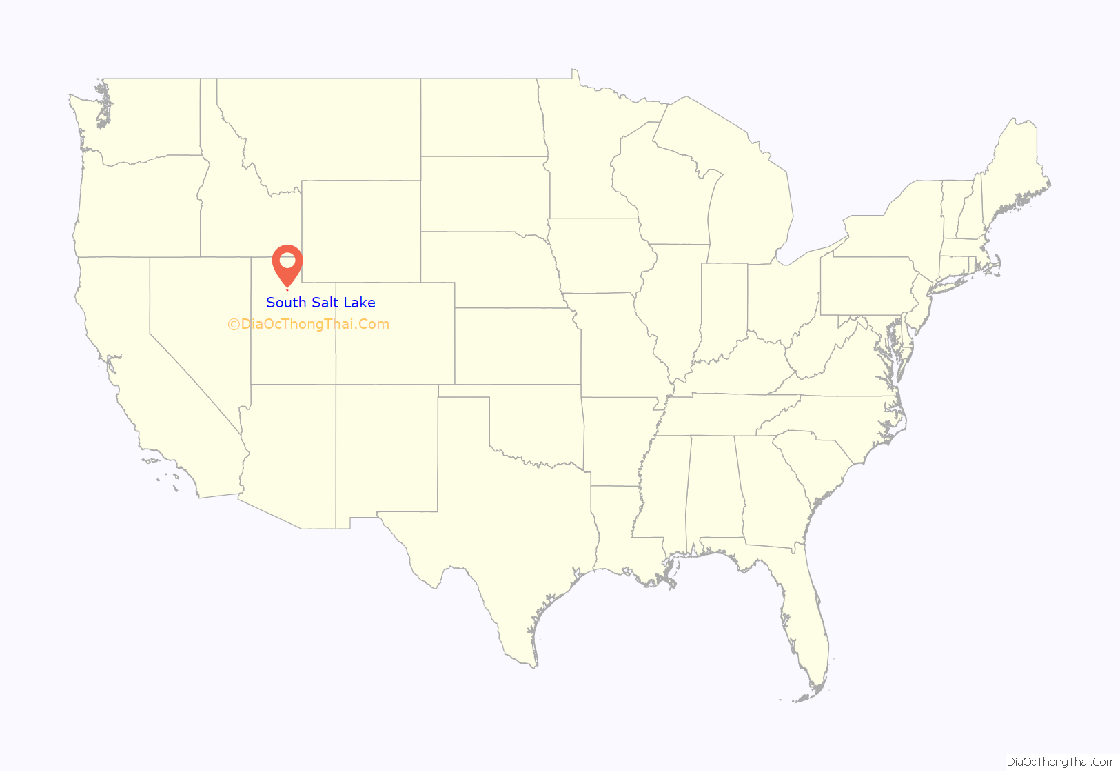
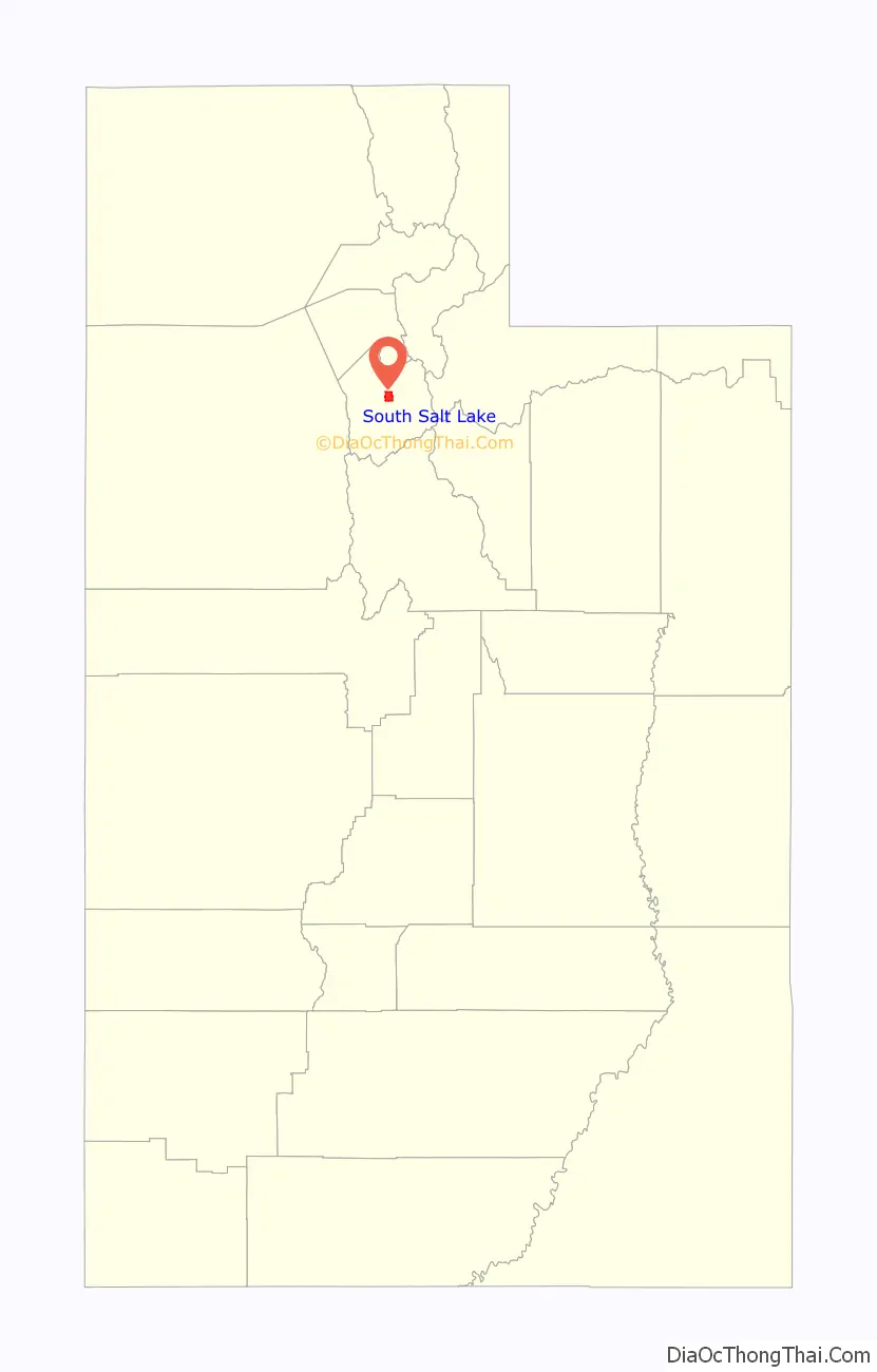
South Salt Lake location map. Where is South Salt Lake city?
History
Jesse Fox Jr. developed the area South Salt Lake referred to as Central Park around 1890. Mr. Fox chose the name after visiting New York and seeing Central Park there. He was impressed by the park and its design within an urban environment. Despite South Salt Lake being rural at the time, he decided to name the area Central Park. In 1925 the LDS Central Park Ward was created and named after the development. In 1936, an attempted annexation by Salt Lake City failed due to concerns over funding and implementation of a sewer system. On August 14, 1936 a resolution creating the Town of Central Park was approved by the Board of County Commissioners – however, this did not last long, as voters then decided to disincorporate the town in 1937. In a close vote, voters then approved incorporation of South Salt Lake. On September 29, 1938, still in need of a sewer system, South Salt Lake voted to incorporate as the Town of South Salt Lake, with Robert R. Fitts as the first town president. The town was also lacking many other basic amenities at the time that would be easier to implement with incorporation, such as a post office and fire department. In 1939, the Works Progress Administration finally began construction of a sewer system, with a cost of $462,000. The original boundary of South Salt Lake was from 500 East to 300 West and 2100 South to Mill Creek on the south. On August 1, 1950 the population had increased enough for South Salt Lake to be designated as a third class city. This changed the form of government to a mayor and city council. The town president of the time, Marlow Callahan, became the first mayor of the City of South Salt Lake. In the 1990s, South Salt Lake annexed portions of an unincorporated portion of Salt Lake County to the south, and nearly doubled in land area and population.
On January 4, 2010, Cherie Wood became South Salt Lake’s first female mayor. During her administration, South Salt Lake has seen extensive redevelopment efforts. In 2012, a Chinatown development opened on a lot in the city near 3500 South and State Street. It is the only Chinatown in the Intermountain West. In addition to having many Asian-themed restaurants, it has a large Asian-themed supermarket. In 2017, after nearly 7 years of planning, ground was broken on a new mixed-use development known as The Crossing (formerly called Market Station) between State St. and Main St. just south of 2100 South, intended to serve as South Salt Lake’s “downtown”. This development is oriented around mass transit, with an S-Line streetcar stop adjacent to the development, and 1 stop away from the Central Pointe TRAX Station. The first phase includes a WinCo Foods and a townhome development. Ultimately, this downtown development is planned to have 2,500 family housing units, 1.5 million square feet of retail, 3 million square feet of office and commercial space, and additional greenspace and trails.
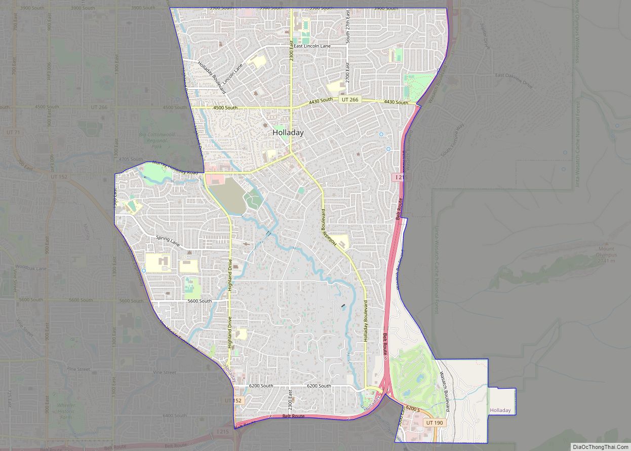
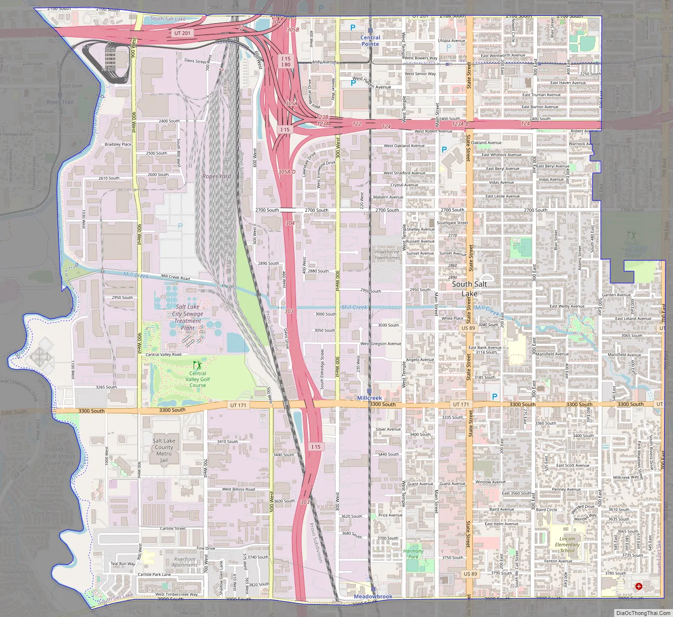
South Salt Lake Road Map
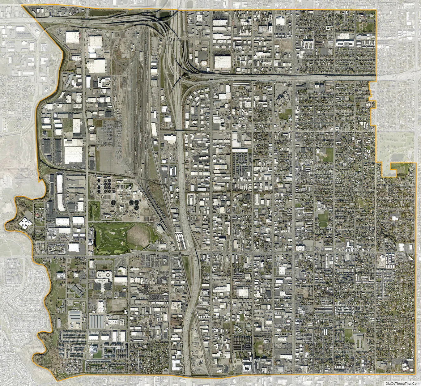
South Salt Lake city Satellite Map
Geography
According to the United States Census Bureau, the city has a total area of 6.9 square miles (18 km), all land.
The city is bordered by the Jordan River on the west, 500 East and 700 East on the east, 2100 South on the north, and 3900 South on the south. West Valley City lies to the west, Salt Lake City to the north, northeast, and east; and Millcreek to the east, south, and southeast. Because of its location next to the Jordan River and well away from the mountains, it is mostly flat, only ranging in elevation from about 4,330 feet (1,320 m) to 4,380 feet (1,340 m). It has a fairly high water table, with some areas being somewhat swampy before development in the early 1900s. Much city water comes through wells from the aquifer beneath the city. Three tributaries of Mill Creek converge in Fitts Park.
See also
Map of Utah State and its subdivision: Map of other states:- Alabama
- Alaska
- Arizona
- Arkansas
- California
- Colorado
- Connecticut
- Delaware
- District of Columbia
- Florida
- Georgia
- Hawaii
- Idaho
- Illinois
- Indiana
- Iowa
- Kansas
- Kentucky
- Louisiana
- Maine
- Maryland
- Massachusetts
- Michigan
- Minnesota
- Mississippi
- Missouri
- Montana
- Nebraska
- Nevada
- New Hampshire
- New Jersey
- New Mexico
- New York
- North Carolina
- North Dakota
- Ohio
- Oklahoma
- Oregon
- Pennsylvania
- Rhode Island
- South Carolina
- South Dakota
- Tennessee
- Texas
- Utah
- Vermont
- Virginia
- Washington
- West Virginia
- Wisconsin
- Wyoming