South Weber (/ˈwiːbər/ WEE-bər) is a city on the northeastern edge of Davis County, Utah, United States. It is part of the Ogden–Clearfield, Utah Metropolitan Statistical Area. The population was 6,051 at the 2010 census, with an estimated population of 7,518 in 2018.
| Name: | South Weber city |
|---|---|
| LSAD Code: | 25 |
| LSAD Description: | city (suffix) |
| State: | Utah |
| County: | Davis County |
| Incorporated: | 1938 |
| Elevation: | 4,511 ft (1,375 m) |
| Total Area: | 4.67 sq mi (12.11 km²) |
| Land Area: | 4.63 sq mi (12.00 km²) |
| Water Area: | 0.04 sq mi (0.10 km²) |
| Total Population: | 6,051 |
| Population Density: | 1,690.61/sq mi (652.82/km²) |
| ZIP code: | 84403, 84405 |
| Area code: | 385, 801 |
| FIPS code: | 4971180 |
| GNISfeature ID: | 1445935 |
| Website: | www.southwebercity.com |
Online Interactive Map
Click on ![]() to view map in "full screen" mode.
to view map in "full screen" mode.
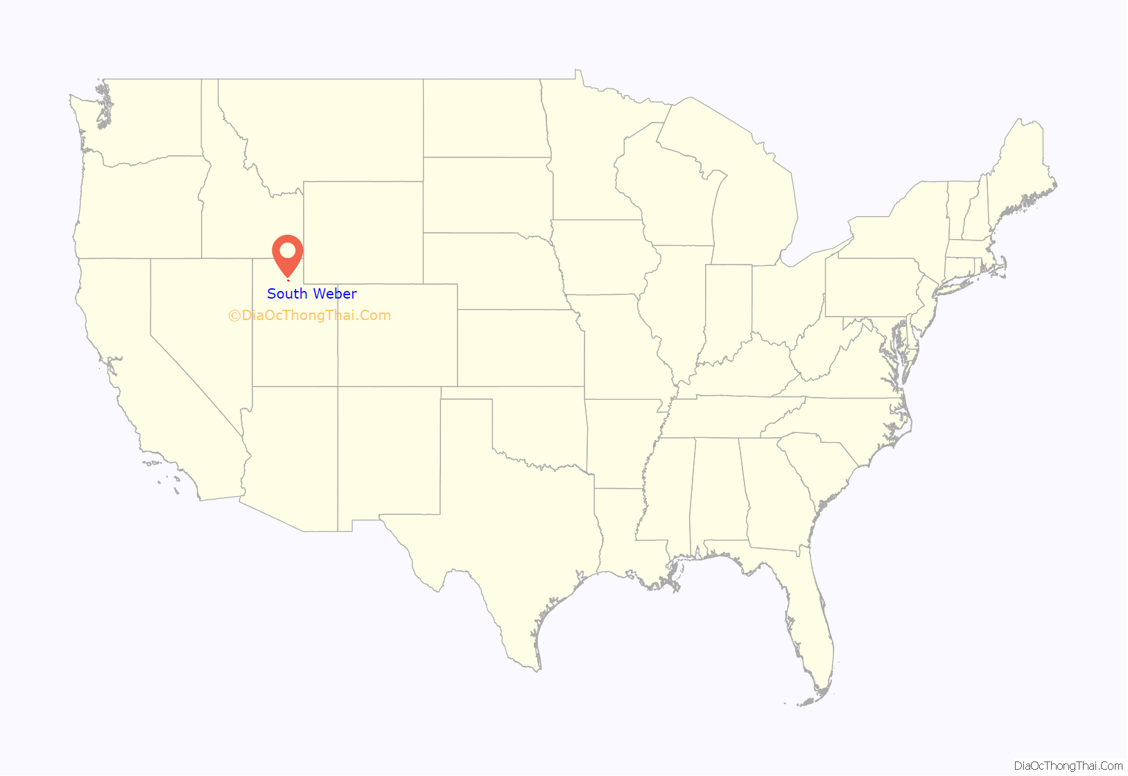
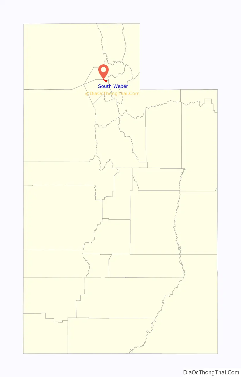
South Weber location map. Where is South Weber city?
History
South Weber was the site of the Morrisite War. On June 13, 1862, an estimated 500-man army perched cannons atop the bluffs on the south side of the city, aimed at Joseph Morris. The war lasted three days, and ultimately resulted in the death of Joseph Morris, John Banks, and a few others. Upon seeing their leaders dead, the remainder of the Morrisites surrendered.
South Weber is also known for a week of Bigfoot sightings in February 1980. For one week, residents reported signs of the legendary Sasquatch. At the time, multiple residents claimed to have seen the creature while feeding horses, smelled foul “bigfoot” odors, and found large patches of strange fur throughout the small community. Although no animal was ever found, the legend lives on.
Business Week magazine named South Weber the sixth best suburb in the country in 2009.
South Weber Road Map
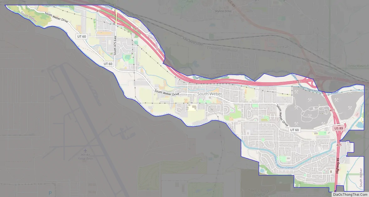
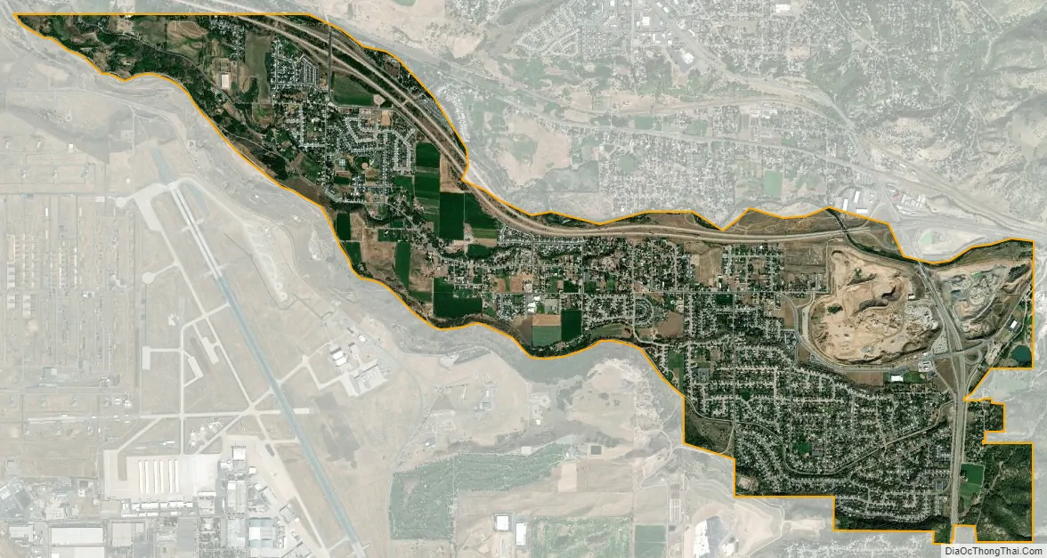
South Weber city Satellite Map
Geography
South Weber is located in northeastern Davis County, bordered to the north by the Weber County line. Neighboring cities are Uintah to the north Washington Terrace and Riverdale to the northwest, and Layton to the south. Hill Air Force Base borders the southwest side of the city.
According to the United States Census Bureau, the city has a total area of 4.7 square miles (12.2 km), of which 0.04 square miles (0.1 km), or 1.20%, is water. The Weber River forms most of the northern boundary of the city.
Although located in Davis County, the city’s streets follow the street grid of Weber County to the north (which is based upon the meridians of Ogden).
See also
Map of Utah State and its subdivision: Map of other states:- Alabama
- Alaska
- Arizona
- Arkansas
- California
- Colorado
- Connecticut
- Delaware
- District of Columbia
- Florida
- Georgia
- Hawaii
- Idaho
- Illinois
- Indiana
- Iowa
- Kansas
- Kentucky
- Louisiana
- Maine
- Maryland
- Massachusetts
- Michigan
- Minnesota
- Mississippi
- Missouri
- Montana
- Nebraska
- Nevada
- New Hampshire
- New Jersey
- New Mexico
- New York
- North Carolina
- North Dakota
- Ohio
- Oklahoma
- Oregon
- Pennsylvania
- Rhode Island
- South Carolina
- South Dakota
- Tennessee
- Texas
- Utah
- Vermont
- Virginia
- Washington
- West Virginia
- Wisconsin
- Wyoming