Fox Island is an island and census-designated place (CDP) in Pierce County, Washington, United States, in Puget Sound. It is located approximately 5 miles (8 km) from Gig Harbor. The island was named Fox by Charles Wilkes during the United States Exploring Expedition, to honor J.L. Fox, an assistant surgeon on the expedition. The population was 3,633 at the 2010 census.
| Name: | Fox Island CDP |
|---|---|
| LSAD Code: | 57 |
| LSAD Description: | CDP (suffix) |
| State: | Washington |
| County: | Pierce County |
| Elevation: | 177 ft (54 m) |
| Total Area: | 6.4 sq mi (16.6 km²) |
| Land Area: | 5.2 sq mi (13.5 km²) |
| Water Area: | 1.2 sq mi (3.0 km²) |
| Total Population: | 3,633 |
| Population Density: | 536.3/sq mi (207.1/km²) |
| ZIP code: | 98333 |
| Area code: | 253 |
| FIPS code: | 5325370 |
| GNISfeature ID: | 1867612 |
Online Interactive Map
Click on ![]() to view map in "full screen" mode.
to view map in "full screen" mode.
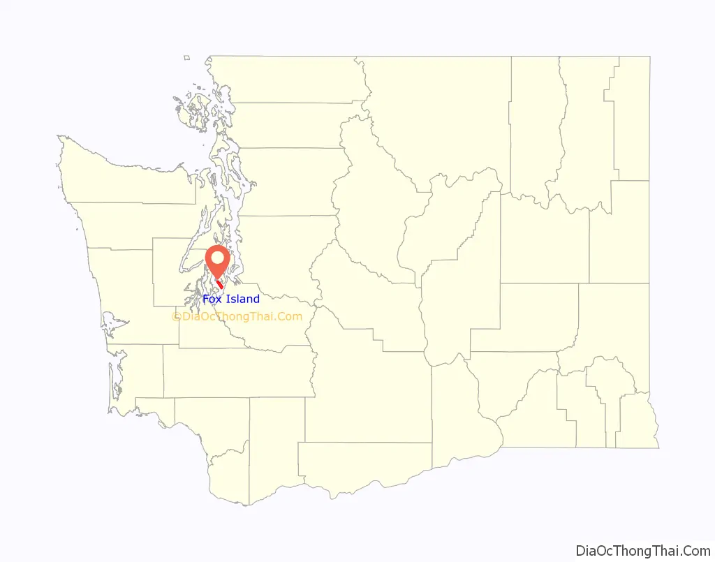
Fox Island location map. Where is Fox Island CDP?

History
The island was part of the territory of the Steilacoom people, a Coast Salish tribe.
In 1792, during the Vancouver Expedition, Peter Puget led an exploration party through southern Puget Sound. After an encounter with local Native tribes ended with Puget ordering a musket fired as warning, the exploration party retreated to Fox Island, where they made camp for the night.
In 1856, during the Puget Sound War, most of the Puyallup and “non-hostile” Nisqually Indians, totaling about 500 people, were removed from their homelands and displaced to Fox Island. John Swan was assigned to supervise the internment camp and distribute food rations provided by the government (territorial government). On January 5, 1856, Chief Leschi and other “hostile” Indians arrived at Fox Island with a flotilla of canoes. Trusting Swan, they had come to talk about the war and how to resolve it. While the hostile Indians were on Fox Island, Captain Maurice Maloney took the steamship Beaver to the island, hoping to rescue Swan, but forgot to bring landing craft and was unable to send men ashore. Before Maloney could figure out what to do, Swan came to the shore and paddled a canoe to the Beaver. He told Maloney that there had been no violence, urged him to not come ashore, and said he had promised to return to the island, which he did. Maloney returned to Steilacoom and, along with other military officers, took another steamship, the USS Active from Steilacoom to Seattle to get a howitzer (which they failed to acquire), then back to Fox Island, hoping to capture Chief Leschi. But by the time the Active returned, more than 30 hours after Leschi had arrived on Fox Island, the hostile Indians had left.
By August 1856 the war was essentially over. Governor Isaac Stevens went to the Indian encampment on Fox Island to renegotiate the 1854 Treaty of Medicine Creek, which had been a major factor in the outbreak of war. Stevens agreed to new, larger reservations for both the Puyallup and Nisqually tribes.
The first non-Indians settled on Fox island in 1856, just after the war ended. One of the first real estate transactions was in 1881 when 56.5 acres (22.6 hectares) were sold for $118. By 1908 there were about 60 homes scattered across the island.
The most important change to this community happened in 1954 when the Fox Island Bridge was completed, connecting Fox Island to the mainland. This allowed easy access to businesses, schools, and medical facilities outside the island. During the construction a historical Indian canoe was found preserved in the mud, which can be visited in the Fox Island history museum. In 1956 the population of the island was 120, by 2000 it had grown to more than 2,800.
Cartoonist Gary Larson visited Fox Island frequently as a child. He has called Fox Island a “wondrous place” and credits the island’s swamps and wildlife with inspiring his interest in nature.
On April 29, 1988, at 6 PM local time, a nuclear-powered US Navy submarine, the USS Sam Houston (SSBN-609), ran aground on Fox Island while operating in nearby Carr Inlet. The ship remained aground for approximately 10 hours until high tide returned and tugboats were brought in to unstick the ship. No damage was done to the island, and the ship entered a drydock at the Bangor Naval Submarine Base for minor repairs to its hull.
In recent years, Fox Island has become a wealthy exurb of Tacoma, largely because of the amount of waterfront property on the island and because of the island’s location between the Olympic Mountains and Mount Rainier; a large number of the island’s residential properties have views. Based on per capita income, one of the more reliable measures of affluence, Fox Island ranks 29th of the 522 ranked areas in the state of Washington.
Fox Island Road Map
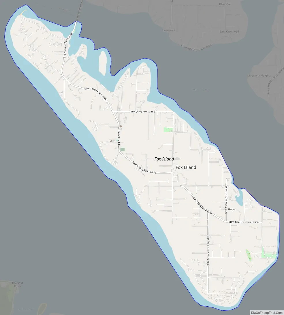
Fox Island city Satellite Map

Geography
Fox Island is located at 47°14′39″N 122°37′12″W / 47.24417°N 122.62000°W / 47.24417; -122.62000 (47.244053, -122.619906). There is a dock on the north side of the island. The waters around the island are used for fishing and scuba diving.
According to the United States Census Bureau, the census-designated place has a total area of 6.4 square miles (17 km), of which, 5.2 square miles (13 km) of it is land and 1.2 square miles (3.1 km) of it (18.31%) is water.
Fox Island is separated from the mainland by Hale Passage to the north. The Fox Island Bridge crosses that passage to connect the road network to the mainland at Artondale. A small inhabited island named Tanglewood lies just off Fox Island along the Hale Passage; it was included as part of the Fox Island CDP for the 2010 Census. To the southwest, Carr Inlet separates Fox Island from McNeil Island.
See also
Map of Washington State and its subdivision:- Adams
- Asotin
- Benton
- Chelan
- Clallam
- Clark
- Columbia
- Cowlitz
- Douglas
- Ferry
- Franklin
- Garfield
- Grant
- Grays Harbor
- Island
- Jefferson
- King
- Kitsap
- Kittitas
- Klickitat
- Lewis
- Lincoln
- Mason
- Okanogan
- Pacific
- Pend Oreille
- Pierce
- San Juan
- Skagit
- Skamania
- Snohomish
- Spokane
- Stevens
- Thurston
- Wahkiakum
- Walla Walla
- Whatcom
- Whitman
- Yakima
- Alabama
- Alaska
- Arizona
- Arkansas
- California
- Colorado
- Connecticut
- Delaware
- District of Columbia
- Florida
- Georgia
- Hawaii
- Idaho
- Illinois
- Indiana
- Iowa
- Kansas
- Kentucky
- Louisiana
- Maine
- Maryland
- Massachusetts
- Michigan
- Minnesota
- Mississippi
- Missouri
- Montana
- Nebraska
- Nevada
- New Hampshire
- New Jersey
- New Mexico
- New York
- North Carolina
- North Dakota
- Ohio
- Oklahoma
- Oregon
- Pennsylvania
- Rhode Island
- South Carolina
- South Dakota
- Tennessee
- Texas
- Utah
- Vermont
- Virginia
- Washington
- West Virginia
- Wisconsin
- Wyoming


