Kent is a city in King County, Washington, United States. It is part of the Seattle–Tacoma–Bellevue metropolitan area and had a population of 136,588 as of the 2020 census, making it the fourth-largest municipality in greater Seattle and the sixth-largest in Washington state. The city is connected to Seattle, Bellevue and Tacoma via State Route 167 and Interstate 5, Sounder commuter rail, and commuter buses.
Incorporated in 1890, Kent is the second-oldest incorporated city in King County, after Seattle. It is generally divided into three areas: West Hill (mixed residential and commercial along Interstate 5), Valley (primarily industrial and commercial with some medium-density residential; significant parkland along Green River), and East Hill (primarily residential with retail).
| Name: | Kent city |
|---|---|
| LSAD Code: | 25 |
| LSAD Description: | city (suffix) |
| State: | Washington |
| County: | King County |
| Incorporated: | May 28, 1890 |
| Elevation: | 43–500 ft (13−152 m) |
| Total Area: | 34.42 sq mi (89.14 km²) |
| Land Area: | 33.75 sq mi (87.41 km²) |
| Water Area: | 0.67 sq mi (1.73 km²) |
| Total Population: | 136,588 |
| Population Density: | 4,000/sq mi (1,500/km²) |
| ZIP code: | 98030, 98031, 98032, 98035, 98042, 98064, 98089 |
| Area code: | 253 |
| FIPS code: | 5335415 |
| GNISfeature ID: | 1530952 |
| Website: | kentwa.gov |
Online Interactive Map
Click on ![]() to view map in "full screen" mode.
to view map in "full screen" mode.
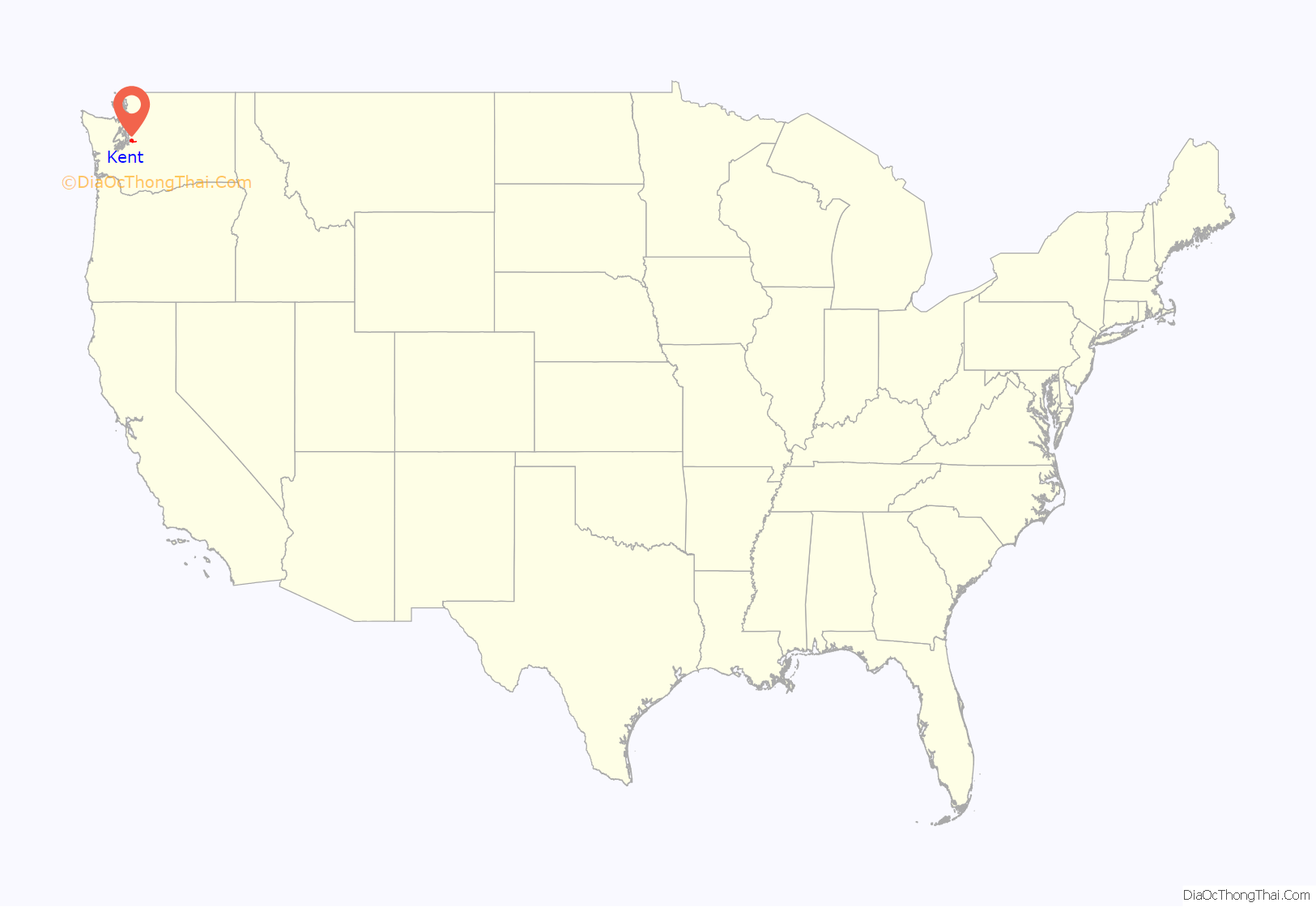
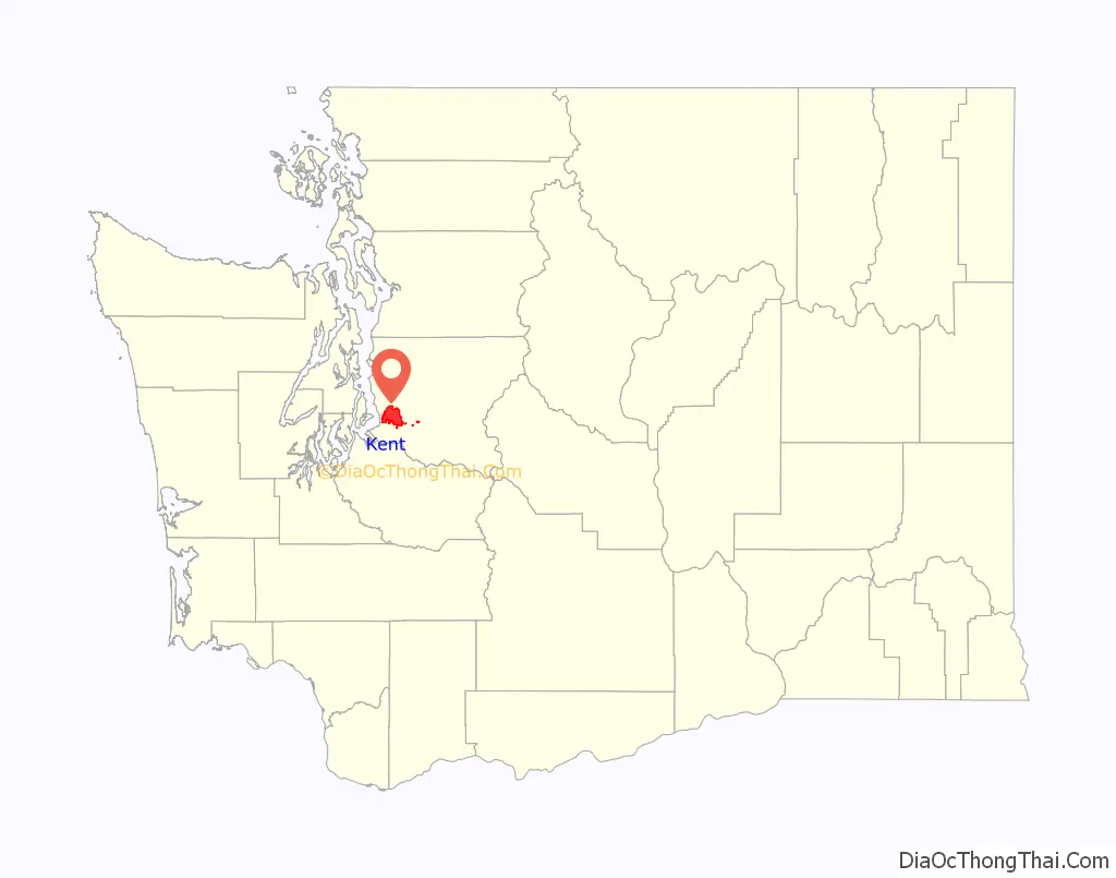
Kent location map. Where is Kent city?
History
The Kent area was first permanently settled by European Americans in the 1850s along the banks of what was then the White River. The first settler was Samuel Russell, who sailed the White and Duwamish rivers until he claimed a plot of land southeast of modern-day downtown Kent in the spring of 1853. Russell was followed by several other settlers who quickly staked claims around the area. The settlements were originally known as “White River” and later the town was called “Titusville” after an early settler by the name of James Henry Titus. (There is still a “Titusville Station” sign on Gowe Street near First Avenue). In 1861 a post office was established under the name White River and was located at the farm of David and Irena Neely who settled in modern-day Kent in 1854. In 1855 their farm was attacked by Native Americans when David Neely served as a lieutenant in the Territorial Army. Another settler was Henry L. Yesler, who was the first sawmill operator in Seattle. By 1870 the population was 277 and all of the quality bottom-land had been claimed.
Throughout the 1860s and 70’s, grain and forage crops such as wheat, barley, oats, hay, and timothy accounted for much of the annual return of farmers in the valley. During the late 1870s the town discovered hops production as a major source of income. Due to an aphid invasion which affected hops crops in Europe, hops from the Puget Sound area began to command high prices. Hops were shipped from Titusville either by the river or via rail. In 1889 the town was renamed for the County of Kent, the major hops-producing region in England. Ezra Meeker was asked by the Northern Pacific Railroad to name its station. Meeker suggested that it be known as Kent as it was “Hop Capitol of the West”. Hops production in the White River valley came to an end soon after its own invasion of aphids in 1891.
Kent was officially incorporated on May 28, 1890, with a population of 793, the second city incorporated in King County. Seattle was the first.
After the turn of the 20th century the area turned to dairy farming and was home to a Carnation condensed milk plant. Flooding from both the Green and the White Rivers was a constant problem. In 1906, flooding changed the course of the White River, which reduced the flood hazard by half. The Green River continued to present problems until the creation of the Howard A. Hanson Dam at Eagle Gorge in 1962.
During and after the Great Depression, Kent was known as the “Lettuce Capital of the World”. After WWII, Kent began to grow more rapidly. From 1953 to 1960 the city’s size grew twelve-fold. In 1965 Boeing began building in Kent, followed a few years later by other aerospace and high-tech companies.
In 1992, the Greater Kent Historical Society was formed to promote the discovery, preservation and dissemination of knowledge about the history of the greater Kent area. In 1996, the City of Kent purchased the historic Bereiter house, the home of one of Kent’s early mayors, for use as the Kent Historical Museum. The museum is operated by the Greater Kent Historical Society.
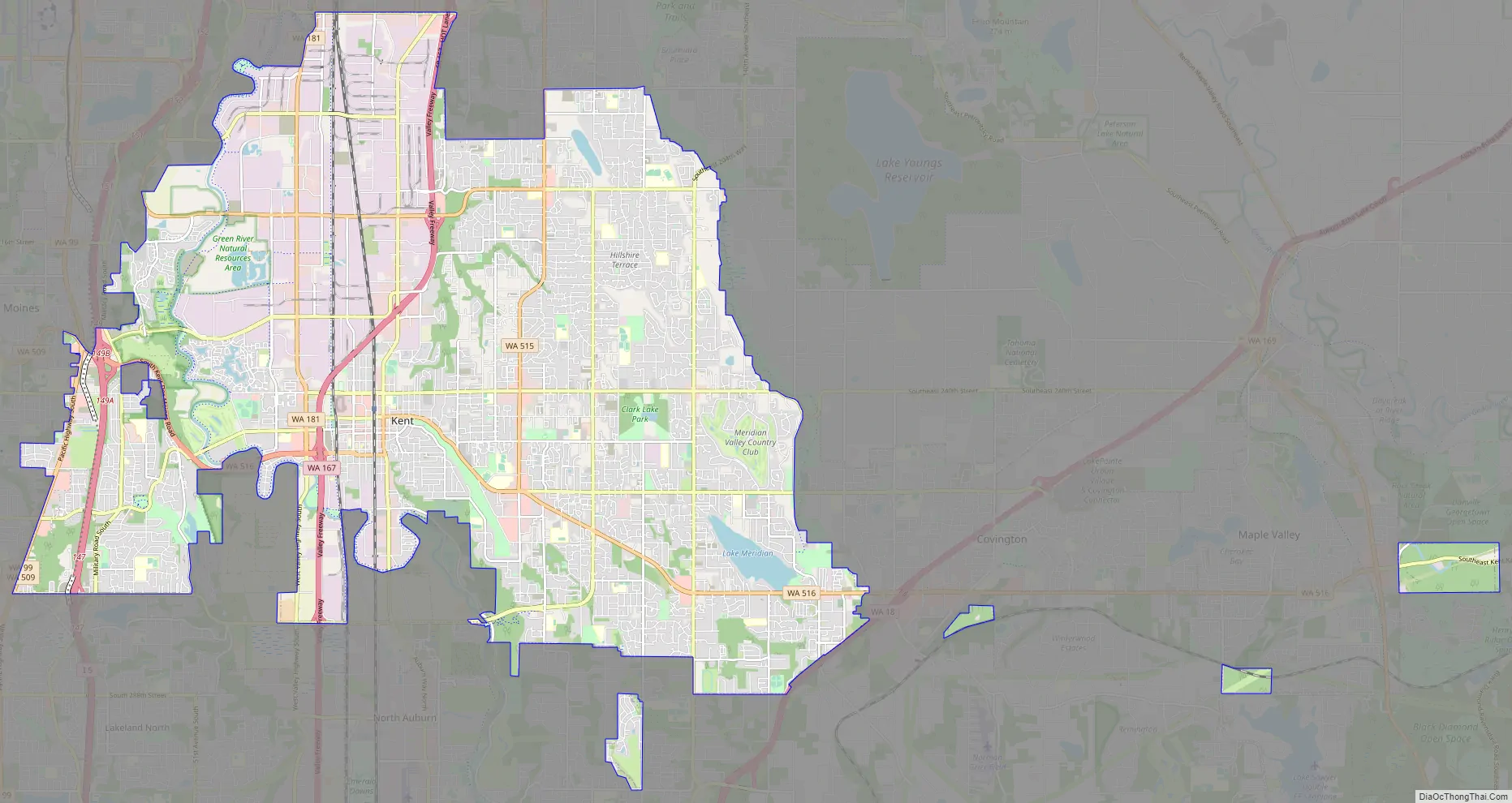
Kent Road Map
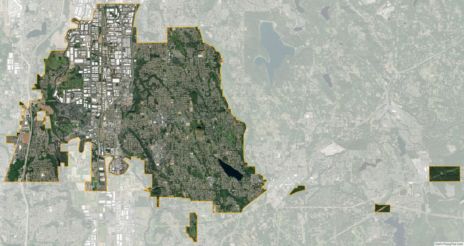
Kent city Satellite Map
Geography
Kent is located in southern King County and is part of Seattle’s metropolitan area. The city is generally divided into three geographic sections: West Hill, the Green River Valley, and East Hill. Downtown Kent is located on the east side of the valley, about 16 miles from downtown Seattle and downtown Bellevue. Adjoining cities are Renton to the north, Covington to the east, Auburn to the south, Federal Way to the southwest, Des Moines to the west, SeaTac to the northwest, and Tukwila to the north.
According to the United States Census Bureau, the city has a total area of 29.19 square miles (75.60 km), of which, 28.63 square miles (74.15 km) is land and 0.56 square miles (1.45 km) is water. Major waterways include the Green River, which flows north through Kent on its way to Puget Sound. The largest lake is Lake Meridian on the city’s East Hill. Mount Rainier is a prominent geographical landmark to the southeast.
Transportation
There are several major freeways and highways in or near Kent, including Interstate 5, State Route 167, and State Route 516. Kent is also served by King County Metro transit, with the Kent Station providing service to many destinations, including downtown Seattle by multiple commuter buses, the Sounder commuter rail system, and local buses. Heavy rail service includes two major north–south lines through the Kent Valley, with freight traffic operations by the BNSF and Union Pacific railroads. The Link light rail system is scheduled to be extended to Federal Way in 2024, with intermediate stops at Kent Des Moines station near Highline College and Star Lake station at South 272nd Street.
Parks
Kent’s park system includes 73 parks, miniparks, playfields, skateparks, greenbelts, and other related facilities. These parks range in size from as little as 4,300 square feet (400 m) to over 310 acres (1.3 km).
Climate
Kent has a warm/cool-summer Mediterranean climate (Köppen Csb).
City landmarks
Kent has designated the following landmarks:
See also
Map of Washington State and its subdivision:- Adams
- Asotin
- Benton
- Chelan
- Clallam
- Clark
- Columbia
- Cowlitz
- Douglas
- Ferry
- Franklin
- Garfield
- Grant
- Grays Harbor
- Island
- Jefferson
- King
- Kitsap
- Kittitas
- Klickitat
- Lewis
- Lincoln
- Mason
- Okanogan
- Pacific
- Pend Oreille
- Pierce
- San Juan
- Skagit
- Skamania
- Snohomish
- Spokane
- Stevens
- Thurston
- Wahkiakum
- Walla Walla
- Whatcom
- Whitman
- Yakima
- Alabama
- Alaska
- Arizona
- Arkansas
- California
- Colorado
- Connecticut
- Delaware
- District of Columbia
- Florida
- Georgia
- Hawaii
- Idaho
- Illinois
- Indiana
- Iowa
- Kansas
- Kentucky
- Louisiana
- Maine
- Maryland
- Massachusetts
- Michigan
- Minnesota
- Mississippi
- Missouri
- Montana
- Nebraska
- Nevada
- New Hampshire
- New Jersey
- New Mexico
- New York
- North Carolina
- North Dakota
- Ohio
- Oklahoma
- Oregon
- Pennsylvania
- Rhode Island
- South Carolina
- South Dakota
- Tennessee
- Texas
- Utah
- Vermont
- Virginia
- Washington
- West Virginia
- Wisconsin
- Wyoming


