Mountlake Terrace is a suburban city in Snohomish County, Washington, United States. It lies on the southern border of the county, adjacent to Shoreline and Lynnwood, and is 13 miles (21 km) north of Seattle. The city had a population of 19,909 people counted in the 2010 census.
Mountlake Terrace was founded in 1949 by real estate developers on the site of a disused airfield, intending to provide low-cost housing for veterans. Within five years, the community had grown to over 5,000 people and was incorporated as a city in 1954 to provide municipal services. An industrial park was developed at the northwest corner of the city, which was connected by Interstate 5 after it opened in 1965. Mountlake Terrace originally had several small shopping centers that declined due to the local economy and a pair of arsons in 1990.
The city government began developing a downtown revitalization plan with mixed-use buildings in the 2000s, with hopes of growing beyond a bedroom community for Seattle commuters. The Mountlake Terrace Transit Center, a major bus hub, opened in 2009 and is planned to have Link light rail service in 2024. The city has several parks, including access to Lake Ballinger, and hosts an annual summer festival that is part of Seafair.
| Name: | Mountlake Terrace city |
|---|---|
| LSAD Code: | 25 |
| LSAD Description: | city (suffix) |
| State: | Washington |
| County: | Snohomish County |
| Incorporated: | November 30, 1954 |
| Elevation: | 456 ft (139 m) |
| Total Area: | 4.16 sq mi (10.78 km²) |
| Land Area: | 4.06 sq mi (10.50 km²) |
| Water Area: | 0.10 sq mi (0.27 km²) |
| Total Population: | 19,909 |
| Population Density: | 5,260.85/sq mi (2,031.32/km²) |
| ZIP code: | 98043 |
| Area code: | 425 |
| FIPS code: | 5347490 |
| GNISfeature ID: | 1512488 |
| Website: | cityofmlt.com |
Online Interactive Map
Click on ![]() to view map in "full screen" mode.
to view map in "full screen" mode.
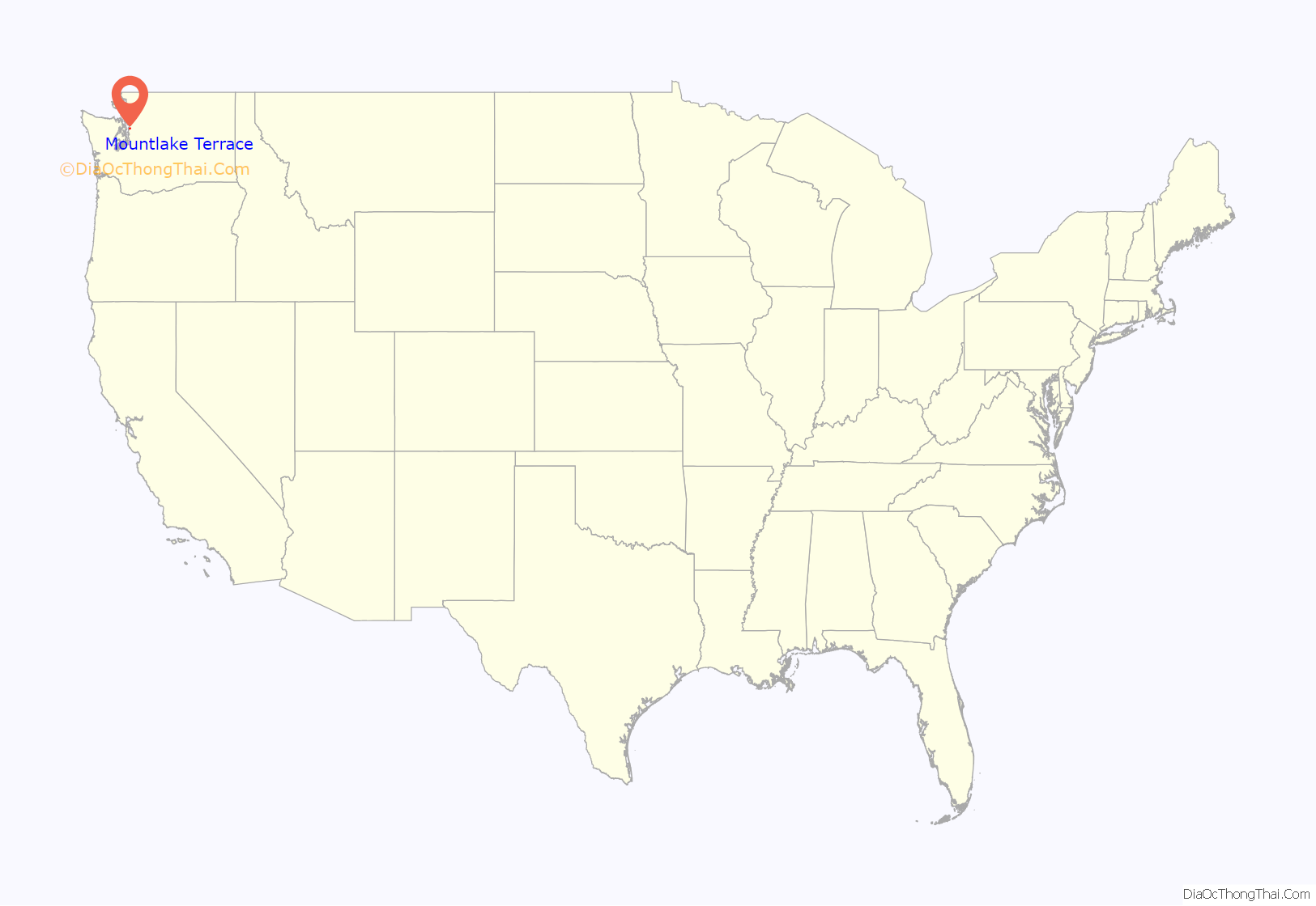
Mountlake Terrace location map. Where is Mountlake Terrace city?
History
The southwestern region of Snohomish County was originally inhabited by the Snohomish people, who primarily settled along the Puget Sound and used inland areas for seasonal hunting and foraging. In 1862, Puget Mill Company acquired 17,000 acres (6,900 ha) in the newly-formed county, including the thickly-forested plateau where modern-day Mountlake Terrace sits and the adjacent Lake McAleer. The land was logged by 1900 and was later subdivided into 10-acre (4.0 ha) chicken ranches, which were sold to farmers. Judge Richard A. Ballinger purchased Lake McAleer in 1901 and renamed it to Lake Ballinger for his father, later leaving the area to become Seattle mayor. The Nile Shrine of Seattle purchased 135 acres (55 ha) on the east side of the lake in 1927, building a clubhouse and later a private golf course.
An interurban railway between Everett and Seattle opened in 1910, improving access from the farms to various markets. Many of these small farms failed during the Great Depression and were affected by the closure of the interurban in 1939, following the completion of Highway 99. The area remained home to chicken and mink farms well into the 1950s, while areas to the south underwent suburban development.
Development and incorporation
A landing field was built on the north side of the King–Snohomish county line by the federal government for use during World War II. It was abandoned after the war, despite plans to expand it for civilian aviation, and acquired by real estate developers Albert LaPierre and Jack Peterson in 1949. LaPierre and Peterson named the property “Mountlake Terrace” for its plateau-like setting with views of Lake Washington and Mount Rainier, and sought to develop a low-income bedroom community for returning veterans. Construction on the first 250 homes began in June 1949, using a simple 20-by-30-foot (6.1 by 9.1 m) floorplan with two bedrooms and basic amenities. The cinderblock homes were built in an assembly line, taking several weeks to complete and leaving landscaping and interior painting to the owners. The homes were initially priced at a minimum of $4,999 (equivalent to $46,000 in 2021 dollars) and sold quickly, requiring expansion beyond the initial subdivision.
Mountlake Terrace was one of the first large-scale suburban developments in the Pacific Northwest, becoming the second-largest residential area in Snohomish County with 5,000 people by 1954. LaPierre and Peterson developed additional areas to the north and east of their initial subdivision, later adding larger homes that remained in an affordable price range for young families. A small shopping center opened on the south side of the county line, followed by a second in the modern-day Town Center in June 1954 with the area’s first supermarket. Mountlake Terrace remained an unincorporated area that was reliant on the county government for services, which were unable to cope with the rising population of the area. The telephone system used a party line shared between 10 homes, the water mains and septic tanks were prone to failure, and the community lacked protection due to their distance from the nearest sheriff’s precinct.
LaPierre and Peterson funded construction of a local fire station and provided a police radio to link community volunteers with the county sheriff in Everett, but response times for emergencies remained long. Patrick McMahan, a local firefighter, began organizing an incorporation campaign in 1953 after waiting a day for the sheriff to respond to an attempted burglary at his home. He first proposed an annexation into Edmonds at a city council meeting in June 1953, where he was rejected by the mayor but approached by a city councilmember who suggested incorporating as a separate city. An incorporation committee was formed by McMahan and other residents, including two attorneys, and collected 650 signatures for their petition to the county government.
The county commissioners scheduled an incorporation ballot measure and a concurrent city council election for November 23, 1954. An anti-incorporation bloc was formed by Mountlake Terrace residents who were opposed to increased taxes and potential costs that were previously covered by the county government. The vote ended 517–483 in favor of incorporating as a third-class city with a council–manager government and elected five councilmembers, including the wife of an anti-incorporation leader. The new city council convened the following day and appointed hardware store owner Gilbert “Gil” Geiser as the first mayor of Mountlake Terrace. Geiser loaned $5 (equivalent to $41 in 2021 dollars) to the city government to file an incorporation charter with the state government, which was issued on November 29 and delivered the following day. City manager Evan Peterson was hired from Bellevue and initially conducted city business from his car before renting an empty two-bedroom house to act as an interim city hall.
Early growth
Within a few years of incorporating, the city government had rebuilt most of Mountlake Terrace’s original roads, added 14 miles (23 km) of sidewalks, and begun work on a permanent water and sewer system. The early homes in the neighborhood were renovated and expanded with financial assistance from the Federal Housing Administration, which also encouraged neighborhood improvements. In 1955, the city annexed 150 acres (61 ha), bringing its population to over 5,400, opened its own post office, and established a police department with five full-time personnel. The Edmonds School District built several schools for the growing city, including Mountlake Terrace High School, which opened in September 1960.
Mountlake Terrace’s population increased by 50 percent within its first five years of incorporating and doubled between 1950 and 1960. LaPierre and Peterson donated land for the construction of several churches, including the St. Pius X Catholic Church, which held its first mass on June 22, 1955. In 1958, the city government signed agreements with the sewer districts of Edmonds and Ronald (now part of Shoreline) to form a “Little Metro” and share treatment facilities. The city also placed restrictions on relocated homes from Seattle later that year, following a surge of those displaced from the construction of Interstate 5, a major regional freeway that would later reach Mountlake Terrace.
In the early 1960s, a new industrial park was developed in Mountlake Terrace that attracted several companies, including electronics firm John Fluke Corporation, who moved 325 employees from Seattle in 1960. Several retailers and other small businesses opened at Mountlake Terrace’s shopping centers, including a pair facing each other at the intersection of 232nd Street Southwest and 56th Avenue West. The city passed a bond issue in 1961 to fund construction of a permanent city hall, which opened in October 1962 with 17,800 square feet (1,650 m) of space for the city government, police department, and fire department. In 1964, Mountlake Terrace approved a bond issue solely for parks, which was later used to construct the Recreation Pavilion in 1968.
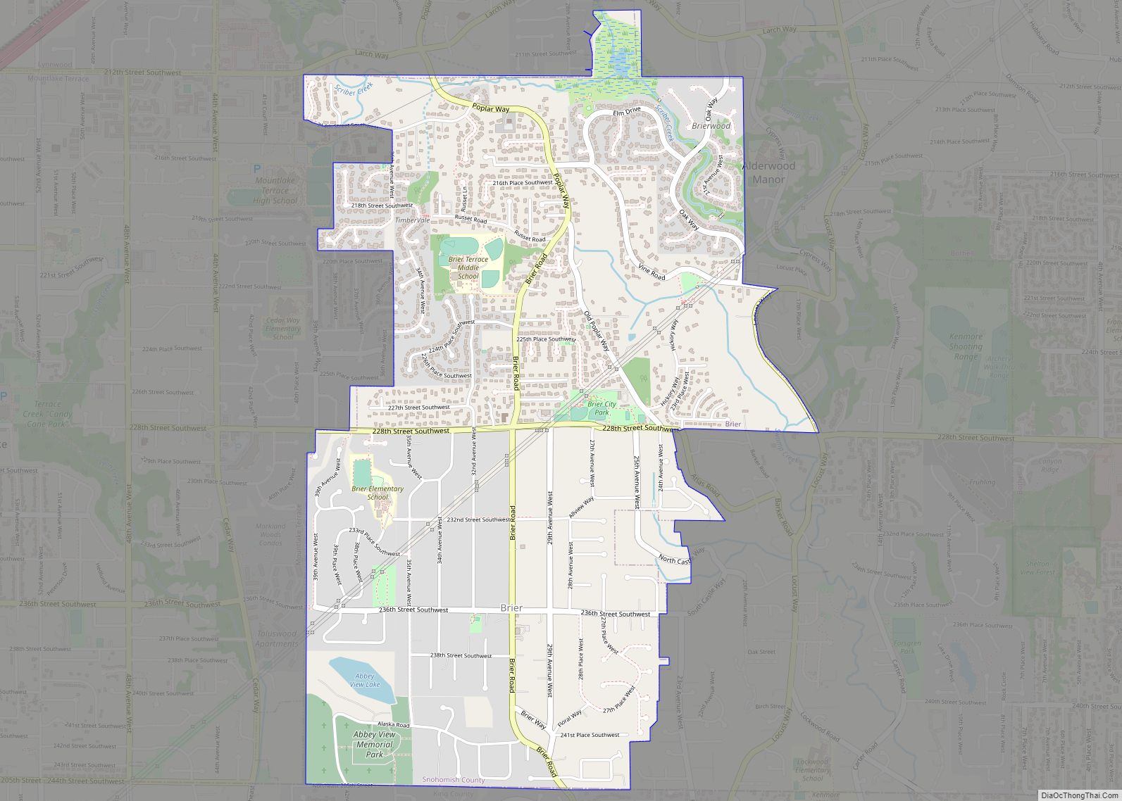
Interstate 5 opened on February 3, 1965, providing faster access from bedroom communities in Snohomish County to Seattle. On the same day, the adjacent area of Brier voted to be incorporated as a city, in part to prevent an annexation by Mountlake Terrace. The two cities later settled a dispute over sewer services that would allow Brier to use Mountlake Terrace’s system.
Late 20th century
The completion of the Boeing Everett Factory spurred continued population growth in the region, with Mountlake Terrace nearly doubling to over 16,000 residents by 1970. The prosperity was short-lived, however, as Boeing announced major layoffs after the collapse of the supersonic transport program, which caused a local recession. The city government had hoped to develop a standalone town center, but local businesses were unable to compete with the Alderwood Mall in Lynnwood, which opened in 1979 and drew away shoppers. Mountlake Terrace’s population declined slightly in the 1970s, resulting in the closure of some local schools and the post office. The number of housing units increased significantly through the construction of apartments and condominiums, but the average occupancy per household decreased. The city government had a budget deficit of $420,000 in 1979 (equivalent to $1.28 million in 2021 dollars) due to declines in revenue and its small sales tax base.
Fluke moved its headquarters in Everett in 1981 and was later replaced by Blue Cross, which moved from Seattle and became the largest employer in the city. The city government continued to encourage development of its industrial center on the northwest side of Interstate 5, including improvements to a freeway interchange and special zoning initiatives. The freeway project also included funding from the state government to improve city parks and sports fields as compensation for lost land at an elementary school in Melody Hill. A 18-acre (7.3 ha) site at the southwest corner of the original subdivision with 14 homes and several small business was proposed for a hotel and commercial development that was later put on hold because of planning complications. The site was later revived in the late 1980s as Gateway Place, an office and retail complex that began construction in 1989.
Despite repeated decreases in spending, the city’s budget had a $1.3 million deficit (equivalent to $2.51 million in 2021 dollars) in 1989 due to increased administrative costs. A pair of arson fires in downtown Mountlake Terrace destroyed two shopping centers and caused $3 million in damage (equivalent to $5.58 million in 2021 dollars). As a result, one shopping center took 20 months to reopen and the other was closed permanently. The city government opposed the construction of a strip club in the 1990s and debated a comprehensive rezoning of the town center to support traditional retail and commercial uses. Mountlake Terrace rebuilt its high school in 1991 and opened a variety of recreational facilities by the end of the decade, including an indoor ice-skating rink and a section of the multi-use Interurban Trail, alongside plans for two casinos.
21st century redevelopment
The city government began planning for a redeveloped town center in the early 2000s, passing zoning regulations to spur the construction of mixed-use residential and commercial. The town center plan, which was adopted in 2007, allowed for building heights of up to seven stories, encouraged architectural variety, and required smaller setbacks from sidewalks. The changes were dependent on the construction of the Mountlake Terrace Transit Center, a major bus hub that opened in 2007 with a parking garage.
The first major project to use the new town center plan, a five-story apartment building with shops, was approved in 2010 and opened in 2013 as Arbor Village. Two more buildings were completed later in the decade, along with reconstruction of the city’s main street (56th Avenue West). An extension of Link light rail along Interstate 5, including a station at Mountlake Terrace Transit Center, was approved by voters in 2008 and is scheduled to open in 2024. The light rail extension triggered an update to the town center in 2019 that would allow for building heights of 12 stories and encouraging walkable development with smaller blocks. A strip of land along Interstate 5 near the transit center, including the former Evergreen Elementary School, is being redeveloped into a three-building housing complex with 600 apartments and retail space that will open in stages from 2020 to 2026.
The city hall building was permanently closed on July 18, 2009, a year after a ceiling collapse in the city council chambers revealed structural issues and hidden asbestos. The city government temporarily relocated to various office spaces in the city before moving into an interim city hall at an office park. The building was demolished in 2010 and funding for a new city hall at the site was approved by voters in 2017 as the centerpiece of a civic campus adjacent to Veterans Memorial Park. The new city hall opened in September 2021 and cost $12.5 million to construct.
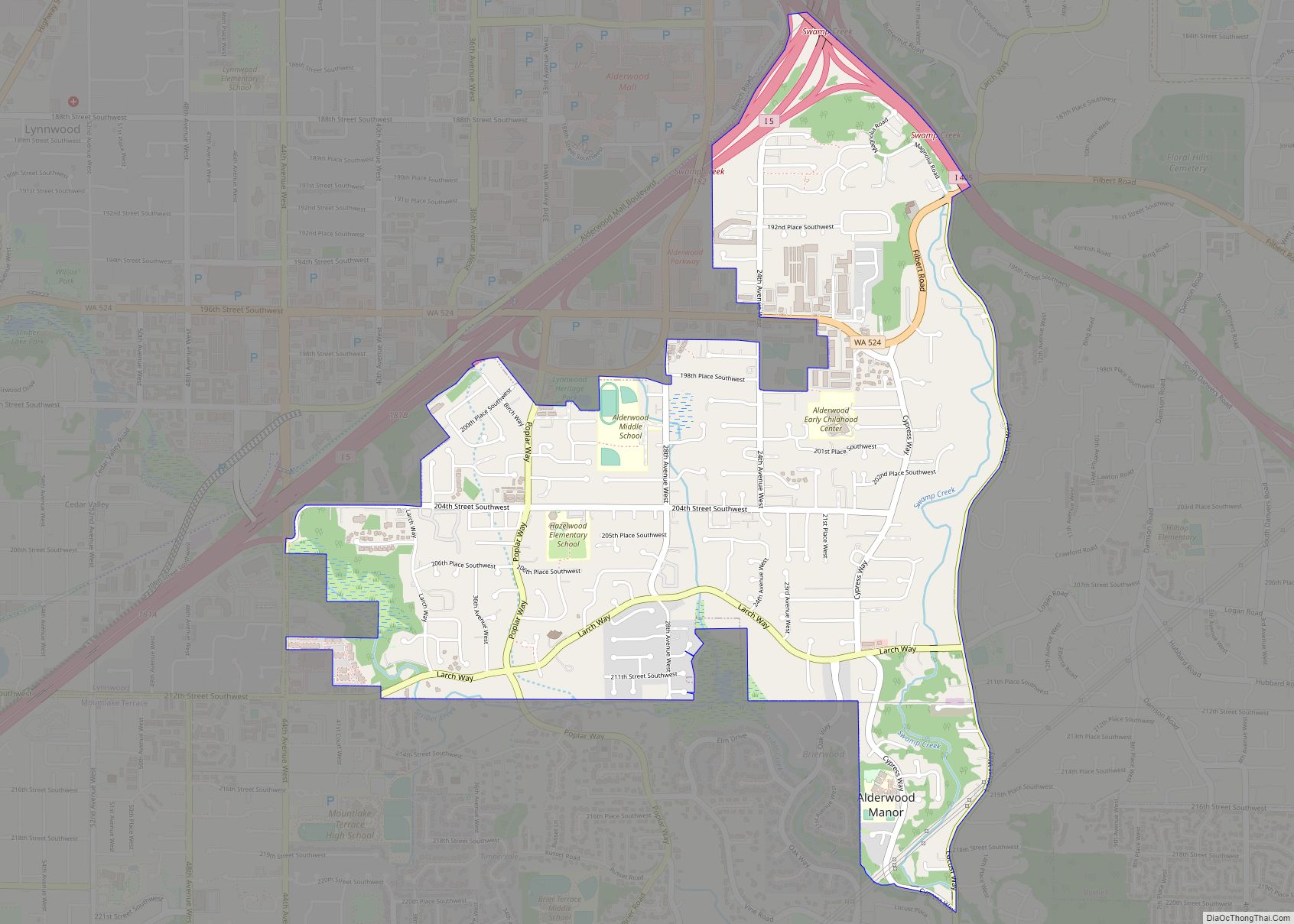
Mountlake Terrace Road Map
Mountlake Terrace city Satellite Map
Geography
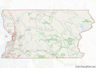
Mountlake Terrace is in southwestern Snohomish County, approximately 14 miles (23 km) north of Downtown Seattle on Interstate 5. It is on the southern border of the county, beyond which lies the cities of Shoreline and Lake Forest Park in King County. The city limits are generally defined to the west by Hall Creek and the Interurban Trail, separating it from Edmonds; to the north by 212th Street Southwest and Lynnwood; and to the east by 39th Avenue West and Brier. According to the United States Census Bureau, the city has a total area of 4.16 square miles (10.77 km), of which 4.06 sq mi (10.52 km) is land and 0.10 sq mi (0.26 km) is water.
The city sits on a plateau that is elevated from the surrounding landscape, with views of the Olympic and Cascade mountains. The Mountlake Terrace’s elevation ranges from 263 to 528 feet (80 to 161 m) above sea level, with an average altitude of 440 feet (130 m). The southwestern portion of the city includes the 100-acre (40 ha) Lake Ballinger, which is fed by Hall Creek from Lynnwood and discharges into McAleer Creek towards Lake Washington. Other portions of Mountlake Terrace lie in the watersheds of Lyon Creek and Swamp Creek, which both drain into Lake Washington.
Neighborhoods
Mountlake Terrace is divided into six designated neighborhoods for use in city planning: the Town Center, Cascade View (formerly North Terrace), Cedar Terrace (formerly East Terrace), Gateway, Lake Ballinger, and Melody Hill.
- The Town Center between 220th and 236th streets is home to several retailers, restaurants, and civic buildings near Veterans Memorial Park. It is planned to be developed into a mixed-use community with commercial and office space alongside denser housing.
- Cedar Terrace is located east of the Town Center and Terrace Creek Park, which is along a section of Lyon Creek. The neighborhood is predominantly residential, with a shopping center and several apartment complexes along Cedar Way.
- Cascade View encompasses the north side of the city, stretching from Interstate 5 in the west to the border with Brier in the east. It is predominantly residential and also includes the high school campus and a shopping center.
- The Gateway neighborhood is a mostly residential neighborhood to the south of the Town Center with a commercial center near Interstate 5 and its interchange with State Route 104. A parcel at the western edge of the neighborhood is being developed into a three-building complex with 600 apartments and retail.
- The predominantly residential Lake Ballinger neighborhood is located at the southwest corner of Mountlake Terrace, between the Interurban Trail and Interstate 5, and includes the eponymous lake.
- Melody Hill has a mix of office parks, industrial businesses, and apartment buildings located in the northwest corner of the city. The neighborhood is located atop a hill west of Interstate 5 and north of Lake Ballinger.
See also
Map of Washington State and its subdivision:- Adams
- Asotin
- Benton
- Chelan
- Clallam
- Clark
- Columbia
- Cowlitz
- Douglas
- Ferry
- Franklin
- Garfield
- Grant
- Grays Harbor
- Island
- Jefferson
- King
- Kitsap
- Kittitas
- Klickitat
- Lewis
- Lincoln
- Mason
- Okanogan
- Pacific
- Pend Oreille
- Pierce
- San Juan
- Skagit
- Skamania
- Snohomish
- Spokane
- Stevens
- Thurston
- Wahkiakum
- Walla Walla
- Whatcom
- Whitman
- Yakima
- Alabama
- Alaska
- Arizona
- Arkansas
- California
- Colorado
- Connecticut
- Delaware
- District of Columbia
- Florida
- Georgia
- Hawaii
- Idaho
- Illinois
- Indiana
- Iowa
- Kansas
- Kentucky
- Louisiana
- Maine
- Maryland
- Massachusetts
- Michigan
- Minnesota
- Mississippi
- Missouri
- Montana
- Nebraska
- Nevada
- New Hampshire
- New Jersey
- New Mexico
- New York
- North Carolina
- North Dakota
- Ohio
- Oklahoma
- Oregon
- Pennsylvania
- Rhode Island
- South Carolina
- South Dakota
- Tennessee
- Texas
- Utah
- Vermont
- Virginia
- Washington
- West Virginia
- Wisconsin
- Wyoming
