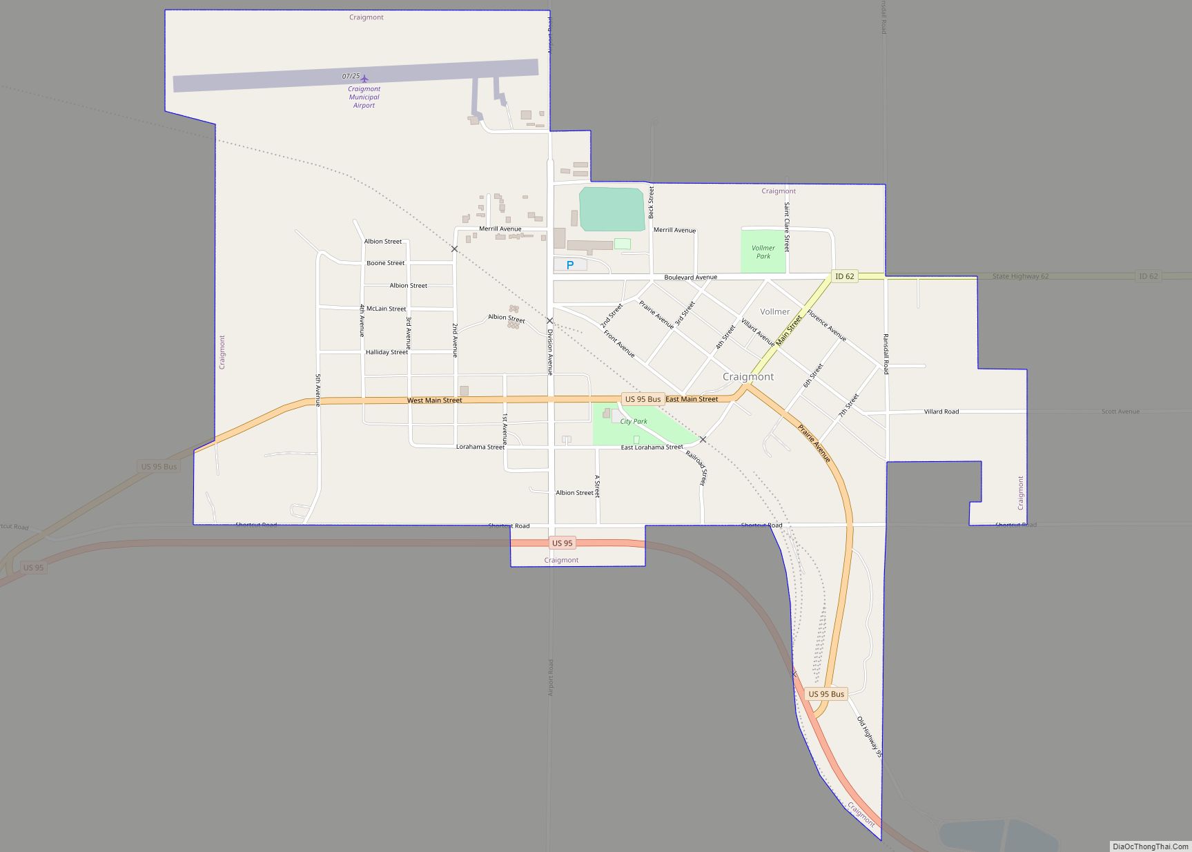
Craigmont is a city in the northwest United States in Lewis County, Idaho. Located on the Camas Prairie in north central Idaho, it is within the Nez Perce Indian Reservation. The population was 501 at the 2010 census, down from 556 in 2000.
| Name: | Craigmont city |
|---|---|
| LSAD Code: | 25 |
| LSAD Description: | city (suffix) |
| State: | Idaho |
| County: | Lewis County |
| Elevation: | 3,740 ft (1,140 m) |
| Total Area: | 0.78 sq mi (2.02 km²) |
| Land Area: | 0.78 sq mi (2.01 km²) |
| Water Area: | 0.00 sq mi (0.00 km²) |
| Total Population: | 501 |
| Population Density: | 629.34/sq mi (242.86/km²) |
| ZIP code: | 83523 |
| Area code: | 208 |
| FIPS code: | 1619270 |
| GNISfeature ID: | 0399839 |
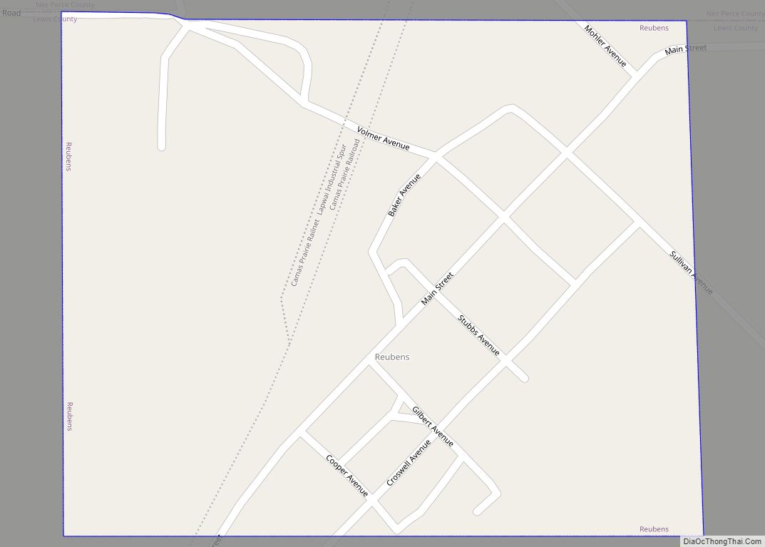
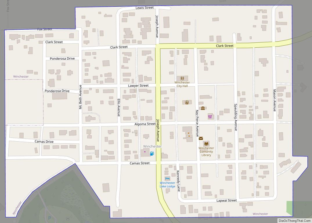
Online Interactive Map
Click on ![]() to view map in "full screen" mode.
to view map in "full screen" mode.
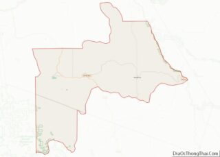
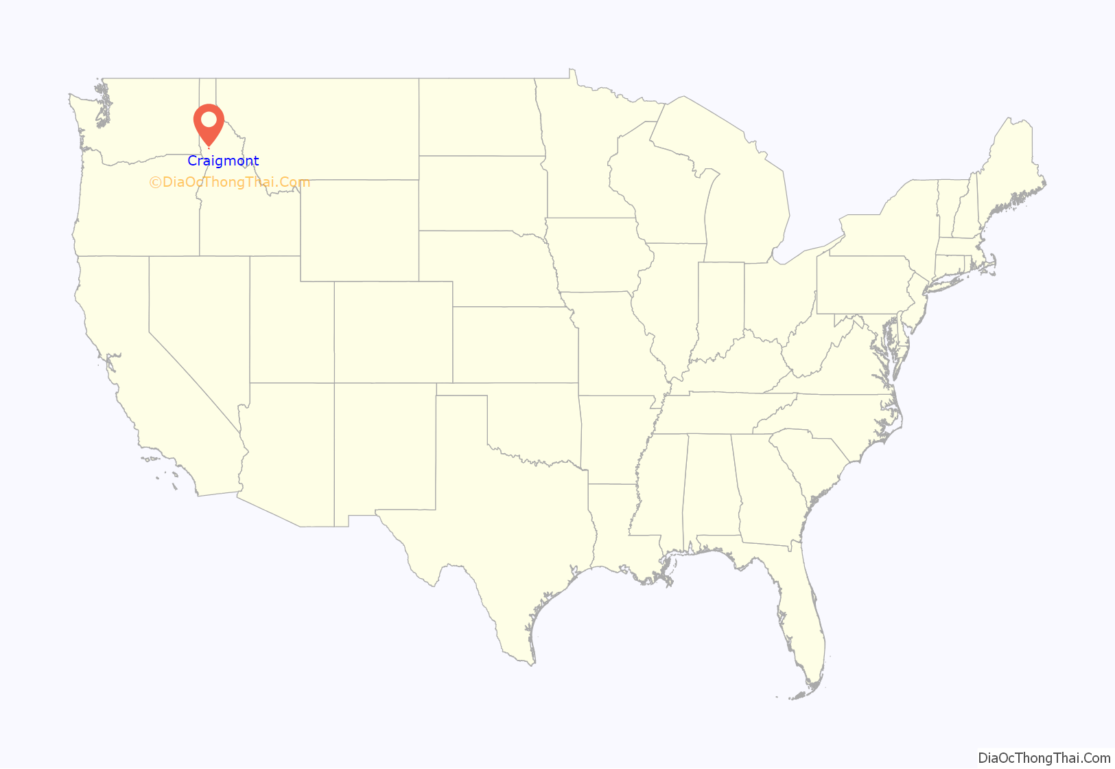
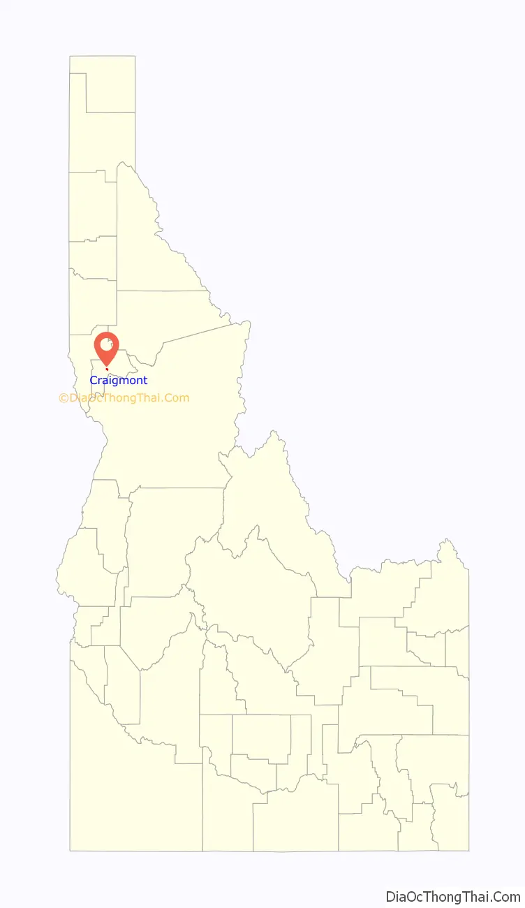
Craigmont location map. Where is Craigmont city?
History
The city is named for Colonel William Craig (1809–69), a mountain man who had a Nez Perce wife. He settled at Lapwai near his father-in-law Hin-mah-tute-ke-kaikt or James in 1840 when he gave up being a fur trapper due to the collapse of the market for beaver.
The Nez Perce Reservation was opened to white settlement 128 years ago in 1895, and a town named “Chicago,” a mile west of the current Craigmont, was founded in 1898. In response to not getting their mail from the post office, it was renamed “Ilo” four years later, after Ilo Leggett, daughter of town founder and merchant W.O. Leggett. A fire burnt the town in 1904 and shortly thereafter the Camas Prairie Railroad bypassed the town and started a settlement, platted by Lewiston financier John P. Vollmer, on the northeast side of the railroad tracks, and he named it “Vollmer.” Ilo responded and moved its community to the southwest side of the tracks, adjacent to Vollmer. After a decade-long feud and the consolidation of the school districts, the communities merged in 1920 to become Craigmont.
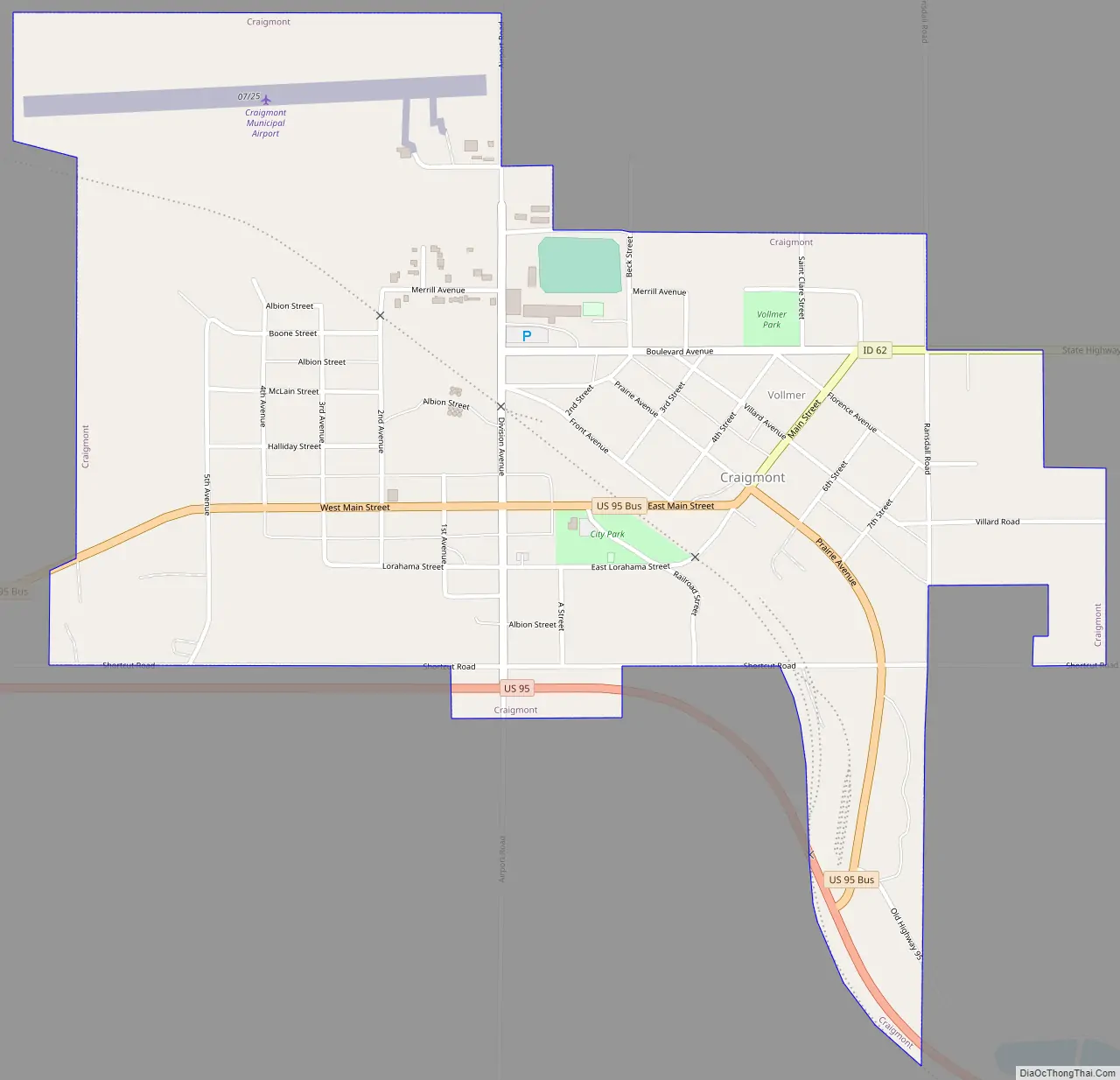
Craigmont Road Map
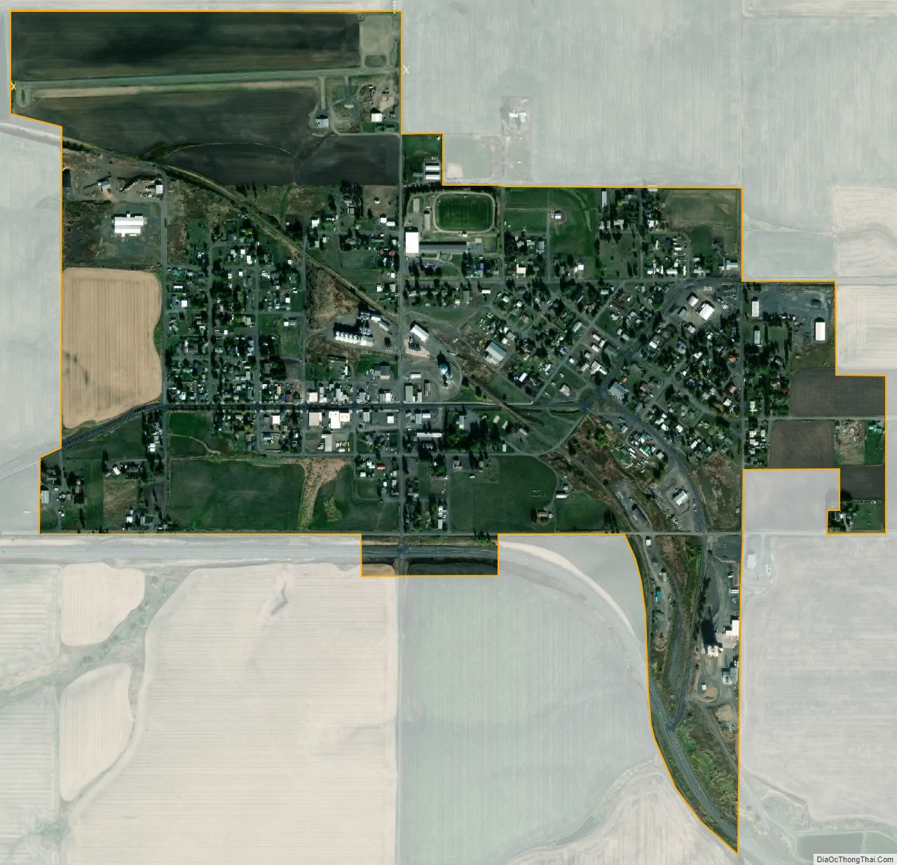
Craigmont city Satellite Map
Geography
Craigmont is located at 46°14′32″N 116°28′14″W / 46.24222°N 116.47056°W / 46.24222; -116.47056 (46.2422, -116.4705), on the Camas Prairie. Located within the Nez Perce Indian Reservation, its elevation is 3,740 feet (1,140 m) above sea level.
According to the United States Census Bureau, the city has a total area of 0.76 square miles (1.97 km), all of it land.
Climate
The climate in this area has mild differences between highs and lows, and there is adequate rainfall year-round. According to the Köppen Climate Classification system, Craigmont has a humid continental climate, abbreviated “Dfb” on climate maps.
See also
Map of Idaho State and its subdivision:- Ada
- Adams
- Bannock
- Bear Lake
- Benewah
- Bingham
- Blaine
- Boise
- Bonner
- Bonneville
- Boundary
- Butte
- Camas
- Canyon
- Caribou
- Cassia
- Clark
- Clearwater
- Custer
- Elmore
- Franklin
- Fremont
- Gem
- Gooding
- Idaho
- Jefferson
- Jerome
- Kootenai
- Latah
- Lemhi
- Lewis
- Lincoln
- Madison
- Minidoka
- Nez Perce
- Oneida
- Owyhee
- Payette
- Power
- Shoshone
- Teton
- Twin Falls
- Valley
- Washington
- Alabama
- Alaska
- Arizona
- Arkansas
- California
- Colorado
- Connecticut
- Delaware
- District of Columbia
- Florida
- Georgia
- Hawaii
- Idaho
- Illinois
- Indiana
- Iowa
- Kansas
- Kentucky
- Louisiana
- Maine
- Maryland
- Massachusetts
- Michigan
- Minnesota
- Mississippi
- Missouri
- Montana
- Nebraska
- Nevada
- New Hampshire
- New Jersey
- New Mexico
- New York
- North Carolina
- North Dakota
- Ohio
- Oklahoma
- Oregon
- Pennsylvania
- Rhode Island
- South Carolina
- South Dakota
- Tennessee
- Texas
- Utah
- Vermont
- Virginia
- Washington
- West Virginia
- Wisconsin
- Wyoming