Elk City is a census-designated place in Idaho County, Idaho, United States. As of the 2020 census, its population was 170.
| Name: | Elk City CDP |
|---|---|
| LSAD Code: | 57 |
| LSAD Description: | CDP (suffix) |
| State: | Idaho |
| County: | Idaho County |
| Elevation: | 4,006 ft (1,221 m) |
| Total Area: | 2.510 sq mi (6.50 km²) |
| Land Area: | 2.506 sq mi (6.49 km²) |
| Water Area: | 0.004 sq mi (0.01 km²) |
| Total Population: | 170 |
| Population Density: | 68/sq mi (26/km²) |
| ZIP code: | 83525 |
| Area code: | 208, 986 |
| FIPS code: | 1625030 |
| GNISfeature ID: | 396453 |
Online Interactive Map
Click on ![]() to view map in "full screen" mode.
to view map in "full screen" mode.
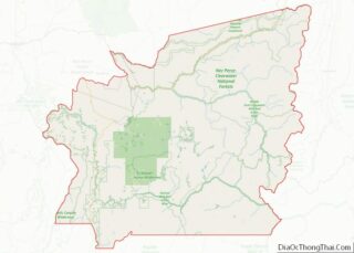
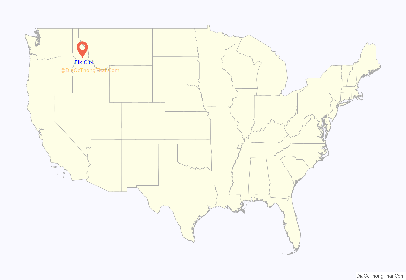
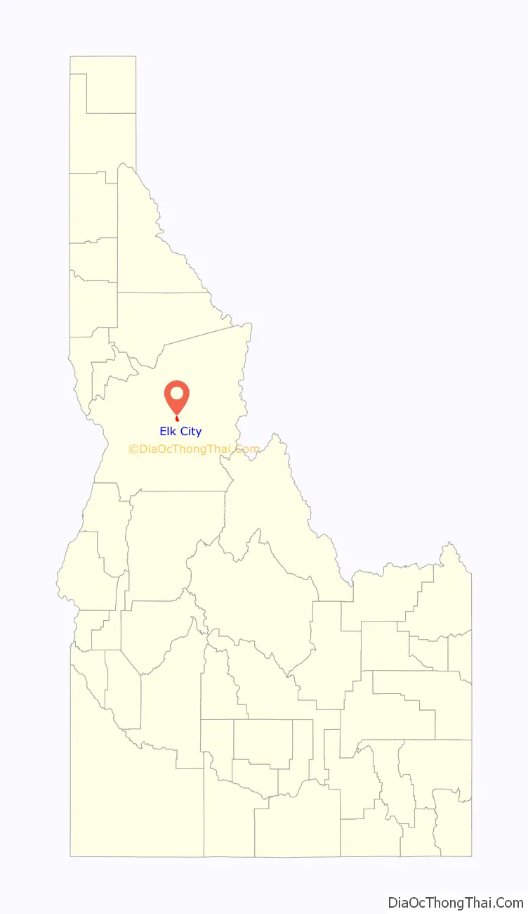
Elk City location map. Where is Elk City CDP?
History
Elk City was the site of a gold strike in 1861, as prospectors rushed south from Pierce, two years before the formation of the Idaho Territory. In the 1870s, Chinese miners leased the claims but were later driven out by mistreatment. Quartz lode operations began in 1902 and dredging in 1935.
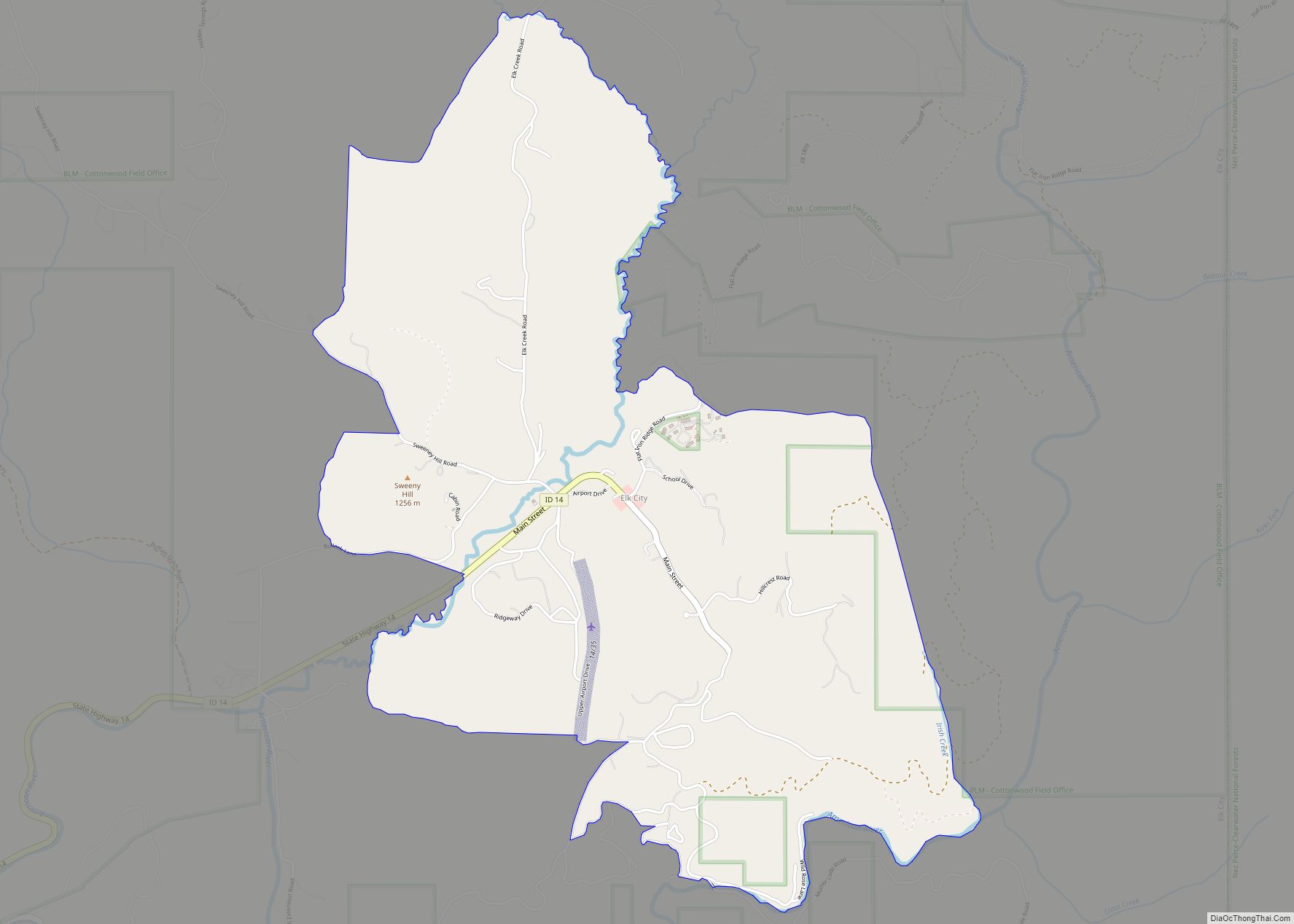
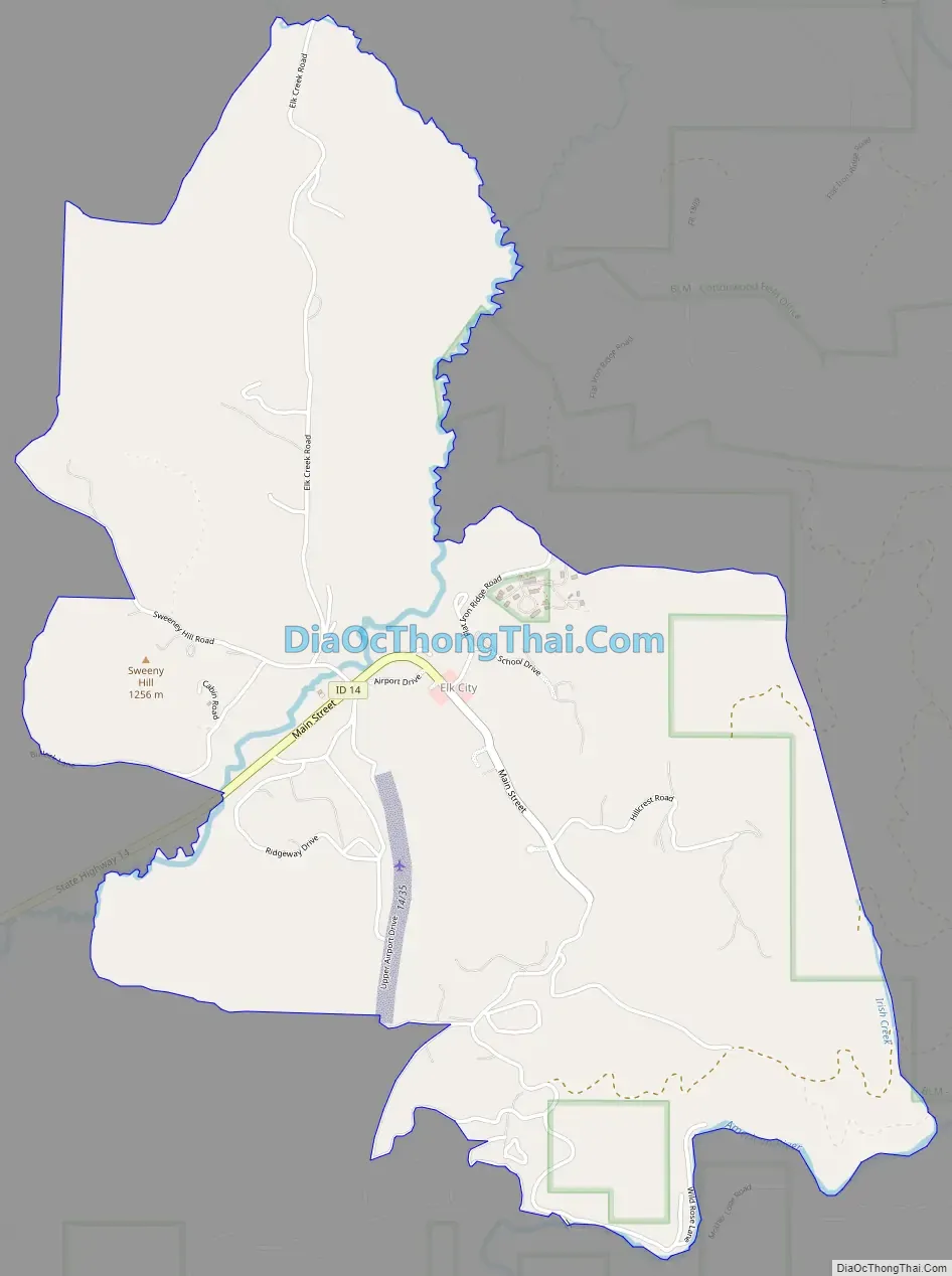
Elk City Road Map
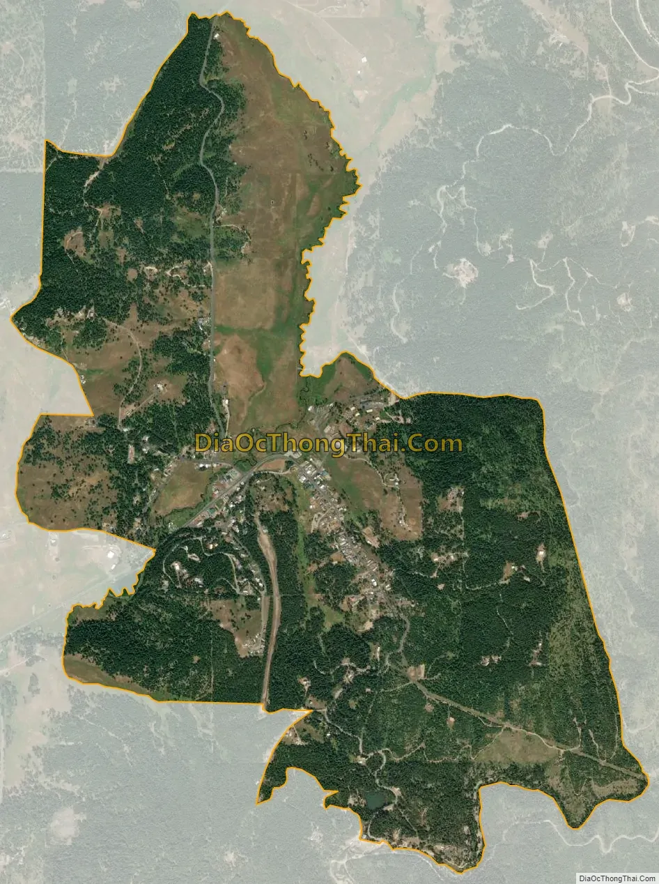
Elk City city Satellite Map
Geography
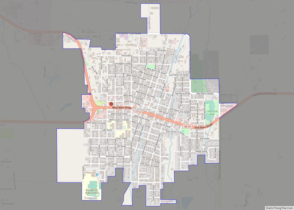
Elk City is located at 45°49′37″N 115°26′12″W / 45.82694°N 115.43667°W / 45.82694; -115.43667, at an elevation of 4,006 feet (1,221 m) above sea level. At the eastern end of State Highway 14, it is fifty miles (80 km) east of Grangeville, the nearest city. Elk City has a post office with ZIP code 83525.
Climate
This climatic region is typified by large seasonal temperature differences, with warm to hot (and often humid) summers and cold (sometimes severely cold) winters. According to the Köppen Climate Classification system, Elk City has a humid continental climate, abbreviated “Dfb” on climate maps.
See also
Map of Idaho State and its subdivision:- Ada
- Adams
- Bannock
- Bear Lake
- Benewah
- Bingham
- Blaine
- Boise
- Bonner
- Bonneville
- Boundary
- Butte
- Camas
- Canyon
- Caribou
- Cassia
- Clark
- Clearwater
- Custer
- Elmore
- Franklin
- Fremont
- Gem
- Gooding
- Idaho
- Jefferson
- Jerome
- Kootenai
- Latah
- Lemhi
- Lewis
- Lincoln
- Madison
- Minidoka
- Nez Perce
- Oneida
- Owyhee
- Payette
- Power
- Shoshone
- Teton
- Twin Falls
- Valley
- Washington
- Alabama
- Alaska
- Arizona
- Arkansas
- California
- Colorado
- Connecticut
- Delaware
- District of Columbia
- Florida
- Georgia
- Hawaii
- Idaho
- Illinois
- Indiana
- Iowa
- Kansas
- Kentucky
- Louisiana
- Maine
- Maryland
- Massachusetts
- Michigan
- Minnesota
- Mississippi
- Missouri
- Montana
- Nebraska
- Nevada
- New Hampshire
- New Jersey
- New Mexico
- New York
- North Carolina
- North Dakota
- Ohio
- Oklahoma
- Oregon
- Pennsylvania
- Rhode Island
- South Carolina
- South Dakota
- Tennessee
- Texas
- Utah
- Vermont
- Virginia
- Washington
- West Virginia
- Wisconsin
- Wyoming