Grace is a city in Caribou County, Idaho, United States. The population was 915 at the 2010 census.
| Name: | Grace city |
|---|---|
| LSAD Code: | 25 |
| LSAD Description: | city (suffix) |
| State: | Idaho |
| County: | Caribou County |
| Elevation: | 5,535 ft (1,687 m) |
| Total Area: | 0.96 sq mi (2.48 km²) |
| Land Area: | 0.96 sq mi (2.48 km²) |
| Water Area: | 0.00 sq mi (0.00 km²) |
| Total Population: | 915 |
| Population Density: | 975.99/sq mi (376.82/km²) |
| ZIP code: | 83241 |
| Area code: | 208 |
| FIPS code: | 1632500 |
| GNISfeature ID: | 0396575 |
Online Interactive Map
Click on ![]() to view map in "full screen" mode.
to view map in "full screen" mode.
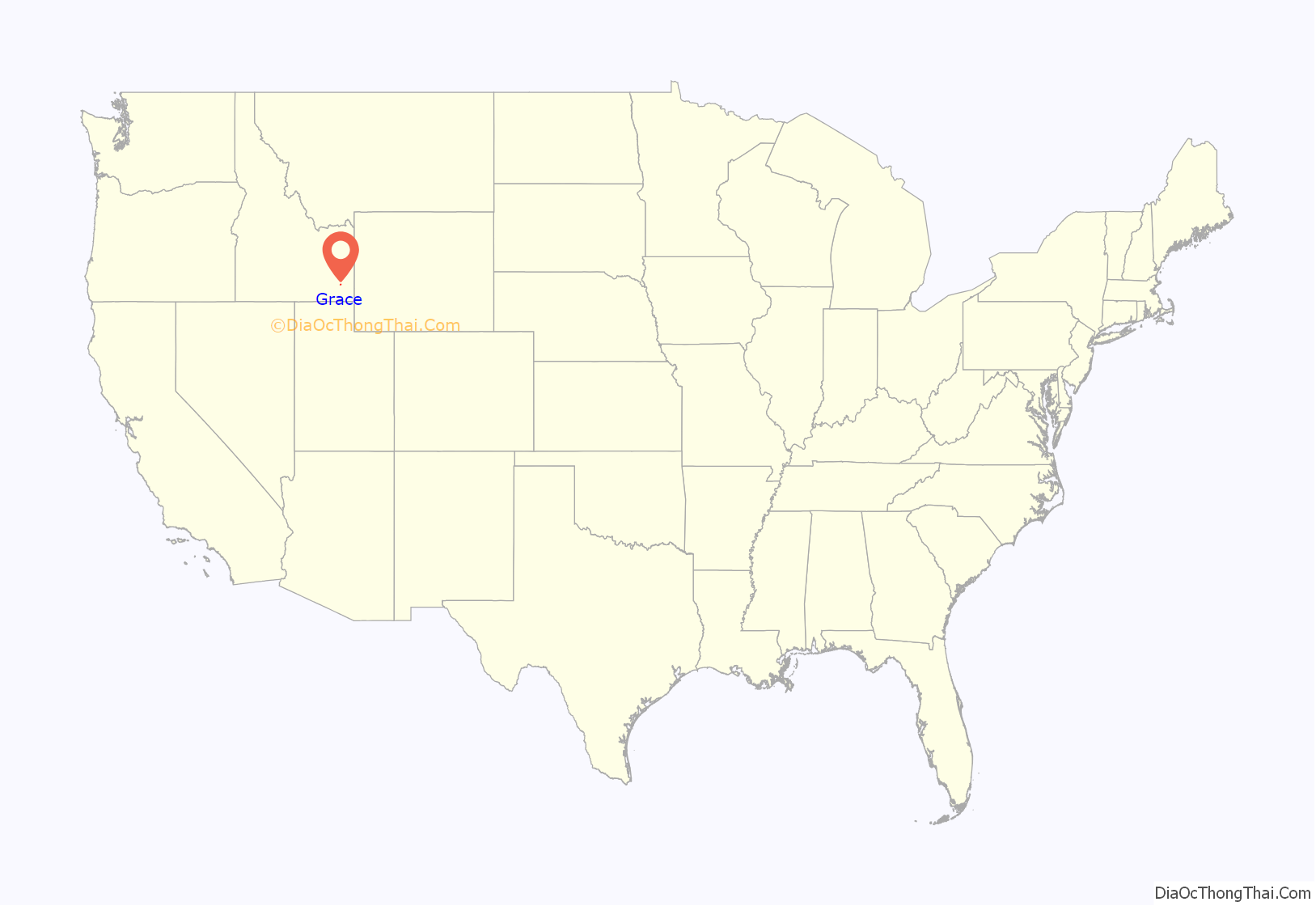
Grace location map. Where is Grace city?
History
The area of Grace was once inhabited by the Shoshone Indians. The Oregon Trail passed within 4 miles (6.4 km) of Grace and the town itself was established with a post office in 1894. Unlike other nearby historic towns such as Paris and Franklin, Grace was not originally settled by Mormon pioneers, but has since become a predominantly Mormon-populated town. The economy in and around Grace has traditionally been driven by agriculture, with potatoes, alfalfa, grain, dairy and ranching being the main staples.
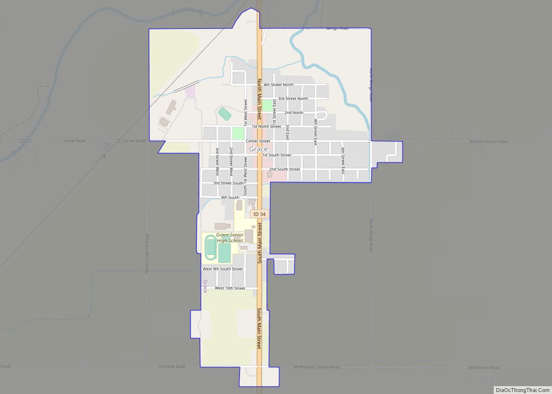
Grace Road Map
Grace city Satellite Map
Geography
According to the United States Census Bureau, the city has a total area of 0.99 square miles (2.56 km), all of it land.
Grace is one of the northernmost cities along the Wasatch Range which extends approximately 160 miles (260 km) south, and is only 1 mile (1.6 km) west of the large fault line that defines the range. Grace is located near the center of Gem Valley.
In stark contrast to the surrounding mountains, the valley floor in the immediate area of Grace is flat due to volcanic activity in the area some 30,000 years ago. The lava flow that created the valley also diverted the Bear River from its Pacific drainage into the Great Basin. This was a significant contributor to the growth of the prehistoric Lake Bonneville of which the Great Salt Lake is a remnant. Lake Bonneville reached its farthest north advance about four miles (6 km) southwest of Grace before it broke through the earthen barrier at Red Rock pass north of Preston, Idaho. The Bear River today runs to the north and west of Grace and terminates in the Great Salt Lake.
Grace’s neighboring towns are Soda Springs to the north east, Bancroft to the north west, and Preston to the south. It is about 20 miles (32 km) from Lava Hot Springs, which is a local tourism and recreation destination. The nearest city with a major airport is Salt Lake City, Utah, which is approximately 175 miles (282 km) south.
Climate
This climatic region is typified by large seasonal temperature differences, with warm to hot (and often humid) summers and cold (sometimes severely cold) winter. According to the Köppen Climate Classification system, Grace has a humid continental climate, abbreviated “Dfb” on climate maps.
See also
Map of Idaho State and its subdivision:- Ada
- Adams
- Bannock
- Bear Lake
- Benewah
- Bingham
- Blaine
- Boise
- Bonner
- Bonneville
- Boundary
- Butte
- Camas
- Canyon
- Caribou
- Cassia
- Clark
- Clearwater
- Custer
- Elmore
- Franklin
- Fremont
- Gem
- Gooding
- Idaho
- Jefferson
- Jerome
- Kootenai
- Latah
- Lemhi
- Lewis
- Lincoln
- Madison
- Minidoka
- Nez Perce
- Oneida
- Owyhee
- Payette
- Power
- Shoshone
- Teton
- Twin Falls
- Valley
- Washington
- Alabama
- Alaska
- Arizona
- Arkansas
- California
- Colorado
- Connecticut
- Delaware
- District of Columbia
- Florida
- Georgia
- Hawaii
- Idaho
- Illinois
- Indiana
- Iowa
- Kansas
- Kentucky
- Louisiana
- Maine
- Maryland
- Massachusetts
- Michigan
- Minnesota
- Mississippi
- Missouri
- Montana
- Nebraska
- Nevada
- New Hampshire
- New Jersey
- New Mexico
- New York
- North Carolina
- North Dakota
- Ohio
- Oklahoma
- Oregon
- Pennsylvania
- Rhode Island
- South Carolina
- South Dakota
- Tennessee
- Texas
- Utah
- Vermont
- Virginia
- Washington
- West Virginia
- Wisconsin
- Wyoming


