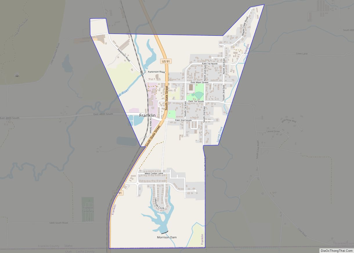
Preston is a city in Franklin County, Idaho, United States. The population was 5,204 at the 2010 census. The city is the county seat of Franklin County. It is part of the Logan, Utah-Idaho Metropolitan Statistical Area.
| Name: | Preston city |
|---|---|
| LSAD Code: | 25 |
| LSAD Description: | city (suffix) |
| State: | Idaho |
| County: | Franklin County |
| Elevation: | 4,715 ft (1,437 m) |
| Total Area: | 6.80 sq mi (17.61 km²) |
| Land Area: | 6.79 sq mi (17.60 km²) |
| Water Area: | 0.01 sq mi (0.01 km²) |
| Total Population: | 5,204 |
| Population Density: | 817.81/sq mi (315.76/km²) |
| ZIP code: | 83263 |
| Area code: | 208 |
| FIPS code: | 1665260 |
| GNISfeature ID: | 0398011 |
| Website: | prestonidaho.net |
Online Interactive Map
Click on ![]() to view map in "full screen" mode.
to view map in "full screen" mode.
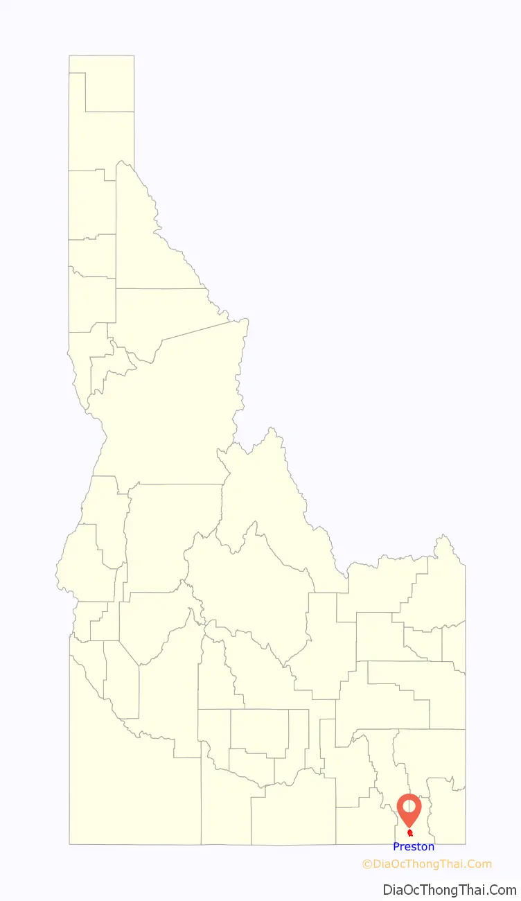
Preston location map. Where is Preston city?

History
The Bear River Massacre occurred in 1863 at a point a few miles northwest of Preston. The Bear River Massacre Site is a National Historic Landmark.
In 1866, Latter-day Saint pioneers arrived in the northern end of the Cache Valley, stretching across southeastern Idaho and northeastern Utah. They founded a community in that location and named it Worm Creek, but in 1881 changed it to Preston because leaders of the Church of Jesus Christ of Latter-day Saints (LDS Church) in Salt Lake City objected to the name “Worm Creek” being part of any church congregation’s name. The name Preston was suggested by a local member to honor William B. Preston, who at the time was president of the LDS Church’s Cache Stake.
It was not until the 1880s while William C. Parkinson was serving as the bishop of the Preston LDS Ward that a regular townsite was laid out.
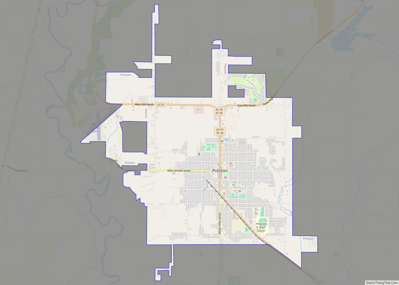
Preston Road Map

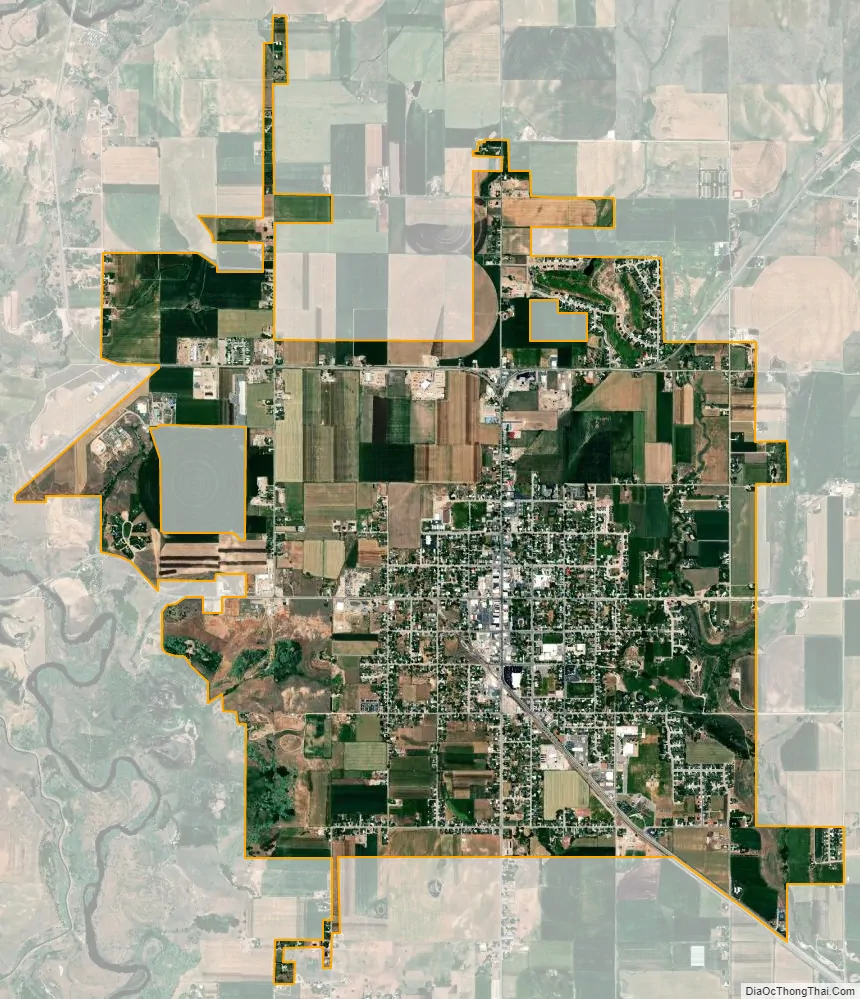
Preston city Satellite Map
Geography
According to the United States Census Bureau, the city has a total area of 6.66 square miles (17.25 km), of which, 6.65 square miles (17.22 km) is land and 0.01 square miles (0.03 km) is water.
Nearby is the Cub River Canyon, which is a popular recreation area.
Within Preston itself, U.S. Highway 91 is the main north-south street, State Street. By driving south on US-91, it is a 25-minute drive from Preston to the larger Logan, Utah. Oneida Street, also State Highway 36 is the primary west-east road. Preston is a half-hour drive from Interstate 15.
Climate
Preston has a warm-summer humid continental climate (Köppen climate classification: Dfb).
See also
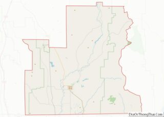
Map of Idaho State and its subdivision:- Ada
- Adams
- Bannock
- Bear Lake
- Benewah
- Bingham
- Blaine
- Boise
- Bonner
- Bonneville
- Boundary
- Butte
- Camas
- Canyon
- Caribou
- Cassia
- Clark
- Clearwater
- Custer
- Elmore
- Franklin
- Fremont
- Gem
- Gooding
- Idaho
- Jefferson
- Jerome
- Kootenai
- Latah
- Lemhi
- Lewis
- Lincoln
- Madison
- Minidoka
- Nez Perce
- Oneida
- Owyhee
- Payette
- Power
- Shoshone
- Teton
- Twin Falls
- Valley
- Washington
- Alabama
- Alaska
- Arizona
- Arkansas
- California
- Colorado
- Connecticut
- Delaware
- District of Columbia
- Florida
- Georgia
- Hawaii
- Idaho
- Illinois
- Indiana
- Iowa
- Kansas
- Kentucky
- Louisiana
- Maine
- Maryland
- Massachusetts
- Michigan
- Minnesota
- Mississippi
- Missouri
- Montana
- Nebraska
- Nevada
- New Hampshire
- New Jersey
- New Mexico
- New York
- North Carolina
- North Dakota
- Ohio
- Oklahoma
- Oregon
- Pennsylvania
- Rhode Island
- South Carolina
- South Dakota
- Tennessee
- Texas
- Utah
- Vermont
- Virginia
- Washington
- West Virginia
- Wisconsin
- Wyoming