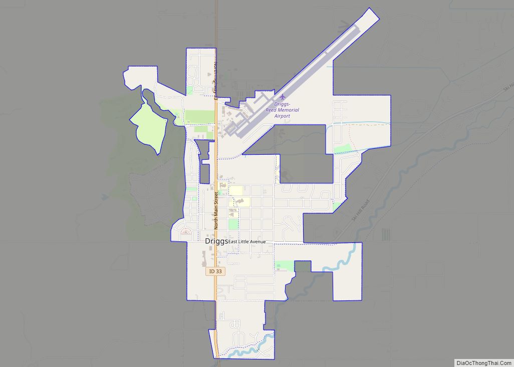
Driggs is a city in the western United States in eastern Idaho, and is the county seat of Teton County. Part of the Jackson, WY-ID Micropolitan Statistical Area, it is located in Teton Valley, the headwaters of the Teton River. The population was 1,660 at the 2010 census, up from 1,100 in 2000.
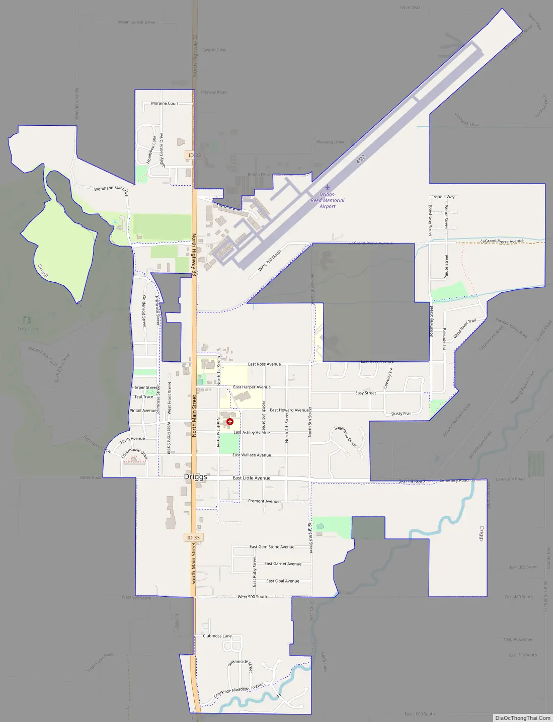
Located within city limits is the Driggs-Reed Memorial Airport, a class II airport that can accommodate private aircraft on its 7,300-foot (2,225 m) runway.
| Name: | Driggs city |
|---|---|
| LSAD Code: | 25 |
| LSAD Description: | city (suffix) |
| State: | Idaho |
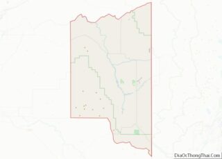
| County: | Teton County |
| Elevation: | 6,109 ft (1,862 m) |
| Total Area: | 2.92 sq mi (7.56 km²) |
| Land Area: | 2.92 sq mi (7.56 km²) |
| Water Area: | 0.00 sq mi (0.00 km²) |
| Total Population: | 1,660 |
| Population Density: | 622.90/sq mi (240.50/km²) |
| ZIP code: | 83422 |
| FIPS code: | 1622690 |
| GNISfeature ID: | 0380758 |
| Website: | www.driggs.govoffice.com |
Online Interactive Map
Click on ![]() to view map in "full screen" mode.
to view map in "full screen" mode.
Driggs location map. Where is Driggs city?


History
The Teton Valley was discovered by John Colter in 1808, a member of the Lewis and Clark Expedition (1804–06). It later became known as Pierre’s Hole, in honor of “le grand Pierre” Tivanitagon, and hosted the well-attended 1832 Rendezvous, which was followed by the Battle of Pierre’s Hole.
Driggs was founded in 1888 by Benjamin Woodbury Driggs, Jr. and Don Carlos Driggs, whose descendants later moved to Arizona(where most live still), and there founded Western Savings and Loan. John Driggs, a descendant of Don Carlos Driggs, later became the mayor of Phoenix, Arizona in the 1970s.
In 2007, National Geographic magazine listed Driggs as one of the 10 best outdoor recreation destinations in the U.S.
Driggs Road Map
Driggs city Satellite Map

Geography
According to the United States Census Bureau, the city has a total land area of 2.76 square miles (7.15 km).
Climate
This climatic region is typified by large seasonal temperature differences, with warm summers and cold (sometimes severely cold) winters. According to the Köppen Climate Classification system, Driggs has a humid continental climate, abbreviated “Dfb” on climate maps. It has a surprising amount of seasonal lag for a place in the Rocky Mountains- more than what would be expected in the northeast.
See also
Map of Idaho State and its subdivision:- Ada
- Adams
- Bannock
- Bear Lake
- Benewah
- Bingham
- Blaine
- Boise
- Bonner
- Bonneville
- Boundary
- Butte
- Camas
- Canyon
- Caribou
- Cassia
- Clark
- Clearwater
- Custer
- Elmore
- Franklin
- Fremont
- Gem
- Gooding
- Idaho
- Jefferson
- Jerome
- Kootenai
- Latah
- Lemhi
- Lewis
- Lincoln
- Madison
- Minidoka
- Nez Perce
- Oneida
- Owyhee
- Payette
- Power
- Shoshone
- Teton
- Twin Falls
- Valley
- Washington
- Alabama
- Alaska
- Arizona
- Arkansas
- California
- Colorado
- Connecticut
- Delaware
- District of Columbia
- Florida
- Georgia
- Hawaii
- Idaho
- Illinois
- Indiana
- Iowa
- Kansas
- Kentucky
- Louisiana
- Maine
- Maryland
- Massachusetts
- Michigan
- Minnesota
- Mississippi
- Missouri
- Montana
- Nebraska
- Nevada
- New Hampshire
- New Jersey
- New Mexico
- New York
- North Carolina
- North Dakota
- Ohio
- Oklahoma
- Oregon
- Pennsylvania
- Rhode Island
- South Carolina
- South Dakota
- Tennessee
- Texas
- Utah
- Vermont
- Virginia
- Washington
- West Virginia
- Wisconsin
- Wyoming