Landover is an unincorporated community and census-designated place in Prince George’s County, Maryland, United States. As of the 2020 census, it had a population of 25,998.
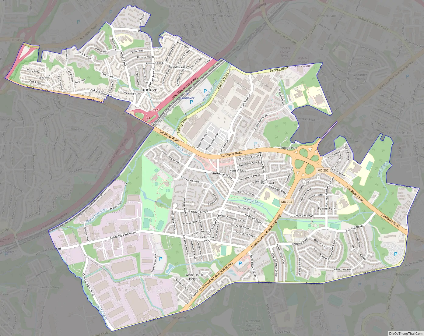
Landover is contained between Sheriff Road and Central Avenue to the south, Hill Road, Cabin Branch Drive, and the Washington Metropolitan Area Transit Authority (Metro) Orange Line tracks to the west, John Hanson Highway (U.S. Highway 50) to the north, and Washington D.C.’s Capital Beltway (Interstate 495/95) to the east. Landover borders the communities of New Carrollton, Landover Hills, Glenarden, Lanham, Ardmore, Kentland, Cheverly, Chapel Oaks, Fairmount Heights, Carmody Hills, Pepper Mill Village, Walker Mill, and Largo.
| Name: | Landover CDP |
|---|---|
| LSAD Code: | 57 |
| LSAD Description: | CDP (suffix) |
| State: | Maryland |
| County: | Prince George’s County |
| Total Area: | 4.00 sq mi (10.37 km²) |
| Land Area: | 4.00 sq mi (10.36 km²) |
| Water Area: | 0.01 sq mi (0.01 km²) |
| Total Population: | 25,998 |
| Population Density: | 6,499.50/sq mi (2,509.46/km²) |
| ZIP code: | 20785 |
| Area code: | 301, 240 |
| FIPS code: | 2445325 |
| GNISfeature ID: | 597655 |
Online Interactive Map
Click on ![]() to view map in "full screen" mode.
to view map in "full screen" mode.
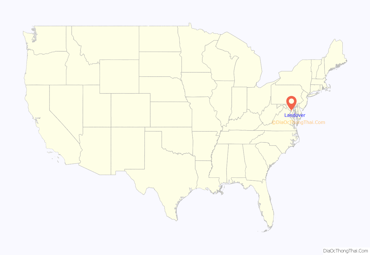
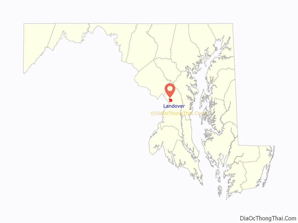
Landover location map. Where is Landover CDP?
History
Landover was named after the town of Llandovery, Wales.
The former CDPs of Landover, Dodge Park, Kentland, and Palmer Park, defined as such by the U.S. Census Bureau in the 1990 U.S. Census, were consolidated into the Greater Landover CDP as of the 2000 U.S. Census. This amalgamated area was renamed the Landover CDP as of the 2010 U.S. Census.
Landover Road Map
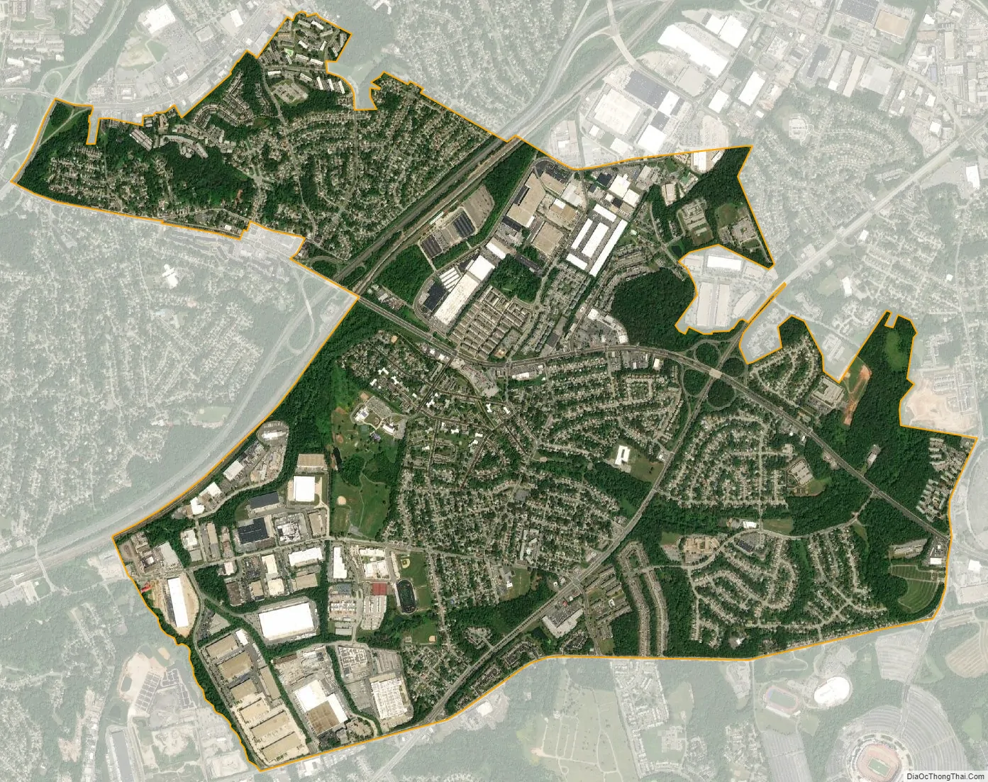
Landover city Satellite Map
Geography
Landover is located at 38°55′26″N 76°53′17″W / 38.924°N 76.888°W / 38.924; -76.888. According to the U.S. Census Bureau, it has an area of 4.07 square miles (10.55 km), of which 0.004 square miles (0.01 km), or 0.13%, is water. Landover residents have the postal zipcode of 20785. Since Landover is an unincorporated community in Prince George’s County, residents of Landover have Hyattsville postal addresses though they live in Landover and not Hyattsville. Landover does not have its own postal zipcode.
Landover consists of several small subdivisions which are notably Ardwick Park, Kentland, Kenmoor, Dodge Park, Brightseat, Palmer Park, Columbia Park, Village Green, White House Heights, and Summerfield. Landover is home to FedExField, which the NFL’s Washington Commanders have played at since it opened in 1997. It is also home to the Prince George’s Sports & Learning Complex, WMATA’s Landover Metrobus Division, WMATA’s Carmen E. Turner Maintenance Facility, Giant Food Corporate Office, Giant Food Corporate Plant, National Harmony Memorial Park Cemetery, and Ardwick Industrial Park. WMATA Metrorail’s Orange Line from New Carrollton to Vienna, MARC train Line to the BWI Light Rail Station to Washington D.C.’s Union Station, Cargo Trains, and Amtrak’s Train Line from Washington D.C.’s Union Station to New York’s Penn Station via Wilmington and Philadelphia, all go through Landover. Landover Hills is a separate, incorporated community just across the Orange Line train tracks and John Hanson Highway (U.S. Highway 50) to the north. Landover is the birthplace of the late Len Bias. From 1960 to 1972, Landover was the home of jazz guitarist, composer, arranger, author, and jazz educator Steve Rochinski.
For the 2000 census, Landover was delineated by the U.S. Census Bureau as the Greater Landover census-designated place.
See also
Map of Maryland State and its subdivision: Map of other states:- Alabama
- Alaska
- Arizona
- Arkansas
- California
- Colorado
- Connecticut
- Delaware
- District of Columbia
- Florida
- Georgia
- Hawaii
- Idaho
- Illinois
- Indiana
- Iowa
- Kansas
- Kentucky
- Louisiana
- Maine
- Maryland
- Massachusetts
- Michigan
- Minnesota
- Mississippi
- Missouri
- Montana
- Nebraska
- Nevada
- New Hampshire
- New Jersey
- New Mexico
- New York
- North Carolina
- North Dakota
- Ohio
- Oklahoma
- Oregon
- Pennsylvania
- Rhode Island
- South Carolina
- South Dakota
- Tennessee
- Texas
- Utah
- Vermont
- Virginia
- Washington
- West Virginia
- Wisconsin
- Wyoming


